Favorite Ride: The Gila Loop

© 2006 by Kathleen Kemsley, first published in Rider Magazine, Jan. 2006

Take a road that loops around 80 miles of asphalt twisties in the Gila National Forest near Silver City.  Blend it with some of the most spectacular mountain scenery in the southwest.  Throw in a few Indian ruins, ghost towns, art galleries and outstanding home-cooked New Mexican food.  The result?  One serving of the best motorcycle ride in southwest New Mexico: the Gila Loop.

Gila_loop_0001
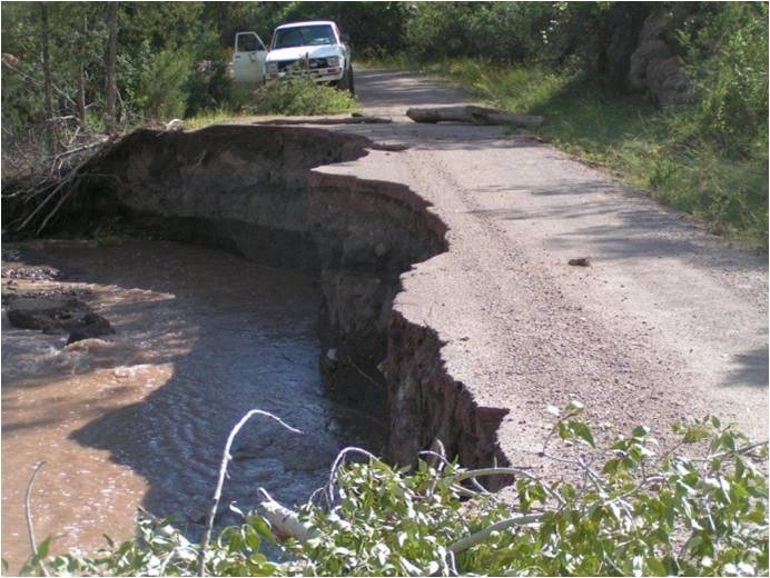
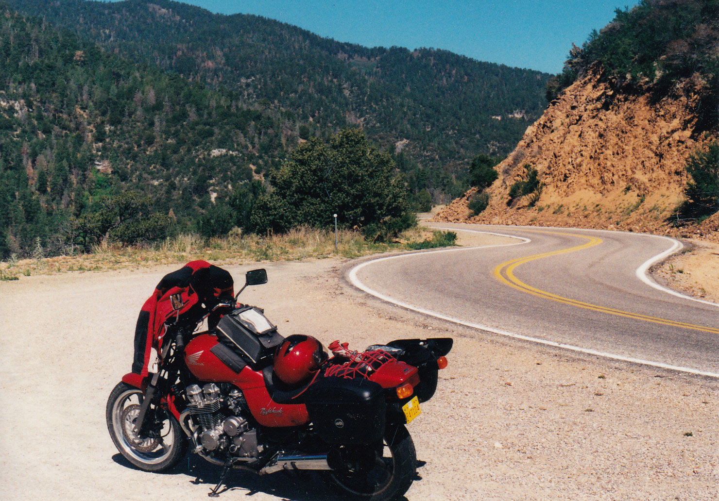
Just getting to the loop is half the fun.  From Caballo Lake, Highway 152 – the only paved route through the east side of the Gila Mountains – snakes past Hillsboro and Winston and up over Emory Pass.  A scenic overlook near the top of the pass allows a non-vertigo-prone rider a panoramic view of the Rio Grande Valley, 4000 feet below.  Beyond the pass, the road winds around hairpin curves and alongside cheerful little spring-fed creeks through the Gila National Forest.  A word to the wise: beware of loose gravel strewn on the turns near Emory Pass.

Once you reach the junction of highways 152 and 35, a decision looms.  Counterclockwise leads directly up to the Gila Cliff Dwellings with only a few eateries along the way, while a clockwise move takes you to civilization first.  I chose counterclockwise because out of the few places to eat on this route, Sister’s Restaurant in San Lorenzo has the best meals.  However, your timing has to be just right, as it’s only open Wednesday through Sunday between 11 a.m. and 2:30 p.m.  If your timing is off, there is always a good burrito to be had at the Mimbres Valley café.  Order it banarse, bathed in red or green chile sauce, for a special New Mexican treat.

The ride to the cliff dwellings passes scenic Lake Roberts, a summer magnet for boaters,Gila_loop_0002 
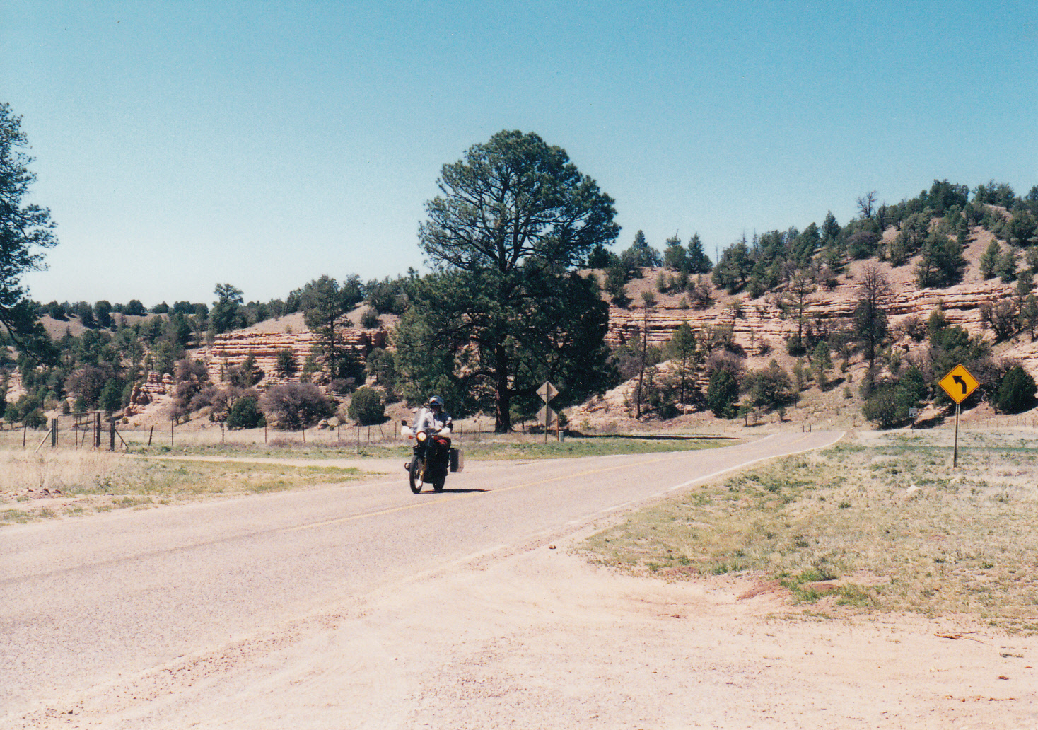
fishermen, campers, and other hot-weather refugees.  Just beyond the lake, turn right onto the Highway 15 spur road.  Another 17 miles of colorful rock formations, voluptuous curves and spectacular vistas will bring you to the Gila Cliff Dwellings National Monument.

Stopping by the visitor center, you will learn that the Mogollon Indian cliff dwellings preserved within the monument are just one set among dozens of 13th-century structures located near this portion of the Gila River.  A pleasant 30 minute walk up to the dwelling site follows a streambed lined with cottonwood and ponderosa Gila_loop_0004
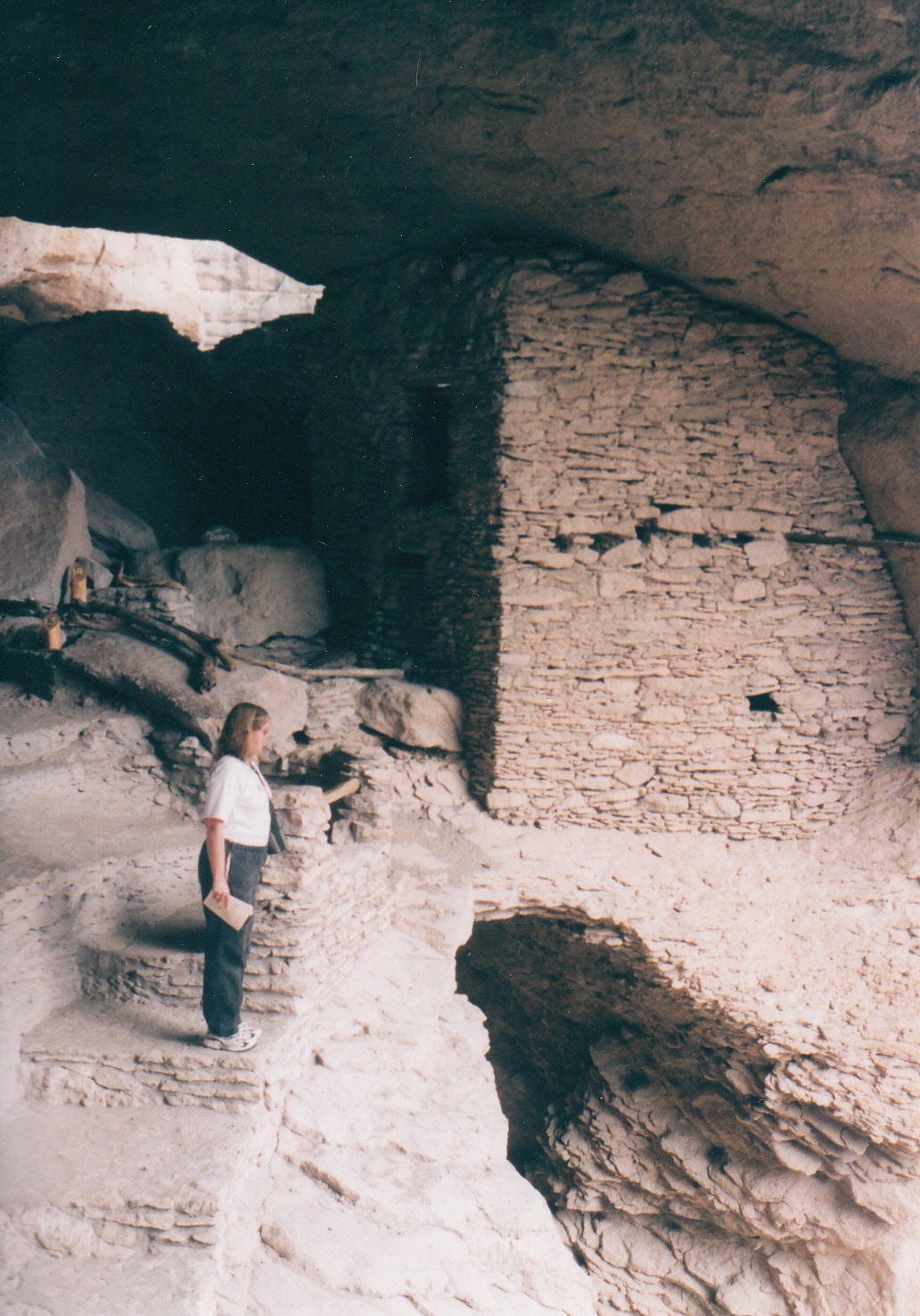
pine trees.  The $3 entry fee will buy you a comprehensive trail guide covering the history, culture, architecture and mysterious disappearance of the Mogollon people who once lived here.

Backtracking to the junction of Highways 15 and 35, veer right to follow the Gila Loop toward Silver City.  Along a 19-mile stretch from the junction to Pinos Altos, the road becomes almost impossibly narrow with no center stripe.  The biggest hazard to be encountered will likely be an errant motor home in the wrong lane.

Once a gold rush destination, Pinos Altos (“tall pines”) today consists of just a handful of art galleries as well as entertainment and food at the well-known Buckhorn Saloon.  History buffs can take a short walking tour of such sites as an old cabin, a cemetery, and a 1971-vintage courthouse.

From Pinos Altos the road emerges unceremoniously into Silver City, a bustling town that boasts “four gentle seasons.”  Main Street, lined with an interesting collection of gift shops, restaurants, galleries and second-hand stores, backs up to the “Big Ditch.”  Formerly the main street until it was washed out in 1905 by a flash flood, the chasm today is a city park complete with walking paths, picnic areas and two foot bridges, 55 feet below street level.

A favorite place to eat in Silver City is the Adobe Springs Café on Silver Heights Boulevard, named for a natural spring still active beneath the 1937 building.  The Southwest Breakfast, a pile of hash browns liberally laced with green chile and served with tortillas, is a treat at any time of day.

Whether you consider it an ode to modern industriousness or an offensive blight onGila_loop 
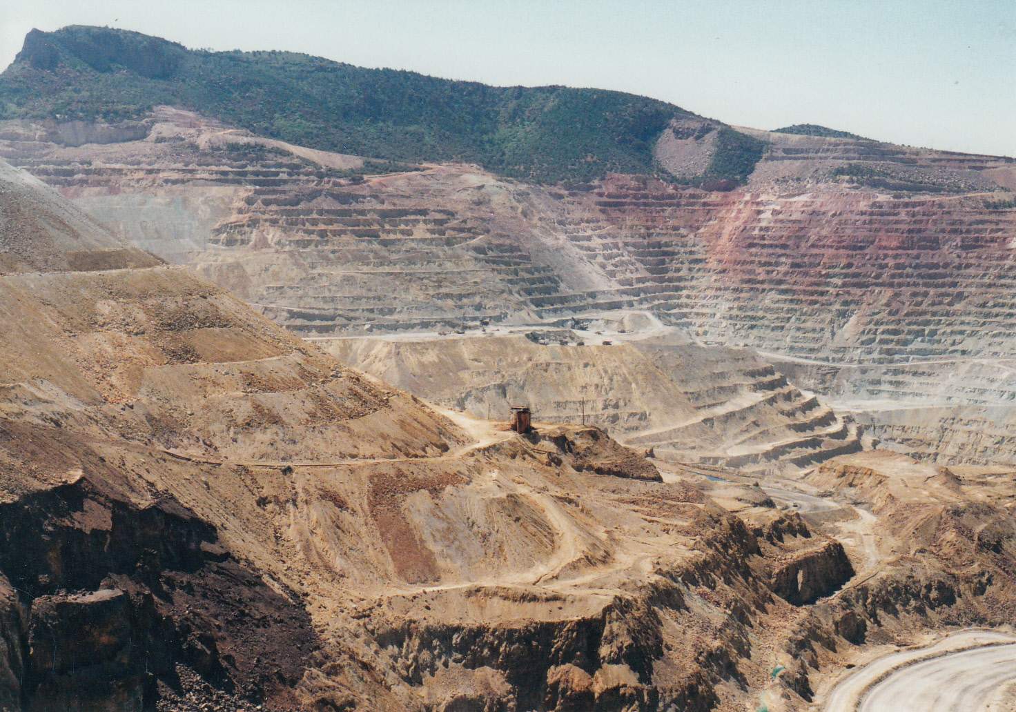
the landscape, the great hole in the earth left by the Santa Rita Mine is impossible to miss on the south side of the road heading east from Silver City toward the ride’s starting point.  This copper mine, the oldest active mine in the Southwest, has been worked for more than 200 years.

Radiating like warped spokes from the Gila Loop, intriguing twisty roads lead to local attractions such as the forlorn ghost town of Lake Valley (which features neither a lake nor a valley), the famous chiles of Hatch, the refreshing waters of Elephant Butte Reservoir, the quirky charms of Truth or Consequences, the haunting beauty of the City of Rocks and the engineering marvel of the Catwalk.  Yield to the temptation to linger; the winding roads of the Gila Loop region provide all the ingredients for a large helping of motorcycling satisfaction.

In Search Of Spring

© 1986 by Kathleen Kemsley, first published in We Alaskans magazine, May 1986.

My usual habit of taking the S-curves on two wheels was confounded this afternoon when I fell in behind a camper bearing Oregon plates.  I watched with thinly concealed glee as the slow-moving vehicle hit every frost heave head on.  The driver was unfamiliar with the phenomenon of breakup, and his shocks and his carefully stored dishes were taking the brunt of the consequences.

I went for this drive in search of spring.  Along the highway, stubble of willow bushes, trimmed close to the ground by lean moose, were crimson in anticipation of the chlorophylled days ahead.  White spruce stood mired in swampy sinkholes, patient as ever, but atop the frozen ponds skated a sheet of liquid melt-off.  The patches of snow were dirty and seemed to be shrinking in the sunlight.

Along the Kenai River a character interchange had occurred overnight.  Gulls, summer understudies for the art of catching salmon, had replaced the bald eagle population.  Here and there in the woods was parked a Bronco or Blazer containing a cabin-fevered fisherman unable to wait for the first run of reds.  I understood with the empathy of a fellow Alaskan winter veteran that it did not matter whether all they caught was a Dolly Varden.  At least they were outside without their parkas.

Down along the bridge across the river delta, a parking lot jam had developed.  The scene wasSpring_AK_0001 reminiscent of Polychrome Pass in Denali when a caribou crosses the road.  But the crowds of people were at the delta to look at birds.  These birds were the special ones that made the front page of newspapers when the glided in for a landing – the true harbingers of spring.

I felt a little sorry for the hundreds of honking, cackling snow geese as they waddled en masse through the delta mud.  They were welcomed by ground still semi-frozen and marsh grasses the color of dried wheat.  A stiff wind whipped through their feathers, pelting them with the remnants of a cold northern winter.

I imagined the geese trading stories, much like summer seasonal employees who just got back to Alaska, discussing their exotic winter sojourns: “I lived on top of a grass hut in Fiji!”  Yet the magpies and I were glad to see the seasonal residents returning.  Their presence told us that we had managed to survive another seven months of winter, and the end of it was imminent.

What a relief to drive through hubcap-deep mud on the back roads outside of town.  What a joy to put my sunglasses on at six o’clock in the morning.  What a thrill to be driving 20 miles anSpring_AK_0002 hour behind a camper looking for a dump station.

For awhile there, I was afraid that spring would not arrive.  I thought perhaps it was cancelled.

Alaska is the last bastion on the continent against spring.  I have learned not to call it by that name, full of promise, as they do in warmer lands.  I say “breakup” or “thaw” or “when it’s light longer,” for I have seen it snow a foot on Mother’s Day.  By the time the flowers get around to blooming, I will be too busy working and building on my cabin and fishing and hiking to give the flowers much thought.

But in this season of anticipation, all my concentration has been centered on the minute changes moving through the land.  It is a classic paradox that we Alaskans, who have less in the way of spring than any of the folks down south, appreciate it more.  Today, the mud on my truck looked beautiful.

Durango Zone 2012 Fire Summary

By Kathleen Kemsley, Published by San Juan National Forest, December 2012

The 2012 fire season in Durango Zone was the busiest in ten years.  A less than average snowpack in the San Juan Mountains melted off some six weeks early in the spring, so conditions started out dry.  The first fire of the year, East Fork, burned 25 acres in early April at an elevation of 8500 feet on the Pagosa District.  This was a precursor of the extreme fire season to come.

OLYMPUS DIGITAL CAMERAA lightning storm moved through the Durango region on May 12, quite unusual for that time of year.  Seven fires popped up in the zone, including one near Little Sand Creek north of Pagosa Springs.  The Little Sand fire was reported to be burning in an inaccessible area of the Piedra drainage in heavy dead and down timber.  Wildfire Decision Support System (WFDSS) analysis led to a decision by resource managers to monitor and manage the fire rather than fully suppressing it.  After a week, it was still only ten acres in size.  Then on May 22 it began to move and grow.  Before the summer was over, Little Sand hosted a Type 2 team, two Type 3 teams, and a National Incident Management (NIMO) team.  It reached a size of 24,133 acres, making it the largest fire on the San Juan National Forest since 2002.

June was a month of record dryness.  Both the Burning Index and the Energy Release Component stayed above the 97th percentile across the zone.  Fire LittleSand2restrictions were put in place.  A human-caused fire on June 22 began on BLM land and quickly moved onto private land in Montezuma County.  The Weber fire grew over 700 acres on the first day.  Over 100 homes were immediately threatened and evacuations began.  A Type 2 team was ordered.  Rapid response from aircraft, crews, and engines kept structure losses to one outbuilding, but the fire burned 10,100 acres just north of Mancos before it was controlled a month later.  The next day, the State Line fire started near Bondad Hill on La Plata County and Southern Ute land.  The Type 3 team deployed to that fire and held it to 350 acres, again narrowly avoiding destruction of several nearby residences.

Lightning ignited numerous new fires in late June.  Quick response by resourcesAirpark1 diverted from Little Sand and Weber kept these fires from growing to hundreds of acres.  Finally, some rain arrived along with the lightning to slow down the spread of fires.  However, precipitation was spotty, as evidenced by the Air Park fire on Southern Ute lands which took everyone by surprise in late July.  This lightning fire near Nighthorse Reservoir burned in an area that had been missed by the summer rains.  It quickly spread to 500 acres, threatening 150 residences and 20 oil and gas wells.

August lightning ignited several extended attack fires from 5 to 40 acres in the Ute Burns1-2012-08-19_Mountain region, as well as one more large fire, Burns, which charred 170 acres on Archuleta County.  Finally the intermittent monsoon rains dampened enough of the zone to slow ignitions, and many of the zone resources headed north to Idaho, Montana, and northern California to assist on project fires up there.

By mid-August, Durango Dispatch had been in service 24 hours a day, 7 days a week, for nearly three months straight.  Both Expanded Dispatch and Buying Teams operated continuously out of the Sonoran Rooms of the Public Lands Center.  Between the Initial Attack operation and Expanded Dispatch, some 50 dispatchers came in from all over the country to help staff and support the ongoing fire activity.  It was not until early September that all the excess dispatch personnel were demobilized.  Things appeared to calm down, but that was not the end of the story.  The 2012 fire season still had one more big trick up its sleeve.

On October 12, the zone received over 9,000 lightning strikes, again an anomaly for that time of year.  Between October 5 and November 4, a total of 40 fires Goblin1were reported in the zone.  Four of the fall fires went large.   The biggest of these topped 1400 acres.  Expanded Dispatch and the Buying Team re-convened; local Type 3 teams were deployed to both Vallecito and Roatcap.  Extended attack also lasted for several days on the lightning-caused Little East and Cinnamon Bear fires, as well as the railroad-caused Goblin.  The zone ordered engines, crews, helicopters and air tankers to suppress these fires.  No one in Durango can remember ever fighting fires to that extent or magnitude, so late in the year.

OLYMPUS DIGITAL CAMERABalmy temperatures marked the entire month of November, and there was zero snow pack in the mountains below 9,000 feet at Thanksgiving.  As of mid-December, two large fires on the San Juan still smoldered, not having received enough precipitation to be called out.

Overall 2012 was a successful year for one so busy.  New Division Supervisors, Task Force Leaders, Type 3 Incident Commanders, and Initial Attack Dispatchers became qualified, while other firefighters opened task books toLittleSand3 begin working on higher qualifications.  The Durango Zone partner agencies hosted over 100 engines and 25 crews from as far away as Alaska, West Virginia, and Pennsylvania.   At one point in late June, five air attack ships, four single engine air tankers, and ten helicopters were simultaneously working fires in the zone.  For all this activity, only a handful of minor incidents were reported.  It is commendable that everyone kept safety in the forefront during a year that was extremely busy not only here but everywhere in the Rocky Mountain geographic area.

The Daylight Season

© 1986 by Kathleen Kemsley, published in We Alaskans magazine, June 1986.

They say there are only two times when the salmon fishing is good: when it’s raining and when it isn’t.  The other requirement is that it be light enough to see where rocks lie hidden just beneath the surface of the river.  During the endless light hours of summer, each day slides into the next with no further notice than a slight dimming of illumination, a pause to take a breath before the next day rushes in. fish_on

I joined the throngs of salmon-crazed anglers several evenings ago and went up to the Kenai River to try for a monster king.  It rained and it didn’t rain; I ate chicken salad and chocolate chip cookies with my fishing partners and sang songs to pass the time.  We motored up through the current and drifted back over a hole countless times, jerking our poles expectantly at every little tug of flowing water on the lines.

We had the river almost to ourselves that evening.  We shared the fishing hole with terns and herring gulls that were busy dive-bombing the water for hooligan and insects.  Clouds parted briefly to reveal a sky of blazing azure.  Without fanfare a rainbow sliced through the air and disappeared into the silty green water upriver.  Daylight hung like backlit curtains around the boat.  Over the sound of water slurping past the sides of the boat, the plink of raindrops on my hip boots was almost unnoticeable.

A bite on the hook brought us all to attention.  My shout of “fish on!” was redundant, as my pole wavered wildly above the current.  Ten minutes later I landed a 48-pound king salmon.  I could not take my eyes off of her as she slid around on the bottom of the boat.  I had never seen a fish so big.

Shortly before midnight we reluctantly pulled the boat out of the water and snapped some pictures before I started for home.  Six times along the 50 mile drive, I slammed on the brakes of my truck to allow the crossing of a moose with one or more calves in tow.  The newborn calves’ wobbly stick legs refused to observe the rules of right-of-way, so I waited patiently for them all to move safely off the highway.

That was how, at one o’clock in the morning, I came to be kneeling on the cabin porch filleting a salmon in the twilight of an Alaska summer night.  My thoughts wandered forward to the coming weeks, when sandwiched between work shifts I would be entertaining visitors from Outside, attending meetings in town, going on emergency ambulance runs with the local fire department, taking the dog for walks in the woods, and riding my mountain bike down dirt roads in search of rainbow trout streams.  There was salmon to smoke and berries to pick, oil to change and wood to haul.  Somehow, too, the dishes would have to be washed and the floor of the cabin swept.

What happened to the time I spent sleeping late last winter?  It seemed to have disappeared with the last ice on the lake.  Lately the days have melted together in a blur of daylight.  In a moment of clarity, I looked beyond my arms, immersed to the elbows in fish eggs, to the season looming ahead.  I had to accept, and in fact embrace, the exhausting days to come.  There would be plenty of time for rest later, I knew, once the season turned again and long winter arrived.  But for now, I would burn with the midnight sun.

Letter From Valdez

© 1989 by Kathleen Kemsley, first published in Arete Magazine, July 1989

In April, my work sent me to Valdez, Alaska to establish a communications center to support the clean-up of the largest oil spill in United States history.  But I quickly discovered that Valdez was not ready for emergency dispatchers.  The radio lines were not connected, the repeaters were not Valdez_0001installed, and nothing was operable yet.

The town was a madhouse of bureaucratic red tape.  Every agency present (including Exxon, the Coast Guard, the state Department of Environmental Conservation, the Office of Emergency Service, the Alaska State Troopers, and the Alaska Pipeline Company) had its own headquarters.  No one was eager to cooperate.

Valdez was overrun with Alaskans and people from the Lower 48, all looking for work.  Many of those working were being paid to do nothing but go to meetings and order new equipment.  It was said in town that Exxon was spending $7 million per day – loose change for a company that makes $1 billion every quarter.  Exxon had resolved to throw money at the problem, and there were plenty of eager hands reaching out to grab it.

The streets of Valdez teemed with people.  Motor homes were parked on every available inch of open pavement, and people were living in their cars.  There were stabbings at night in the bars; I was propositioned on the street.  Everyone said it was just like the pipeline days of the 1970s.  But there was a strange silence among people in Valdez regarding criticism of Exxon.  I had expected the people to be outraged about the destruction of their beautiful sound.  But the atmosphere of the town was more like, “Yahoo!  Happy days are here again!”

I explored Valdez to see the clean-up efforts firsthand.  I began by making a heartbreaking visitValdez_0004 to the bird rescue center.  First stop was an entire trailer full of dead bird.  The few birds that had been cleaned were still trying to preen and remove oil from their feathers, ingesting the lethal substance in the process.  I saw loons, murres, cormorants, even a bald eagle struggling to survive being poisoned.  Most of the birds were never even pulled from the water; immersed in the oil slick of Prince William Sound, they sank like stones to the bottom of the sea.  The atmosphere at the bird rescue center was desperate, for the workers (the only people in town who were volunteering) seemed to sense the futility of their task.

I attended a “town meeting” staged by an Anchorage television station in the Valdez Civic Center.  A panel of representatives from the Coast Guard, the Department of Environmental Conservation, Veco (the company contracted by Exxon for doing the clean-up) and the mayors of Valdez and Cordova fielded questions, live and on camera, from a studio audience.  Most of the questions centered on money: How can I get a job?  How do I file my fisherman’s claims?

At one point, someone in the audience asked whether they honestly thought the spill could be cleaned up.  The answer from the DEC man was the most honest statement I had yet heard in Valdez: “We probably will never get it cleaned up.  Mother Nature will do that, but it will take years.  What we really need to do is take steps so that this type of disaster never happens again.”

Valdez_0002On Thursday, two other dispatchers and I were told to go out to the airport and board a helicopter for a flyover of the oil spill.  Normally, the Valdez airport has three or four flights departing per day.  But since the spill, that number had risen to 500.  The helicopters were lined up like cars in a shopping mall parking lot the week before Christmas.

When we found our helicopter, the co-pilot harassed us about taking the flight.  “Admit it,” he said, “you women have absolutely no reason to go out there except to sightsee.”

Our assurances that “they” told us we needed an orientation flight did nothing to sway him.  Finally I said, “Look, lighten up.  How many days in a row have you been working?”

He cracked a smile and sighed wearily.  “You’re right.  It’s been a lot of long days in a row.  Get in.”

Our helicopter left Valdez, and we flew along the narrows which lead out to Prince William Sound.  Up-current from the spill, where no oil had reached, I saw huge flocks of seagulls, many bald eagles and sea birds floating on the gentle swells.  Otters and sea lions dove into the turquoise water, and the herring roe glowed milky white just beneath the surface.

Then we came to Bligh Reef, where the tanker Exxon Valdez ran aground on March 24, spillingValdez_0003 ten million gallons of North Slope crude oil into the pristine waters.  From there south, the water was streaked black, brown, green, red, and blue, topped by an iridescent sheen of oil.  Beneath the ocean surface I could see huge globules of oil; for ten fathoms down, the crude was as thick as molasses.

We saw boats frantically trying to lay booms across a back bay to prevent the oil from reaching the salmon streams.  The boats and the boom lines looked tiny against the expanse of oily ocean.  There would be no way to hold back the mess.  Ten million gallons of crude oil had, in three weeks, slimed its way into every corner of the sound.  It would never be the same.

The smell of oil and death was everywhere.  Nothing moved, nothing lived in Prince William Sound.  Beaches were black to the high-water mark.  Workers went out at low tide to scrub individual rocks, while photographers’ cameras clicked.  After they returned to town, the tide came in to redeposit the oil.  The work was useless.

The next day, one of the chiefs came into our communications center to tell us that it would be the middle of next week, at least, before any of the radios worked.  He cut us loose for the weekend and told us to come back Monday.  I said I was going home and they could get a different dispatcher from Soldotna to take my place.  If there had been something to do, I would have stayed.  But it was way too late for me to be of any help at all, to the birds, or the fish, or the beaches.

I had always been an advocate for the preservation of wilderness and wildlife and letting natural things be, but since moving to Alaska I had become complacent.  I read about smog and dead rivers and barges dumping toxic waste into the sea, but I never gave it more than a passing thought because it wasn’t happening in Alaska.  Only now, it is.

Driving home from Valdez, I stopped on the highway to let six caribou cross.  Two whistler swans flew past my truck, bound for the Kenai River.  Stands of willow next to the glacier were shot with crimson, in anticipation of the coming warm season and the new growth of spring.  The first shrill call of a varied thrush, harbinger of summer, echoed across the empty land.

Spring in Alaska is a time of rebirth, of the cycles of life beginning anew.  This year, the swans somehow made it past the oil slick to return to their summer nesting grounds.  As the sky glowed orange, I made a silent promise to those swans.  I resolved to make a better effort to tread lightly on the land that we share, so there will still be a safe place for them to nest when they return next year to paradise in the land of the midnight sun.

Gila-Las Cruces Zone 2013 Fire Summary

By Kathleen Kemsley, published by Gila National Forest, December 2013

The 2013 fire season in the Gila Las Cruces Zone started out with a lot of potential.  Snowpack was minimal and melted early in the third straight year of severe drought.  Lack of fine fuels keptSilver_0627 wind-driven starts from spreading rapidly.  Early season fires were suppressed quickly.  A handful of lightning-caused starts on the Gila National Forest on May 10 and 11 were all kept to less than five acres.  The largest early season fire was McKinney, on State and private lands, which burned 153 acres of grass and shrubs near Tyrone on May 21.  With assistance from the Gila contingent of smokejumpers and several loads of retardant, firefighters saved 10 nearby residences.

By June 1, indices across the zone exceeded the 97th percentile.  The next round of lightning began June 4, producing three fires, including the Sawmill Canyon fire on Quemado District.  This Type 3 fire burned 42 acres and utilized several local engines and crews.

Gila1On June 7, five more lightning fires ignited across the forest.  Papoose and Indian, close to each other on Wilderness District, both grew to about 80 acres before efforts of several crews, smokejumpers, engines, retardant and helicopter support succeeded in containing them.

Meanwhile, the Silver fire was initial attacked the same day with two engines from Silver City District. The crews got a scratch line around the five acre fire by midnight on a moonless night.  Soon after that, some logs rolled out and ignited super-dry fuels on the steep slopes below.  The engine crews were forced to retreat for safety reasons.  The next day, 80,000 gallons of retardant were dropped on the growing fire.  The steep, rugged terrain prevented any crews from approaching the fire on the ground.  By the morning of June 9, the fire established itself in a bugkill-choked area of the forest that had not burned in more than 100 years.  Pushed by red flag level southwest winds, the fire took off and a Type 2 team was ordered.

The Silver fire was managed first by the Flagstaff Type 2 Team, then by the New Mexico Type 2Gila2 Team.  It burned over Emory Pass and threatened the community of Kingston.  The town was evacuated for ten days, but efforts by hotshot crews, engines, and retardant kept the fire out of the town.  During the next month, the Silver fire jumped Highway 152, burned past the Hillsboro Lookout, and moved into the Aldo Leopold Wilderness. No structures were destroyed.

The summer monsoon arrived in early July to moderate the fire’s spread.  By the time it was Gila3called contained on July 18, it had burned a total of 138,546 acres on the Silver City, Black Range, and Wilderness districts.  Besides the two Incident Management Teams and miscellaneous overhead from 19 states, the fire suppression operations utilized 15 Type 1 crews, 18 Type 2 and T2IA crews, 27 engines, 2 dozers, and 7 helicopters.  Expanded Dispatch and a Buying Team set up in the Silver City Supervisor’s Office conference room and were operational for 5 weeks.  Silver City Dispatch was staffed 24/7 with aircraft and initial attack dispatchers detailed from California, Idaho, Oregon, Colorado, Arizona, and Montana.

As the monsoon season wore on, lightning strikes ignited some 80 new fires on the forest, BLM, and State lands in July and August.  Initial attack was successful on all these fires.  A large Burned Area Emergency Rehabilitation project was initiated to stabilize the slopes impacted by intense burning during the Silver fire.

Summer rains turned into a deluge in September, causing fire-scorched drainages in both theGila4 Silver fire scar and the Whitewater-Baldy fire scar of 2012 to flood.  On September 15, Mogollon RAWS recorded 9.1 inches of rainfall.  Forest roads were damaged, creeks went over their banks, and state highways became clogged with debris.  Affected areas included the Emory Pass road, the Gila Cliff Dwellings, the village of Mogollon, the Catwalk, and the area around Snow Lake.  Several stranded hikers and hunters were rescued and one man was swept to his death in a flash flood.  Rehabilitation of forest roads will be an ongoing project over the winter.

In summary, the total number of fires in the Gila-Las Cruces zone in 2013 was 160, less than the five-year average of 276.  This was due to the small number of BLM and State fires this year (only 40 between them), compared to their usual 123 or so, as well as a smaller than average number of starts on the Forest.  Acres burned this year totaled 140K, very close to the average of 150K over the past five years.  Of the 140,101 acres burned in the zone in 2013, 138,546 belonged to the Silver fire.  Initial attack was 98% successful in the zone.

A Time To Let The Open Water Flow

(c) 1986 by Kathleen Kemsley.  Originally published in We Alaskans Magazine, March 1986. 

Glaciers consume the parking lots and ooze across the highway.  The entire upper Kenai River Valley has been glazed with gray ice and overflow for two months.  I wish for the lake to freeze, but what ice the lake’s surface forms inevitably ends up piled like driftwood on its shores, the victim of Chinook winds and rain.  I wax my skis longingly, but meager snowfalls liquefy and then congeal into glaciers before my eyes.

AK_moon

I moved here from the Interior of Alaska while the aspens still glowed like fire on the steep slopes of the Kenai Mountains and the sun threw laser rays off turquoise riffles of the river.  Since mid-October the weak glimmer of winter sun has not reached this town.  Nestled in a pocket of river valley and dense spruce trees, Cooper Landing surrenders the sun to the Harding Icefield.  But this year, the traditional icy grip of Alaska winter has been dissipated by warm rain.

Day after day I stare at the gray skies and glaciers and question the redeeming value of this so-called Banana Belt paradise.  One day I look up to see the silhouette of soaring black wings against the leaden sky.  An eagle!  I follow it down to the river and discover a community of hundreds.  The rain and open water and warmish winds provide a perfect haven for them.  The absence of sunlight does not seem to deter them from reveling in the riparian domain.

AK_eagleI become an eagle watcher along the river.  Clusters of them crouch like old cronies on an ice-glazed rocky bank, tearing into dead salmon with gusto and enthusiasm.  A juvenile bird, already sporting a four-foot wingspan but clad in the mottled brown feathers of youth, slides past me on an invisible gust of humid air and banks out across the rapids without apparent effort.  Another afternoon a young eagle swishes past my shoulder with a bit of salmon carrion clenched in its talons.  An adult with sunburst-yellow beak gaping hungrily dives and pursues the youngster, but fails in its efforts to make the kid to surrender its morsel.

Between these rounds of activity, the eagles seem merely to be biding their time on the river.  They perch in groups of three or four for hours at a time, staggered on the limbs of the biggest, deadest trees along the opposite shore.  And they wait patiently.  They have been wintering here long enough to notice when the daylight begins to lengthen.  Into their collective memory is instilled the assurance of spring salmon runs, green buds bursting forth from mazes of willow branches, and fierce competition from black bears and anglers for dinner.

In this valley of perennial rain and warm air currents that slide down rocky mountain slopes, the eagles let the time pass.  And I have begun to let the time pass in their company.  In the hours I have spent spying on them across the open water, I have never heard them complain about the weather or the glaciers.  They accept what is.  Their conversations contain no snowfall record comparisons, no discussions of the merits of wearing golf shoes for parking lot travel.  Each winter is unique, with character determined independently of last season’s conditions.  The only certainties are that the time will pass and that the seasons will change.  So the eagles teach me.

Tossing into the swift river my fickle thermometer, I too commence to let the open water flow.  I possess neither the power nor the will to halt it.