Y2K

 © 2015 By Kathleen Kemsley, from 1999 trip journals

 When Brian and I chose December 1999 for our first foray into Mexico on four wheels, it never occurred to us to worry about the changing millennium.  We were far more concerned with what camping conditions might be like in a foreign country.  For a week we sat in Death Valley, getting our courage up.  Finally we took a deep breath and rolled wheels into Mexico at the Tecate border crossing.

As soon as we got across, we relaxed.  The Suzuki Samurai was a perfect vehicle for the Baja.  The roads were mostly paved (if potholed) and the people were welcoming.  Y2K fears of the pending Baja_0001
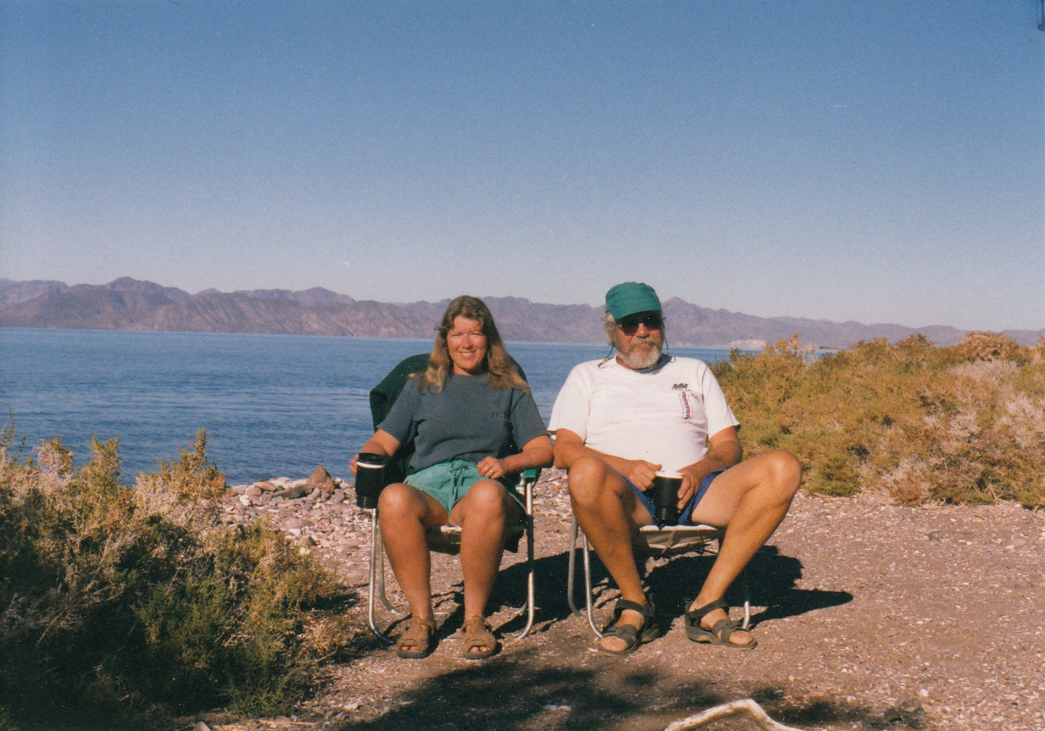
millennium change had scared the majority of tourists away from foreign travel that year, so we found a lot of empty campsites.

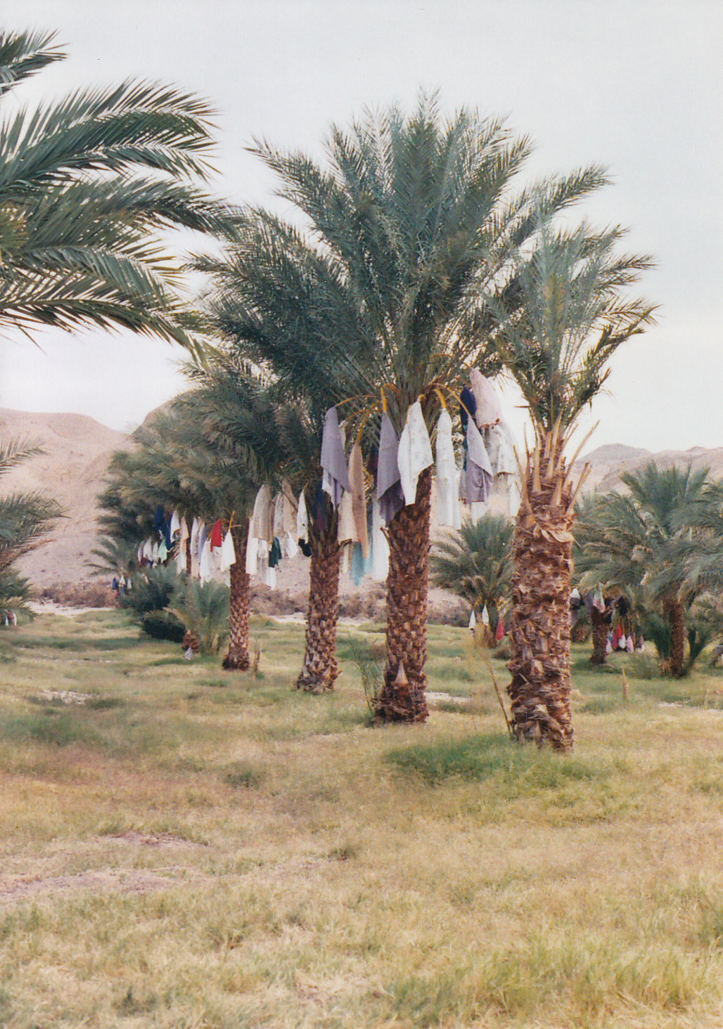
Just south of Mulegé, we settled into a palapa at Conceptión Bay.  We met a few campers who planned to stay through the winter “on the beach,” but we wanted to keep exploring.  After a few relaxing days there, we went inland, attended a Posada celebration for Christmas, paused in La Paz long enough to get really sick on some bad chicken, then departed for the cape in search of free camping.

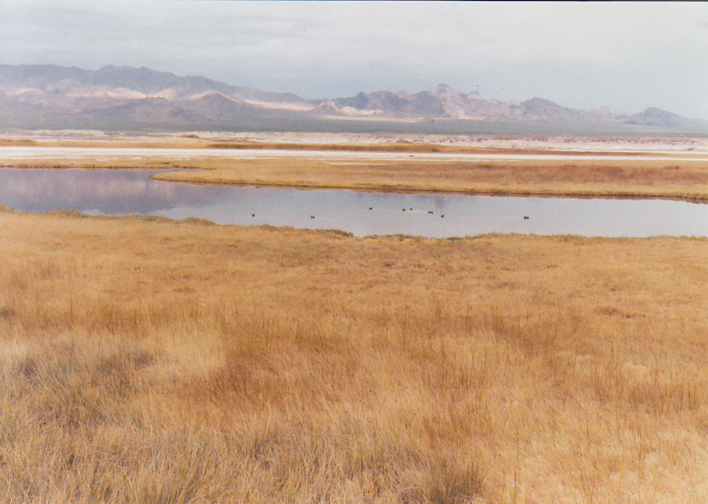
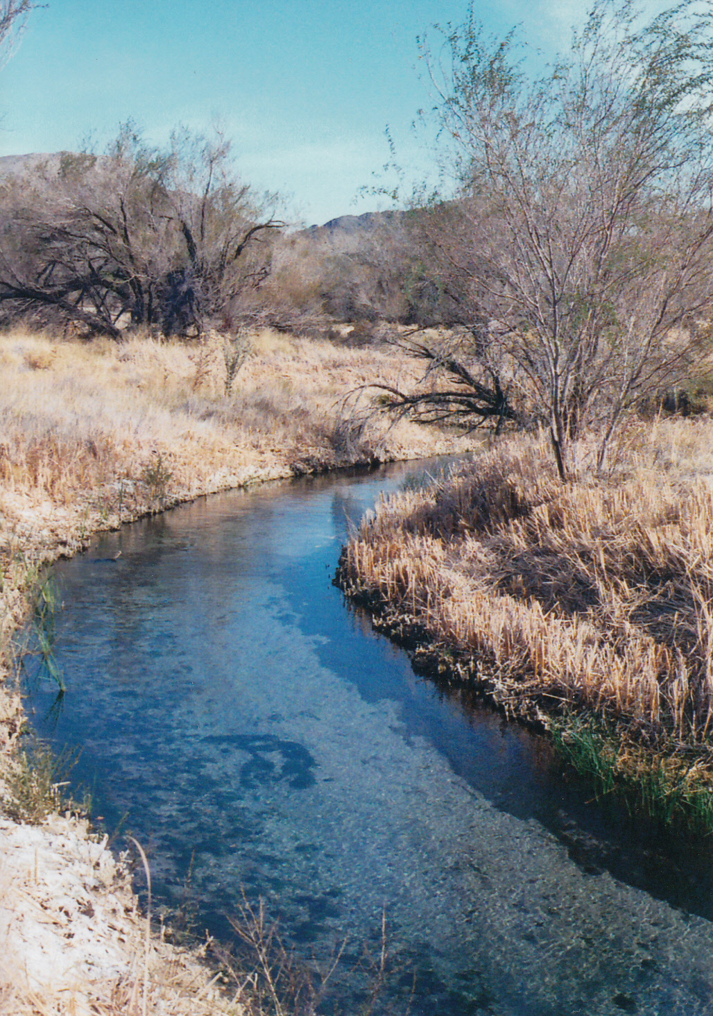
The first free camping space we christened “Perfect Beach.”  We had neighbors half a mile away down the white sand; some sandstone rocks grouped in a shelter off the water to set up our chairs and a campfire; and a view of pelicans and magnificent frigate birds diving into the water out the front door of the tent.  This beach we ranked a perfect 10, and the one against which allBaja_0002 
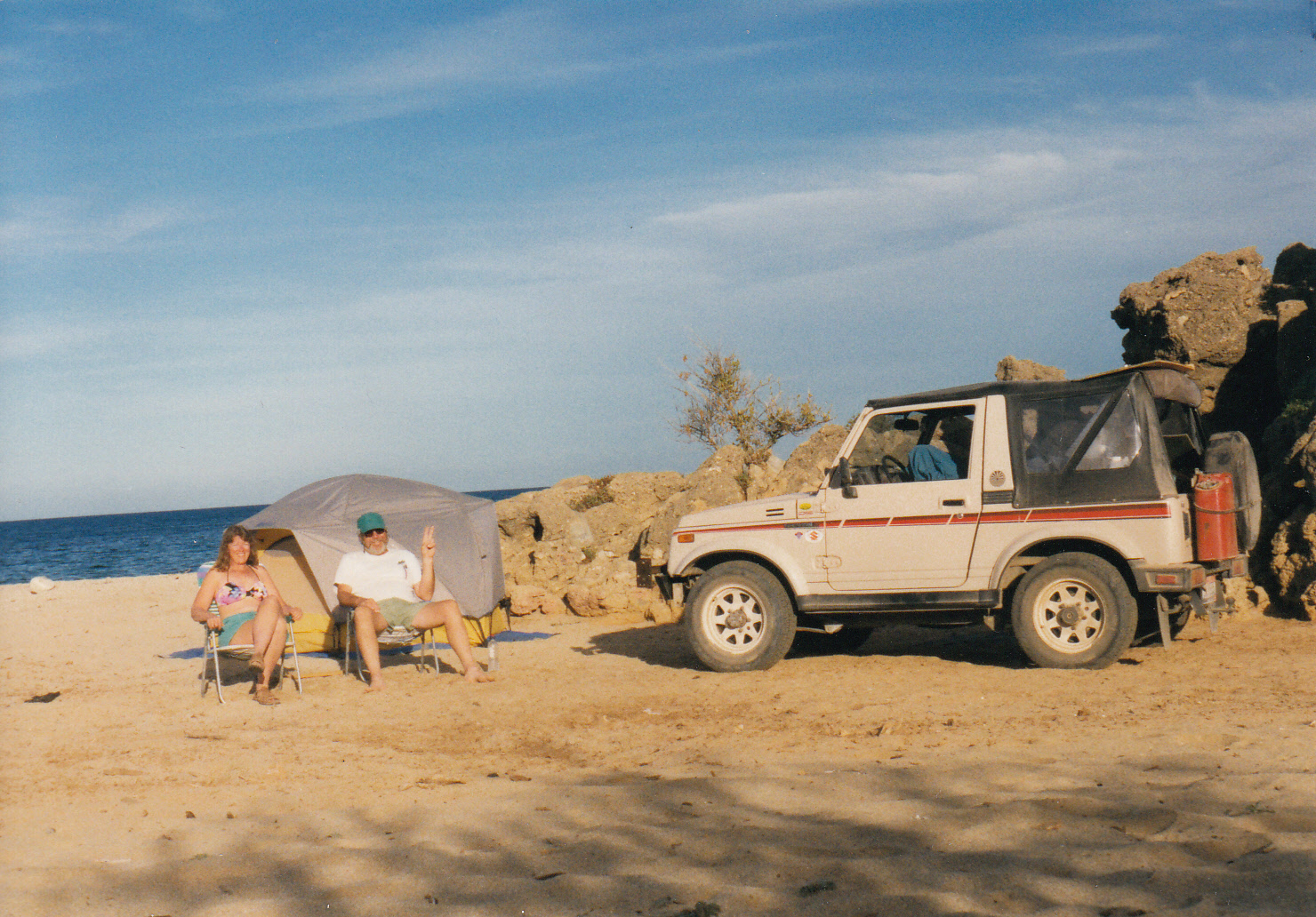
the subsequent campsites would be judged.

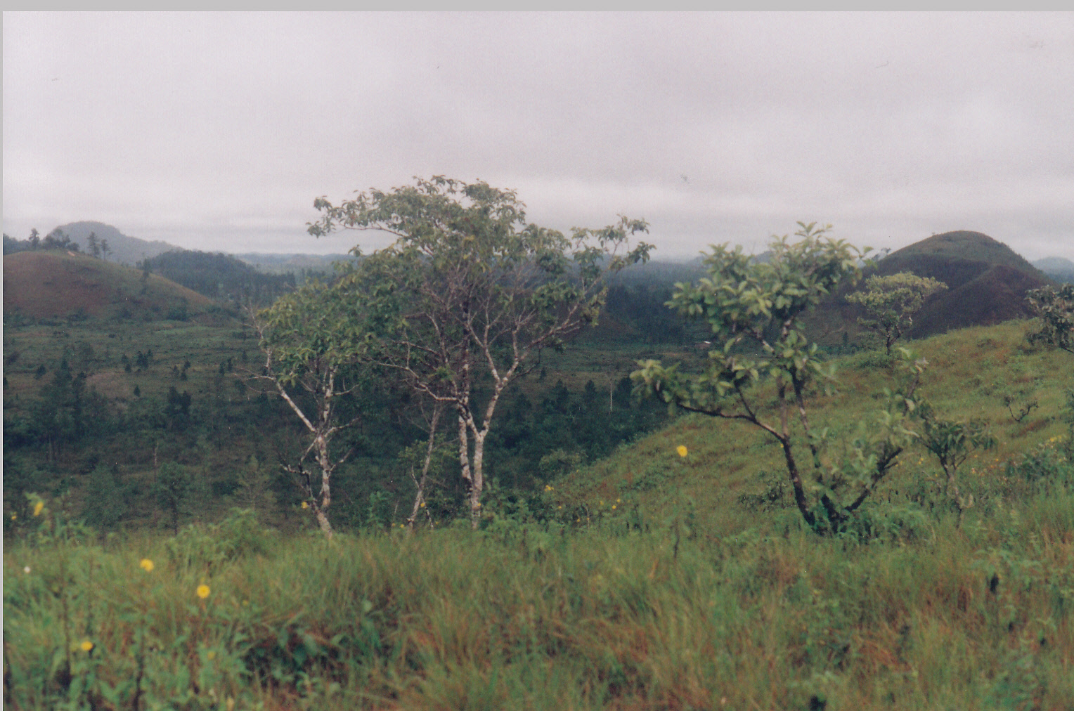
A dirt road took off just south of the ritzy town of Los Barriles, heading in a roundabout way down to San Juan del Cabo.  We went for miles and miles past private property and fields of corn and grazing cattle, all of it fenced off to vagabonds like ourselves.  Finally we turned on a two-track and drove for several miles before stopping to camp in an open field that didn’t appear to be owned by anyone.

We set up the tent and night fell.  After dinner we started a tiny campfire and had just sat down when we heard heavy footsteps.  Out of the darkness emerged a man shouting something in Spanish.  Alarmed, Brian jumped up and tried to intercept the man.  As soon as he got closer, it became obvious that he was an extremely intoxicated local.  He held a machete in one hand and a bottle of tequila in the other.  Yikes.

Miguel spoke a little English and we spoke a little Spanish.  For the next hour we labored to communicate with this plastered little campesino.  He got across that he worked on the ranch there, but he had a cousin in California.  He implored us to take him with us back to the USA.

There were cattle ranging loose in the field where we were camped, and he kept repeating that they were “muy peligroso animals,” very dangerous!  Over his head, Brian and I exchanged a glance.  We need to get out of there immediately!  Hastily, we folded up the tent and chairs and stuffed them in the back of the rig.  Brian started up the engine.  I jumped in the passenger seat.  Miguel came right in after me and sat on my lap, reeking of tequila and tobacco.  I gave him a shove out and slammed the car door.  Brian hit the gas and we sped back down the two-track to
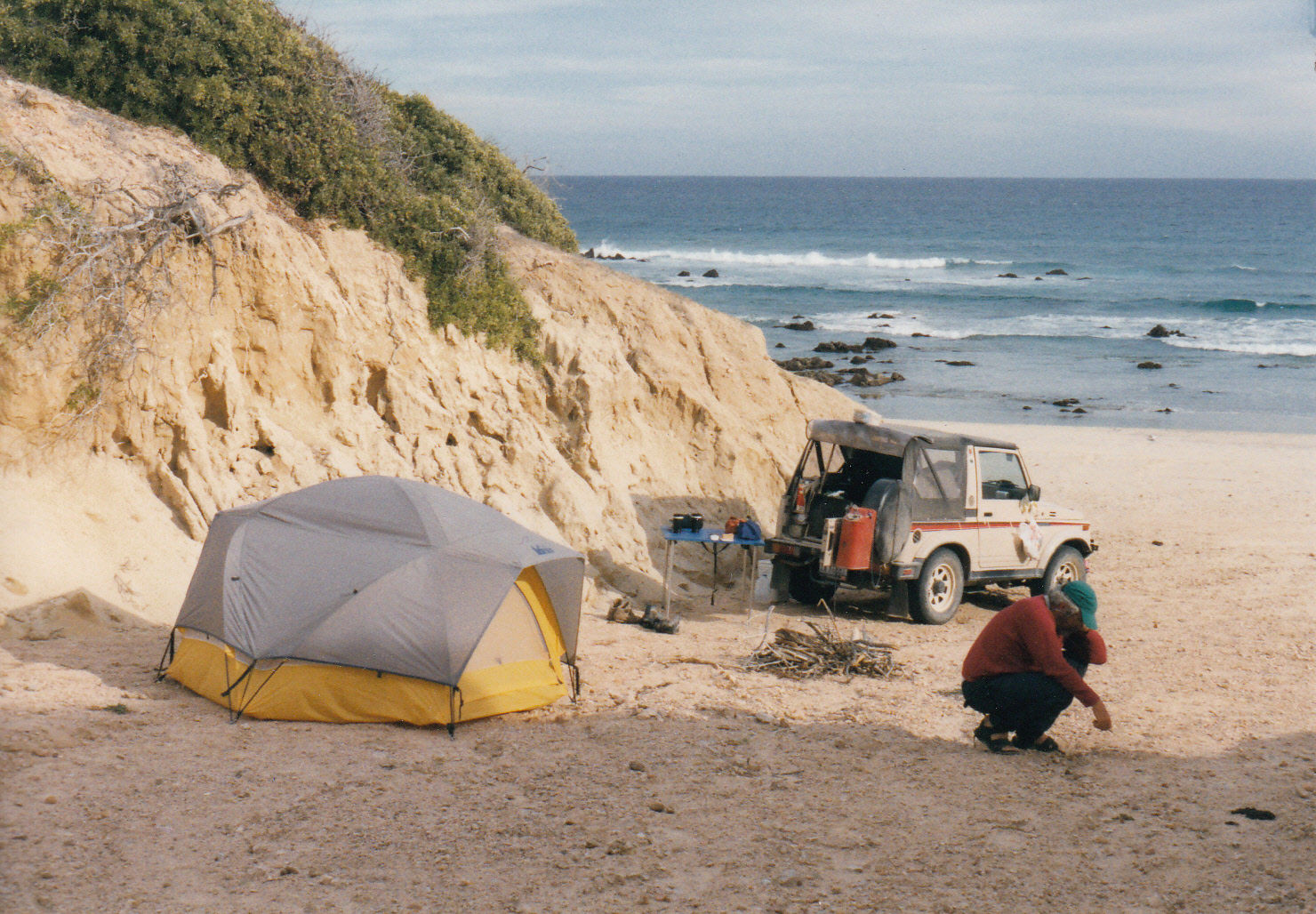
Baja the main road.

Only now it was pitch dark.  We continued further on the unfamiliar road until another turnoff appeared.  Undiscriminating at that point, we turned in and drove back a ways onto some sand.  There we set the tent back up and collapsed into weary sleep.

The next morning was Christmas Eve.  We looked around to discover that we were on an empty and pristine beach backed by sandstone cliffs, next to the Gulf of California.  It was another perfect 10 of a campsite, made even sweeter by the fact that there were no drunk Miguels around to bother us.  We pulled the rig back into an alcove between two sandstone cliffs, and set the parking brake.

A small herd of skinny longhorn vacas, or cattle, came by a little later.  No doubt they were the same “Muy peligroso animals” that Miguel had tried to warn us about.  But they paid us no heed.  They ambled along past our campsite, then went down to the shore for a drink before continuing on down the beach.  By now we were laughing and making fun of the drama of the night before.  Soon I came up with a song for the occasion, to the tune of “The Monkees.”

Here we come, walking down the beach,Baja_0003

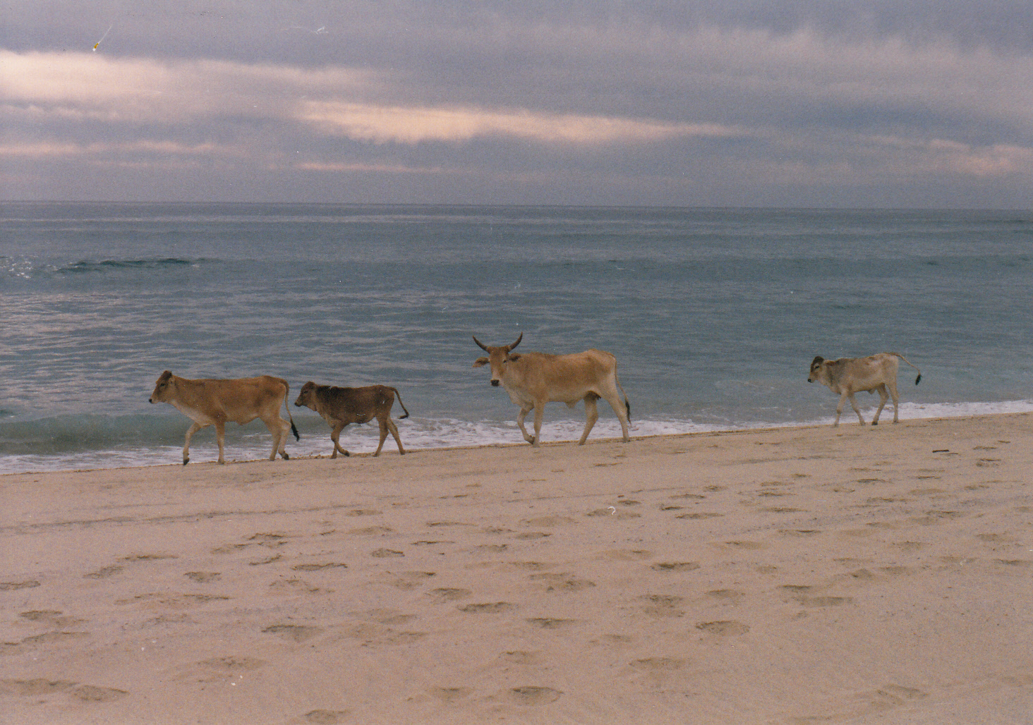
We’re the craziest vacas, that you could ever meet.

Hey hey peligrosoMuy peligroso are we!

We walk down to the tide line, and drink right out of the sea.

After departing Christmas Beach, we hit civilization at San Jose del Cabo.  There we heard about an upcoming New Year’s event, so we bypassed Cabo San Lucas and drove directly to Todos Santos to check it out.  It turned out that the local expat community was planning a sober campout at the beach, so with two days remaining in the old millennium we set up camp next to a couple from Hawaii to wait for Y2K.

People began arriving with food at sunset on New Year’s Eve. More and more salads, side dishes, Baja_0004
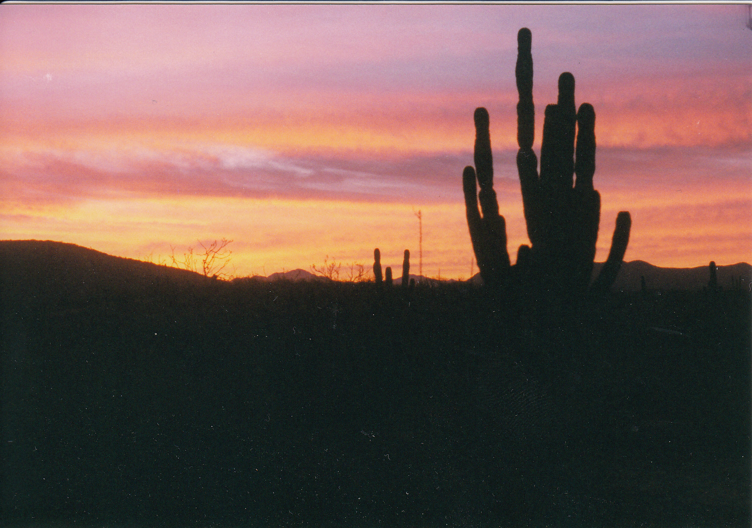
and desserts showed up.  Finally, someone backed a truck in and offloaded a whole roast pig.  We ate until we hurt, laughing and talking with other travelers.  When no one could eat another bite, we pulled the chairs into a circle.  One by one, each of the 40 or so people present shared their experience, strength and hope.  There wouldn’t have been enough booze in all of Mexico for us, if the group had decided to drink that night.  But sober, we found much to be grateful for, in both the old millennium and the new.

In this place, on the isolated coast of Baja, we felt safe from any conspiracy theory-based paranoia about the end of the world.  After all, rural Mexicans still made change out of a cigar box.  The Y2K bug was not going to be a problem here.  Down on the beach, people set off fireworks as the old millennium slipped away under a waning moon.  And the next morning, the new year dawned peaceful and serene.  The end had become the beginning, and the day was full of promise.

Where Ya From?

© 2015 by Kathleen Kemsley, never previously published

 It’s the standard greeting of RVers everywhere.  But it doesn’t mean only what it says.  They can look at your license plate and know where you are from.  It’s just that they have a need to know so much more.

You can see their insatiable curiosity coming from a mile away.  As soon as you pull into a campground, they will come out of their tin castles and feign polishing a headlight or sweeping the artificial turf square in front of their doorway, so that they can cast surreptitious looks your way.  You can almost hear the numbers crunching in their heads.  Calculating: Is his rig bigger than mine?  Does he have more bells and whistles?  Is his spousal accessory younger?  Prettier?  Has she got a richer daddy than mine? It’s a regular Keeping Up With the Jones on wheels.

Next they come ambling over – usually when you’re still in the midst of raising the roof of your camper, taking chairs and tables out of the rig, placing blocks under tires to make the bed level.  The man – for some reason  it is almost always the male half of the RV couple – will walk around behind your truck, glance at the plate, and utter The Question.  Where ya from?

Where_ya_from_0001Back in the old days, we used to travel the United States and Canada in a 1964 Ford van painted school bus-yellow and sporting Alaska plates.  There were times when I fervently wished we could change them for less attention-getting plates from Iowa or something.  No one knows where anything is in Iowa.  But, we learned, everyone thought they knew all about Alaska.

“We went to Alaska – took a cruise up the Inside Passage,” was the most common way people laid claim to a knowledge of the 49th state.  Well, in my opinion the Inside Passage, which only covers the southeast coast of Alaska, looks exactly like what all the land just inland from that narrow strip is – Canada.  Alaska’s mainland is nothing like Southeast.  It’s about northern lights, seven months of winter, moose on the roads, thousands of loon-spotted lakes, rivers milky with glacial flour, and grubby bearded men living in plywood one-room cabins with a common law wife and an outstanding warrant in Nebraska.

“My uncle used to live in Fairbanks”—that was another way well-meaning RVers tried to connect with us sourdoughs tumbling out of the old yellow van.  “Didja know my cousin, Joe?  He was on the pipeline in the 1970s.” Alaska is a state of half a million people, spread over a parcel of land half the size of the entire continental United States.  At times it seemed like the Last Frontier was, indeed, a small town with long streets.  Still I could not keep track of these ghosts who had lived there thirty or forty years ago, Uncle John or cousin Richie.  How many people claim Alaska connections because they knew someone who lived there once?  And really, why would they think I care?

The other classic response to an Alaska license plate is, “I always wanted to go up there.”  What am I supposed to say to that?  The first thought out of my mouth is, “What are you waiting for?”  The Alcan Highway isn’t the wilderness-dirt-road-with-no-services-for-100-miles journey that it used to be the first time I went south on it.  Nowadays there’s plenty of gas stops, souvenirs, car repair shops, Overwatea grocery stores, and greasy spoon overpriced restaurants that call themselves “roadhouses.”  It’s not an “adventure” drive anymore.  It’s simply just a long haul.

Truthfully, I had never been over it in the summer time, which was when these Fair Weather RVers undoubtedly wanted to travel.  The best time to drive the Alcan really is in the winter, when the corduroy is smoothed over with packed snow and your headlights shine brightly on the snow-covered mountains.  When the northern lights blaze green and blue and white, shimmering like curtains in the sky.  When it’s so cold you can hear the tree trunks cracking.  When you invite your dog onto the bed of the van, and learn the true meaning of a “Three Dog Night.”

Fast forward a few years.  We exchanged the Alaska plate for an Idaho plate and began driving toWhere_ya_from_0002 Mexico during the winters.  Do you think that stopped the vultures at the RV parks from asking The Question?  No, of course not.  It didn’t even slow them down.  Only now, instead of making ridiculous remarks about Alaska, they made them about Idaho.

“Where ya from in Idaho?”  (Polite pause, only long enough for me to mumble, “Boise.”)  Immediately they jumped in with a story about how they went to college in (fill in the blank): Moscow, Coeur d’ Alene, or Rexburg.  Or, alternately, how they traveled through Idaho on their way to (fill in the blank): Yellowstone, Sturgis, or their grandmother’s house.  If they couldn’t think of some similarly tenuous connection between themselves and my home state, their last resort was to simply repeat a cliché, such as, “Lots of potatoes there.”

After weathering a particularly tiresome assault of old guys with nothing better to do than pounce on me whenever I exited the camper at an RV park near Culiacán, I struck back and composed a song.  From then on, any time anyone asked The Question, I replied by singing, to the tune of “Camptown Races.”

Where ya from in Idaho, doo dah.   Where ya from in Idaho, doo dah.

Where ya from in Idaho, it’s the land of the potato.

Where ya from in Idaho, doo dah.

As time went on, I started adding verses:

Where ya from in Alaska, doo dah.  (repeat) Where ya from in Alaska, my uncle used to live in Wasilla.

Where ya from in New York, doo dah.  (repeat) Where ya from in New York, we eat our tacos with a knife and fork.

Where ya from in Oregon, Doo dah.  (repeat) Where ya from in Oregon, we smoked some dope and we had some fun.

Where ya from in Vermont, doo dah.  (repeat) Where ya from in Vermont, same sex marriages are what we want.

Where ya from in California, doo dah.  (repeat) Where ya from in California, I’ve seen every episode of LA Law.

Where ya from in New Mexico, doo dah  (repeat) Where ya from in New Mexico, I saw Julia Roberts in Taos Pueblo.

Well needless to say, over the longs weeks of driving all over Mexico, I eventually  came up with a full set of 50 verses to this song, plus 10 more for the Canadian RV community.  And after that, the question, “Where ya from” no longer bothered me so much.  I’d just start humming the tune for “Camptown Races” and wandered off in the opposite direction, toward the nearest beach or mountain or panaderia.

Back Roads of Guatemala

Back Roads of Guatemala

 © 2015 By Kathleen Kemsley, from journals kept in 2007

On the back side of Guatemala, coming from Belize, the state of Petén is known as the “last frontier”.  Until the end of the Guatemalan civil war, the road wasn’t even paved.  The journey to Tikal was then a grueling 20+ hour ride by chicken bus from Guatemala City.  At one time in the past, the Germans offered to pave the road if Guatemala would promise to preserve the rain forest, which was at that time pristine.  But the deal fell through.  Later on, someone elseGuat_0001 (Weyerhauser?) paid to pave the road from Santa Elena to Rio Bravo, while clear cutting most of the forest.  Now there are evergreen seedlings interspersed with cornfields.  Hillsides are still green-green, but the wild tangle of forest is gone.

We soon made our way to Finca Ixobel, a hidden gem of a low-key retreat.  Staffed by young travelers working to pay for their stay, the ranch has a system where you run a tab for food and drink, for horseback riding or caving trips, for internet use.  There was an international flavor to the place, with Spanish being the primary spoken language and Q’eqchi coming from the kitchen.  American rock music blared, someone shouted in German during a game of ping pong, and novels in French, German, Italian, Portugese and Spanish were available to trade in.

Finca Ixobel had unwittingly become involved in the Guatemalan civil war, in a story which ended badly.  Once upon a time, in the idealistic 1970s, a young couple from the United States bought 1400 acres of land in the rural jungle of Guatemala.  The “back-to-the-land movement” was in full swing and Carole and Michael DeVine wanted to live it in Petén.  The couple raised two adopted Mayan children, kept chickens and pigs and goats, grew vegetables, baked bread, and built a cabin.  When adventurous travelers stopped by, they began serving simple home-cooked meals and providing places to camp.  This hospitality eventually morphed into an Eco-tourism business which still exists to this day.

On their little slice of paradise, the DeVines made uneasy peace with the occupying Guatemalan army and tried to ignore drug smugglers and leftist rebels operating near their ranch.  But in 1991, the unthinkable happened.  Michael DeVine was kidnapped and murdered on the road from town to his home.  His wife and kids demanded answers but got none.  Five years later, it Guat_0005was revealed that the man who had commanded the nearby Guatemalan Army post and had ordered DeVine’s murder was actually a paid informant for the U.S. CIA.  But nobody was ever arrested or tried for DeVine’s murder.

After several peaceful days of rest, we left Finca Ixobel with its fresh baked bread and sad history and continued on deeper into the wilderness.  Evidence of the Guatemalan civil war, which ran from the 1960s through 1996, was everywhere.  We saw it in the lack of males of a certain age.  Some 200,000 Guatemalans rebels, most of rural, Mayan heritage, were killed during the years of the war.  We saw it in the eyes of the women, who trudged uphill carrying huge baskets and water jugs on their heads, but wouldn’t meet our eyes.  They had that vacant thousand-yard stare, the same one guys had after a tour in Vietnam.  We also saw it in the coffee plantations, places optimistically begun as co-ops during the war, but now surviving only as subsidiaries of the Nestlé or Kraft companies, after the Guatemalan economy tanked.

Guat_0002In our camper we followed a road into a cloud forest.  The paved road disappeared after about twenty miles.  In its place was a narrow, bumpy, one lane road.  Eventually, hidden in the highlands, we located a place someone at Finca Ixobel had told us about.  Gruta de Lanquin is an extensive limestone cave.  Beneath it, the Rio Lanquin comes rushing out beneath the cave in a burst of whitewater.

Unlike the national park caves in the United States, this one provided no escorts for  explorers; it was strictly “enter at your own risk.”  Inside the cave, lights for the first half mile illuminated paths, steps, and metal or wood catwalks.  Signs gave descriptive names of the formations: The Eagle, The Monkey, The Tower, The Sheep, The Femur, and The Cobra.  Cave walls were mucky and slimy.  It was impossible to climb without holding onto the limestone – a spelunking purist would have been shocked.  The air inside the cave was substantially warmer than the air outside, and stuffy.  It felt like all available oxygen had been used by the ten or so people who had signed the register earlier that day.

When it got dark, we parked by the river to camp for the night.  The current was very strong, the water cold and none too clean.  A seven year old boy came up to speak Spanish with us.  Brian thought he was telling us how some people camped there and got choked or robbed.  Then he asked us if we had a gun.  Once the kid left with his uncle, we both felt very nervous.

We climbed back into the camper and locked the door.  Before long we heard another vehicle approaching.  Overcoming our quaking fear of being alone in the Guatemalan wilderness without a gun, we peeked out the door.  Much to our relief, the vehicle was a VW bus with California plates.  Whew!

The people, Mark and Nancy, were newlyweds who worked in the medical profession.   Their two big dogs were friendly, but we definitely felt better with a couple of canine alarm dogs nearby.  They invited us to come sit in their van for a couple hours, to talk and drink herbal tea.  Back in my own camper later, I slept soundly that moonless night.  And of course, no banditos ever came anywhere near our riverside camp spot.

The next day we drove another eight miles farther on a road so steep and narrow that we had toGuat_0003 use the 4wd low gear for the first time.  It took 45 minutes to reach Semuc Champey, an utter paradise of a place where the thundering Rio Cahabón passes underneath a limestone terrace.  On top were several large turquoise pools, reminiscent of Havasupai, begging to be swum in.  Gentle waterfalls tinkled and fish swam fearlessly around my feet.

We left before noon and got back on the bad road to Cobán.  There we ran into supreme difficulties trying to get more money.  None of the ATMs worked, due to the collapse of most of the Guatemalan banks three weeks earlier.  Apparently the post-civil war economy was still in shambles.  The problem (as we understood it with our kindergarten-level Spanish) was that the country had ordered all new bills to be printed in France, then taken the old currency out of circulation.  But something went wrong with delivery of the new bills to Guatemala.  So, there was no money to be had.

Belatedly, I wished I had followed Brian’s suggestion to take some travelers cheques on the trip.  At the time, I had prevailed in that argument: “No one uses those anymore!”  Of course, in Cobán, he could not resist saying “I told you so.”  But that didn’t help us get quetzales.  Eventually I had to run a charge against my Visa card to get some cash, a most expensive undertaking.  I looked daggers at Brian when he opened his mouth to gloat; he took the better part of valor and said nothing further.

Camp that night was a visually peaceful but noisy little place called “Holanda” that offered a restaurant, pool, lake, and cabins.  Right next door was the source of the noise: a farm yard with chickens clucking, cows mooing, white geese honking, and a dog barking late into the night.Guat_0004

We tried a “short cut” to get down out of the mountains, which turned out to be a, shall we say, scenic route.  After Salamá, the road narrowed to one lane, the outside lane having literally fallen off the cliff.  At Rabinál we walked through the market and purchased some tomatoes, avocado, peanuts and oranges.  The road out of there was marked as all-weather gravel on the 25 year old map I had.  Naively I thought it must be paved by now.  But no!  I hadn’t factored in the effects of 35 years of civil war on the country’s infrastructure.  The track we had chosen ran for 50 miles, all of it narrow, bumpy, and steep.

The route went over the top of the Sierra de Chuacus, nearly 7000 feet in elevation.  Just past the summit, a little stream tumbled down an almost vertical hillside.  Pine and tropical deciduous trees vied for space on the steep slope.  We headed downhill through several small villages, populated by very traditional-looking women wearing colorful embroidered blouses and ankle-length skirts, their long black hair in pony tails.  We crossed the Rio Motagua, then around a hairpin curve we suddenly were deposited – boom! – into 21st century San Juan, just 15 miles from Guatemala City.

Talk about culture shock!  From one-lane dirt roads to eight lane chaos.  Busses belched black exhaust, traffic crawled along at a snail’s pace, everyone honked and cut in front of each other.  Brian exhibited a mastery of driving skills to negotiate through Guatemala’s largest city.  At last I spied a directional sign and yelled for him to turn right.  And like magic, we were swept out of the city and on to touristy Antigua, leaving the wild highlands behind.

Canoeing The Kenai

© 1995 by Kathleen Kemsley, first published in Alaska Outdoors Magazine 

At ten o’clock in the evening, the sky is bright with sunset streaks of orange and pink.  Gavia Lake is flat calm, and no breeze ripples the leaves of mature birch trees crowding the lake’s shore. Canoe_Kenai_0007

But the placid wilderness scene is far from quiet.  Two loons call to each other across the water, their haunting voices recalling the ancient music of prehistoric times.  Rainbow trout rise, breaking the surface of the lake to leap for insect meals.  On the far side of the water, a young moose emerges from a spruce grove to venture into knee-deep water, in search of succulent plants growing on the lake bottom.

Teeming with wildlife and promising a unique wilderness experience, the Kenai National Wildlife Refuge canoe systems are a recreational paddler’s paradise located just a short drive from civilization.  Very little specialized equipment is needed for an excursion into the region: a canoe and a sense of adventure are the minimum requirements.

Both of the refuge canoe systems are located in the flatlands north of Sterling.  Swan Lake system, a series of 30 lakes connected by waterways and short portages, is the more popular of the two canoe trails.  The remote Swanson River canoe route consists of better than 40 lakes, and contains a killer portage one mile in length.  The reward for choosing that course is an array of first-rate campsites on the shores of pristine lakes, deep in the Kenai backcountry.

The two canoe systems were designated as wilderness areas in 1980.  At the same time, both Canoe_Kenai_0002routes were granted status as National Recreational Trails.  Management by the Fish and Wildlife Service is aimed toward providing recreational users with an opportunity to observe the Kenai Peninsula’s wildlife species in their native environment.

A trip to one of the canoe systems can be as short as one afternoon, or as long as a week.  Campsites located on the lake shores include established fire pits and excellent places to pitch a tent.  Registration is mandatory at canoe system entrances if a group plans to stay overnight.

Equipment to take along on a canoe trip is minimal.  Food, a portable cooking stove, rain gear, and extra clothes are the basic supplies.  Refuge regulations require a life jacket be carried for each participant, and an extra paddle should be carried.

Waterproof footwear is essential.  Tennis shoes or hiking boots are useless on lake shores andCanoe_Kenai_0001 soggy portages.  Although the land routes connecting the lakes are maintained by a trail crew, they tend to turn to mucky bogs after a rain.  Rubber knee boots, or better, hip boots, are the only foot gear to wear on the trail.  Be sure the boots fit well, as they will be worn for long periods of time, and blisters can render even the shortest portage distressingly painful.

Another indispensable item to carry during a trip into the lakes is insect repellent.  Mosquitoes are thickest in June, but they linger until autumn leaves turn yellow.

If the proximity of bugs is irritating, try to keep in mind that they provide food for a large population of rainbow trout in the lakes, which suggests another vital piece of equipment to carry: a lightweight fishing rod.  A fishing license is necessary for both residents and nonresidents above age 16.

More than 30 species of wildlife reside within the two canoe systems.  Moose are common alongCanoe_Kenai_0006 shores.  Paddle close to islands, too, in early June, to see moose with baby calves.  Seeking refuge from black bears, moose stay on islands until their young are strong enough to move to the mainland.  Don’t approach moose too closely.  They’re protective of their young and can be dangerous when they feel threatened.

Black bears are fairly widespread in the northern lakes region.  Precautions should be taken to avoid an unwelcome guest in a campsite.  Hang food from a tree some distance from your tent, wash all dinner dishes thoroughly, and bury scraps of food.  If a bear is spotted, canoeists should make noise to let their presence be known.  If necessary, an escape can be made via canoe onto a lake.  Bears belong in the backcountry, as do moose and eagles; these animals must be treated with respect.

Other wild animals living in the canoe systems include mink, otter, beaver, and muskrat.  Beaver dams, common on the lakes, assist in maintaining lake water levels.  The presence of beaver indicates that lake water should be boiled or treated before drinking.  Giardia, or Beaver Fever, can make life miserable for weeks if infected water is consumed.

Canoe_Kenai_0004Bird life around the lakes is varied and fascinating.  Almost every lake supports a pair of nesting loons.  The young hatch in early summer.  For several weeks, chicks can be seen riding on their parents’ backs before they learn how to dive and swim.  Curious about people, loons will sometimes swim quite near a canoe to get a closer look.

Several pairs of trumpeter swans nest on the canoe trail lakes.  These uncommon white birds move with a grace and beauty that’s a delight to watch.  Bring along a pair of binoculars to observe nesting birds and wildlife without disrupting their domain.

Summer weather on the northern lakes can best be described as variable.  Sunny, windless daysCanoe_Kenai_0003 feel downright hot.  More frequently, days are mild and cloudy, with temperatures in the 50 to 70 degree range.  Nights can be cool, sometimes dipping into the upper 30s.

No description of the canoe system would be complete without a mention of the possibility of rain.  Summer storms move in quickly, transforming a lake from mirror smooth to dangerously choppy within just a few minutes.  If the wind picks up, or clouds approach from the southwest, boaters should stay close to shore and prepare to camp nearby.

On the positive side, an inverted canoe makes a great shelter from the rain!   An awkward form of transportation, portaging is an unpleasant surprise to the uninitiated.  The canoe, fitted with pads on the middle strut, is balanced upside down on the shoulders.  Most of the portages are Canoe_Kenai_0005short enough that the carry of the canoe is not too difficult.  Canoe rests have been built for the longer portages; the wooden pole structures are a godsend to any weary portager who has just carried a 60 pound canoe to the top of a steep hill.

The northern portion of the Kenai Peninsula contains more than a thousand lakes spread across its unpopulated flatlands.  As designated wilderness areas, the lakes are accessible to entry only under the power of paddle and foot.  Traveling by canoe can be hard work, but the payoff is handsome.  The sound of a loon calling its mate, a moment of contact with the soft, brown eyes of a moose calf, or the chance sighting of a bald eagle in the nest are some of the rewards earned on a canoe trip in the refuge.  The rewards are worth every paddle stroke, every step through a boggy swamp portage, and every mosquito swat.

Colorado’s Hidden Canyonlands

(c) 2012 By Kathleen Kemsley, first published in Rider Magazine, June 2012

Colorado is best known for its lofty peaks, and rightly so.  Fourteeners, peaks reaching at least 14,000 feet elevation, number 53 in this not-flat state.  A lesser known side of Colorado is its canyons.  On the west slope of the Rocky Mountain Range, sliding toward Utah, are several remarkable canyons.  I set out on a sunny August day to explore these hidden chasms carved into red and black rocks.

To get to the Colorado canyon country, I coasted downhill from Red Mountain Pass on the Million Dollar Highway.  The first rough grey canyon burst out of the rugged mountains near Ouray.  The Uncompaghre River tore through ancient Precambrian bedrock and flowed north toward the Gunnison River.  I followed the river’s rushing route through Montrose, then turned east for eleven curving miles up into Black Canyon of the Gunnison National Park.

The approach did not prepare me for the Black Canyon.  Pulling in to a turnout inside the park, IIMG_0006 stepped to the railing, looked down and gasped involuntarily.  Sheer cliffs dropped vertically for 2700 feet.  I wondered if U2 had been at the Black Canyon when they wrote their lyrics: “Hello hello, I’m at a place called Vertigo.”  I literally had to grab onto the handrail to keep from pitching forward.

After following a pleasant winding park road out to its end, I rode down the East Portal Road, five miles long at a 16% grade, which led to the bottom of the Black Canyon.  Down at the canyon’s floor, the Gunnison River described a paradise of still water running deep below the dam.  A tiny campground beckoned, but it was too early in the day to camp.  Besides, I had learned at the Visitor Center that poison ivy grew lushly along the river, which spelled trouble in paradise for me.  The BMW agreeably powered me back up the grade to the canyon rim and I resumed my journey north.

Broad agricultural valleys and small towns dotted the route from Montrose through Olathe andIMG_0064 Delta to Grand Junction.  There I crossed the Colorado River and rode up into Colorado National Monument, a preserve of red sandstone and shale eroded into graceful formations.  The road through the monument was twenty miles of nonstop twisties, with another dazzling view around every corner.  Arriving at the campground an hour before sunset, I paused while setting up the tent to watch virga slanting over the Book Cliffs, and canyon rocks flaming red in the sunset.

The next morning I backtracked through Grand Junction to reach the Unaweep-Tabegauche Scenic Byway.  This sliver of blacktop runs for 90 miles over remote Uncompahgre Divide.  Two creeks named simply East and West drain the region.  Near West Creek, in the middle of nowhere, I stopped to look at a ruined structure in the shadow of towering canyon walls.  “Driggs Mansion” was part of an early 1900s effort to homestead and irrigate the isolated parcel.  The long-abandoned stone building waits patiently for the elements to slowly reclaim it.

Without warning around a curve in the road, a fancy resort appeared.  The Gateway Canyon Resort boasted luxury lodging, fine dining, adventure tours, a spa, a car museum, mountain bike and hiking trails, and special events such as music festivals and artists’ retreats.  Briefly I considered venturing onto its manicured grounds, but in my grubby riding clothes and twelve year old motorcycle, I felt out of place. From a distance, it appeared that its location, along the bank of the Dolores River overlooking the Uncompahgre Plateau, was first class.

After Gateway, the scenic byway ran southeast alongside the twisting, turning course of the IMG_0089Dolores River through increasingly stunning red rock canyons.  The only traffic on the road was other motorcyclists; I waved at a dozen of them while swooping through long delicious curves.

I stopped again at a remarkable historical site farther down the Dolores River canyon.  Peering over the edge of the canyon, I spotted the wooden framework affixed to the smooth red canyon wall with no visible means of support.

Exactly how did this gravity-defying flume get there?  Little is known about the specifics, but the flume was built as part of a failed attempt to turn a profit placer mining along the Dolores River.  Sections of the skillfully designed flume still cling to the rock to this day, mute testimony to the ingenuity of humans on the trail of gold.

IMG_0103At the end of the Scenic Byway, I turned west, to check out one more of western Colorado’s canyons.  Paradox Valley lay about 25 miles of seldom-used blacktop west of Naturita.  I had to know: what is the Paradox?

Turned out the answer was geological.  Instead of running from one end of the valley to the other, the Dolores River bisected the valley and exited to the west into the rugged La Sal mountains.  There was a logical explanation which involved ancient anticlines, uplift and erosion.  Still, it was an Escher-worthy jarring visual, to see the river’s path cross-cut across the valley.

I left the Paradox Valley the same way the Dolores River did, and rode through a fierce rainstorm over the mountains into Utah.  For the next couple days I rode the red rock country of Arches and Canyonlands.  But as I departed those famous parks with their crowds, I found myself longing to return to the remote, beautiful and less known western slope of the Rocky Mountains, Colorado’s hidden canyonlands.

Tripping Along La Ruta Maya

© 2015 by Kathleen Kemsley, from journals kept during a 2007 overland camping trip to Guatemala.  The first day of our journey on La Ruta Maya was nearly a disaster.  Leading up to the route’s start, my husband Brian and I had spent a day wandering through the mysterious Teotihuacán pyramids, watched dancers perform at El Tajin in Veracruz, and strolled past the giant black basalt Olmec heads in Tabasco state.  So we were primed for our first Mayan ruin, not expecting a negative experience.

But it was undeniable – Palenque had bad vibes.  We were late getting in to the park and out of sorts – simply a function of too many days in a row together in a tiny cab-over camper.  So we agreed to disagree, and stayed separate for the rest of the day.  Walking alone, Brian set his camera down on a wall and forgot it.  When he returned a half hour later, of course, the camera had been stolen.

In a different part of the complex, I read interpretive signs describing the blood sacrifices madeRuta_maya_0001 by the Mayan elite and felt my stomach turn.  I pictured severed heads rolling down the steps.  Blood running like a river in front of the palace.  The violence of the place could still be felt a thousand years later.  Most of the ruin had been rebuilt, but the new pieces looked like guesswork to me.  The lower parts, small outlying villages of the main city, looked more natural with trees growing out of the middle and moss-covered jungle overtaking the civilization.  I sensed turmoil in the quiet.

One of our Theories Of Camping is that when faced with overwhelming landscapes (i.e., the Grand Canyon or a huge Mayan ruin), people tend to make lots of noise because the place they’re visiting seems too vast.  At the Maya Bell Campground just outside the park, this seemed to be the case.  All the other campers were in the bar – except for one asshole from Colorado who cranked Johnny Cash up to top volume from his van, competing with the bar music.  Everyone was drinking heavily.

Distressed, I left the campground and walked down the road until I couldn’t hear anything besides the natural world.  Flocks of parakeets passed over.  A howler monkey called out, the sound reminding me of the flush of an airplane toilet at 35,000 feet high.

Crossing from the jungle environment of Palenque to the Yucatan Peninsula meant moving into a more open, brushy and drier environment.  We escaped the noisy crowds the next day, moving north to the next cluster of Mayan ruins.  There we re-established equilibrium and the pleasure of discovery returned.

Edzna, a nice little ruin just outside of Campeche, provided us with a tidy introduction to the Ruta Maya proper, before, as the guidebook warned, we would be spoiled by Uxmal. We camped that night at Sacbe (the name referencing the paved elevated roads between Mayan cities).  It was cheap enough, 50 pesos including nice hot water showers, but of course there was no toilet paper and no locks on the doors.  The clouds misted and sprinkled on the bright red dirt which got tracked into the camper, making a big mess.

At the Chac-Mool Lodge while eating pibil (tender pork cooked in banana leaves), we learned that Chac-Mool is the Mayan god of rain.  You pray to him for rain in the dry season because there is noRuta_maya_0004 natural water anywhere in the Yucatan.  No rivers, lakes, or springs.  The bedrock below the surface is porous limestone and rain soaks in like a sponge.  So the people built these huge underground cisterns and caught rain water during the wet summer to use all winter.  A small opening in the roof kept the water from evaporating.  Very clever.

But I wondered: was there more to the story?  The Chac-Mool stylized figure which is ubiquitous on Mayan buildings has this weird hook nose-looking protrusion.  Now tell me that doesn’t look like a rain gutter holder?  Seems like the Mayans, who mastered writing and numerology and astronomy, would have been morons not to have figured out how to catch run-off from the palace roofs with rain gutters.

Mayans approached the world differently than we do, though.  So perhaps, hard as it might be to believe, they didn’t think of rain gutters.  Logical, rational left-brain thinking was not their strong point.  Dualities such as time and space, mind and body, science and religion were meaningless to them.  The world was seen as magical and encompassing of all these things.

In Maya Land the brush and tangled woods and jungle beckoned.  We explored Kabah, a small ruin near the Sacbe campground one day.  On the west side the palace and buildings had been Ruta_maya_0005excavated and neatly reconstructed.  The front desk guy told us only an arch was visible across the street.  But in the jumble of brush beyond, the forms of two pyramids emerged, one huge, the other smaller.  They were covered with vegetation, cactus as tall as me, trees and rocks tumbling down.  I was drawn toward them, but couldn’t get close without a machete.  Then off to the east, a path lead through the woods and I came upon a site in the midst of excavation.  I could see where workers had been camped recently, though there was no one there now.  I was drawn in, back a little farther, a little farther – what else is here?  I felt myself tugged ever-deeper into the jungle, by the mischievous magical spirits of the Mayans.

The city of ruins at Uxmal was graceful, welcoming, and peaceful.  There had been no human Ruta_maya_0002sacrifices here, unlike Palenque – just genteel life and perhaps higher learning.  From atop the Grand (north) Pyramid I could see across the whole complex.  We came back at night for an eerie light show and retelling of Mayan legends concerning four gods of four directions and four colors.

The resemblance to Zuni mythology was a bit unnerving.  The two cultures flourished during the same time frames, but they were separated by thousands of miles at a time of no mass communication.  At least none that we know of.  But I wondered: the similarities  strain the bounds of coincidence.  The Mayans facially resembled Mongolians; built pyramids like Egyptians; worshiped the same three creatures as the Incas; used symbols comparable to the ancient people of Teotihuacan.  The only relevant question was, what part of their culture was NOT related to other civilizations?  The Mayans had the equinox and solstice figured out, a calendar, hieroglyphics.  Farming. Irrigation.  And yet – they only had stone tools?  No wheels?  No beasts of burden, no metal, nothing but stone and their own hands and backs?  It’s hard to believe.

Ruta_maya_0006We blew through Chichen Itza fairly quickly.  Unlike some of the smaller ruins, it seemed overrun with tourists and the central pyramid was closed for repairs.  We put in the requisite footsteps just to make sure we didn’t miss anything.  But by now I actively avoided bi-lingual men who approached offering to “interpret” the ruins.  Their every sentence was preceded with “They might have…”  In other words, no one really knew.  I preferred my own observations and imagination to their “educated” guesses.

A highlight for me was a visit to the nearby Dzipnuk Cenote.  Cenotes are natural caves beneath the surface of the limestone.  In the Mayan world, cenotes were considered sacred places.  The Mayan people often threw statues, valuable stones, jewelry, and even the bones of sacrificed humans to the murky bottom. I was the only person in the Dzipnuk Cenote at nine o’clock in the morning.  Stalagtites rippled down like drapes from the cave’s ceiling and disappeared into the water.  Bats flew around upRuta_maya_0008 high.  Catfish swam in the water.  How did they get there?  I was confounded and frankly a little creeped out when they brushed past my legs.  High overhead, an opening maybe 2 meters across provided the only illumination from the outside world.  Clear blue water filled the cave, but you couldn’t see to the bottom.  Greenery spread out across vertical cave walls, ferns and moss and roots of trees hanging from a domed ceiling.

Closer to the Caribbean coast, we ventured to Cobá, a giant ruin which is not very well known, despite containing the tallest pyramid in the Yucatan.  Supposedly you could see the top of Chichen Itza from its peak, though they had the back half access blocked off so I couldn’t go check it out myself.  At Cobá we walked for nearly five miles down several Sacbes – white stone highways – of which there were said to be more than 40.  Coba was the largest city in Maya Land at one time.  Now tell me, if they didn’t have wheels – why in the world would they have paved highways twelve or more feet wide?

We camped for free in the ruin parking lot and left early the next morning, reaching Tulum by nine o’clock to beat the crowd.  Only two busses were parked there when we arrived; that number had multiplied to more than 30 by the time we left a couple hours later.  Tulum Ruin was perched on a sea cliff, next to an azure sea picture-postcard perfect.  Except for all those pesky tourists who walked in front of my camera just as the lens clicked.  All my pictures of Tulum had modern humans in them.  But as we exited, a sea of incoming thronged through the archway.  I mean hundreds.  Thousands.  Guides babbling in four languages, theorizing about what “they might have” done in Tulum.  Ugh.

Ruta_maya_0009Next crossing into Belize, we camped in the back yard of a small hotel in Orange Walk.  The Queen Bee (Sonia, the proprietor’s wife) gave us a recommendation to catch a boat with these brothers on a jungle river float to the Lamanai Ruin.  They departed from a bridge and floated us down past crocodiles, green herons, kingfishers, egrets, storks, and what they called “Jesus Christ Birds” because they walked on the water.  Two hours later we beached the boats and hiked up to a smallish ruin hidden in the jungle.  An intricate mask graced the front of one of the pyramids.  We climbed it and from there took in a view of the river, the forest above the canopy, and miles of flat-ass swampland.  It was a stunning vantage point.

We had no trouble getting across the border from Belize to Guatemala, contrary to the horror stories we had been told, and we drove to Tikal before noon.  Despite having “ruin fatigue” after touring 14 other Mayan ruins, we were impressed with Tikal.  It was easy to imagine it a millennium ago.  I got that same “woo-woo” feeling at Tikal as I had at Teotihuacan.  The power of both places was tangible.  Then I read that the two were the most powerful cities in Mesoamerica in 400 a.d. and that they forged a strong alliance.

Tikal was also special because it was located deep in the jungle: steamy, hot, sun and puffy clouds passing overhead.  Spider monkeys swung from treetops, and I could hear howlers in the distance along with parrots and other strange birds calling.  I climbed Mundo Perdido (Hidden World) Pyramid, where the tops of four other pyramids appeared above the canopy.  The JaguarRuta_maya_0011 Temple stood tall, slim, and regal. Tikal was set on a hill so that the tops of the structures gave a commanding view of the whole countryside.  How did they learn to build up?  And how did they move all that stone? Who was the architect?  Great mysteries, few answers.  And for me, the fun was to be mystified, intrigued, instead of being told by someone who may or may not know, what the current theory of answers is.

We spent a night outside of Tikal, then decided to move on the next morning.  Mostly we were motivated by a desire to avoid this 18-vehicle caravan of RV’s which were on their way to Panama and back.  The big rigs traveled in a pack and they took up a lot of space!  We had camped with the same group in Belize a few days earlier.  Twice was more than enough.  They were nice enough folks, but the gaggle of them was pretty overwhelming.

So off we drove toward what we called “good filters,” rough dirt roads where the big rigs could not follow.  Deep into the rural highlands of Guatemala we ventured, for an amazing journey which I will chronicle in another story soon.

Petrified Forest National Park Off Season

© 2004 By Kathleen Kemsley, adapted from a sample chapter for a book proposal that never sold.

The colorful chunks of stone which give this national park its name began their life as tree trunks about 225 million years ago. The warm, humid climate of ancient northern Arizona supported a flourishing population of trees, giant ferns, horsetails, and animals such as dinosaurs, fish, crabs, snails, and clams.

Fossil remains of nearly 100 species of the Late Triassic period have been foundPefo1_0001 throughout the petrified forest. The most abundant fossilized material is the wood of huge trees, estimated to have reached a height of 200 feet. Most of the petrified wood littering the park’s Chinle formation belongs to a distant member of the Auracaria family. These pine-like trees grew in primeval forests at the headwaters of streams south of the present-day park. Streams carried them to their present location, then buried them in sediment. Subsequent erosion of the landscape by water and wind eventually revealed wood chunks that had turned to stone.

It’s difficult to picture the tropical lowlands of yore in the high altitude desert starkness of present-day Petrified Forest. After traveling all day, we faced the camper into a stiff wind at Lyman Lake State Park, only a few miles east of Petrified Forest. Low clouds threatened, and by dark the sideways snowfall began. All night the wind shook our vehicle. We played Yahtzee hunched close to the little electric heater, grateful for the miracle of campground plug-ins. In the early morning light, I looked outside at a world pained white. A skein of ice topped the puddles and lake edges. An inch of snow had fallen.

The weak January sun rose bravely. I left footprints in the snow all around thePefo5 campground loops and made sandwiches. “If you don’t like the weather, wait five minutes,” residents of the Southwest are fond of saying. In this case it was more like two hours, but by mid-morning we made our way from the campground to the highway. Passing vehicles had reduced snow on the highway to wet slush, so the route into the park was easy going.

When we reached Rainbow Forest Museum late in the morning, a whopping twelve people had signed the day’s guest register before us. Three of them wandered around in the museum. Two more walked on the Giant Logs trail. The other seven, who knows? Perhaps they beat feet to Yuma.

Pefo1_0004The temperature climbed to 34 degrees as we drove north under a severe clear sky as blue as lapis. Each pullout and each trail we had to ourselves. At Lacey Point, a red tailed hawk coasted noiselessly above us, searching for movement on the pain that might equal a meal. A pair of antelopes grazed the sparse grasses. The low angle of the sun cast long shadows into the arroyos, preserving snow wherever the rays of sun could not reach. Snow patches exposed to sun dissolved silently, absorbed into the desert soil like a sponge. A lone raven perched near us in an otherwise empty parking lot and cawed his displeasure that we weren’t leaving any morsels for him.

Petrified Forest receives over half a million visitors per year, most during the summer months. Summer temperatures often exceed 90 degrees and since the park is essentially desert, there is little shade. Private vehicles compete with tour busses and RV’s on the park’s narrow road. A long line awaits a thirsty visitor at the drinking fountain.

The change of seasons restores peace to Petrified Forest. The park is open every day except Christmas, but in the off-season the number of people driving through shrinks to a tiny trickle. Parking areas for the roadside attractions seem impossibly immense to a winter visitor. Trails are deserted, or nearly so. An off-season walker need not even depart from the paved pathway in order to spend a few minutes in solitary meditation beside one of the massive petrified logs.

Though Petrified Forest is most well-known for its fossils and its sublime views ofPefo1_0002 the Painted Desert, it’s also a protected haven for Indian ruins and petroglyphs. Park archeologists have completed inventory on over 500 archeological sites within the park boundaries. Some, like Puerco Pueblo and the Agate House, are dwelling sites which were occupied 700 to 1500 years ago. Pottery, tools, and other artifacts have been recovered from these sites, helping archeologists reconstruct details about the daily lives of the ancient park residents.

Pefo1_0003The ancient native people of the Little Colorado River region also left permanent, but cryptic, records of their occupation chiseled on flat slabs of sandstone. Petroglyphs in the park, some of which are visible from turnouts along the park road, include figures of humans and animals, as well as geometric patterns of unknown meaning.

Researchers in the field of archeo-astronomy have deduced that some petroglyphs were chiseled to mark important annual events such as solstice, equinox, and the start of the frost-free growing season. Shadows or sunlit images move across spiral petroglyphs and pierce the center to mark those dates. This phenomenon occurs elsewhere in the Southwest, but Petrified Forest National Park contains the largest known concentration of ancient spiral calendars carved into the rocks.

Rangers do not lead hikes to the calendar sites on the winter solstice as they do in the summer. But if you ask ahead of time at the Visitor Center, you might be able to get directions to one of the sites on December 21.

Windswept and empty, Petrified Forest off season offers the visitor a chance to reflect upon the forces of time and nature which created the colorful hills, erosion-sculpted rocks, and silent fossils. It also provides a chance to walk off the paved roads, walk in the high desert, and discover secret messages captured in mysterious rock art figures. It’s well worth the couple-hours-long detour off Interstate 40 to take the long way round through Petrified Forest National Park, but be forewarned: you might end up wandering around there all day.

Amargosa Valley, Hidden Gem of the Desert

(c) 2014 By Kathleen Kemsley, never previously published.

Tired of dodging clumps of tourists in Golden Canyon?  Weary of trudging the over-interpreted ruins of the Harmony Borax Works?  Bored with the sameness of the dunes at Stovepipe Wells?  For anyone who has become jaded from too many treks to Death Valley National Park, there exists a gem of an alternative.  It’s the region which lies just to the east: the Amargosa Valley.

Amargosa1_0006Sparsely populated and seldom visited, the Amargosa region encompasses the reach of a river which mostly flows underground.  Nicknamed “The Hide-And-Seek River,” this 60 mile long waterway makes appearances only sporadically along its course.  The river is a fragile jewel in the desert. Las Vegas, the fastest growing city in the United States, lies just east of the Amargosa.  Developers have tapped into the underground water reserves which feed the Amargosa, threatening the river’s continued existence.

The Amargosa Conservancy, an organization based in Shoshone, California, was formed by locals a few years ago, for the purpose of protecting the river’s riparian zone.  The group staffs a visitor center in Shoshone, leads outings to various locations in the river valley, and lobbies politicians for support.  In 2009 they succeeded in securing Wild And Scenic River designation for the Amargosa, thanks to a bill sponsored by Senator Barbara Boxer (D-Calif.).

Within the bounds of the river region, many natural and cultural marvels can be explored by RV travelers in a few days’ time.  Attractions in the Amargosa River Valley include crystal clear mineral hot springs, a wetland zone dotted with bottomless springs that are home to several endangered species, a working date ranch tucked into a remote canyon, traces of a National Historic Trail, a surprisingly well-stocked museum, a series of caves that were inhabited by miners for more than 70 years, several delightful day-hiking trails, and the stunning desert scenery for which the entire Death Valley region is justifiably world-famous.

People have been soaking in the “healing waters” of Tecopa Hot Springs since beforeAmargosa1_0008 recorded history.  Minerals in the water include potassium, chloride, boron, and sodium, but none of the sulfur that gives many hot springs that “rotten egg” smell.  Bathing suits are not allowed in Tecopa’s public bathhouses; bathers must enter the water nude.  Separate facilities are provided for men and women.

Many of the people who winter in the Amargosa Valley live in one or another of the Tecopa RV parks.  Most are retired and over (some WAY over) 65, and they all swear by the fountain-of-youth properties of the hot springs water.  One woman, who stated her age to be 82, bounced up and down the steps of the hot pool with the energy of a teenager.  She related that a car accident a few years ago had broken 40 bones in her body; she was nearly immobile before discovering the healing waters of Tecopa.  Perhaps she was exaggerating, but the spry spring in her step could not be denied.

Up the road about five miles, the town of Shoshone was originally populated by a small band of Shoshone Indians.  The abundant water of the springs and of the seldom-seen Amargosa River made the locale bearable in the searing heat of one of the hottest environments on the planet.

Silver and lead mining began in the Shoshone area in 1877, attracting the first fortune-hunting outsiders to the area.  Some time during this mineral rush, or perhaps before it began, someone dug about a dozen caves out of a 600,000 year old layer of soft volcanic ash and named the settlement “Dublin Gulch.”

Miners occupied these caves continually between 1907 and the 1970s.  When oneAmargosa1_0002 resident died, another would move in.  Each resident of the caves added his own accoutrements: doors, wooden floors, a stove, windows.  Some of the residents became colorful “attractions” in their own right, such as Joe Volmer, who occupied a cave until his death in 1938, and was well known for his love of cold beer and the possession of a working refrigerator in his cave.

Charles Brown, founder of Shoshone and later a state Senator, never charged any of the squatting miners rent.  Therefore, no written records ever existed of who lived in the caves when.  But Brown would often stroll up Dublin Gulch, past the town cemetery, to shoot the breeze with gulch residents.

Today, a visitor to Shoshone can walk behind the gas station and see the caves.  Cave entrances are blocked by doors or fencing.  But it’s still possible to gaze through openings in the doors into the dark, cool depths of the caves on a warm day and imagine what life in the little squatter community must have been like.

Amargosa1_0001Also in Shoshone, a museum small but bursting with memorabilia preserves the town’s history.  Old photographs, mining accessories, items used by women in their homes, handmade Shoshone Indian goods, and the bones of three species of mastodon are displayed in attractive cases and wall arrangements.  Though there is no admission charge, a donation of a dollar or more is greatly appreciated.

Next door to the museum, the Crowbar Café and Saloon serves big, tasty portions.  For breakfast, a Spanish omelet, served in a skillet with sour cream and salsa, will run you $7.95.  It’s a good bargain, especially compared to the price of gas across the street….which is always on the high side of $4.00 per gallon, even when it’s half that price in Baker, 60 miles to the south.

Some sweet oases await the adventurous traveler willing to venture onto the (well-maintained) dirt roads that venture into the Amargosa.  Ash Meadows National Wildlife Refuge encompasses 23,000 acres in the desert just east of California Highway 127, preserving several clear and seemingly bottomless springs which bubble up to feed the Amargosa River.

The nicest of several sites on the refuge is Crystal Spring.  A quarter-mile-longAmargosa1_0004 boardwalk leads the walker on a leisurely stroll out to the spring.  Interpretive signs along the way identify native vegetation and suggest geological history of the area.  One sign claims that the Ash Meadows Pupfish, an endangered species which is plainly visible in the water of the spring, “swam around the feet of mastodons.”  This fish, along with five other species of pupfish which live in nearby springs, is a rare endemic species.  Habitat destruction and competition with non-native species threaten to eliminate these remnant populations left over from the last ice age.

No round-up of Amargosa Valley attractions would be complete without a mention of the China Ranch Date Farm.  Tucked into a steep canyon just a few miles from Tecopa, the Date Farm was first settled by Ah Foo, a Chinese man who came from the Borax Works in Death Valley in the 1890s.  He disappeared mysteriously a few years later.  Since then, various owners have developed the ranch.  The current owners started planting date trees in 1990 and opened the compound to the public in 1996.

Amargosa1_0005The ranch offers a gift store full of every imaginable product you could think of, made of dates.  Free samples of at least six varieties of dates tempt visitors to buy a bag or two. The home-made date bread is moist and sweet, and the date shakes are to die for.

But dates are not exactly a low-calorie food.  Ranch visitors can work off their indulgence by hiking on several trails which depart from the China Ranch parking lot.  One leads to the top of a mesa for a sweeping view of China Ranch Creek and the Amargosa River Canyon.  Another leads to a place where the elusive Amargosa River flows for a mile or more above ground in a gentle riffle of rapids among reeds.  The remains of the Tonopah & Tidewater Railroad, as well as a historical cabin, can be seen along the pleasant two-mile walk to the river.  Maps and trail information may be obtained at the China Ranch gift store.

A small interpretive sign near the entrance to the China Ranch canyon marks a fascinating chapter in western U.S. history.  This is the Old Spanish Trail, a cross-country route which was first established by Santa Fe merchant Antonio Armijo in 1829.  Following a meandering route from water-hole to water-hole, the trail linked northern Mexico’s outpost at Santa Fe to the San Gabriel Mission in California.

During the next 20 years, the trail was used primarily by a loosely knit ring of horse thieves known collectively as “Los Chaguanosos.”  These bandits stole horses and mules from the early California ranches and herded them east along the trail to Santa Fe and points east, where stock animals were scarce and valuable.  Still later, the Spanish Trail was used by gold seekers bound for California.  Once word got around about the ill-fated route of the Donner Party, many Forty-Niners opted to follow the longer, but warmer, trail that led south of the dreaded Sierra Nevada.

The Old Spanish Trail was designated as a National Historic Trail in 2002.  Today, the National Park Service administers this unit as part of a national network of 17 historical routes.  Planning is underway for future interpretive kiosks.  But for now, a faint trace of the route passing next to the paved road between Tecopa and Las Vegas is the only evidence that can be seen of this piece of American history.

For natural beauty, historical significance, quirkiness, tranquility, outstanding camping,Amargosa1_0007 plus a soak in mineral hot springs at the end of the day, the Amargosa Valley can’t be beat.  Next time your travels take you near Death Valley, consider making a detour to this little-known but extremely worthwhile destination.