Lost and Found in Costa Rica

© 1996 by Kathleen Kemsley, published in Motorcycle Tour & Travel

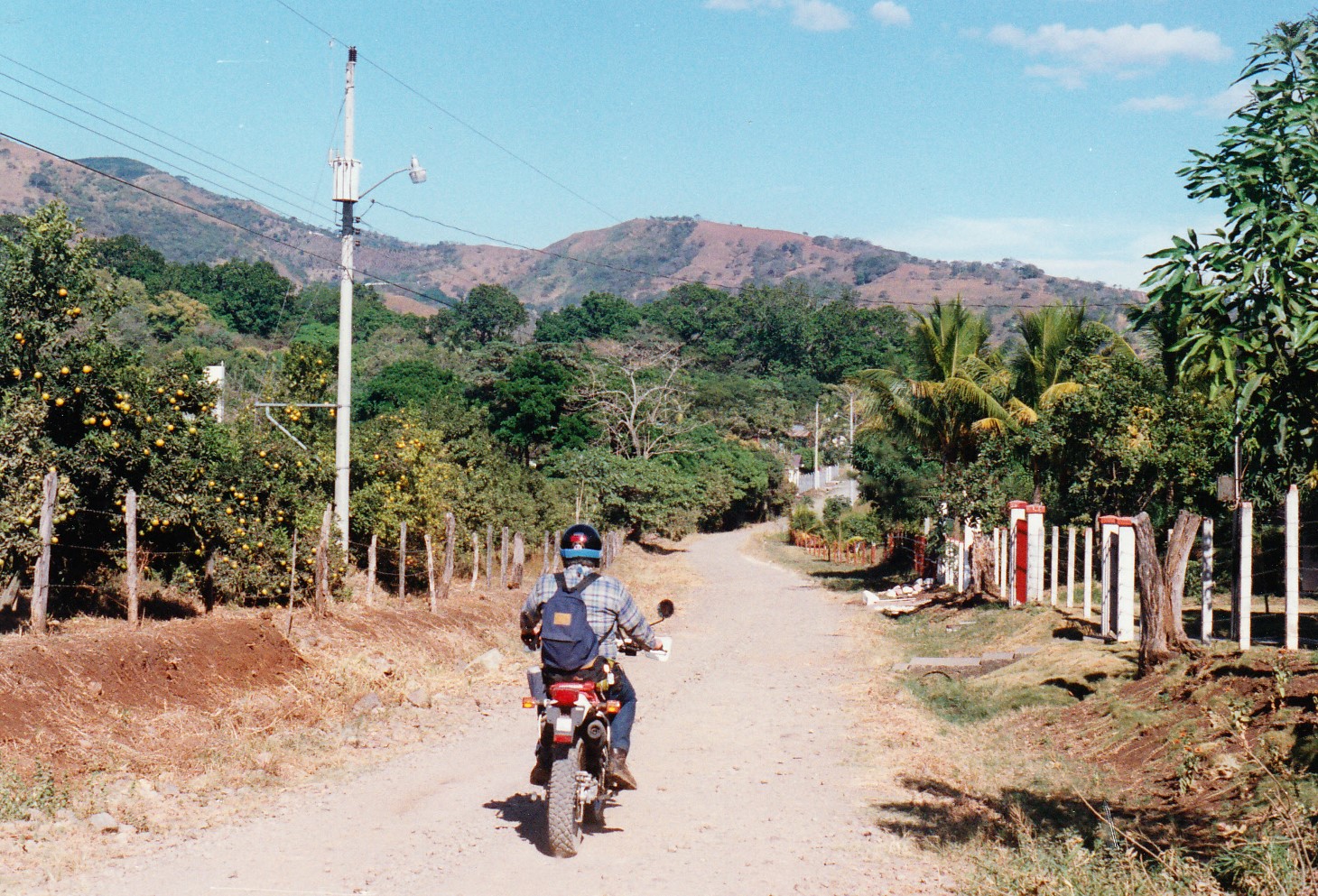
The dirt road twisted upward, climbing the side of a mountain.  I dodged boulders and powered my way out of ruts that threatened to swallow my bike’s knobby tires.  At the top of the hill, the road disintegrated into a livestock trail, then disappeared altogether.  With one eye scanning the grass for snakes, I carefully turned the motorcycle around.  Brian pulled a topographic map from his backpack.  Sweat poured off of us in the tropical sun as we searched the surrounding valleys and sugarcane fields for a landmark.  Nothing looked familiar.  Our first day touring Costa Rica, and already we were hopelessly lost.

From a gated driveway to our left, a beat-up Toyota truck appeared, three young Tico men crammed into the cab.  They stared at the pale North Americans fiddling with a compass.  Eventually, one of them emerged from the truck and asked us, in Spanish, if we needed help.

“¿Habla Inglés?” Brian asked hopefully.  The Tico shook his head and said something in Spanish.  We showed him the map, and asked – for the first of many times – “¿Donde esta aqui?”  Where is here?  The young man pointed and gestured.  His two friends joined into the action, arguing among themselves about the best route to Grecia.  “No comprende,” we said.

Finally they pointed to the truck and the motorcycles, getting across to us the idea that we should follow them.  They all watched with great interest and humor while I kick-started my motorcycle.  We followed them down the mountain and along a back road which crossed a river, ran underneath the Pan-American Highway, and emerged at pavement.

costa_rica_0002The Tico driver pointed north.  “Diez kilometres a Grecia,” he said, “y derecho a la iglesia.”  With an easy smile, he pulled a U-turn and went back the way he had come.  Grateful for the assistance, we accelerated on the paved road toward Grecia.  It took only a few minutes before we lost our way again.

Getting lost in the jungles of Central America was the only one of my fears about touring Costa Rica by motorcycle that actually came true.  Robbery, deadly snakes, colliding with a crazy driver or chicken, crocodiles lurking at river crossings, and the lack of  bathrooms along the route: these fears never materialized.  Exploring Costa Rica by motorcycle proved to be an extremely challenging journey of lost and found.

It began when I spotted an ad at the back of a motorcycle magazine for a company called Motorcycles Costa Rica.  I called the number, in Virginia, and talked to Jim Thompson, a man whose calm, soothing voice assured me that my scant two years of riding experience in Alaska was adequate to tackle Costa Rica.

Three weeks later, we stumbled off the red-eye flight in San Jose, Costa Rica and were whisked to a bed-and-breakfast called Villa Tranquilidad in Atenas.  Coming from a sub-zero January in Alaska, I immediately realized that I was overdressed.  Quickly I changed into shorts and went to sit on a terrace next to the pool.  Unseen insects buzzed in the trees; brightly colored birds flew beneath the tropical sun.  I relaxed that afternoon, trying not to think about the winding, traffic-choked road we had traversed between the airport and Atenas.

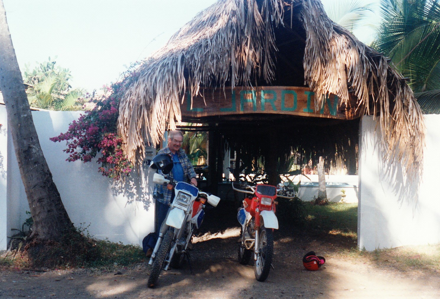
The next morning Jim fitted us with Honda motorcycles.  Brian took one of the XR250L’s, while I chose the XR200, mainly because it was the only one small enough to fit my 5’ 5” frame.  Jim gave us some maps and suggested a couple options for loop trips, then we were on our own.

Eventually, after the young men in the Toyota set us back on track the first day, we found ourcosta_rica_0006 
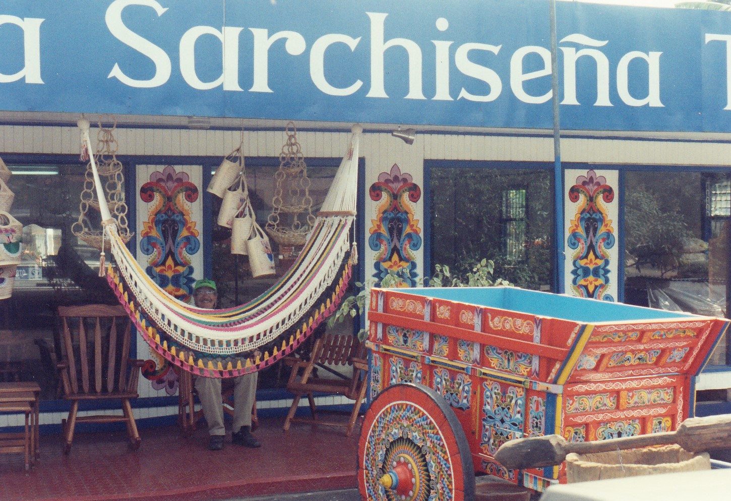
way to Sarchi, a town known for its beautiful wood and leather crafts.  We continued on some distance past Sarchi, until growling stomachs led us off the paved road to a restaurant called Señor Pollo, Mr. Chicken.  The waitress babbled in Spanish; we nodded weakly and waited to see what she would bring.  The result was a delicious lunch consisting of half a roasted chicken (one that was, no doubt, crossing the road yesterday) and a fresh strawberry milkshake.

The next day, Sunday, was, Jim advised, a good day to stay off the paved roads.  Costa Ricans, or Ticos, as they called themselves, worked six days a week.  Sundays they were off, and half the population of San Jose drove to the coast.  At his suggestion, we skipped the highway and instead followed a rough route over a mountain south of Atenas.

Views of coffee plantations and cattle rangeland unfolded around every turn.  In what seemed like the middle of nowhere, we rode around a corner and suddenly found pavement beneath our wheels.  The pavement lasted for a couple hundred meters, then ended abruptly at a driveway leading into a beautiful whitewashed house.  Flowers filled the yard; the tile roof shimmered in the heat.  Beyond the driveway, the dirt road returned.  It was a reminder that, though the rural countryside appeared desolate, a lot of people lived tucked away in the hills.

Creatures on the road also reminded us of civilization hidden behind the wild veneer of the costa_rica_0003
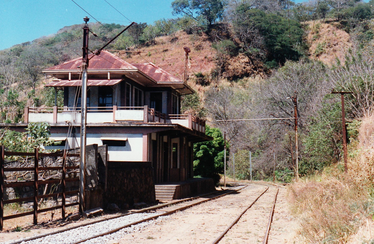
mountains.  Cattle ranged freely, often wandering onto the road.  Chickens waddled right into our paths.  Small dogs, cats, and pigs came into view.  Children ran along the road, playing; mothers walked sedately behind them, umbrellas shielding them from the tropical sun.

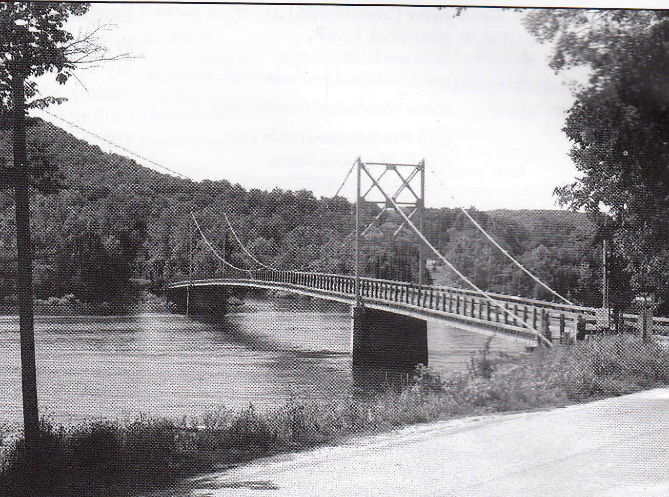
The road followed some train tracks for several kilometers before plunging down another steep hill to the Rio Tarcoles.  There a wooden bridge, one lane wide and none too sturdy, spanned the river directly above a radical stretch of whitewater.  As I eased my Honda onto the bridge, I looked up to see a date etched on the span: 1928.

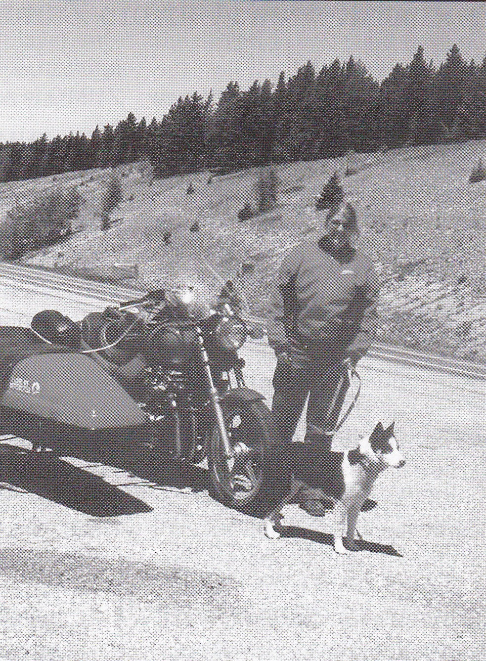
Rising from the river canyon, the road led to San Pablo, a sleepy town arranged around a grassy plaza.  I felt all the Tico eyes upon me as I dismounted and removed my helmet.  I could almost hear the collective gasp: That’s a woman!!  In my travels through Costa Rica, I only once saw another woman on a motorcycle.  Wearing a skirt, she sat behind her man – side-saddle!!  Apparently the people of this conservative nation viewed motorcycling as a man’s sport.  Intent on doing my part to raise feminist consciousness, I pasted a smile on my dust-covered face.  Perhaps someday, I thought, some Tica girl might tell her father that she, too, wanted to ride a motorcycle.

After a lunch of tortillas, cookies, and Coca-Cola, we climbed a paved road out of San Pablo to a ridge top.  From the summit, we rode along the spine of a mountain which divided the river valley to the left from the coastal plain to the right.  For thirty kilometers, we leaned into peg-costa_rica_0007
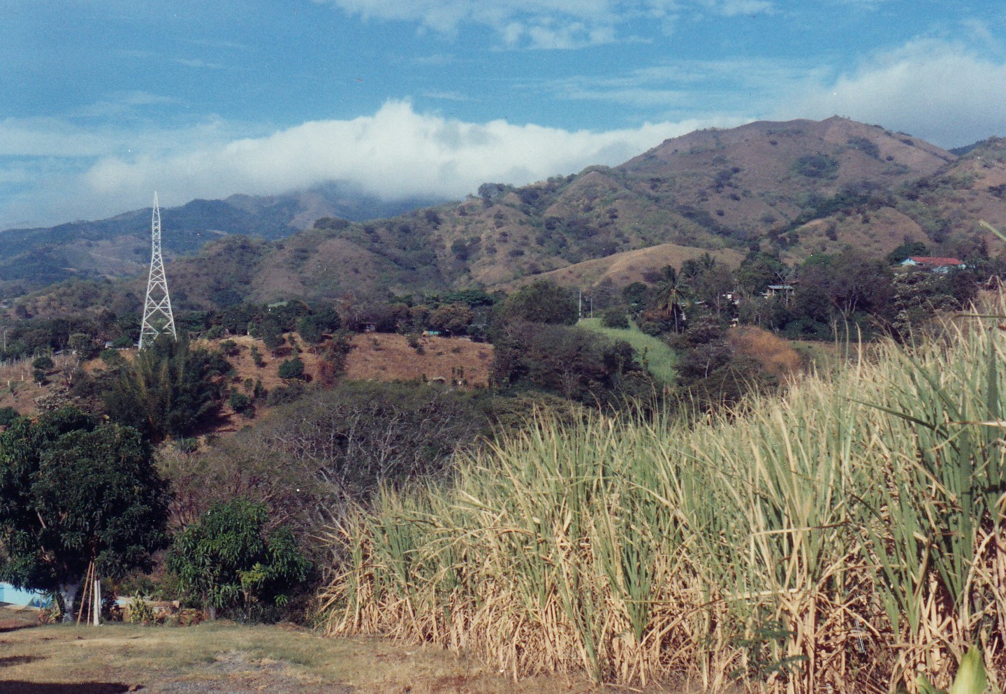
scraper curves.  Across a valley dotted with villages, a distant volcano flanked by cloud forest was visible.  It was difficult to keep my eyes on the road.

Eventually we glided into a good-sized town.  I spotted a sign pointing the way to San Jose, only 43 kilometers away.  “Yikes!” I exclaimed, motioning for Brian to pull over. We stopped in front of a church and retrieved the maps to figure out where we were.

The name of the town did not match anything on the map.  “We’ve ridden off the map!” I said.  Donde esta aqui?  Lost, once again, in Costa Rica.

“We could ask directions in the store there,” Brian suggested.

“But they’ll answer us in Spanish,” I countered.  The people of Costa Rica, when told we didn’t understand Spanish, responded by talking faster, waving their arms, and shouting.  Unprepared to deal with this routine again, I suggested that we turn around and go back the way we came.

Brian assented, mostly, I suspect, because he wanted another go at the curvy road between thecosta_rica_0005 
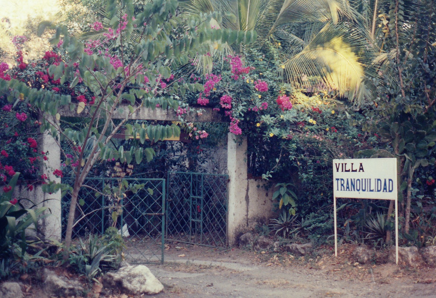
mystery city and San Pablo. We headed back over the wooden bridge and, after a stop for a Coca-Cola in a tiny village near the tracks, made it back to the bed-and-breakfast just before sundown.

Jim accompanied us the following day on our trip to the beach.  He said he needed to complete a business transaction, although I got the feeling that his errand was just an excuse to go riding.  Out of Atenas, the main highway toward the coast followed an ancient route used during the Spanish colonial days.  Like every other road in Costa Rica, it skirted cliffs and sported potholes.  Huge sugarcane trucks and busses barreled around hairpin curves on the way down the mountain.  One-lane bridges appeared without warning.  A truck with its hood up sat right in the middle of the road.  Its owner grinned at me as I roared past, then went back to the leisurely task of adding a liter of oil to his engine.

At Orotina the air temperature and the humidity both climbed by 20 points.  The size and frequency of potholes increased steadily.  Just after we crossed the Rio Tarcoles, I felt my bike wobble.  A mile later, Brian motioned me into a roadside restaurant parking lot and told me the bad news: my back tire was flat.

We proceeded to a gas station nearby.  There, Jim, using broken Spanish, obtained a new tube, which he helped the attendant install.  I stood in the shade sipping a Coca-Cola and wondering how we would have handled this minor crisis without Jim.  He assured me that all the gas stations fix tires.  Still, I mumbled to Brian what had become a refrain: “We’ve got to learn some Spanish.”

costa_rica_0001Once in Jaco Beach, we cruised the main drag, stopping while a three-foot-long iguana crossed the road.  No one hawked souvenirs on the sidewalk; no one tried to steal my bag.  Though Jaco was said to be the most popular beach in the country, it seemed low key and tame compared to Puerto Vallarta or Mazatlán.

We went into the mountains above Jaco Beach the next morning.  Within the first 20 kilometers of the ride, we made four river crossings.  Veteran off-road riders would probably not term them rivers, but for me, inexperienced in crossing anything bigger than a garden hose, the streams looked swift and terrifying.

I put the bike into first gear, took a deep breath, and plunged in.  With white knuckles I hung on as the tough little Honda forged its way across the gravel riverbed safely.  Brian’s luck was not so good.  Starting in second gear instead of first, he lost momentum in the swift current and his motor stalled.  Plunk!  Down went his booted feet into the river.  But the water was warm, and he quickly got the bike restarted.

Roads in the mountains inexplicably branched off, seeming to go every which way.  We had to stop three times in a five-mile stretch to consult the map.  A truck going the other way stopped.  Hanging his head out the window, the driver inquired in Spanish something to the effect of, “Do you have any idea where you are?”  Brian waved the map at him and smiled.  “Turista,” he explained.  The man nodded and disappeared in a cloud of dust.

Vast coffee plantations lined the road.  Leather-skinned men working in the fields waved as we went by.  Children in the tiny villages peeked at us shyly; I wondered if they had ever seen North Americans before.  Certainly they had never seen a blonde, sunburned Alaskan woman on a
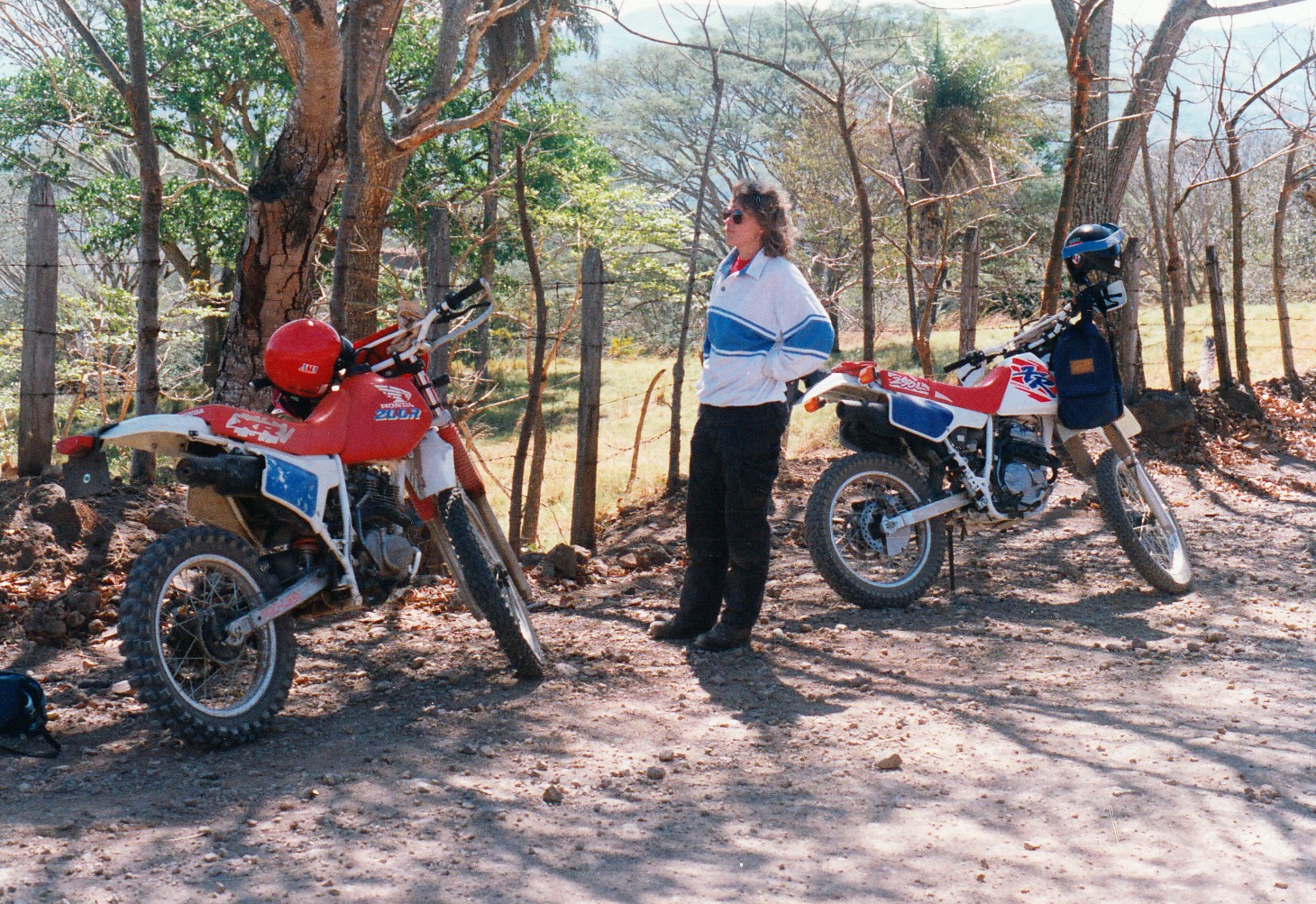
costa_rica_0004 motorcycle.

Passing over another mountain range, we were treated to a spectacular view of the Pacific Ocean and, in the distance, the Nicoya Peninsula. I stopped to take a picture, and instantly regretted it as I realized the difficulty of kick-starting a motorcycle facing downhill next to a suicide cliff.  But Costa Rica had improved my riding skills; wiping the sweat from my forehead, I squeezed the front brake, pulled in the clutch, and hit the kick start.  The engine roared to life, and down the hill I went, brakes squealing.

On the last day of the motorcycle adventure, we followed the paved road back to Atenas, stopping at the Carara Biological Reserve to watch some crocodiles recline lazily on a river bank.  Then it was up the hill, dodging potholes and runaway cows and crazy drivers all the way back to Villa Tranquilidad.

Five days, 600 miles of riding, and I had only seen a small portion of Costa Rica.  Remaining were more than a dozen national parks, volcanoes, jungle rivers, rain forests, and pristine beaches.  So many more roads to get lost on!  So many grinning Ticos to ask directions from!  As Jim rolled the Honda into the garage, he casually mentioned that his company was running a trip down the Pan-American Highway from Costa Rica to Patagonia next year.

“I’d love to go!” I said, my blistered hands and sunburned nose forgotten.  “But first”— I turned to Brian, grinning – “We have got to learn some Spanish!”


Colorado Roots in the Rockies

© 2013 by Kathleen Kemsley, first published in Rider Magazine, August 2014

As children we heard many of Grandma Louise’s stories about Colorado.  She was born in a log cabin a few miles outside of Creede, to a mother who had been born in Leadville and spent part of her childhood in Cripple Creek.  This family history at high altitudes caught my imagination when, a couple years ago, I started looking for these places on a map.  I couldn’t help but notice the winding two-lane roads and high passes on a route that traversed through those towns.  Out rolled my motorcycle on a sunny day in August, and off I rode to search for my roots in the mountains of Colorado.

My first destination involved popping over Wolf Creek Pass from Durango.  Once on the east side of the Continental Divide, I turned north along the headwaters of the Rio Grande.  The valley I followed was wild, isolated, and beautiful.  I tried to imagine what it might have felt like to be a child living so far from civilization.  Several miles past Wagon Wheel Gap, I turned onto a scarcely marked dirt road which led to La Garita Ranch.

The ranch was purchased in 1908 by Senator Lawrence Phipps as a fishing and hunting img_0001retreat for himself and his buddies.  My great-grandfather, Otto Crain, worked as the first ranch foreman.  He arrived with his new bride, Gertrude Kavanagh, right after their New Years wedding, 1909.  In a one-room log cabin that October, Gertrude gave birth to their first child, Louise.

La Garita Ranch today is still a retreat for the rich and famous.  The private guest ranch offers horseback riding, fishing in the Rio Grande, and relaxing in a lodge with picture windows framing the adjacent La Garita Wilderness.  A few weeks before I visited, Johnny Depp and company stayed there while filming portions of “The Lone Ranger.”

Continuing my ride upstream along the Rio Grande River and the old railroad bed for a few miles, I reached Creede, a mining town which boomed in the 1890s.  This would have been the closest town for the young Crain family to buy supplies, get medical help, or meet their neighbors.  It took me 15 minutes to ride there, but might have taken them half a day.

A Polish hot dog purchased at the Best Little Doghouse In Creede satisfied my hunger while only setting me back $3.75.  Heading north out of town, Highway 149 carried me past the Rio Grande Reservoir and over two high passes.  A flash of blue caught my eye at the top of Slumgullion Pass as a mountain bluebird flapped past, thriving like the evergreen trees at 11,000 feet.

The Silver Thread, as this highway is known, looped down to Lake City, another isolated mountain town founded in the latter part of the nineteenth century to serve as theimg_0004_3 
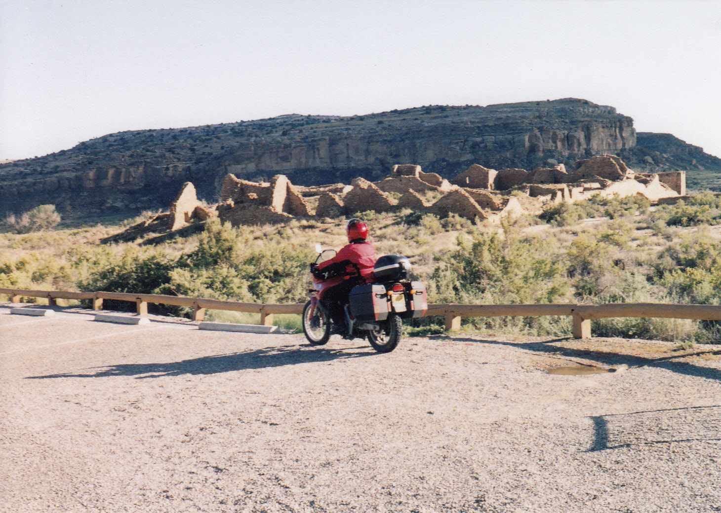
commercial center for nearby mining claims.  Today it hangs on mostly due to a small but steady procession of two- and four-wheeled explorers traveling the rough dirt roads of the Alpine Loop Backcountry Byway from Silverton.

I crossed Highway 50, one of the main east-west thoroughfares in Colorado, rode beside Blue Mesa Reservoir for awhile, and found a place to camp at Crawford State Park.  The next morning I rode to Paonia, longtime site of a well-known BMW rally.  Paonia wasn’t high in the mountains as I had imagined.  Rather it was a scattering of valley bottom farms watered by the Gunnison River, with roads running out like spokes to a number of spectacular high country loops.  The perfect base camp for a motorcycle rally!  I followed Highway 133 over the pass to Redstone, a town appearing a little too touristy for its own good.

Emerging from the mountains, I stopped for a breakfast burrito in Carbondale.  The red rocks made a nice backdrop for a down-to-earth sort of town.   Turning uphill out of Carbondale, I spied a newly ignited brush fire running up a hill on some BLM lands.  My img_0030
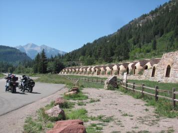
pulse quickened reflexively, since I have worked for more than twenty years in the fire suppression field.  But a helicopter had already been launched and it was working the flames with its bucket, so I didn’t need to stop.  A few miles later I reached world famous Aspen.  To my right, trees were clear-cut in rows down the mountainsides to accommodate ski lifts and world class runs.  Nothing of interest to a motorcyclist in August!!

The paved approach to Independence Pass narrowed with curves turning back on themselves.  I leaned into the arcs and breathed deeply of the thin air.  It was Never Summer on the top of the Rockies – 12,150 feet elevation, swept clean of trees and oxygen.  On both sides, numerous Fourteeners – otherwise known as Bigass Mountains – towered over the pass.

When I finally reached Leadville late in the day, I was dismayed to find that a “Boom Days” festival was underway, and every hotel was full.  A bored hotel clerk took pity on a weary motorcyclist who had just ridden 500 miles across the rooftop of Colorado.  With nothing else to do, she obligingly made some calls and found me the last available room in town, at a bed and breakfast a block back from Leadville’s main street.

Refreshed and revitalized after changing into shorts and sandals, I walked downtown to look at the restored grandeur of Leadville.  The town had been the second-largest in Colorado during the mining heyday of the 1880s, with a population estimated at 40,000 people.  Here passed through famous folks like Horace Tabor, Doc Holliday, Harvey Mudd, and Poker Alice.  Here too, settled thousands of not-so-famous miners and people servicing them, including my great-great-grandfather, Civil War veteran Austinimg_0054 
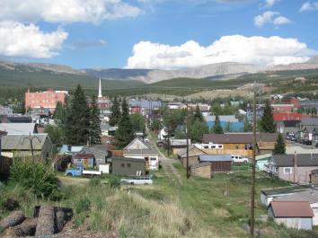
Kavanagh.  He, along with his wife Mary and several children, made the difficult trek across country by rail, stage, and foot to reach Leadville in 1882.  Austin had some connections with politicians and businessmen from his native Boston, so he established himself as the right-hand-man of a wealthy local businessman in Leadville.  Most of their children perished in the harsh conditions at 10,400 ft elevation, but then two more (including my great-grandmother Gertrude) were born in Leadville, growing up fit and hardy in the rough mountain town.

I tried to imagine, as I admired the ornate architecture of the Delaware Hotel and the collected antiques in the Healy House, what it might have been like to grow up in a  lawless mining town where, so the saying goes, summer only lasts for 30 days, and those days are never consecutive.  I felt great (if a little winded) walking around two miles above sea level on one of those 30 summer days, enjoying fake shoot-outs in the street, and women parading in period costumes for Boom Days.  Typical street food, gyros and lemonade, tasted extra-flavorful in the thin air at the top of the world.

The next day I rode out of Leadville and down a side road to reach the Leadville National Fish Hatchery.  As I walked the nature trail between the lakes above the hatchery, I img_0095
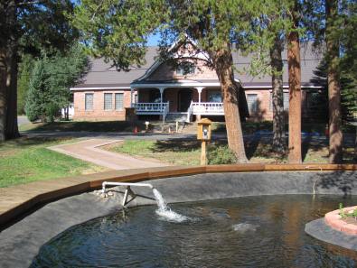
pictured my grandmother Louise and her seven siblings wandering around in these woods while their dad raised trout.  The Crain family moved here after several years in Creede and lived in a tiny cabin behind the main hatchery building.  The hatchery was a peaceful, natural place where I imagined the children would grow up away from the influence of crooked miners and other shady characters back in town.  They lived there in apparent bliss, a loving Irish-American family with a new baby arriving almost every year.

As I rode down the mountain from Leadville and headed east to Cripple Creek, I thought about Gertrude’s hardy upbringing .  For several years during Gertrude’s childhood, the Kavanaghs lived in the rough mining town of Cripple Creek, the scene of grim mining accidents, workers’ riots, and shootouts in the 1890s.  What violence did she witness as a child there, and how did she stay out of harm’s way?  The formerly difficult trip across wild mountain terrain between Buena Vista and Florissant was smoothed by some gently curving asphalt roads.  A spur road to Cripple Creek rose steeply out of cattle and llama ranch lands into jagged black rock cliffs.

Cripple Creek itself has long since ceased to be a mining town, unless you count mining for img_0123
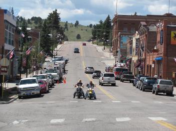
people’s hard-earned savings.  The main street was lined with casinos, attracting people from Denver and Colorado Springs to try their luck on the poker machines and roulette wheels.  One of my Ben Franklins disappeared at lightning speed into a one-armed bandit, so I gave up and headed back to my bike to continue my journey.

An unexpected surprise and delight on the downhill side of Cripple Creek was a sweet little two-lane backcountry road, adorned with luscious undulations and sweeping curves.  Lined with late summer sunflowers and scented of juniper, the road was posted with 25 mph speed signs but I confess to doing twice that, leaning into the rounds and sharing the road with only a handful of Sunday drivers, mostly motorcycles.

In high summer, with mild temperatures and flowers abloom, it was tempting to stay longer in the Colorado Rockies.  I’m sure Gertrude’s family felt that way too, until the fateful year in which their fortune changed.  In the fall of 1919, a horse stepped on Otto Crain while he was working at the hatchery.  Over the next couple weeks, the injury became infected.  Lacking antibiotics, the doctor wasn’t able to halt it.  Septic shock set in, and Otto died in November leaving Gertrude a widow with seven children to support.  She managed to survive by farming out the kids and finding work as a waitress in a Harvey House.  Five years later Gertrude re-gathered her family and bailed out of the mountains, riding a train to Pasadena, California to live with her sister.

The Crains were unable to stay in Colorado.  But the mountains stayed with them.  More than sixty years later, Grandma Louise reminisced fondly about blooming columbine and fireweed, tall spruce trees, ice-cold clear lakes, and aspen leaves shimmering like fire in the weak autumn sun.  I saw Colorado as she described it, big and bright and beautiful.  Long after my ride ended, the power of the mountains still reverberated.  Someday soon I will return, to learn more about the pioneering spirit of my ancestors who carved a life for themselves in the wild highlands of the Colorado Rockies.

Along the Santa Fe Trail

© 2006 By Kathleen Kemsley, First published in Rider Magazine, November 2006

We planned to attend a regional sidecar club rally in September.  There was just onesanta-fe-trail_0008 drawback: the rally took place in eastern Kansas.  Kansas?  What was there to see in Kansas?

Though I had never set foot in the state, I had heard plenty about how flat and tedious the journey is across the Great Plains.  And I had watched The Wizard of Oz enough times to cement my conception of Kansas, always appearing in black and white.

A GPS unit could tell me which route would get us to the rally site in Council Bluffs the quickest. A good old fashioned map told me something more important: What was along the way.  Between our home state of New Mexico and the rally, there existed the remnants of a trail over which was etched the history of American commerce.

My husband and I picked up the Santa Fe Trail where it branched into two routes.  From Interstate 25 in northeast New Mexico, we rode onto Highway 56, a.k.a. the Cimarron Cutoff, across some empty country.  The Point of Rocks east of Springer marked the trail’s santa-fe-trail_0001last (or first, depending on whether you were coming or going) view of the Rocky Mountains.

Undulating plains along the Cimarron Cutoff lay dry and barren, crossed only by a couple of small creeks and inhabited by a healthy population of rattlesnakes.  In one segment between Springer and the Oklahoma border, I braked hard four different times to avoid squashing three-footers stretched across my lane in the afternoon heat.

The first night on the Santa Fe Trail, we camped at Cimarron National Grasslands, 11 miles northeast of Elkhart, Kansas.  The campground sat next to the Cimarron River, one the few permanent water sources along the southern branch of the trail.  Trail travelers traditionally stopped here to water their animals and rest before pushing on through the big empty.

The next morning, I walked along remnants of the trail that was first traveled in 1822, under a sky the color of orange sherbet.  Sounds filled the dawn: coyotes yipping nearby, a flock of birds startling from a riverside bush.  A cottonwood tree stood sentinel by the trail.  In my imagination I became one of the intrepid traders who paused beneath this same tree nearly 200 years before.

Unlike the Oregon Trail farther north, tramped by thousands of migrating settlers, the Santa Fe Trail was all about commerce.  The city of Santa Fe in the early 1800s functioned as a northern outpost of the republic of Mexico.  Merchants running the trail between Santa Fe and Kansas City traded silver, mules and Mexican textiles for American manufactured goods and supplies hauled via the Missouri River.

Plains Indians along the way joined the free enterprise fray, santa-fe-trail_0002trading buffalo robes and beaded clothing for horses.  Some conflicts were inevitable, but trail users for the most part cooperated with each other because everyone had something the others wanted.

Two hours northeast of Elkhart, the northern and southern branches of the Santa Fe Trail converged near Dodge City.  Thanks to Hollywood, exaggerated stories about the Wild West had transformed Dodge City into a kitschy tourist attraction.  We chose not to pay eight bucks to tour a re-created version of the Front Street which burned to the ground in the 1880s.  But we did take a few minutes to admire an authentic steam engine sided next to the visitor center and poke around a couple of turn-of-the-century shops selling Western gear and memorabilia.

After lunch, I finally got to say the words I’d waited all morning to utter: “Let’s get the hell out of Dodge!”  Northeast we continued along the Santa Fe Trail toward civilization.

The famous trail landmark, Pawnee Rock, was our next stop.  The tallest natural feature for miles around, the rock marked the halfway point between the Missouri River and Santa Fe.  Many early travelers carved their names into the rock face.  Today, modern graffiti has mostly covered the original signatures.  Looking south from the top of the rock, we could see a line of trees making the bank of the Arkansas River.  Beyond, the seemingly endless prairie-turned-farmland plain swam before my eyes, flat as slate, extending forever.

We overnighted 80 miles east of Pawnee Rock at a lake near the Maxwell Wildlife Refuge.  santa-fe-trail_0003Our ride on a dirt road back to the highway the following morning was halted for a few magical minutes while a herd of bison passed by.  Separated from us only by a cattle guard, they milled around, males sparring half-heartedly, calves chasing after mothers who leisurely grazed on the remnants of long prairie grasses.

The memorized words of Carl Sandburg’s poem, Buffalo Dusk, came to me unbidden: The buffaloes are gone / And those who saw the buffaloes are gone / Those who saw the buffaloes by thousands and how they pawed / the prairie sod into dust with their hoofs / their great heads down / pawing on in a great pageant of dusk….  A lump formed in my throat, a sadness for the passing of an era now extinct from the plains.

In the Flint Hills, we rode south of the Santa Fe Trail a few miles to visit the Tallgrass Prairie National Preserve.  From the parking lot, rolling hills overlooked what’s left of a santa-fe-trail_0005tallgrass prairie that once covered 400,000 square miles of the Great Plains.  We stretched our legs walking up a steep driveway to reach a ranch home and three-story barn built of hand-cut limestone in 1881.

A curving scenic road led through the Flint Hills to Council Grove, where buildings 150 years old adorned the town’s main street.  Historic Conn Store, dating from the 1850s, provided travelers a last chance for “retail therapy” before hitting the dusty trail west.  Across the street, Hays House, built in 1857, served as a gathering place for meals, church services, court trials, mail distribution, and political rallies.  Todaysanta-fe-trail_0004 it is billed as the oldest continuously operated restaurant west of the Mississippi River.

We attended a “Santa Fe Days” celebration held on the grounds of Terwilliger Home, a limestone building on Main Street dating to 1861.  Locals in period costumes spun wool, sang, and sold handmade crafts, evoking 19th century village life – at least until they emerged from the house carrying hamburgers and cans of pop.

After the rally we detoured north, then picked up the Santa Fe Trail again in Dodge City and followed its northern branch back home.  Though longer than the Cimarron Cutoff, the mountain route was preferred by trail travelers because it offered more water sources and less danger of Indian attacks.  We liked the fact that it was, as the beer commercial says, a few degrees cooler.

Wagon tracks were visible in several places along the route between Dodge City and the santa-fe-trail_0006Colorado state line.  The Santa Fe Trail followed the bank of the Arkansas River, once the southern border of the United States.  The railroad, too, followed the trail route next to the river.  Ironically, the materials used to build the railroad were hauled on the Santa Fe Trail; once completed in 1880, the railroad then rendered the trail obsolete.  But later, when long-haul trucks eclipsed freight trains, the trail route was resurrected and paved.

Just outside of Las Animas, Colorado, we camped another night on the old Santa Fe Trail at a place called Boggstown.  Situated on the Purgatoire River not far from Bent’s Old Fort, the little settlement was founded by pioneer Thomas Boggs in 1862.  A group of families related by marriage, including Kit and Josefa Carson, built hacienda-style houses in the settlement during the 1860s and 1870s.  When the site was acquired by a local historical society in 1985, ruins of more than 20 structures were located.  Slowly the homes of these early influential families are being restored.

That night I felt a deep kinship to those who camped before me along the Santa Fe Trail.  After nine days on the road, the food in our cooler was spoiling; my skin was dirty, mosquito-bitten and sunburned.  A full moon rose over Boggsville.  Wind blowing through cottonwood branches suggested the long-faded laughter of travelers who met in the village’s central plaza to swap goods and road stories.  Two owls hooted back and forth, recalling a simpler, wilder time when people lived beyond the reach of mass communications, and camping was a way of life.

We visited Bent’s Old Fort a few miles upriver from Boggsville the following day.  Unlike military forts farther east, this fort’s purpose was for trading.  The Bent brothers situated themselves at the juncture of Indian country, the Santa Fe Trail, and Mountain Man routes into the Rockies.  They sold stores to the frontiersmen, acquired skins from the Arapaho, Cheyenne and Kiowa tribes, and traded for Mexican goods with the wagons from Santa Fe.  Trade flourished at the fort for about 20 years beginning in 1833.  During the Mexican War of 1846-48, it also functioned as a supply point and staging area for the U.S. Army running raids into New Mexico.

Completely destroyed by fire, floods, and the sands of time, the fort was abandoned in 1853.  The National Park Service excavated andsanta-fe-trail_0007 
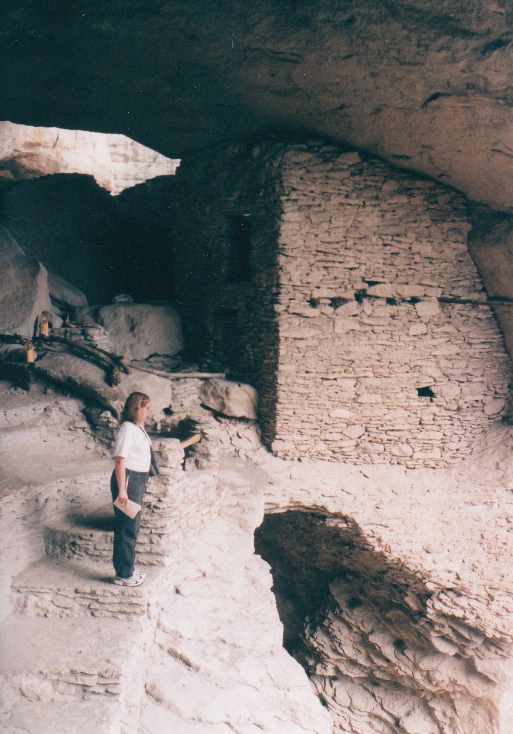
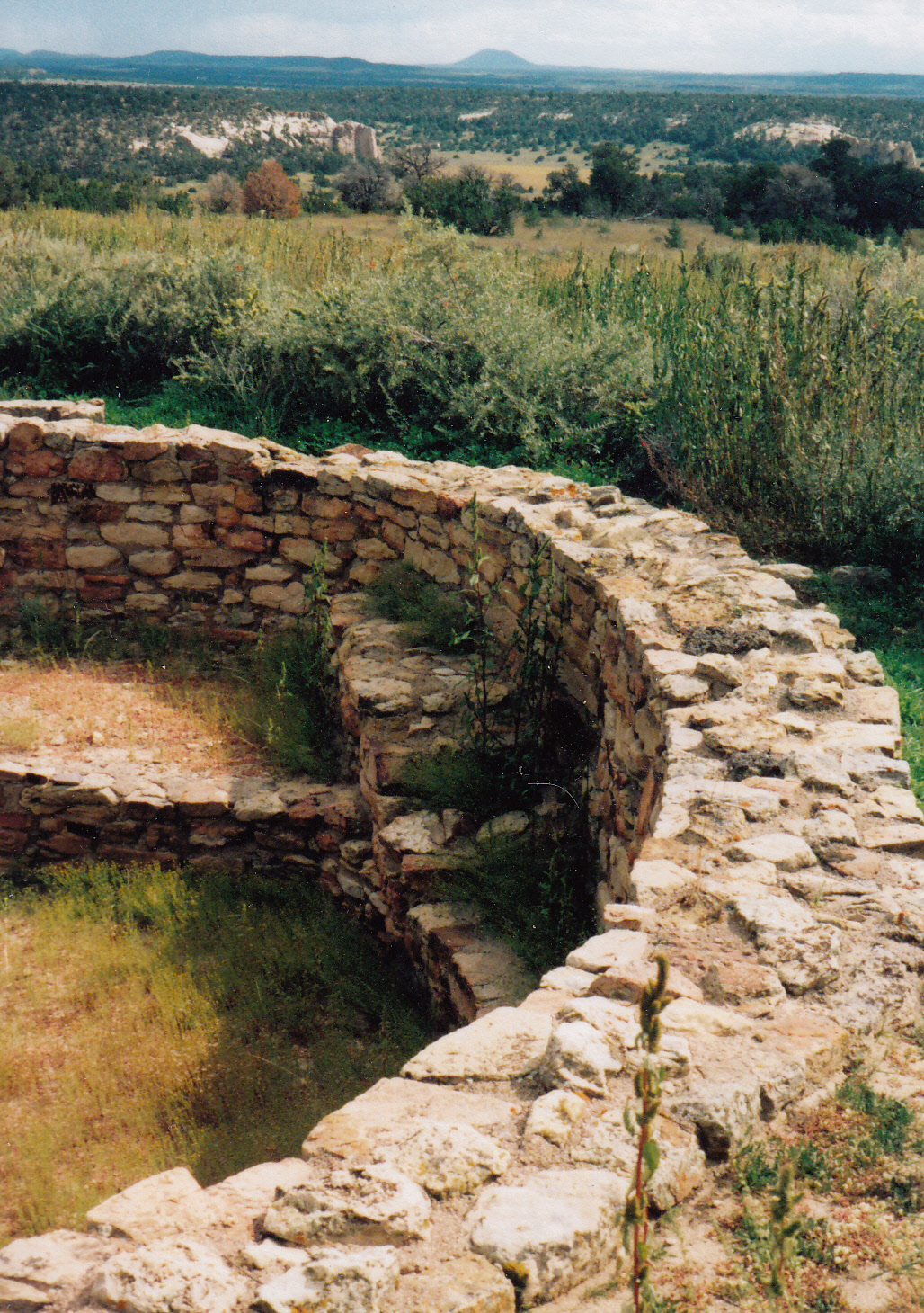
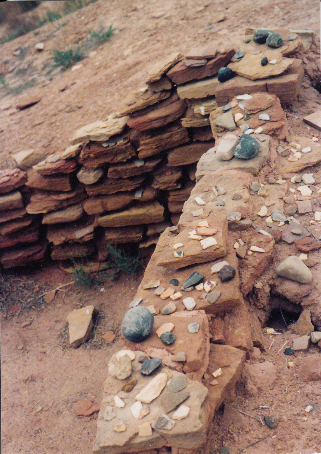
reconstructed the building in the 1970s using historically accurate drawings and photographs.  As we wandered past doorways of more than 20 adobe rooms on two levels, a historian dressed in period clothing fed a campfire by the fort’s door and answered questions about life on the frontier.  The smell of burning juniper added to the authenticity of the restoration at this important outpost on the Santa Fe Trail.

The trail turned sharply south past Bent’s Old Fort, leading across the Comanche Grasslands to Raton Pass on the Colorado-New Mexico border.  At 7,400 feet, the pass represented the final major obstacle along the way to Santa Fe.  Today railroad tracks and Interstate 25 both follow the original trail’s route across the conifer-dotted pass.  Nearly 200 years later, it is still the only passage through this section of the Rocky Mountains.

South of Raton, the trail closely followed the interstate all the way into Santa Fe.  A die-hard history buff might continue along the interstate, visiting historical sites like Fort Union, an Army outpost, and Glorieta Pass, site of the westernmost battle of the Civil War.  Otherwise, more interesting ways for a motorcyclist to reach Santa Fe include the scenic highway through Taos and the mountain route through Mora.  Our own journey on the Santa Fe Trail ended where the Pecos River crossed the Interstate, as we detoured downstream to the delightful state park at Villanueva.

By that time, immersed in the rich history and drama of the Santa Fe Trail, I could scarcely recall that my original objective had been to get to a rally in Kansas.  The “boring” drive across the Great Plains had proven to be fascinating.  Once again, the journey trumped the destination.


National Park Trifecta

© 2009 by Kathleen Kemsley, published in Rider Magazine, June 2011

In the most popular national parks, swarms of tourists can be as oppressive as the heat of summer.  Many people’s memories of these places consist of fighting motor home traffic jams, jostling for souvenirs, and eating cheap hot dogs that have been on the warmer too long.  On the shoulder season, however, crowds thin, parking spaces open up, and the animals emerge from hiding and show themselves.

Now, gambling is legal in Montana, and I’m a gambling woman.  When I moved here last winter, I naturally indulged in some video poker (Jacks Or Better is my game) in the mini-casinos that grace every intersection.  I’ve also been known to bet on the ponies from time to time.  So I decided to try my luck on the week after Labor Day to hit the National Park Trifecta: Glacier, Yellowstone, and Grand Teton.

From Missoula, I first rode north alongside a three-of-a-kind of long, skinny lakes – Salmon, Seeley, and Swan.  The mountains of Bob Marshall Wilderness, towering to the east, are locally known simply as “The Bob.”  As in, “What happens on The Bob, stays on The Bob.”  Shades of Las Vegas.  I hasten to add that I haven’t any personal experience with what happens on The Bob.  At least not yet.

At Columbia Falls I turned east and headed for Glacier National Park.  For a motorcyclist, the 3) Tunnel1sure bet is Going-To-The-Sun Highway, which famously clings to the side of an impossibly steep mountain.  An engineering marvel from the CCC era, the road easily lives up to its reputation for narrow and winding, with views to die for.

I do not know the exact number of people who have taken their last breath sailing over the edge, but I would wager it’s a few.  Traveling from west to east placed my motorcycle in the outside lane of the road.  Near the road’s summit at Logan Pass, I glanced over the low wall along the road’s edge to my right.  Empty air gaped, 2000 feet down.  At that moment a sudden gust of wind hit me from the left.  And, well, let’s just say that I “nearly” had to change my undies.  Quite the thrill, quite the rush, the rider’s equivalent of being dealt a natural full house.  Aces and eights, dead man’s hand.

More motorcycles than cars crawled up the narrow strip of asphalt between Lake McDonald and Logan Pass.  BMWs appeared to be the most common brand, though a healthy number of Harley-Davidsons were engaged in conquering the pass also.  The people sealed inside of cars looked at us longingly.  Anyone could see this road was a motorcyclist’s run for the roses.

Camped at Rising Sun that evening on St. Mary Lake, I was busily slicing sausage onto crackers2) Lk_McDonald when I looked up to see a black bear less than 40 feet away.  He was moving along the fringe of the campground.  I like to see creatures in the wild, especially when they appear to have something better to do than paw through my food.  This little guy ran right through and disappeared.  My food was locked inside sturdy Jesse bags, but it still felt a little dicey to sleep in a nylon tent that night.

Riding out the east side of Glacier the next morning, I leaned into a terrific side wind all the way down through the reservation.  The Rocky Mountain Front rose abruptly from the golden plains of central Montana like a dream, like a mirage, like a neon-lit casino 5) Column_bikefrom the sands of the desert.

Presently a distraction appeared southeast of my route: a smoke column appeared against the blue sky and built into a plume.  Since I work in fire management for the U.S. Forest Service, the growing wildfire worried me.  If it was anywhere near my forest, I’d have to cut my trip short.  But as I got closer, I saw that it was on the Helena, not the Lolo.  Still, in a year that was notoriously devoid of fires, it was the biggest column I’d seen all summer.

I camped that night at a BLM campground called Red Rock, just a few miles west of Bozeman on7) RedRock_camp a lovely twisting back road.  Approaching Yellowstone from the north the next day, I threaded my way through the town of Gardiner.  On my right sat the Two-Bit Saloon, looking a little worse for wear and tear after three decades.  Back in the day, I was a college student having the time of my life working as a waitress in Mammoth Hot Springs.  Life was carefree in those days, my only responsibility being to show up at work on time.  The drinking age was 18, the Two-Bit Saloon stayed open late, and my friends and I were as wild as one-eyed Jacks.

Along the ridiculously curvy road between Gardiner and Mammoth was a special, magic place for which I now aimed the front tire of my bike.  Only now, in 2009, Boiling River was no longer a secret that only the park employees knew about.  After having been trampled and run down and eroded, the spot was rehabilitated and regulated in the manner for which the National Park Service is famous.  A parking area a quarter mile down the road had been built, and a well-marked trail followed the Gardner River upstream to the site we used to stumble down a steep hillside in the dark to reach.  (Author’s note: this is NOT a typo.  The town is called Gardiner but the river is called Gardner.  Go figure.)

Ah, but Boiling River itself was still a world-class free hot spring, and my favorite in the whole8) BoilingRiver2 world.  The hot creek fed by the Mammoth Terraces burst from the hillside and tore down to mix with the cold, clear water of the Gardner River.  At their juncture, a motorcyclist tired from 300-plus miles ridden the day before could position herself underneath a thundering hot cascade and receive a straight flush of hot water to massage sore shoulders.   The odor of sulfur was heady, seductive.  The view downstream to sagebrush-and-juniper-clad hills was spectacular.  Ignoring the handful of fellow tourists nearby, I leaned back against a rock, raised my face to warm sunlight, and soaked until my skin pruned.

After my soak, I rode up to Mammoth Hot Springs Hotel, to find myself in the midst of a genuine elk jam.  A huge bull elk, antler rack splendidly displayed, urged his harem of 20 cows across the hotel lawn.  Park rangers used cones and megaphones to move people out of their way.  I watched the show from the window of the restaurant where I used to work.  The bull elk was 9) Elk2larger than my motorcycle, and I figured it was even odds whether I could actually outrun it.  Especially if it was protecting 20 girlfriends.   Exiting the building at the rear, I cut behind the old boy’s dorm, rolled the dice, and made a successful dash for my bike.

Temperatures dipped below freezing at Indian Creek, the campground where I stayed that night.  In the morning I was thankful for the BMW’s heated handgrips as I made the ride on a gorgeous curving road past lakes and mountains to beat the tour busses to the Norris Geyser Basin.

Norris is less visited than its sisters to the south, but is every bit as spectacular.  With no company save the cheerfully erupting geysers, I followed a boardwalk out past the Ledge Geyser to reach some algae-laden streams colored the same bright green hue as a blackjack table.  I passed a noisily bubbling pond aptly named Crackling Lake, and went the long way round to reach Little Whirligig, the cutest miniature geyser around.

My next stop on the Yellowstone circuit was the obligatory gawk at the Grand Canyon of the Yellowstone River.  I rode along a one-way road, parking my bike in a nearly-empty parking lot to walk to Grandview Point.  The canyon always looks stunning, but slightly illusory.  How could12) GrCa2 those colors be real?

Restless, like a gambler on a losing streak, I felt an urgent need to move on.  The lower geyser basins were calling and I could deny them no longer.

Old Faithful was gushing as I rolled off the cloverleaf at most famous attraction in Yellowstone.  But there are other geysers more faithful than Faithful, bigger, more frequent, so I didn’t bother to wait for it to go again.  Instead I wolfed down an Old Faithful Inn chicken burger and headed north, betting on the come that I would catch an eruption of one of the less famous (and less crowded) geysers.

Sure enough, I hit a modest jackpot when I pulled up to Great Fountain Geyser.  It agreeably sputtered, then shot into blue sky in a graceful plume three stories tall.  I scored another win at Firehole Lake when I parked my bike in a lot absolutely empty of any other vehicles, and had the place to myself.

And my third stop was a charm: I got to visit my best old friend, my favorite thermal feature in my favorite national park: the Grand Prismatic Spring.

Kurt Cobain’s line in “Aneurysm” came into my head: “I love you so much it makes me sick.”  As I breathed 15) Grand_Prism3deeply of the sulfur, the steam, the brilliant rainbow colors, the delicate bright algae and bubbling water, I knew exactly what he meant.  Suddenly I was transported back one year in time.  The previous September, while I was preparing for a different motorcycle ride, a piano fell on me.  An infection started, spread, slid into my bloodstream.  One day I was running my customary six miles and packing my saddlebags; the next day I was in the Intensive Care Unit, fighting for my life, as my organs failed and my systems shut down.  I came closer than I’ve ever been to cashing in my chips and joining the Big Poker Game In The Sky.

Floating for days on a hazy morphine cloud, barely hanging on, I lay in the hospital dreaming of this place – Grand Prismatic Spring.  Now fully recovered from septic shock, I stood at the place which had sustained me through the darkness.  My stomach wrenched remembering how near to the finish line I had drifted.  There may have been a few tourists on the boardwalk but I didn’t see them through the tears of gratitude that filled my eyes.

I waved at tons of motorcycles the next day as I wended my way south from my campsite at Lewis Lake into the little sister of Yellowstone, Grand Teton.  It was a first class ride with yet another spectacular view around each curve.  The paved road glided past the startling silhouette of sharp, craggy peaks which reminded the early explorers (who obviously had been away from the comforts of home for way too long) of breasts.  In my opinion the Tetons looked more like18) Teton_Bike wizard caps than women’s breasts.  But you see what you want to see, and I’m sure the name appealed to those lonely guys – gamblers all – who had taken the chance of exploring the unknown instead of staying home where it was safe.

An antelope jam gave me an excuse to stop along the park road.  It was then that I noticed, snaking through sagebrush beneath the towering peaks, a beautiful, smooth asphalt bike path that paralleled the road for miles.  So I promptly shed my riding gear, donned shorts and a jog-bra, and treated myself to an hour-long run beneath the magnificent peaks of the Teton Range.

Buzzing on a runner’s high, I reviewed the whole thousand miles I had just ridden, through the National Park Trifecta.  It was a blanket finish for the three most beautiful places in the Northern Rockies.  But in the final stretch, it was perennial favorite Yellowstone on the nose to win; wild, beautiful Glacier to place; and iconic Grand Teton in the money to show.  And I went home a winner.

Favorite Ride: The Gila Loop

© 2006 by Kathleen Kemsley, first published in Rider Magazine, Jan. 2006

Take a road that loops around 80 miles of asphalt twisties in the Gila National Forest near Silver City.  Blend it with some of the most spectacular mountain scenery in the southwest.  Throw in a few Indian ruins, ghost towns, art galleries and outstanding home-cooked New Mexican food.  The result?  One serving of the best motorcycle ride in southwest New Mexico: the Gila Loop.

Gila_loop_0001Just getting to the loop is half the fun.  From Caballo Lake, Highway 152 – the only paved route through the east side of the Gila Mountains – snakes past Hillsboro and Winston and up over Emory Pass.  A scenic overlook near the top of the pass allows a non-vertigo-prone rider a panoramic view of the Rio Grande Valley, 4000 feet below.  Beyond the pass, the road winds around hairpin curves and alongside cheerful little spring-fed creeks through the Gila National Forest.  A word to the wise: beware of loose gravel strewn on the turns near Emory Pass.

Once you reach the junction of highways 152 and 35, a decision looms.  Counterclockwise leads directly up to the Gila Cliff Dwellings with only a few eateries along the way, while a clockwise move takes you to civilization first.  I chose counterclockwise because out of the few places to eat on this route, Sister’s Restaurant in San Lorenzo has the best meals.  However, your timing has to be just right, as it’s only open Wednesday through Sunday between 11 a.m. and 2:30 p.m.  If your timing is off, there is always a good burrito to be had at the Mimbres Valley café.  Order it banarse, bathed in red or green chile sauce, for a special New Mexican treat.

The ride to the cliff dwellings passes scenic Lake Roberts, a summer magnet for boaters,Gila_loop_0002 fishermen, campers, and other hot-weather refugees.  Just beyond the lake, turn right onto the Highway 15 spur road.  Another 17 miles of colorful rock formations, voluptuous curves and spectacular vistas will bring you to the Gila Cliff Dwellings National Monument.

Stopping by the visitor center, you will learn that the Mogollon Indian cliff dwellings preserved within the monument are just one set among dozens of 13th-century structures located near this portion of the Gila River.  A pleasant 30 minute walk up to the dwelling site follows a streambed lined with cottonwood and ponderosa Gila_loop_0004pine trees.  The $3 entry fee will buy you a comprehensive trail guide covering the history, culture, architecture and mysterious disappearance of the Mogollon people who once lived here.

Backtracking to the junction of Highways 15 and 35, veer right to follow the Gila Loop toward Silver City.  Along a 19-mile stretch from the junction to Pinos Altos, the road becomes almost impossibly narrow with no center stripe.  The biggest hazard to be encountered will likely be an errant motor home in the wrong lane.

Once a gold rush destination, Pinos Altos (“tall pines”) today consists of just a handful of art galleries as well as entertainment and food at the well-known Buckhorn Saloon.  History buffs can take a short walking tour of such sites as an old cabin, a cemetery, and a 1971-vintage courthouse.

From Pinos Altos the road emerges unceremoniously into Silver City, a bustling town that boasts “four gentle seasons.”  Main Street, lined with an interesting collection of gift shops, restaurants, galleries and second-hand stores, backs up to the “Big Ditch.”  Formerly the main street until it was washed out in 1905 by a flash flood, the chasm today is a city park complete with walking paths, picnic areas and two foot bridges, 55 feet below street level.

A favorite place to eat in Silver City is the Adobe Springs Café on Silver Heights Boulevard, named for a natural spring still active beneath the 1937 building.  The Southwest Breakfast, a pile of hash browns liberally laced with green chile and served with tortillas, is a treat at any time of day.

Whether you consider it an ode to modern industriousness or an offensive blight onGila_loop the landscape, the great hole in the earth left by the Santa Rita Mine is impossible to miss on the south side of the road heading east from Silver City toward the ride’s starting point.  This copper mine, the oldest active mine in the Southwest, has been worked for more than 200 years.

Radiating like warped spokes from the Gila Loop, intriguing twisty roads lead to local attractions such as the forlorn ghost town of Lake Valley (which features neither a lake nor a valley), the famous chiles of Hatch, the refreshing waters of Elephant Butte Reservoir, the quirky charms of Truth or Consequences, the haunting beauty of the City of Rocks and the engineering marvel of the Catwalk.  Yield to the temptation to linger; the winding roads of the Gila Loop region provide all the ingredients for a large helping of motorcycling satisfaction.

Riding the Indian Lands

© 2006 By Kathleen Kemsley, First published in Rider Magazine, July 2007 

The climate can be too hot and rainy in the summer, too cold and windy in the winter.  But motorcycling conditions in the high desert during the spring and fall months are nearly perfect.  A commitment-free week in September beckoned my husband and me to ride the Indian lands ofIndian_lands_0001 the Southwest, following a loop route that offered cultural, historical, and scenic highlights.  A little frost, a stiff crosswind, a brief rain shower, a sunburned nose – these minor inconveniences simply reminded us that we were not looking at the landscape from the inside of a car.

We began our ride in a place that bears traces of the waves of migration characterizing the Indian lands.  Following the Ancient Way Highway from Grants, New Mexico off Interstate 40, we reached El Morro National Monument in the early afternoon.  The tall sandstone cuesta offered centuries of passers-by an irresistible blank slate on which to scratch pictures, names, dates, and narratives – graffiti elevated to historical treasure.

Earliest are drawings by ancestral Puebloans (also known as Anasazi in the Navajo language).  Indian_lands_0002These ancient people lived on top of the rocks in a village called A’ts’ina.  Next, 17th century Spanish explorers such as Don Juan de Oñate and Don Diego de Vargas etched ornate inscriptions into the rock face commemorating their passage.  Finally, Army soldiers and tough American pioneers heading west in the mid-1800s added their signatures to the rock.

Open fields around the monolith flashed with a riot of wildflowers, paintbrush and globe mallow and purple asters and sunflowers, yield of heavy summer monsoon rains just past.  A small campground within a mile of the inscription rock provided our night’s lodging.  Convenient piles of free firewood, product of a juniper eradication project, took the chill off a starry evening at 7,200 feet elevation.

West of El Morro on the Ancient Way Highway lay Zuni Land.  The Zuni Indian tribe, 14,000 strong, carries on its traditional way of living in stone-and-mud pueblos.  Tribe members survive economically by selling intricately crafted jewelry and carvings and by forming fire crews to battle summer blazes for the Forest Service.  Zunis believe themselves, along with their cousins the Hopis, to be direct descendents of the Anasazi.  A Zuni guide from the Visitor Center showed us elaborate murals painted on the inside walls of a 17th century church in the center of town.  “These images depict our kachinas – spirits of the Zuni people,” she said.  “We have adopted some aspects of Christianity, but we Zuni revere many Gods.”

A dirt road south of Zuni leads to the ruins of Hawikuh, site of the first contact between Zunis and Spanish in 1539.  Explorers searching for the legendary “Seven Cities of Cibola” saw sunlight glinting off mica flakes in the windows of Zuni pueblo dwellings and mistook it for gold.  TodayIndian_lands_0003 most of Hawikuh remains buried under a heap of red dirt.  A check-in with the Zuni Visitor Center is required before touring the site; the Zunis ask that visitors respect the ancestors by leaving any found artifacts in place.

From Zuni we crossed into Arizona and headed south to St. Johns.  There we rode west through scrub-covered hills to reach Petrified Forest National Park.  Though Petrified Forest is known mostly for its fossils, park researchers have inventoried over 500 archeological sites, including Puerco Pueblo and Agate House.

Besides dwelling site ruins, the native people of the Little Colorado River region left drawings of humans and animals, as well as geometric patterns and spirals, chiseled on flat slabs of sandstone.  Archeo-astronomers discovered that the spiral petroglyphs function as calendars.  Shadows or sunlit images move across and pierce the center to mark important annual events such as solstice, equinox, and the start of the frost-free growing season.  This phenomenon occurs elsewhere in the Southwest, but Petrified Forest contains the largest known concentration of these ancient almanacs.

Indian connections aside, riding through Petrified Forest provided astonishing views of the Painted Desert, Crystal Forest, and the Teepees, interspersed with many fun twisties.  It seemed a shame to stick to the posted 35 mile-per-hour limit.  Passing slow motor homes, we leaned into the scenery and too soon emerged onto Interstate 40.

Indian_landsFifty miles west of Petrified Forest we reached the ruins of Homolovi, four distinct villages populated along the Little Colorado River during the 13th and 14th centuries.  Native oral tradition recounts that Hopi Indian ancestors came from this part of Arizona.  Archeological work on the ruins, supported by the Hopi tribe, is ongoing.

Few people ever exit the Interstate long enough to visit Homolovi State Park; even fewer actually spend the night there.  But we found the campground comfortable (if a bit windy) and the showers blessedly hot.  A walk through the ruins of one village presented us the opportunity to finger 800 year old black-on-white, gray corrugated, and black-on-red pottery fragments.  Taking a shard home crossed my mind, of course – who doesn’t consider pocketing a souvenir?  But in the end I left them where they lay, because on my living room mantel, these ancient relics would lose their context.

We rode north of Homolovi to reach the Hopi Cultural Center on Second Mesa.  A three dollar entry fee allowed us to view the museum’s historical photographs of life on the Hopi mesas a hundred years ago.  Ancient, lined faces of Hopi elders and camera-shy children peeking from behind their mothers’ skirts provided a window into an exotic, bygone world.

Today Hopis continue to weave, carve, dance, make jewelry, and celebrate the celestial seasons much as their ancestors did.  But the Hopis also have a foot firmly planted in the modern world.  A patriotic people, a high percentage of young Hopi warriors volunteer for the armed services.  The first American woman killed in Iraq, back in 2003, was Hopi.

East of the Hopi mesas the road led to Hubbell Trading Post National Historical Site.  A remnant of many such outposts established a century ago, the Hubbell Trading Post still buys rugs, jewelry, and baskets made by local Navajo Indians.  In browsing through several rooms of the store, I learned that my taste was champagne: the Ganado Red rug I picked as a favorite carried a price tag of $2900.

We listened to a talk given by the museum curator later that day about his experiences living among the Navajo.  He recounted attempts to speak the difficult Navajo language and participate in traditional dances.  I admired his willingness to let go of his own viewpoint – that of a single white man from Michigan – and share perceptions gathered by close observation of Navajo Indian_lands_0004customs (limp-wristed hand shaking), taboos (pointing with the index finger), and etiquette (never interrupting a speaker).

Thirty miles up the road from Hubbell, Canyon de Chelly National Monument preserves a canyon inhabited by Navajos who farm the rich bottomlands.  We rode both the north and south rims of the canyon, pausing often to take in startling views of slickrock domes, slot canyons, and cliff dwellings tucked into caves along Chinle Wash.  Visitors are allowed foot access into the canyon on White House Trail, but traveling anywhere else within the monument requires a Navajo guide.  Half-day tours by foot, horseback or jeep cost $50 to $130 per person.  Unfortunately, dual-sport motorcycle trips into the chasm were not offered as an option.  Too bad, because the rutted dirt roads on the canyon bottom just begged to be navigated by my BMW F650.

Ah, well.  The brick red soil of Navajo Land reflected pink on the underside of puffy cumulous clouds.  Sheep, goats, horses, cattle, even a donkey grazed along unfenced roadside fields.  We stopped at Amigos Restaurant in Kayenta to fulfill the time-honored tradition of consuming a Navajo taco – in this case, a humongous round of fry bread topped with mountains of beans, chili, and cheese.Storm clouds gathered as we approached Monument Valley.  A brief stop at Goulding’s Lodge brought back memories of watching John Wayne movies on Saturday Indian_lands_0005afternoon: many of those classic westerns were filmed in the canyons behind Goulding’s.  With rain looming ahead, and arroyos flash-flooding beside the highway, we sailed through the valley.  We reached cover at a campground in Bluff, Utah just moments before the clouds delivered their promised deluge.  A male rain, the Navajos call it, intense and violent.  The gentle sustaining rains that characterize the winter months they designate female.

The Indian lands route led us past Four Corners and up to Aztec, a national monument named by someone who mistook the pueblo for ruins found deep in Mexico.  On the contrary, Aztec looks nothing like the Pyramid of the Sun.  But its three-story dwellings, giant round kivas, and T-shaped doorways bear remarkable similarity to both Mesa Verde to the north and Chaco to the south.

We inquired about the road to Chaco.  A flash flood had run across the road, but the ranger said the water was receding, so we decided to chance it.  The last fifteen miles of wet dirt into Chaco were recently graded and fairly smooth.  At Escavada Wash, water twelve inches deep rushed across an arroyo bottomed by concrete.  I plunged ahead; what’s a dual sport bike for?  My lowerIndian_lands_0006 legs and boots took a drenching in the muddy bath, as did my husband’s Gold Wing and sidecar, but we successfully completed the crossing and proceeded into the park.

Chaco is the granddaddy of ancestral Puebloan ruins.  Consensus among contemporary archeologists is that Chaco was a rendezvous place for residents from throughout the Southwest.  The wind whistled past crumbling walls of Pueblo Bonita’s great houses and kivas.  Remnants of ancient voices floated through empty rooms.  Obviously a huge effort went into building this sandstone city.  What drew hundreds – perhaps thousands – of Native Americans to traipse to this remote site?

But then I thought about modern motorcycle rallies – Sturgis, Daytona Bike Week, Laconia.  Perhaps human nature hasn’t changed so much after all.  We still gather in large numbers to party, play games, tell stories, meet people, flirt, dance, feast, drink, buy and sell trinkets, argue, Indian_lands_0007and philosophize.  Perhaps Chaco was nothing more than the Sturgis of the Anasazi world.

Thinking of it in those terms humanized the place for me.  Picturing the ancient inhabitants of the desert playing “bite the weenie,” kicking stone tires, and collecting Poker Run cards in the sandstone plazas kept me chuckling all the way out twenty miles of washboard dirt road.  Eventually we reached pavement, gas stations, ice cream, and yet another winding road which led back to Interstate 40 and Grants, where our Indian lands ride had begun.

Colorado’s Hidden Canyonlands

(c) 2012 By Kathleen Kemsley, first published in Rider Magazine, June 2012

Colorado is best known for its lofty peaks, and rightly so.  Fourteeners, peaks reaching at least 14,000 feet elevation, number 53 in this not-flat state.  A lesser known side of Colorado is its canyons.  On the west slope of the Rocky Mountain Range, sliding toward Utah, are several remarkable canyons.  I set out on a sunny August day to explore these hidden chasms carved into red and black rocks.

To get to the Colorado canyon country, I coasted downhill from Red Mountain Pass on the Million Dollar Highway.  The first rough grey canyon burst out of the rugged mountains near Ouray.  The Uncompaghre River tore through ancient Precambrian bedrock and flowed north toward the Gunnison River.  I followed the river’s rushing route through Montrose, then turned east for eleven curving miles up into Black Canyon of the Gunnison National Park.

The approach did not prepare me for the Black Canyon.  Pulling in to a turnout inside the park, IIMG_0006 stepped to the railing, looked down and gasped involuntarily.  Sheer cliffs dropped vertically for 2700 feet.  I wondered if U2 had been at the Black Canyon when they wrote their lyrics: “Hello hello, I’m at a place called Vertigo.”  I literally had to grab onto the handrail to keep from pitching forward.

After following a pleasant winding park road out to its end, I rode down the East Portal Road, five miles long at a 16% grade, which led to the bottom of the Black Canyon.  Down at the canyon’s floor, the Gunnison River described a paradise of still water running deep below the dam.  A tiny campground beckoned, but it was too early in the day to camp.  Besides, I had learned at the Visitor Center that poison ivy grew lushly along the river, which spelled trouble in paradise for me.  The BMW agreeably powered me back up the grade to the canyon rim and I resumed my journey north.

Broad agricultural valleys and small towns dotted the route from Montrose through Olathe andIMG_0064 Delta to Grand Junction.  There I crossed the Colorado River and rode up into Colorado National Monument, a preserve of red sandstone and shale eroded into graceful formations.  The road through the monument was twenty miles of nonstop twisties, with another dazzling view around every corner.  Arriving at the campground an hour before sunset, I paused while setting up the tent to watch virga slanting over the Book Cliffs, and canyon rocks flaming red in the sunset.

The next morning I backtracked through Grand Junction to reach the Unaweep-Tabegauche Scenic Byway.  This sliver of blacktop runs for 90 miles over remote Uncompahgre Divide.  Two creeks named simply East and West drain the region.  Near West Creek, in the middle of nowhere, I stopped to look at a ruined structure in the shadow of towering canyon walls.  “Driggs Mansion” was part of an early 1900s effort to homestead and irrigate the isolated parcel.  The long-abandoned stone building waits patiently for the elements to slowly reclaim it.

Without warning around a curve in the road, a fancy resort appeared.  The Gateway Canyon Resort boasted luxury lodging, fine dining, adventure tours, a spa, a car museum, mountain bike and hiking trails, and special events such as music festivals and artists’ retreats.  Briefly I considered venturing onto its manicured grounds, but in my grubby riding clothes and twelve year old motorcycle, I felt out of place. From a distance, it appeared that its location, along the bank of the Dolores River overlooking the Uncompahgre Plateau, was first class.

After Gateway, the scenic byway ran southeast alongside the twisting, turning course of the IMG_0089Dolores River through increasingly stunning red rock canyons.  The only traffic on the road was other motorcyclists; I waved at a dozen of them while swooping through long delicious curves.

I stopped again at a remarkable historical site farther down the Dolores River canyon.  Peering over the edge of the canyon, I spotted the wooden framework affixed to the smooth red canyon wall with no visible means of support.

Exactly how did this gravity-defying flume get there?  Little is known about the specifics, but the flume was built as part of a failed attempt to turn a profit placer mining along the Dolores River.  Sections of the skillfully designed flume still cling to the rock to this day, mute testimony to the ingenuity of humans on the trail of gold.

IMG_0103At the end of the Scenic Byway, I turned west, to check out one more of western Colorado’s canyons.  Paradox Valley lay about 25 miles of seldom-used blacktop west of Naturita.  I had to know: what is the Paradox?

Turned out the answer was geological.  Instead of running from one end of the valley to the other, the Dolores River bisected the valley and exited to the west into the rugged La Sal mountains.  There was a logical explanation which involved ancient anticlines, uplift and erosion.  Still, it was an Escher-worthy jarring visual, to see the river’s path cross-cut across the valley.

I left the Paradox Valley the same way the Dolores River did, and rode through a fierce rainstorm over the mountains into Utah.  For the next couple days I rode the red rock country of Arches and Canyonlands.  But as I departed those famous parks with their crowds, I found myself longing to return to the remote, beautiful and less known western slope of the Rocky Mountains, Colorado’s hidden canyonlands.

Wisdom, Opportunity, Treasure

(c) 2011 By Kathleen Kemsley, first published in Rider Magazine, July 2011

Three wishes I made, three places I sought on a warm and breezy summer day in western IMG_0236Montana.  Riding south through the Bitterroot Valley, my red BMW glided past Hamilton and Darby, picturesque towns along the river. But I scarcely slowed down, focused as I was on Wisdom, the first destination of this ambitious loop ride.

Near the Idaho state line, I turned left to ride over a pass named after the great Nez Perce warrior, Chief Joseph, and coasted downhill on Highway 43 toward Wisdom.  Presently, I pulled in to the Big Hole National Battlefield.  Through displays at the Visitor Center and along a self-guided trail near the actual battlefield, I absorbed the story of a group of 850 Nez Perce Indians who eluded white soldiers in 1877, fleeing from eastern Oregon across Idaho and the Bitterroot mountains to this location along the Big Hole River.  Believing they were far ahead of their pursuers, the group paused to rest here.  But unknown to the Indians, a second military group had joined the chase.

IMG_0223The soldiers attacked before dawn.  The Nez Perce fought fiercely, and many were killed on both sides.  The diminished Nez Perce group eventually escaped the area and continued their retreat, through Yellowstone and north toward the Canadian border.  There, finally, Chief Joseph uttered those now-famous words of surrender: “I am tired of fighting… My heart is sick and sad.  From where the sun now stands, I will fight no more forever.”

Ten miles in a straight line from the Big Hole National Battlefield, I reached Wisdom, Montana.  The town (and the river that flows past it) was reportedly named by Lewis and Clark for one of the virtues of President Thomas Jefferson.  Wisdom River was later renamed Big Hole River, but the town kept its original name.  It was a typical rural Montana burg, big on scenery, big on sky, but short on services.  A bar, a gas station, and a trading post: that’s about all there was to Wisdom.

I turned north and followed the river through some breathtakingly beautiful country.  The Big IMG_0234Hole River is said to be one of the top blue-ribbon trout streams in America.  Though I saw no fish jumping, I stopped along the way to look at an osprey in the nest with two half-grown chicks, and a badger waddling from the river’s edge to a brushy bank.  Plenty of sweeping curves, as the road followed the gentle undulations of the Big Hole, made this leg of the ride pure pleasure.

I veered away from the Big Hole River at Highway 274, in pursuit of my second wish: Opportunity.  The route snaking over a pass between Grassy and Sugarloaf mountains was paved, but barely.  I slowed my speed by half, the better to see and avoid cavernous potholes in the asphalt.

IMG_0248Presently I reached a landmark famously visible for miles around: the Anaconda Smelter Stack, largest freestanding masonry structure in the world.  Built in 1883, the nonferrous copper smelter processed ore from the mines in nearby Butte for nearly a century.  The “company town” of Anaconda grew up around it, but a smaller town nearby pulled me down the road a few miles farther.

Opportunity, Montana was founded in 1910 by one of the Anaconda Copper Company bigwigs, to allow employees to raise families in a rural setting.  Each home came with a ten-acre plot; a streetcar provided transportation into town for the handful of people who moved out there.

I turned off the main highway and rode through Opportunity, trying to grasp it.  A volunteer fire department building and a tiny community center seemed deserted, and I was not able to locate any businesses, or even a post office.  As I wound around its several unnamed streets, I got the distinct impression that very few people ever have reason to venture into Opportunity.

Now I was ready to go after my third wish: Treasure.  Montana’s nickname is the Treasure State, and I knew right where to find some. IMG_0254

The road out of Anaconda climbed up into the Pintlar Mountains past Lake George, a reservoir that provides summer boating and winter ice fishing for local residents.  After a steep drop down some switchbacks at the head of the dam, the road flattened out and funneled me into Philipsburg.

This town began its life as a mining town in the 1870s.  The treasures sought back then included silver, gold, copper, and manganese.  Today, along its main street, colorful flags wave and flower baskets hang from doorways of beautifully restored buildings.  The shops offer gifts, second-hand clothes, and artwork, but I always make a beeline for the Sapphire Gallery first.  Inside, the family-owned business offers a stunning variety of sapphires mined from nearby Rock Creek.  The glittering stones come in every shade of the rainbow; I personally am partial to the yellow ones.

IMG_0270This time I lingered over a two-stone necklace of sapphires like sun drops set beautifully in gold.  Reluctantly I passed on purchasing it, as my bank account wasn’t quite up to the task.  Next, I moved down Main Street to the Sweet Palace, where they make taffy and fudge and hand-dipped truffles.  Hard candy, imported from all over the world, is displayed in glass jars on shelves that reach to the ceiling.  Soon, my pockets were stuffed with sour lemon drops.  This too was a treasure; along with sapphires and 19th century charm, Philipsburg provided tasty treats to savor on my ride home.

Backtracking a few miles, I headed west to complete the loop ride over Skalkaho Pass.  Breezy winds blew out of the west, and a few cumulus clouds built up to the south.  But it was refreshingly cool up high, green and lush and infused with the sweet smell of ponderosa pine and a laughing rushing creek alongside the road.  IMG_0274

Finally, a surprise, a delight awaited me.  Around a corner on the hard-packed dirt road, with no warning, Skalkaho Falls appeared.  The thundering waterfall plunged several hundred feet down from origins high in the Sapphire Mountains.  I parked on the road’s shoulder and enjoyed the spray of cool mist from the roaring cascade.

Descending to the valley floor, the temperature sizzled close to three digits.  As I rode home northward through the Bitterroot Valley, it came to me that I had been granted all of my wishes, for wisdom, opportunity and treasure.  The bonus gift of Skalkaho Falls created a lovely coda to this scenic and interesting 300 mile ride through the mountains and historical towns of western Montana.

The Moral To The Story

© 2005 By Kathleen Kemsley, first published in BMW Owners News, August 2005

North of Fairbanks, Alaska, in the summer of 1997, a mechanical problem bmwcaused my BMW R65 to go into a tank-slapper at 50 miles per hour.  I ended up face down on the Haul Road with a compound fracture of my left wrist.  “Cookie crumbs,” was how the emergency room surgeon described my forearm bones.  In the months that followed, I was asked many times about the casts and scars on my arm.

Naively, I wanted to talk about my crash with the idea that I could help others avoid a similar accident.  In telling the story, however, I noticed an odd quirk of human behavior: most people don’t ask a question in order to listen for your answer.  They hear what they want to hear and walk away with fears and preconceived notions securely intact.

Here are some of the most common ways people reacted to my story.

1.  Motorcycles are dangerous. “My son wants me to get him a motorcycle,” a woman confided in the copy shop.  “But there’s no way I will do it.  They are so dangerous.  Just look at you!”

Politely, I suggested that buying her son a small dirt bike, with a helmet and protective clothing, would be wise.  “Then he could learn how to ride and how to fall safely,” I said.  “I’m certain that my experience riding dirt bikes and my helmet prevented a worse injury.”

But her eyes had already glazed over.  “No way,” she muttered.  How surprised she will be, I thought, when she finds out that her son has been riding the neighbor’s dirt bike on the sly.  Forbidding it because it is dangerous is the surest way to guarantee that the kid will try it.

2.  It was someone else’s fault. The “other driver” theory survived my numerous denials of plausibility.  Some people turned into ranting maniacs at the sight of my broken arm, going on and on about irresponsible, inattentive, stupid motorists.  When I could shush them long enough to say that no other vehicle was anywhere near me when the accident happened, these blamers inevitably started in about inadequately graded roads or the oppressive weather (rain, cold, sun in your eyes, whatever) in Alaska.

3.  It was your own fault. The most blatant proponent of this theory was the owner of a certain motorcycle shop whose term, “rider effect,” translated to mean that I didn’t know how to handle a motorcycle.  Insulting?  Yes.  True?  With all humility, I don’t think so.  While riding street and dirt bikes for the previous five years, including a tour of the back roads of Costa Rica on a Honda XR200, I had become a very proficient rider.

I tried to take these accusations with a grain of salt.  Apparently a “blame the victim” attitude is so commonplace that Ph.D. candidates in Psychology have written theses about this mindset.  I knew in my heart that I was not drunk when the accident happened.  I was not incompetent.  I was not wearing a halter top.  I knew even if they didn’t, that I was doing everything right.

If there was any blame to put on myself, it would have been for unwillingness to give up on a ride that had been planned for months.  I should have refused to go any farther until my bike was repaired properly.  But my pride didn’t allow me to be the girl rider who couldn’t keep up with the guys.  So instead, I gritted my teeth and continued on with a high speed front wheel wobble.  Seven hundred miles later, the result was disaster.

4.  A woman’s place is on the back. This comment, surprisingly, most often came out of the mouths of women. “You just can’t control one of those things,” one young woman advised.  “You should have let him do the driving.”

Yes, and then I could have spent the rest of my life cursing him for mangling my arm.  (See “It was someone else’s fault, above.)  I’m not against riding double.  In fact, for three years after the accident, until my arm was completely healed, all of my riding was as a passenger behind my husband.  There is nothing wrong with riding pillion.

But a lot of effort and practice went into the acquisition of the motorcycle endorsement on my license.  Berating me for the achievement of learning how to ride felt like a step back into the 1950s for woman riders everywhere.

5.  God is trying to tell you something. People who appointed themselves as God’s messengers were so tiresome.  Where did they get off claiming that they knew what God’s will was for me?  Yet these people – and there were a lot of them – did not hesitate to jump in and interpret: “God doesn’t want you to ride a motorcycle.  God doesn’t want you to travel.  God wants you to stay home with the door locked, where it’s quiet, boring, and safe.”

Well, I understood that people held differing views on God.  But I had to go with my own spiritual beliefs, which did not include a God who caused wrecks or broken arms.  The way I saw it, the crash had nothing to do with God and everything to do with a mechanical malfunction of my motorcycle.

Of all the people who asked about the crash, there was only one who actually heard the moral of the story.  After listening to my tale, the guy went home and inspected his own bike.  He discovered that his tires were weather-checked and the rear brake needed replacement.

“I ran out and got the work done right away,” he told me later.  “Your story made me realize how important it is to maintain my motorcycle in perfect condition.  If it’s not running right, I’m not going to ride it.”

So I didn’t despair.  Once in a while, someone did listen without prejudice or fear.  Sharing my story with that guy might have truly done some good.

As for everyone else?  I tried not to think about them too much as I sat on my motorcycle (which was parked in the living room), making mouth noises and practicing to work the clutch with my mangled left hand.

It took three years, four surgeries, two bone grafts, and many months of physical therapy to repair the damage to my arm.  Once all that was finally past me, I quit talking to anyone about the crash.  Leaving the opinions where they fell, I climbed onto my motorcycle and rode away.

Arkansas Heat Stroke Ride

 (c) 2006 by Kathleen Kemsley, published in Sidecarist magazine, May 2007.

Summer in the South: always oppressive, always miserable.  I don’t know what I was thinking, agreeing to attend the national sidecar rally in Arkansas last July.  The journey took us eastward into record-breaking heat, wilting humidity, and muggy nights – along with campgrounds populated by thieving raccoons, burrowing armadillos, and shrieking worms.  It was, shall we say, an entertaining trip.

Arkansas_0003Brian and I, along with Dina the Dog, launched from southwest New Mexico riding our two sidecar rigs in searing heat.  But, as we desert rats are fond of saying, “It’s a DRY heat.”  By the time we reached Sumner Lake I felt like a fried egg on the sidewalk; so I leapt off my bike and jumped into the cool water of the reservoir.  Desperately diving into any available cold water source was to prove the theme of the weeklong trip.

Somewhere in the Texas Panhandle, we crossed over the hundredth meridian – the invisible line that divides the arid west from the humid east.  The mercury stood at 100 degrees outside the Texas BBQ restaurant in Dalhart, where we stopped for lunch.  Peeling off sweaty riding pants and sprawling in a wooden chair beneath the air conditioner, I revived myself with ice water and barbequed pork.

Oklahoma surprised me with its green treed creek beds and fields of crops.  I had the idea (probably from reading Grapes of Wrath) that Oklahoma’s was a landscape of dust.  A 400 mile day landed us in Boiling Springs, a state park whose springs, boiling or not, had long ago been plowed under, piped away, or otherwise diverted.  All they had was some cold showers, but those would have to do.  I ran into them fully clothed, thinking I could do laundry and cool off at the same time.  The next morning, I discovered that wet clothes don’t necessarily dry out overnight in humid climates.

A strange noise coming from the leaves around trees in the campground caught Brian’s attention.  Moving closer, he discovered the source.  I never would have believed it if I hadn’t poked it with my own fingers.  For on the ground was a fat, bright green worm.  Little more than an inch long, it appeared to have no eyes, no feet, no way to propel itself.  But when prodded, the worm emitted an ear-splitting metallic buzzing noise and squirmed around in the dead leaves.  Very strange was this creature of the heartland.

The next day it was on with the eastern trudge… more heat, more ice water.  I eyed clouds floating across the horizon, wishing one of them would move up to cover the sun for a few minutes of relief.  The next night’s campground in eastern Oklahoma sat on a heavily treed knoll next to a public swimming pool, which we gladly paid an extra four dollars to use.

Returning to camp after the evening swim, Brian hit the brake when he noticed a shuffling movement off to the left.  At the edge of the woods near the road, an armadillo rooted boldly through some dead leaf litter.  Laughing, I leaped from the sidecar with my camera.  The shy creature saw me coming and burrowed under.  In the half mile from the pool back to the campsite, we spotted three more armadillos.  “Will they try to get into our tent?” I wondered aloud.  Living in New Mexico, I had experience with lizards, scorpions, and rattlesnakes, but no clue about the behavior of armadillos.

As it turned out, armadillos weren’t the creatures we needed to worry about.  At dawn we arose to find Brian’s tonneau cover ripped to shreds.  Food from one soft-sided ice chest was strewn all over the floor of his sidecar.  Raccoons!  Missing were a loaf of bread, some nuts, a bag of cereal, and – horror of horrors – the Zenny Butt Muffins.

We always carry some of Brian’s special bran muffins when we travel to keep everything, uh, regular.  I was sorry to see them disappear.  When I thought about how much sorrier the raccoons were going to be, though, I cheered up.  Once, when we were traveling in Mexico, Dina the Dog got into a batch of Zenny Butt Muffins set to cool on a low counter.  A couple hours later, she made a poop that looked like a baguette – well formed, cylindrical, and nearly two feet long.  The raccoons are probably still talking about their trips to the bathroom that day.

When we reached the rally in Beaver, Arkansas, I entered a short version of the raccoon story inArkansas_0001 the “hard luck” contest.  Someone else had a story more worthy of the prize, but I did manage to win second place.  I also won an award for longest distance woman rider.  Actually I think it was an award for stupidity.  Women in their right minds had stayed in the comfort of their air-conditioned vehicles for the trip, trailering their rigs and showing up cucumber-cool.  But not me.  I draped the award medals around my neck and clanked through the campground, sweating and showing off my helmet hair.

Sidecar games beneath the blazing sun were a challenge.  Someone turned on a lawn sprinkler, where we gathered, panting, while we awaited our turns trying to riding our sidecar rigs blindfolded.  In one of the games, Brian sat behind me on my bike, circling my waist with his arms and grasping a pie pan full of water above my lap.  The object was to traverse a few ruts and two-by-fours without spilling.  Truly that was one of those games, like the song says about Waterloo, that “I feel like I win when I lose.”  At that point, I was willing to take cold water any way I could get it.

Temperatures all week long had set new records in Arkansas.  Humidity saturated the air.  Returning to the campground, I encountered Jim Krautz, a friend from Colorado who was also suffering from too much heat.  Even though he hadn’t brought a bathing suit, I talked him into going swimming in his jeans.  We waded into Beaver Lake and languished in water up to our necks, ducking heads under periodically for a refresh.

Two other men came over and joined our conversation.  We discovered that, with 21 years of marriage, I was the newlywed of the group.   I was impressed.  What was the common denominator that would explain each person’s ability to stay married?  Were we all just old-fashioned?  Possessed of high morals?  Not likely.   Perhaps it was just that folks with sidecars seem to have more patience with complications and more tolerance of the quirky – both desirable qualities for long-term marital harmony.

Arkansas_0002On the return trip home, we stayed at a “high elevation” campground on the Oklahoma- Arkansas state line.  Now, in New Mexico we wouldn’t have even called it a hill, but the campground was near the highest point in the state of Oklahoma: 2,558 feet.  An actual cool breeze blew through the holler that evening.

We descended from the campground the next day into a wall of heat.  Bob and Cheryl Elder, fellow sidecarists from New Mexico, had warned us at the rally that they saw the mercury hit 110 degrees in Wichita Falls.  Lunch was a plunge into Lake Texoma.  Even Dina the Dog, who hates water, had to be thrown in to keep from overheating.  Riding westward with the sun in my eyes, I lead us into Ardmore, got lost, and forgot to refill my water jug.  An hour later, when we stopped for gas, I was so hot and dehydrated that I burst into tears in a C-store.

Faced with a hysterical woman, Brian did the sensible thing: he asked for directions to the nearest water.  Fortunately it wasn’t far away.  A ten minute ride later, we reached a tidy campground on the shore of a sparkling lake.  Once again, I did the Oklahoma shuffle: leap off the rig, shed the clothes, sprint to the water, plunge.  Hooray for the Corps of Engineers.

Some time the next afternoon, we celebrated re-crossing the Hundredth Meridian with an ice cream cone at Dairy Queen in Earth, Texas.  Moving westward into a stiff wind like a blast furnace, we finally reached Sumner Lake.  After the standard swim in the reservoir, I sat with Brian on a sandstone ledge, watching the zigzag flight of a kingfisher patrolling the lake as the sun went down.

“If you ever again see me heading east in the summertime, hit me,” I instructed Brian.  “I’m serious.  No more summer riding in the South.”

We did enjoy the national sidecar rally, of course, and we might consider riding to it again next year.  That is, if they hold it in a place with a climate more temperate.  Somewhere, for example, like Fairbanks, Alaska.  In January.  At night.