Lady Musgrave

By Kathleen Kemsley (c) 2020

The Great Barrier Reef!  My dreams of traveling to Australia focused on this place.  The largest living creature, visible from outer space, the reef shimmered with colorful fish and miles of coral in my imagination.  Now, four days into a solo trip to Australia, I was close to reaching the reef’s southern end.   

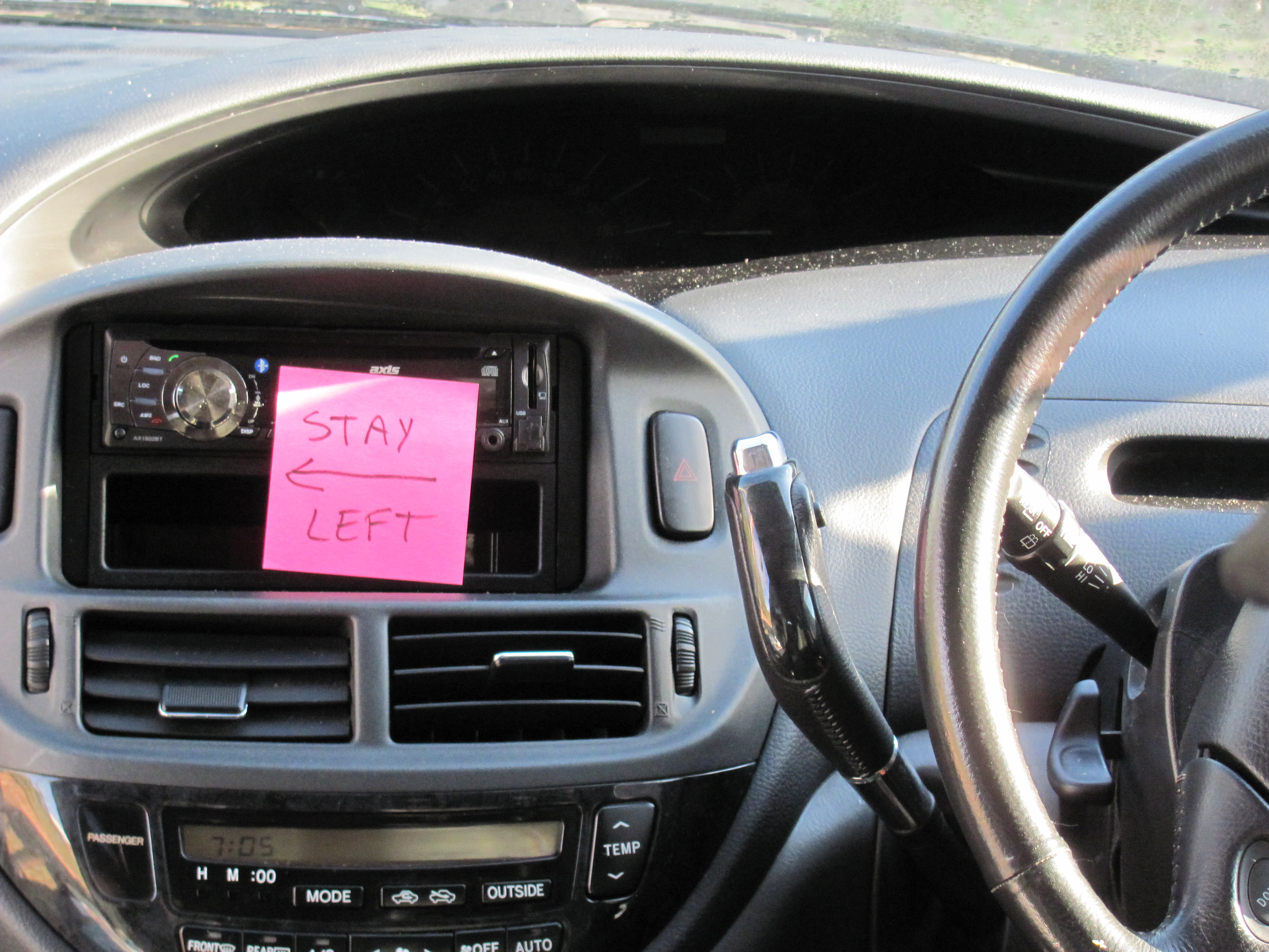
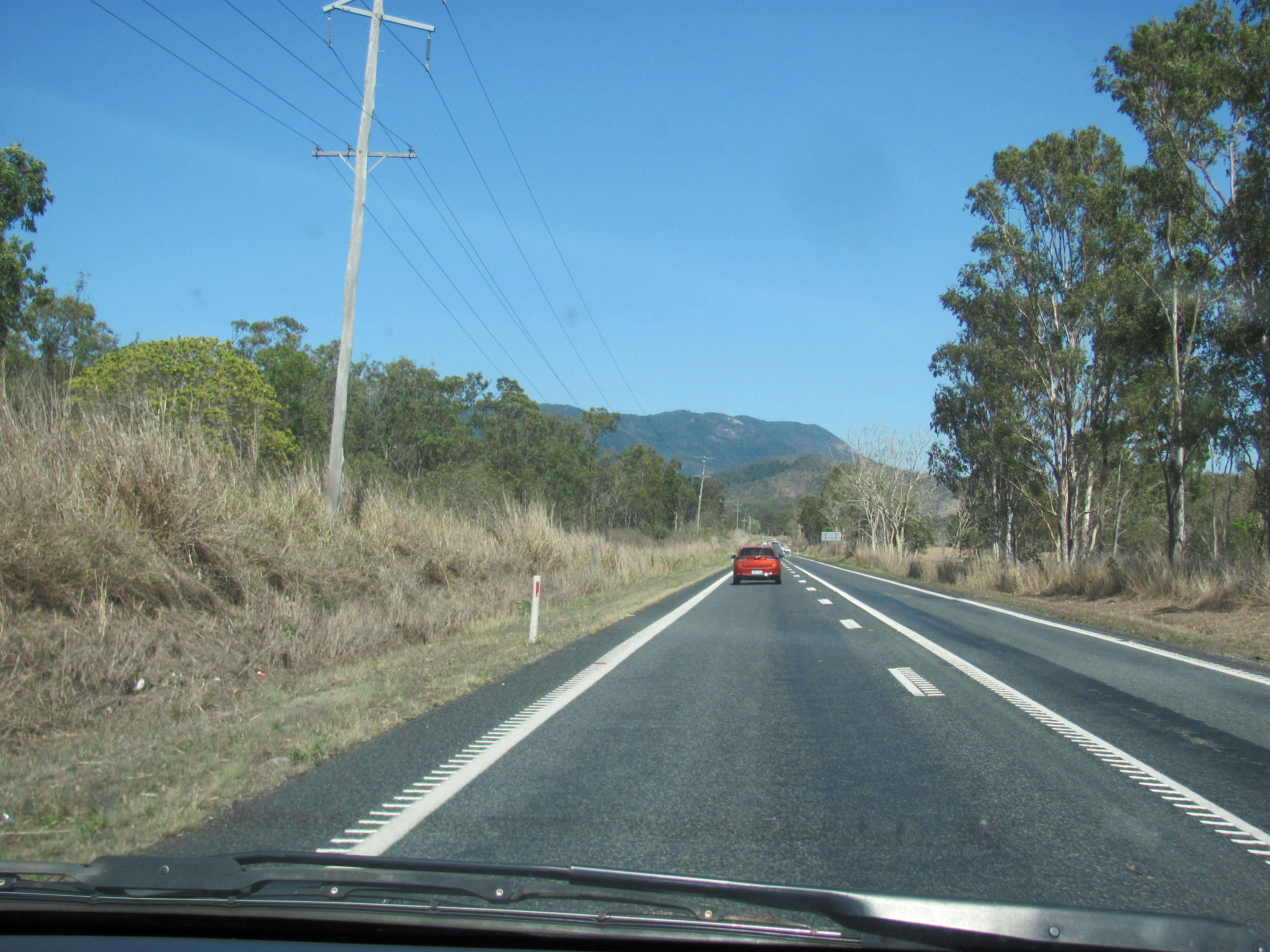
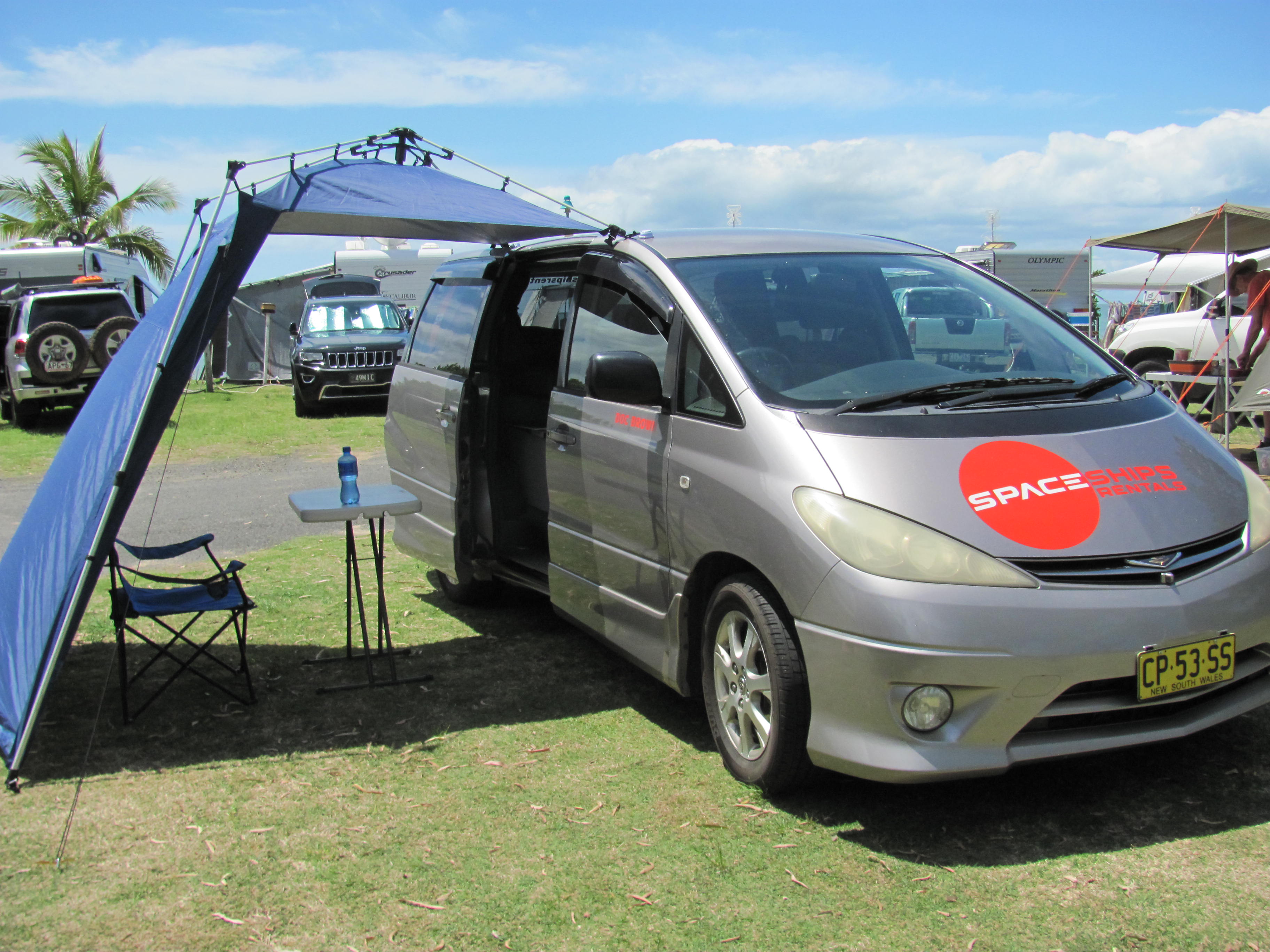
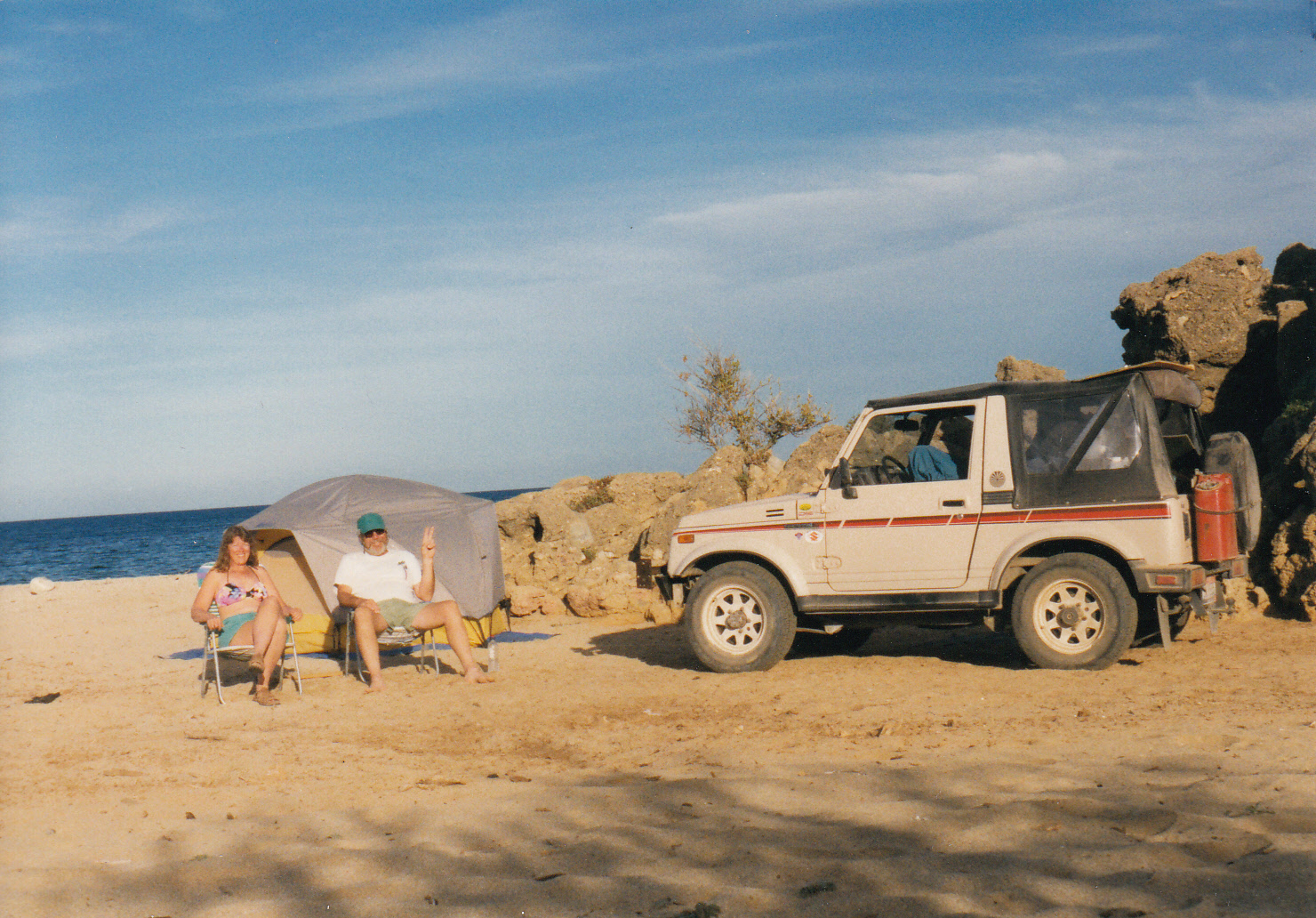
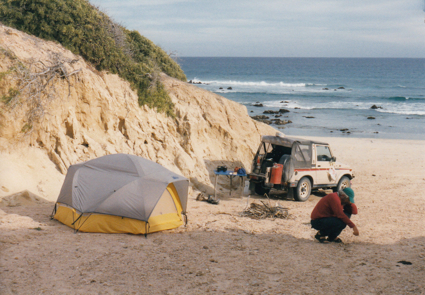
Several hours north of Hervey Bay, Queensland, I turned onto Fingerboard Road, a short cut to the coast posted with Kangaroo Crossing signs all along the way.  After scoring the last available site at a beachfront campground, I inquired about joining an excursion to the Great Barrier Reef.  The man at the desk kindly made some phone calls on my behalf to secure a space on a boat departing the next morning for Lady Musgrave Island. 

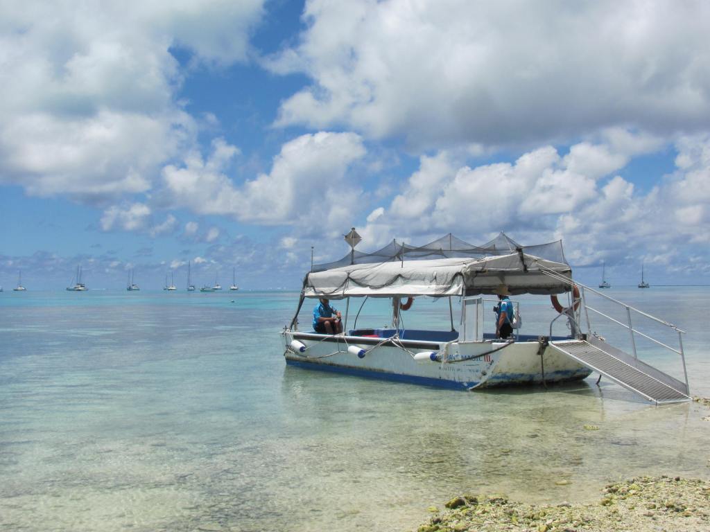
I awoke well before dawn, excited to finally meet this creature that I had traveled halfway around the world to see.  One of the unspoiled and least crowded places to visit the GBR (as it’s locally known) was from the Town of 1770, on the southern end of the reef.  The boat I boarded in the 1770 harbor carried 40 people on a straight shot about 90 minutes east.  A couple of blokes from Melbourne sat with me – one silent and the other talk-your-ear-off chatty.  The talkative one let me know right away that his marriage was on the rocks.  In no mood to listen to his domestic problems, I extracted myself from the one-sided conversation, went outside and climbed up to the railing on top of the cabin where the wind screaming past my ears precluded any further discussion. 

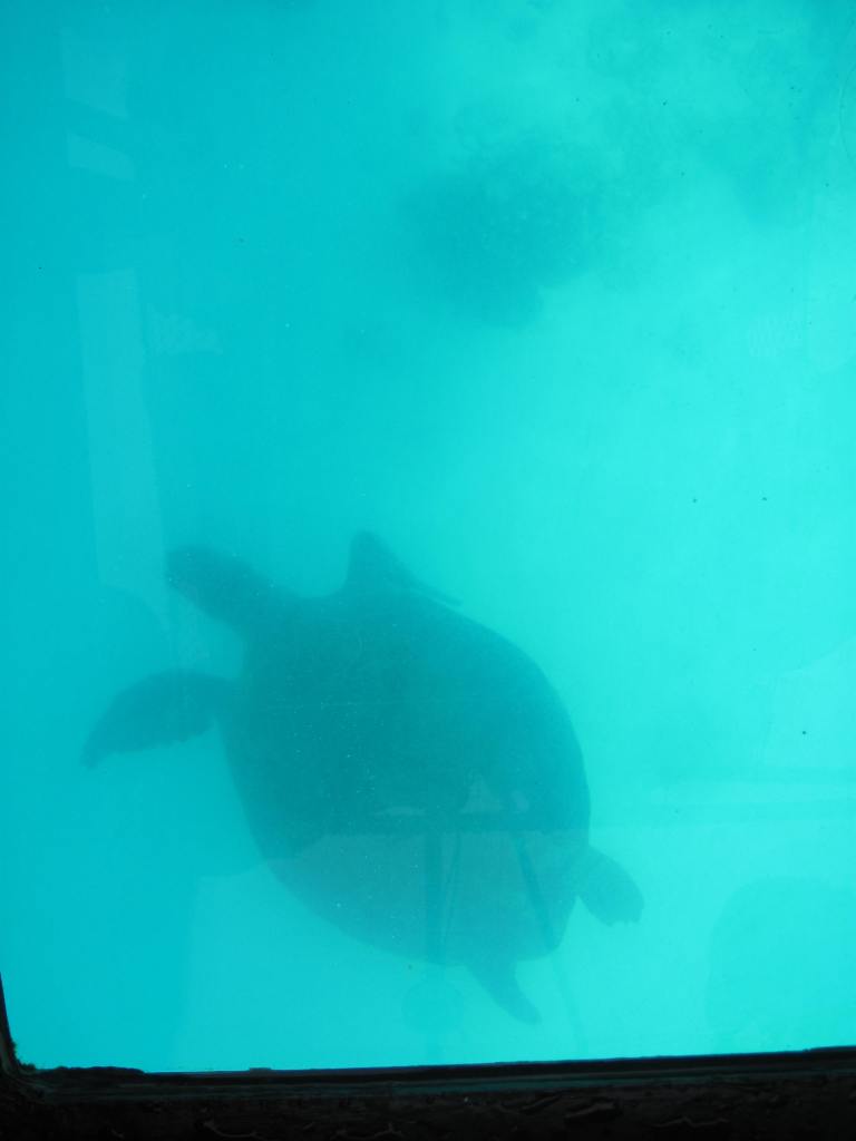
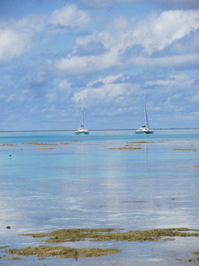
Upon arrival into a protected bay next to Lady Musgrave Island, we split into two groups.  Fortunately, the Brothers Melbourne were in the other group, which immediately went into the water to snorkel.  My group boarded a glass bottom boat to observe loggerhead turtles next to the reef.  They were giants compared to the turtles in my river at home – ancient silhouettes at least three feet long.  The man driving the boat, George, said they could hold their breath under water up to nine minutes at a time. 

I turned toward him as he continued talking about the life cycle of a sea turtle.  In contrast to the other four Millennials who crewed the boat, George was a sun-bleached, bearded older guy.  I estimated that he was about my age, 60 – which meant older than almost everyone else aboard.

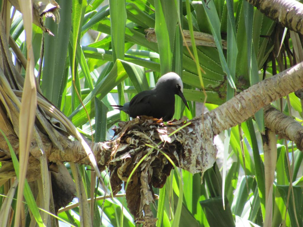
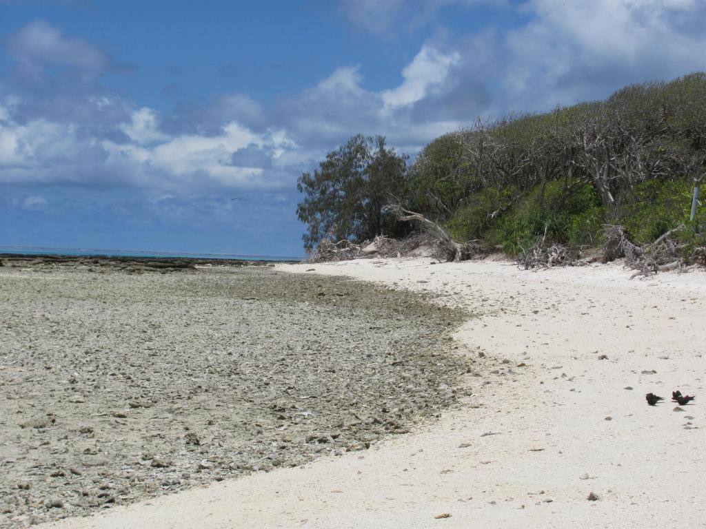
On Lady Musgrave Island, a national park, I walked through a forest of Pisonia trees, whose branches sagged heavy with the weight of thousands of nesting white capped noddie birds.  The beach sand, so white it hurt my eyes, was home to bridled terns and silver gulls.  By the time I walked back around the edge of the island, George and the glass bottom boat had fetched the other half of the group and returned.  I rode with George back to the main boat for lunch, then finally it was time to meet the GBR. 

Immersed in the warm sea, I snorkeled up and down a section of reef near the island for an hour, peering at starfish, jelly fish, sea cucumbers, seahorses, and countless thousands of fish in every color of the rainbow.  The coolest creature was a box fish, Day-Glo yellow with black spots, shaped like a tennis ball with nearly invisible fins. 

That bit of reef itself was not so different from any other place in the world I’ve been snorkeling.  But the mind-boggling fact was the size of the GBR – more than a thousand miles long.  It was difficult to wrap my head around the idea of this organism – this animal – living just beneath the water’s surface, breathing and eating and growing, and trying to survive in the warming waters of the south Pacific Ocean. 

Exhausted, fingers pruned from extended exposure to salt water, I was the last one to climb aboard the boat.  As we started back toward land, I walked outside and perched on a plastic cushion against the stern.  George, the bearded crew member, appeared and sat beside me.  Just to say something, I asked him how long he had been doing this work, guiding tourists to the reef. 

“Up until five months ago, I spent my entire life as a commercial fisherman, he replied.  “Then one day I decided it was time for me to hang up my fishing license and begin to give back to the sea instead of taking from it.  Someone else isn’t using my license – no one is using it.  I still get to be on the sea, which I love, but I’m no longer extracting from it.”

“What brought on the change?” I asked him.   

“I was catching these fish that were 75 or 80 years old.  It occurred to me that they’re older than me.  How long would it take for the resource to replace them?  So I decided to stop killing them and instead share their beauty with people who want to see the sea creatures alive.”

He had a big voice and he shouted in my ear to be heard above the roar of the boat’s engine.  I tried to answer that as a retired resource manager of America’s national forests, I applauded his efforts at conservation.  But my voice failed; all I could do is cough and nod and smile at him. 

He went on to tell me about the kangaroo family that lived in his yard.  The old wooden sailboat he had rescued from the junk heap and was restoring.  And his daughter who had just escaped from an abusive spouse and was building a new life as a single mom in Darwin. 

At one point, George asked me where I was from, and I was able to get across that I was an original California girl, fifth generation, in fact, having grown up in Los Angeles.  He began to sing that awful Beach Boys song about California girls being the cutest girls in the world.  Well, that might have been accurate back in 1974, when I wore a puka shell necklace and a crop top to show off a flat, tan belly.  But for crying out loud, more than forty years had passed since then.  Now my skin was tarnished like leather, and I had long ago moved — first to Alaska, then to the desert. 

George didn’t know all that.  “I bet you’re spiritual, not religious,” he mused.  Another tired cliché that probably applied to any aging hippie from California.  I wanted to change the subject to something deeper.  Relate my experience with forest management, or maybe talk about ways to save the GBR.  But, since my voice was not cooperating, I just nodded and smiled some more. 

Out of the corner of my eye, the Town of 1770 appeared.  Reluctantly, George rose and jumped into action to help bring the boat to dock.  When I disembarked at the pier, the crew lined up to shake the hands of all the passengers.  At the end of the line was George.  He grabbed me in a bear hug. 

It occurred to me later that I probably could have wrangled an invitation to his homestead with kangaroos on the lawn if I had reached out and hugged him back.  But instead, I shrunk away and disappeared into my camper van parked across the street. 

A song by Tom O’dell played on my i-Pod during the drive back to the campground, expressing my feelings at that exact moment.  “I want to kiss you, make you feel all right, but I’m too tired to share my nights.  I want to cry, and I want to love, but all my tears have been used up.  On another love, another love.  All my tears have been used up.” 

This was my first solo international trip since my husband passed away.  As of yet, I didn’t have the hang of this traveling-woman-free-spirit persona.  Some other time, perhaps on the next trip, I might find the courage to go through with one of those traveler’s love affairs.  But this time, it was enough just to feel the warm glow of a shared connection with a man passionate about the Great Barrier Reef.    

Other Side of the Road

By Kathleen Kemsley, (c) 2020

Experienced globe trotters praise solo travel.  When journeying with a spouse or friend, they say, the two of you form a unit which appears impenetrable to outsiders.  When alone, however, you become both more self-sufficient and more open to strangers, as you ask for help or reach out to connect.  In the first few years after my husband passed away, I took international trips with several different friends.  But finally, in the fall of 2018, I decided to take the big step of setting forth to a foreign country all by myself. 

I picked an easy country to begin with: Australia.  At least they spoke English – sort of – and I could get myself around Queensland at my own pace in a rented camper van.  But my first night at a hotel near the airport in Brisbane, I awoke from nightmares about driving the wrong way on the road.  With no co-pilot, how would I navigate my way?  There was nothing to do but walk to the rental agency, claim the van I had reserved, and give it a try. 

It turned out that getting onto the freeway was fairly straightforward.  However, on the northern outskirts of Brisbane I saw a sign for Woolworth’s – the Australian equivalent of Whole Foods – so on a whim, I veered left at the exit.  What followed was a kaleidoscope of random turns, cars pulling in front of me, brakes squealing.  When I finally came to a stop, I was parked crookedly in a movie theatre lot on the wrong side of the freeway from the grocery store.  Hyperventilating, I killed the engine, grabbed a sticky note, and drew an arrow which I attached to the dashboard to remind me which side of the road to use. 

Escaping the multiple lane freeway farther north, I eased onto a two way country road lined with eucalyptus trees which bent to form a tunnel.  Intermittent signs warned of kangaroos crossing.  I pulled in to the exit driveway of a roadside strip mall, again parking sideways in the lot.  On foot I walked the length of the shopping center, then entered an IGA convenience store where I bought staple foods – fruit, bread, cheese, peanut butter, coffee, and chocolate.  Not Whole Foods, not even close, but the idea of healthy eating had gone out the window when I missed the Woolworths.  Asking the clerk for a recommendation for lunch, I was directed next door.  There I scored two hot meat pies, greasy and delicious, for $3 each.  A beverage store at the other end of the strip mall netted me bottles of cold lemonade and diet soda. 

Buoyed by food in my stomach and supplies in the van’s refrigerator, I continued northeast toward the Sunshine Coast – where, naturally, it had begun to rain.  I fumbled to find the windshield wipers, instead flicking the turn signal.  At a junction, without warning, I encountered my first roundabout.  Automatically, I started to veer right.  The oncoming driver laid on his horn.  “Sorry, sorry!” I shouted out the window.  “I’m American!”  His fist turned into an open-handed wave for me to go ahead. 

Another roadside stop to hyperventilate.  Another look at the map.  Another bite of chocolate. And a determination, spoken aloud, to get back onto the wrong side of the road.  “You can do this,” I told myself.  “Leftie bestie. Rightie wrongie.” 

Eventually I reached Coolum Beach, where I drove up and down the main street only three times before locating the turn into a large campground.  The kind woman at the front desk, seeing how frazzled I looked after a mere two hours of driving, assigned me to a site next to the beach front.  Moored at last!  Relieved, I turned the van off and began to set up the camper.  Before I could even finish, a friendly couple at the next campsite wandered over to talk.  The man helped me stretch the awning, while his wife figured out how to set up my portable table. 

The standard camper conversational opening, “Where ya from?” turned into an evening of visiting.  I learned about their home town (Balmain, a suburb of Sidney), their careers as commercial pilot and flight attendant, and their experience with camping in Australia – “there are campgrounds everywhere!”  They taught me the proper Australian word for a bathing suit – “Cossie,” as in, Bathing Costume. And they offered some “lollies,” Australian sweets.  My favorite was the TimTam, something like a KitKat, but better, especially when sharing with new friends.   

Was I lonely, traveling alone? Never.  I had company when I wanted it, and when I didn’t feel like socializing I could duck into the camper like it was my turtle shell.  Was I fearful? In the beginning, of course.  But by the end of the monthlong journey driving around in Australia, my confidence in solo travel soared. 

Y2K

 © 2015 By Kathleen Kemsley, from 1999 trip journals

 When Brian and I chose December 1999 for our first foray into Mexico on four wheels, it never occurred to us to worry about the changing millennium.  We were far more concerned with what camping conditions might be like in a foreign country.  For a week we sat in Death Valley, getting our courage up.  Finally we took a deep breath and rolled wheels into Mexico at the Tecate border crossing.

As soon as we got across, we relaxed.  The Suzuki Samurai was a perfect vehicle for the Baja.  The roads were mostly paved (if potholed) and the people were welcoming.  Y2K fears of the pending Baja_0001millennium change had scared the majority of tourists away from foreign travel that year, so we found a lot of empty campsites.

Just south of Mulegé, we settled into a palapa at Conceptión Bay.  We met a few campers who planned to stay through the winter “on the beach,” but we wanted to keep exploring.  After a few relaxing days there, we went inland, attended a Posada celebration for Christmas, paused in La Paz long enough to get really sick on some bad chicken, then departed for the cape in search of free camping.

The first free camping space we christened “Perfect Beach.”  We had neighbors half a mile away down the white sand; some sandstone rocks grouped in a shelter off the water to set up our chairs and a campfire; and a view of pelicans and magnificent frigate birds diving into the water out the front door of the tent.  This beach we ranked a perfect 10, and the one against which allBaja_0002 the subsequent campsites would be judged.

A dirt road took off just south of the ritzy town of Los Barriles, heading in a roundabout way down to San Juan del Cabo.  We went for miles and miles past private property and fields of corn and grazing cattle, all of it fenced off to vagabonds like ourselves.  Finally we turned on a two-track and drove for several miles before stopping to camp in an open field that didn’t appear to be owned by anyone.

We set up the tent and night fell.  After dinner we started a tiny campfire and had just sat down when we heard heavy footsteps.  Out of the darkness emerged a man shouting something in Spanish.  Alarmed, Brian jumped up and tried to intercept the man.  As soon as he got closer, it became obvious that he was an extremely intoxicated local.  He held a machete in one hand and a bottle of tequila in the other.  Yikes.

Miguel spoke a little English and we spoke a little Spanish.  For the next hour we labored to communicate with this plastered little campesino.  He got across that he worked on the ranch there, but he had a cousin in California.  He implored us to take him with us back to the USA.

There were cattle ranging loose in the field where we were camped, and he kept repeating that they were “muy peligroso animals,” very dangerous!  Over his head, Brian and I exchanged a glance.  We need to get out of there immediately!  Hastily, we folded up the tent and chairs and stuffed them in the back of the rig.  Brian started up the engine.  I jumped in the passenger seat.  Miguel came right in after me and sat on my lap, reeking of tequila and tobacco.  I gave him a shove out and slammed the car door.  Brian hit the gas and we sped back down the two-track toBaja the main road.

Only now it was pitch dark.  We continued further on the unfamiliar road until another turnoff appeared.  Undiscriminating at that point, we turned in and drove back a ways onto some sand.  There we set the tent back up and collapsed into weary sleep.

The next morning was Christmas Eve.  We looked around to discover that we were on an empty and pristine beach backed by sandstone cliffs, next to the Gulf of California.  It was another perfect 10 of a campsite, made even sweeter by the fact that there were no drunk Miguels around to bother us.  We pulled the rig back into an alcove between two sandstone cliffs, and set the parking brake.

A small herd of skinny longhorn vacas, or cattle, came by a little later.  No doubt they were the same “Muy peligroso animals” that Miguel had tried to warn us about.  But they paid us no heed.  They ambled along past our campsite, then went down to the shore for a drink before continuing on down the beach.  By now we were laughing and making fun of the drama of the night before.  Soon I came up with a song for the occasion, to the tune of “The Monkees.”

Here we come, walking down the beach,Baja_0003

We’re the craziest vacas, that you could ever meet.

Hey hey peligrosoMuy peligroso are we!

We walk down to the tide line, and drink right out of the sea.

After departing Christmas Beach, we hit civilization at San Jose del Cabo.  There we heard about an upcoming New Year’s event, so we bypassed Cabo San Lucas and drove directly to Todos Santos to check it out.  It turned out that the local expat community was planning a sober campout at the beach, so with two days remaining in the old millennium we set up camp next to a couple from Hawaii to wait for Y2K.

People began arriving with food at sunset on New Year’s Eve. More and more salads, side dishes, Baja_0004and desserts showed up.  Finally, someone backed a truck in and offloaded a whole roast pig.  We ate until we hurt, laughing and talking with other travelers.  When no one could eat another bite, we pulled the chairs into a circle.  One by one, each of the 40 or so people present shared their experience, strength and hope.  There wouldn’t have been enough booze in all of Mexico for us, if the group had decided to drink that night.  But sober, we found much to be grateful for, in both the old millennium and the new.

In this place, on the isolated coast of Baja, we felt safe from any conspiracy theory-based paranoia about the end of the world.  After all, rural Mexicans still made change out of a cigar box.  The Y2K bug was not going to be a problem here.  Down on the beach, people set off fireworks as the old millennium slipped away under a waning moon.  And the next morning, the new year dawned peaceful and serene.  The end had become the beginning, and the day was full of promise.

Bangkok Bronchitis Blues

© 2015 by Kathleen Kemsley, from 2008 trip journals

Toward the end of our month-long visit to Thailand, we settled into Rich’s guestThailand_0001 house in rural Non Sung for a few days’ stay.  I went for a run along the reservoir’s levee, water and waterbirds on one side and blindingly green rice paddies on the other.  Along the way, I kept my eyes peeled for dogs; a pack of them had attacked me a few days earlier.  They ran at me from a hidden driveway and the dominant one bit me in the leg.  I picked up a stick and beat at them, shouting some choice cuss words.  Though the dogs didn’t speak English, they finally understood and backed off.  I still had bruises on my thigh.

Back at the ranch, our host Rich, who had been my engine foreman in Alaska, put me to work with the hose, watering plants on his eight-acre homestead.  I spent half a day picking cherry-like fruit off trees scattered in the yard, and boiled them into syrup which we poured over raisin bread.  The result was way better than the other fare offered at the local outdoor market: fried insects, ant eggs, big white mushrooms, grubs, and tom sum soup so hot it burned my tongue.

Then my husband Brian came down with some kind of upper respiratory infection and cough, and began complaining a mile-a-minute.  Not that I blamed him: his lungs were already weak with Chronic Obstructive Pulmonary Disease and he couldn’t afford to get pneumonia.  So the next morning, we made a snap decision to do a 911-demob from Rich’s place.  His wife drove us to Khon Kaen and put us on a plane back to Bangkok, where we were picked up by a staff member of St. Carlos Hospital.

It was a hospital for “Farang,” or white foreigners.  The nurses wore old fashioned crisp white dresses and hats, the kind you only see any more in porn films.  The doctor, who looked about 14 years old, had limited English skills.  They took an x-ray of Brian’s lungs, diagnosed pneumonia in his right lung, and hooked him up to an IV.

Later in the day, I learned that this hospital did not provide food or water, but rather Bangkok_streetexpected the family to bring it.  So I went out and wandered the streets of a section of Bangkok that was definitely not in a tourist area.  Under the freeway overpass, I located a marketplace.  By pointing at items and holding out a handful of Thai coins, I managed to buy some bread and fruit, though I’m pretty sure I paid too much for it.  Then I went to a gas station a few blocks away and purchased bottles of water and diet Coke.

The nurses barely spoke just a couple words of English, and had no way to take a history, answer questions, or even explain what medications they were pushing.  But, by God, they checked Brian’s blood pressure every 15 minutes.  They told him what it was, but they didn’t write anything down.  Hence the need to come back fifteen minutes later and check it again.

I slept on the couch in Brian’s room, and awoke the next morning feeling punky, tired and irritable.  This lady who had met us at the airport and spoke some English came in and asked me how I was doing.  In response, I started crying.  My throat hurt, my skin hurt, I was so tired, and I was most of all stressed out about Brian’s pneumonia.  (Was he going to die in Bangkok?)  I was also angry to find myself sitting in a hospital room for four or five days, instead of floating on the Mekong River as I had planned for the last part of our trip.  Brian, happily drugged up and getting all the attention, was grooving on the nurses and ignoring me.

The lady freaked out because I was crying and called the nurses.  Since they couldn’t ask me what was wrong, they insisted on admitting me to the hospital.  They weighed me, took my blood pressure, and gave me a chest x-ray.

Of course I didn’t have pneumonia, it was only bronchitis.  They put me on an IV filled with Vitamin B (because I was tired), but it had the effect of putting me to sleep and I slept most of the day.  Then a nurse showed up late in the afternoon to give me a shot of what turned out to be steroids.  I felt a sting as it went into my arm, burned all the way up, then exploded pins and needles in my head.  I became dizzy and short of breath.

The air-head nurse kept patting my shoulder and saying, “Are you all right?”  She handed me some water which I couldn’t hold onto, along with one square of toilet paper for who knows what.  “Madam, Madam, are you all right?” she said.  I felt like I was in a Stephen King novel, featuring Asian nurses who lock the hospital doors from the outside and come at you with cups full of pills and a syringe.

The 14-year-old doctor showed up after a while and tried to convince me to take more drugs.  My nostrils were dry, he said, so therefore I must be dehydrated.  Even though they just finished pumping a gallon of Vitamin B into my veins, he wanted to administer another bag of saline.  I promised I’d drink more water, if he could just tell the nurse to bring more than a pointy-bottomed paper cup full.  He then pronounced me vitamin-deficient.  You think?  Maybe because we were being slowly starved to death.  All I had to eat all day was a couple finger-sized bananas from the food I had bought under the freeway yesterday.

His response was to give me what he called a “Vitamin Nerve” pill.  I guess he thought I was having a nervous breakdown.  And perhaps I was.  Getting admitted to an Asian hospital where no one speaks enough English to find out what’s wrong, can have that effect.

Next thing I knew, the nurse brought in this brown bottle of medicine for me to take.  I looked at the label – most of it was in gibberish Thai script – but the contents section was written in English and I saw the word “Opium.”  Oh no, I said, pushing the bottle away.  The nurse looked at me blankly.  “OPIUM – NO!!!” I shouted.  She replied, “Sawhadee Kah”, or “thank you, ma’am,” before turning tail and running out.

Now, I know sarcasm when I hear it.  I was sure that all the nurses were whispering about me at the nurse’s station in the hallway where eight or ten of them gathered, gossiping in between their every-fifteen-minutes visits to the Farang room.  Some of them certainly were plotting to get rid of me (whining emotional menopausal complaining rich bitch that I am) and land my old man, take him home as their prize.

I had been in Thailand long enough to know exactly what was happening.  The nursesThailand_0002 were vying for Brian’s favor; he looked like a possible meal ticket for them and their extended families.  Some of them actually made some headway with their idiotic smiles and sing-songy little Asian voices.  Two of them would come into the room while I was away and dab at him with sponges.  Ripped on sedatives, he was all smiles to them.

All they needed to do was get some opium into me, then I’d be permanently out of the way.  When I refused, they sent in their leader, a Nurse Rached who tried to force me to drink from the brown bottle.  I picked up Brian’s cane and waved it at her, shouting no!!  No more drugs!!  Like the Thai dog pack, she got the message and stormed out of the room.

Finally, after four days imprisoned in St. Carlos, they said we could leave… as long as we promised to head right home to the USA.  I had no problem with following those directions.  After a month in Thailand, I had had my fill of Asia.  It was too crowded.  There was too much weird food, too strange of an alphabet, too many hostile dogs and nurses, too many old Farang men foolishly courting a young girl or boy, and too many phony “Sawhadee Kahs.”

A thirteen hour flight later, we landed in San Francisco.  I kissed the ground and vowed not to leave my side of the world for a long, long time.

Iceland Stopover

© 2014 by Kathleen Kemsley, entered in a contest by Icelandic Air

Iceland’s geysers, hot springs, and volcanoes always intrigued me.  I planned to go in the summer of 1983, but life intervened.  My car broke and I had to use the plane ticket money to buy a new car.  The next year, I got a job in Alaska and moved up there to work for one summer.  One summer turned into 14 years; I sobered up, got married, built a house, and launched a career.  By the time I had the time and money to try for Iceland again, a total of 30 years had passed.  This time, my husband wanted to take a trip to England, so I booked the flight on Icelandic Air so that I would be able to fulfill my lifelong desire to explore this mysterious frozen island in the North Atlantic.

IMG_0083We stopped over in Iceland on the way home from England for three days.  Staying in a hostel room in downtown Reykjavik, we walked on Laugavegur Street, enjoyed cheddar soup in bread bowls, and shopped at a mini-grocery around the corner.  One day we took a full day trip to see Gullfoss Falls, Strokkur Geyser, and Thingvellir.  We met some Icelandic ponies and walked through a lava tube.  I was moved by the untamed natural beauty of the land.

The next day, my husband wasn’t feeling well, so I left him at the hostel and ventured alone to the city bus station in search of an “authentic” Iceland experience. With the help of a friendly English-as-a-fourth-language ticket seller I secured a seat on a local bus that took me across town to Laugardalslaug, the best hot spring complex in Reykjavik.

I wasn’t sure how to proceed.  Once entering the locker room, I asked a teenage girl how theIMG_0078 system worked.  Of course she didn’t speak English, but she pantomimed for me where to leave my clothes in a locker, rinse in the shower, and go outside to soak in the hot pots.

The outdoor temperature hovered near freezing, but the water was delightful.  The largest of the six hot pools contained salt water, and it was there that most of the local people congregated.  I lounged with my eyes closed, listening to them debate politics in the Icelandic language.  It seemed like a friendly discussion.  Even though I didn’t understand a word of it, they smiled and nodded at me while they talked, so I felt included.

After two hours of soaking in various pools, my hands were thoroughly pruned and my body was relaxed.  I made my way back to the bus stop in a cold wind.  As I rode back to the hostel, night was falling and the lights of Reykjavik glittered in the twilight.  My experiences in Iceland were magic, and I knew I’d return again someday.

Backwards Through Panama

© 2015 by Kathleen Kemsley, never previously published

In world travel, as in life, the best-made plans often fall by the wayside due to circumstances beyond our control.  Before Brian and I got on the plane for a two-week trip around Panama, I had figured out an itinerary which would take in the best of the country by bus.  We were goingIMG_0078 to ride from Panama City up to Boquete, then proceed over the mountainous spine of the country to the Caribbean coast and the islands of Bocas del Toro.

It was not until we actually landed in Panama City that we learned about an uprising in the indigenous population, which had disrupted travel on the Pan-American Highway.  In the time-honored tradition of banana republics everywhere, the local Indians were protesting a land-grab of their ancestral lands by big mining interests.  The rebels, lacking the firepower of the government-backed corporations, rolled huge boulders onto the main artery through the country.  Then they stood on the road, throwing rocks at passing trucks, until they had effectively shut down the highway.

It was a classic David-versus-Goliath drama, and we could not help but root for the underdogs.  Even though it meant that my carefully planned itinerary went out the window.  On the small-screen television in our hostel in Panama City, we watched live coverage of the insurrection.   Other travelers said the Pan-American Highway was closed indefinitely, and they had various theories about how to get around it.

IMG_0006My first plan was to wait a couple days and see if the situation resolved.  So we spent one day walking around the “old town” and the sea-front malecon, and another day riding a local bus to Miraflores Locks to view the Panama Canal.  After two days, there still was no change in the highway situation, so I called and purchased two seats on a small airplane headed to Bocas del Toro.  If we couldn’t do the trip in the planned order, we would just start at the end and go backwards.

The flight from Panama City to Isla Colón took less than an hour, but the two places seemed worlds apart.  The Bocas del Toro islands have a mellow, relaxed Caribbean vibe.  Thus far largely undiscovered by the hip ex-pat community, the islands are connected to the mainland by ferry and to each other by water taxis for hire at the main dock in downtown Bocas.

We entertained ourselves for several days snorkeling in the islands near Isla Colón, wading andIMG_0121 bodysurfing at Red Frog Beach, bicycling to nearby golden sand beaches, and eating seafood and treats from the local panaderia.  From there we crossed to the mainland and boarded a chicken bus for the six-hour-long ride over the mountains to the Pacific side of Panama.  Grandmas and babies and dogs and young working men sat three to a seat or stood in the aisle during the slow route that stopped in every little town.

The bus dropped us at the main plaza in the town of Boquete.  Not having any advance reservations, we made our way to a nearby local hostel, where we spent a miserable night on lumpy beds listening to obnoxious bar music blaring in through a window that didn’t close. The next day I hiked around until I located a much quieter room up the street.  There we stayed comfortably ensconced for a few days.  I went on a day trip with a group of hostel kids to a hot spring, while Brian enjoyed sitting in the central plaza watching people and making friends.

IMG_0206Boquete had a hefty population of ex-pats who regularly traveled back and forth between there and Quepos, in southern Costa Rica.  We enjoyed meeting some of them and listening to their discussions about the pros and cons of living full time in Panama.  One day we rented scooters to explore some of the countryside around Volcán Barú,  Panama’s only volcano, now dormant, and rising to over 10,000 feet elevation.  For Brian, that day was the highlight of the whole trip.

Reading ahead in the Lonely Planet book, I got a jones to visit the national park at Golfo del Chiriquí on the Pacific Ocean.  The guide book advised that reservations were necessary weeks in advance to secure a spot at the only lodge within the park.  Hoping for a miracle, I e-mailed the lodge and almost immediately heard back that they had just received a cancellation.  So they offered us one “rustic room” at Boca Brava, bathroom down the hall, for $10 per person, take it or leave it!  Of course, I took it.

Departing from Boquete the next day, we rode on two different busses, a taxi, and a water taxi to make our way to the island lodge.  Once there, Brian relaxed in a hammock and talked to otherIMG_0273 travelers, while I went on a day-long snorkeling trip to a couple of the islands inside the national park.  Our rustic room turned out to consist of two mattresses on the floor and a sea breeze blowing through open windows.  Not too bad of accommodations for ten bucks.

By the time we were ready to leave Golfo del Chiriquí, almost a month had passed since the start of the Indian uprising.  Asking around, we learned that the opposing sides had recently come to an uneasy truce, and the boulders had been removed from the Pan American Highway.  So we walked out to the highway and almost immediately flagged down a plush double decker long distance bus that was on its air-conditioned way to Panama City.

IMG_0063Six hours and $30 later, we found ourselves back in civilization, with one more day to spare before our flight home.  It happened to be Mardi Gras, so we dumped our backpacks at a cheap hotel in the Casca Viejo section if the city, then spent the evening enjoying the festivities.

Returning to the hotel late in the evening, we heard multiple fire truck sirens.  We climbed up to the roof to see what was going on.  A whole block of the city was ablaze!  Though I felt sorry for people whose apartments were burning, I must say it was a spectacular show to watch from afar.  The impromptu entertainment of a raging structural fire was a great way to end our seat-of-the-pants backwards trip through Panama.

Back Roads of Guatemala

Back Roads of Guatemala

 © 2015 By Kathleen Kemsley, from journals kept in 2007

On the back side of Guatemala, coming from Belize, the state of Petén is known as the “last frontier”.  Until the end of the Guatemalan civil war, the road wasn’t even paved.  The journey to Tikal was then a grueling 20+ hour ride by chicken bus from Guatemala City.  At one time in the past, the Germans offered to pave the road if Guatemala would promise to preserve the rain forest, which was at that time pristine.  But the deal fell through.  Later on, someone elseGuat_0001 (Weyerhauser?) paid to pave the road from Santa Elena to Rio Bravo, while clear cutting most of the forest.  Now there are evergreen seedlings interspersed with cornfields.  Hillsides are still green-green, but the wild tangle of forest is gone.

We soon made our way to Finca Ixobel, a hidden gem of a low-key retreat.  Staffed by young travelers working to pay for their stay, the ranch has a system where you run a tab for food and drink, for horseback riding or caving trips, for internet use.  There was an international flavor to the place, with Spanish being the primary spoken language and Q’eqchi coming from the kitchen.  American rock music blared, someone shouted in German during a game of ping pong, and novels in French, German, Italian, Portugese and Spanish were available to trade in.

Finca Ixobel had unwittingly become involved in the Guatemalan civil war, in a story which ended badly.  Once upon a time, in the idealistic 1970s, a young couple from the United States bought 1400 acres of land in the rural jungle of Guatemala.  The “back-to-the-land movement” was in full swing and Carole and Michael DeVine wanted to live it in Petén.  The couple raised two adopted Mayan children, kept chickens and pigs and goats, grew vegetables, baked bread, and built a cabin.  When adventurous travelers stopped by, they began serving simple home-cooked meals and providing places to camp.  This hospitality eventually morphed into an Eco-tourism business which still exists to this day.

On their little slice of paradise, the DeVines made uneasy peace with the occupying Guatemalan army and tried to ignore drug smugglers and leftist rebels operating near their ranch.  But in 1991, the unthinkable happened.  Michael DeVine was kidnapped and murdered on the road from town to his home.  His wife and kids demanded answers but got none.  Five years later, it Guat_0005was revealed that the man who had commanded the nearby Guatemalan Army post and had ordered DeVine’s murder was actually a paid informant for the U.S. CIA.  But nobody was ever arrested or tried for DeVine’s murder.

After several peaceful days of rest, we left Finca Ixobel with its fresh baked bread and sad history and continued on deeper into the wilderness.  Evidence of the Guatemalan civil war, which ran from the 1960s through 1996, was everywhere.  We saw it in the lack of males of a certain age.  Some 200,000 Guatemalans rebels, most of rural, Mayan heritage, were killed during the years of the war.  We saw it in the eyes of the women, who trudged uphill carrying huge baskets and water jugs on their heads, but wouldn’t meet our eyes.  They had that vacant thousand-yard stare, the same one guys had after a tour in Vietnam.  We also saw it in the coffee plantations, places optimistically begun as co-ops during the war, but now surviving only as subsidiaries of the Nestlé or Kraft companies, after the Guatemalan economy tanked.

Guat_0002In our camper we followed a road into a cloud forest.  The paved road disappeared after about twenty miles.  In its place was a narrow, bumpy, one lane road.  Eventually, hidden in the highlands, we located a place someone at Finca Ixobel had told us about.  Gruta de Lanquin is an extensive limestone cave.  Beneath it, the Rio Lanquin comes rushing out beneath the cave in a burst of whitewater.

Unlike the national park caves in the United States, this one provided no escorts for  explorers; it was strictly “enter at your own risk.”  Inside the cave, lights for the first half mile illuminated paths, steps, and metal or wood catwalks.  Signs gave descriptive names of the formations: The Eagle, The Monkey, The Tower, The Sheep, The Femur, and The Cobra.  Cave walls were mucky and slimy.  It was impossible to climb without holding onto the limestone – a spelunking purist would have been shocked.  The air inside the cave was substantially warmer than the air outside, and stuffy.  It felt like all available oxygen had been used by the ten or so people who had signed the register earlier that day.

When it got dark, we parked by the river to camp for the night.  The current was very strong, the water cold and none too clean.  A seven year old boy came up to speak Spanish with us.  Brian thought he was telling us how some people camped there and got choked or robbed.  Then he asked us if we had a gun.  Once the kid left with his uncle, we both felt very nervous.

We climbed back into the camper and locked the door.  Before long we heard another vehicle approaching.  Overcoming our quaking fear of being alone in the Guatemalan wilderness without a gun, we peeked out the door.  Much to our relief, the vehicle was a VW bus with California plates.  Whew!

The people, Mark and Nancy, were newlyweds who worked in the medical profession.   Their two big dogs were friendly, but we definitely felt better with a couple of canine alarm dogs nearby.  They invited us to come sit in their van for a couple hours, to talk and drink herbal tea.  Back in my own camper later, I slept soundly that moonless night.  And of course, no banditos ever came anywhere near our riverside camp spot.

The next day we drove another eight miles farther on a road so steep and narrow that we had toGuat_0003 use the 4wd low gear for the first time.  It took 45 minutes to reach Semuc Champey, an utter paradise of a place where the thundering Rio Cahabón passes underneath a limestone terrace.  On top were several large turquoise pools, reminiscent of Havasupai, begging to be swum in.  Gentle waterfalls tinkled and fish swam fearlessly around my feet.

We left before noon and got back on the bad road to Cobán.  There we ran into supreme difficulties trying to get more money.  None of the ATMs worked, due to the collapse of most of the Guatemalan banks three weeks earlier.  Apparently the post-civil war economy was still in shambles.  The problem (as we understood it with our kindergarten-level Spanish) was that the country had ordered all new bills to be printed in France, then taken the old currency out of circulation.  But something went wrong with delivery of the new bills to Guatemala.  So, there was no money to be had.

Belatedly, I wished I had followed Brian’s suggestion to take some travelers cheques on the trip.  At the time, I had prevailed in that argument: “No one uses those anymore!”  Of course, in Cobán, he could not resist saying “I told you so.”  But that didn’t help us get quetzales.  Eventually I had to run a charge against my Visa card to get some cash, a most expensive undertaking.  I looked daggers at Brian when he opened his mouth to gloat; he took the better part of valor and said nothing further.

Camp that night was a visually peaceful but noisy little place called “Holanda” that offered a restaurant, pool, lake, and cabins.  Right next door was the source of the noise: a farm yard with chickens clucking, cows mooing, white geese honking, and a dog barking late into the night.Guat_0004

We tried a “short cut” to get down out of the mountains, which turned out to be a, shall we say, scenic route.  After Salamá, the road narrowed to one lane, the outside lane having literally fallen off the cliff.  At Rabinál we walked through the market and purchased some tomatoes, avocado, peanuts and oranges.  The road out of there was marked as all-weather gravel on the 25 year old map I had.  Naively I thought it must be paved by now.  But no!  I hadn’t factored in the effects of 35 years of civil war on the country’s infrastructure.  The track we had chosen ran for 50 miles, all of it narrow, bumpy, and steep.

The route went over the top of the Sierra de Chuacus, nearly 7000 feet in elevation.  Just past the summit, a little stream tumbled down an almost vertical hillside.  Pine and tropical deciduous trees vied for space on the steep slope.  We headed downhill through several small villages, populated by very traditional-looking women wearing colorful embroidered blouses and ankle-length skirts, their long black hair in pony tails.  We crossed the Rio Motagua, then around a hairpin curve we suddenly were deposited – boom! – into 21st century San Juan, just 15 miles from Guatemala City.

Talk about culture shock!  From one-lane dirt roads to eight lane chaos.  Busses belched black exhaust, traffic crawled along at a snail’s pace, everyone honked and cut in front of each other.  Brian exhibited a mastery of driving skills to negotiate through Guatemala’s largest city.  At last I spied a directional sign and yelled for him to turn right.  And like magic, we were swept out of the city and on to touristy Antigua, leaving the wild highlands behind.

Tripping Along La Ruta Maya

© 2015 by Kathleen Kemsley, from journals kept during a 2007 overland camping trip to Guatemala.  The first day of our journey on La Ruta Maya was nearly a disaster.  Leading up to the route’s start, my husband Brian and I had spent a day wandering through the mysterious Teotihuacán pyramids, watched dancers perform at El Tajin in Veracruz, and strolled past the giant black basalt Olmec heads in Tabasco state.  So we were primed for our first Mayan ruin, not expecting a negative experience.

But it was undeniable – Palenque had bad vibes.  We were late getting in to the park and out of sorts – simply a function of too many days in a row together in a tiny cab-over camper.  So we agreed to disagree, and stayed separate for the rest of the day.  Walking alone, Brian set his camera down on a wall and forgot it.  When he returned a half hour later, of course, the camera had been stolen.

In a different part of the complex, I read interpretive signs describing the blood sacrifices madeRuta_maya_0001 by the Mayan elite and felt my stomach turn.  I pictured severed heads rolling down the steps.  Blood running like a river in front of the palace.  The violence of the place could still be felt a thousand years later.  Most of the ruin had been rebuilt, but the new pieces looked like guesswork to me.  The lower parts, small outlying villages of the main city, looked more natural with trees growing out of the middle and moss-covered jungle overtaking the civilization.  I sensed turmoil in the quiet.

One of our Theories Of Camping is that when faced with overwhelming landscapes (i.e., the Grand Canyon or a huge Mayan ruin), people tend to make lots of noise because the place they’re visiting seems too vast.  At the Maya Bell Campground just outside the park, this seemed to be the case.  All the other campers were in the bar – except for one asshole from Colorado who cranked Johnny Cash up to top volume from his van, competing with the bar music.  Everyone was drinking heavily.

Distressed, I left the campground and walked down the road until I couldn’t hear anything besides the natural world.  Flocks of parakeets passed over.  A howler monkey called out, the sound reminding me of the flush of an airplane toilet at 35,000 feet high.

Crossing from the jungle environment of Palenque to the Yucatan Peninsula meant moving into a more open, brushy and drier environment.  We escaped the noisy crowds the next day, moving north to the next cluster of Mayan ruins.  There we re-established equilibrium and the pleasure of discovery returned.

Edzna, a nice little ruin just outside of Campeche, provided us with a tidy introduction to the Ruta Maya proper, before, as the guidebook warned, we would be spoiled by Uxmal. We camped that night at Sacbe (the name referencing the paved elevated roads between Mayan cities).  It was cheap enough, 50 pesos including nice hot water showers, but of course there was no toilet paper and no locks on the doors.  The clouds misted and sprinkled on the bright red dirt which got tracked into the camper, making a big mess.

At the Chac-Mool Lodge while eating pibil (tender pork cooked in banana leaves), we learned that Chac-Mool is the Mayan god of rain.  You pray to him for rain in the dry season because there is noRuta_maya_0004 natural water anywhere in the Yucatan.  No rivers, lakes, or springs.  The bedrock below the surface is porous limestone and rain soaks in like a sponge.  So the people built these huge underground cisterns and caught rain water during the wet summer to use all winter.  A small opening in the roof kept the water from evaporating.  Very clever.

But I wondered: was there more to the story?  The Chac-Mool stylized figure which is ubiquitous on Mayan buildings has this weird hook nose-looking protrusion.  Now tell me that doesn’t look like a rain gutter holder?  Seems like the Mayans, who mastered writing and numerology and astronomy, would have been morons not to have figured out how to catch run-off from the palace roofs with rain gutters.

Mayans approached the world differently than we do, though.  So perhaps, hard as it might be to believe, they didn’t think of rain gutters.  Logical, rational left-brain thinking was not their strong point.  Dualities such as time and space, mind and body, science and religion were meaningless to them.  The world was seen as magical and encompassing of all these things.

In Maya Land the brush and tangled woods and jungle beckoned.  We explored Kabah, a small ruin near the Sacbe campground one day.  On the west side the palace and buildings had been Ruta_maya_0005excavated and neatly reconstructed.  The front desk guy told us only an arch was visible across the street.  But in the jumble of brush beyond, the forms of two pyramids emerged, one huge, the other smaller.  They were covered with vegetation, cactus as tall as me, trees and rocks tumbling down.  I was drawn toward them, but couldn’t get close without a machete.  Then off to the east, a path lead through the woods and I came upon a site in the midst of excavation.  I could see where workers had been camped recently, though there was no one there now.  I was drawn in, back a little farther, a little farther – what else is here?  I felt myself tugged ever-deeper into the jungle, by the mischievous magical spirits of the Mayans.

The city of ruins at Uxmal was graceful, welcoming, and peaceful.  There had been no human Ruta_maya_0002sacrifices here, unlike Palenque – just genteel life and perhaps higher learning.  From atop the Grand (north) Pyramid I could see across the whole complex.  We came back at night for an eerie light show and retelling of Mayan legends concerning four gods of four directions and four colors.

The resemblance to Zuni mythology was a bit unnerving.  The two cultures flourished during the same time frames, but they were separated by thousands of miles at a time of no mass communication.  At least none that we know of.  But I wondered: the similarities  strain the bounds of coincidence.  The Mayans facially resembled Mongolians; built pyramids like Egyptians; worshiped the same three creatures as the Incas; used symbols comparable to the ancient people of Teotihuacan.  The only relevant question was, what part of their culture was NOT related to other civilizations?  The Mayans had the equinox and solstice figured out, a calendar, hieroglyphics.  Farming. Irrigation.  And yet – they only had stone tools?  No wheels?  No beasts of burden, no metal, nothing but stone and their own hands and backs?  It’s hard to believe.

Ruta_maya_0006We blew through Chichen Itza fairly quickly.  Unlike some of the smaller ruins, it seemed overrun with tourists and the central pyramid was closed for repairs.  We put in the requisite footsteps just to make sure we didn’t miss anything.  But by now I actively avoided bi-lingual men who approached offering to “interpret” the ruins.  Their every sentence was preceded with “They might have…”  In other words, no one really knew.  I preferred my own observations and imagination to their “educated” guesses.

A highlight for me was a visit to the nearby Dzipnuk Cenote.  Cenotes are natural caves beneath the surface of the limestone.  In the Mayan world, cenotes were considered sacred places.  The Mayan people often threw statues, valuable stones, jewelry, and even the bones of sacrificed humans to the murky bottom. I was the only person in the Dzipnuk Cenote at nine o’clock in the morning.  Stalagtites rippled down like drapes from the cave’s ceiling and disappeared into the water.  Bats flew around upRuta_maya_0008 high.  Catfish swam in the water.  How did they get there?  I was confounded and frankly a little creeped out when they brushed past my legs.  High overhead, an opening maybe 2 meters across provided the only illumination from the outside world.  Clear blue water filled the cave, but you couldn’t see to the bottom.  Greenery spread out across vertical cave walls, ferns and moss and roots of trees hanging from a domed ceiling.

Closer to the Caribbean coast, we ventured to Cobá, a giant ruin which is not very well known, despite containing the tallest pyramid in the Yucatan.  Supposedly you could see the top of Chichen Itza from its peak, though they had the back half access blocked off so I couldn’t go check it out myself.  At Cobá we walked for nearly five miles down several Sacbes – white stone highways – of which there were said to be more than 40.  Coba was the largest city in Maya Land at one time.  Now tell me, if they didn’t have wheels – why in the world would they have paved highways twelve or more feet wide?

We camped for free in the ruin parking lot and left early the next morning, reaching Tulum by nine o’clock to beat the crowd.  Only two busses were parked there when we arrived; that number had multiplied to more than 30 by the time we left a couple hours later.  Tulum Ruin was perched on a sea cliff, next to an azure sea picture-postcard perfect.  Except for all those pesky tourists who walked in front of my camera just as the lens clicked.  All my pictures of Tulum had modern humans in them.  But as we exited, a sea of incoming thronged through the archway.  I mean hundreds.  Thousands.  Guides babbling in four languages, theorizing about what “they might have” done in Tulum.  Ugh.

Ruta_maya_0009Next crossing into Belize, we camped in the back yard of a small hotel in Orange Walk.  The Queen Bee (Sonia, the proprietor’s wife) gave us a recommendation to catch a boat with these brothers on a jungle river float to the Lamanai Ruin.  They departed from a bridge and floated us down past crocodiles, green herons, kingfishers, egrets, storks, and what they called “Jesus Christ Birds” because they walked on the water.  Two hours later we beached the boats and hiked up to a smallish ruin hidden in the jungle.  An intricate mask graced the front of one of the pyramids.  We climbed it and from there took in a view of the river, the forest above the canopy, and miles of flat-ass swampland.  It was a stunning vantage point.

We had no trouble getting across the border from Belize to Guatemala, contrary to the horror stories we had been told, and we drove to Tikal before noon.  Despite having “ruin fatigue” after touring 14 other Mayan ruins, we were impressed with Tikal.  It was easy to imagine it a millennium ago.  I got that same “woo-woo” feeling at Tikal as I had at Teotihuacan.  The power of both places was tangible.  Then I read that the two were the most powerful cities in Mesoamerica in 400 a.d. and that they forged a strong alliance.

Tikal was also special because it was located deep in the jungle: steamy, hot, sun and puffy clouds passing overhead.  Spider monkeys swung from treetops, and I could hear howlers in the distance along with parrots and other strange birds calling.  I climbed Mundo Perdido (Hidden World) Pyramid, where the tops of four other pyramids appeared above the canopy.  The JaguarRuta_maya_0011 Temple stood tall, slim, and regal. Tikal was set on a hill so that the tops of the structures gave a commanding view of the whole countryside.  How did they learn to build up?  And how did they move all that stone? Who was the architect?  Great mysteries, few answers.  And for me, the fun was to be mystified, intrigued, instead of being told by someone who may or may not know, what the current theory of answers is.

We spent a night outside of Tikal, then decided to move on the next morning.  Mostly we were motivated by a desire to avoid this 18-vehicle caravan of RV’s which were on their way to Panama and back.  The big rigs traveled in a pack and they took up a lot of space!  We had camped with the same group in Belize a few days earlier.  Twice was more than enough.  They were nice enough folks, but the gaggle of them was pretty overwhelming.

So off we drove toward what we called “good filters,” rough dirt roads where the big rigs could not follow.  Deep into the rural highlands of Guatemala we ventured, for an amazing journey which I will chronicle in another story soon.

To Climb Like an Inca

Copyright © 2007 by Kathleen Kemsley, submitted to a travel writing contest in 2008.  

When the opportunity arose, I seized the chance to spend three weeks travelingPisac4 in the highlands of Peru.  It was not the easiest choice of destinations.  Five years earlier, I had been diagnosed with a nervous disorder that affected my legs, causing numbness, tingling, and weakness.  In the weeks leading up to the departure, I practiced hiking up and down the muddy banks of the Rio Grande River in my hometown.  I wasn’t certain how my legs would work in Peru, but I was willing to try.

I was not the only one of our party to struggle with disability.  My husband, Brian, had chronic obstructive pulmonary disease; our friend Jim suffered from post traumatic stress, courtesy of a tour in Vietnam.  In the end we all went anyway, for we would never get any younger or healthier.

But alas, a serious problem arose when we reached the Andean highlands: Brian was unable to catch his breath.  Aspirin didn’t help, nor did coca tea.  What had been diagnosed as mild emphysema at sea level turned into agonal breathing at two miles high. Cusco’s exotic ambiance could not compete with Brian’s urgent need for oxygen.  He had to descend immediately.

Knowing how badly I wanted to experience the Andes, Brian urged me to stay in Cusco with Jim for the rest of the week.  With great relief – and more than a little guilt – I put Brian on a flight to Lima.

Jim, a long-time friend and former neighbor, had previously accompanied us on trips to Toronto, San Francisco, and down the Alaska Highway.  Generally, left to his own devices, he was more likely to look for a place to string his hammock than he was to explore.  Still, hoping for the best, I hopped a rickety bus with him to attend the Pisac market.

Pisac1_0001Thirty miles or so distant from Cusco, Pisac was, six days a week, the picture of peaceful serenity in the Sacred Valley.  Sundays, however, Pisac hosted a market attended by both villagers and tourists from miles around.

This particular Sunday, the last before Lent, offered a special bonus: a Carnaval celebration.  In the Andes highlands, the holiday was welcomed with parades, pageants, and colorful costumes.  Energetic dancers, accompanied by pan flute and drum, performed on a raised stage in the town square.  Bands of kids ran wild through the audience, throwing buckets of water at each other.  The younger kids threw indiscriminately, while the teenage boys slyly aimed their ammunition at the chests of giggling girls.

Jim mumbled something about getting horizontal and disappeared into the crowd.  Restless, I walked up to the Artisans Market.  Booth after booth was piled with stuff: jewelry, leather purses, flutes, tee shirts, wooden toys, sweaters, stuffed animals, paintings, key chains, pottery.   The sheer number of items for sale was overwhelming.

At the end of one of the vendor aisles, my eye was drawn to some verdant green terraces that sloped upward toward the sky.  I followed a muddy path to a trailhead.  Ruinas Pisac, the sign beckoned.  At a stone booth just past the sign, I asked the gatekeeper in my halting Spanish how far away lay the ruins.

“Una hora, cinco kilometres,” he answered.  With a hand he showed me the slope.  “Straight up,” I translated, tilting my head back.

Could I dare even attempt a hike like this?  Leading up to this trip-of-a-lifetime, I had faithfully practiced walking.  Covering two miles each day, never blowing it off, had thus far managed to keep me moving.  But that was on flat ground.  This was something else.  This was a stairway to heaven worthy of Led Zeppelin.

Pisac2From the time I read Secret of the Andes as a child, I had harbored a dream to someday walk these highlands.  Now I gazed at the terraced hillside, hopelessly steep, and decided to follow my heart’s desire in the Sacred Valley and climb.

There was something calming in the simple labor of stepping up each switchback on the mountain.  The past few days I had spent frantic with worry about Brian’s breathing problems, and selfishly fearful that I would miss the Andes experience.  More than anything in Peru, I wanted to do this:  I wanted to climb like an Inca.  A solo hike up the side of a Peruvian mountain might have been a modest goal for a young, healthy traveler.  But for me, this trek was the realization of a lifelong dream.

A curtain of rain and a shard of sunlight moved past me as I ascended.  There was no need to turn and check whether anyone was keeping up with me.  I breathed deeply.  My legs trembled and wobbled like they were made of rubber.  Prickly tingles along my thighs reminded me that I wasn’t used to this kind of a vertical stroll.

A quarter of the way up, I suddenly remembered Jim.  I had not told him where I was going.  But I couldn’t bring myself to forfeit the altitude I had already gained.  Besides, I told myself, he was most likely stretched out on a piece of cardboard behind someone’s craft booth, snoring away.  He probably hadn’t even missed me.

For one afternoon, nobody needed me.  I was completely free.

I kept climbing, up and up.  Flowers of gold and pale lavender bloomed along thePisac3 narrow trail.  A tiny waterfall tumbled over granite.  Wisps of flute music floated up on the wind from the Carnaval dances.  Beyond a steep gully, a shepherdess urged her flock of llamas across an impossibly green terrace that had been constructed in Roman times.  Essential Peru spread before me like a diorama.  The spirit of the Incas accompanied my every step.

The final half mile nearly defeated me.  Struggling up the last few steps, I cleared the top of the mountain and beheld the Pisac Ruins.

Intriguing the ancient rock structures were.  Stunning.  Mysterious.  For an hour I wandered, photographing a canal here and a stone wall there.  The air at the top of the mountain smelled pungent and moist like freshly turned soil.  A handful of people passed me on the trail; I wondered idly where they came from.  Then I rounded a citadel and – just like that Far Side cartoon – spied a parking lot full of busses and taxis.

“There’s a road to get up here!” My laughter sounded like a screech, borne of both exhaustion and exhilaration.  Tourists ambling up from the parking lot detoured wide around me.  I strode past them, gulping the last water from my bottle and singing El Condór Pasa.

Righteous I felt for having reached the ruin in the same way the Incas reached it.  But I was too tired to walk back down the mountain, too.  Fifteen minutes and a five dollar taxi ride later, I was again in the Pisac plaza, reunited with Jim.

“Where were you?” he asked, yawning.  “I thought maybe you caught a bus back to Cusco.”

“I went for a walk.”

Jim took in my wind-burned cheeks, rumpled clothing and unruly curls.  “How far did you go?”

I waved vaguely toward the green terraces above our heads.  “All the way up,” I grinned.  “I climbed like an Inca to the sky.”

Top Five Runs on Foreign Soil

Running every other day — no matter where I am — has allowed me a different perspective on some very interesting places.  Here I’ll share briefly my most interesting runs in this big world.

5.  Coast of Wales.  The paved trail ran smooth and level for five miles from Swansea toIMG_0096 Oystermouth, a.k.a. Mumbles, where the ruins of a 12th century stone castle kept a silent vigil on a hill above the town.  I thought of a Brian-joke while I ran toward the castle: “What do you think the altitude is here?” Ha.  The tide in Swansea Bay was tremendous, advancing and retreating more than 30 feet per cycle.  The trail stayed a few feet above the high tideline, and I had the path to myself until I reached the village of Mumbles.  Then a bunch of tourists appeared wearing overcoats and gloves, and wondering, I’m sure, why was this crazy Yank running the trail in shorts.

4.  Bocas del Toro.  This island paradise off the coast of Panama sat on the IMG_0123Caribbean side, also known as the rainy side.  On day two of our four-day stay on Bocas, I decided that I was waterproof, and so it wouldn’t hurt me to run in the rain.  I set out from our hotel toward the coast, splashing through puddles and enjoying the eye-popping green tropical vegetation along a rural dirt road.  A couple miles along the way, I ran past an abandoned house with a “se vende” (for sale) sign on it.  Immediately my mind took off to imagination-land and I spent the rest of the run fantasizing about opening a women-only bed-and-breakfast hotel in Panama.  By the time I got back I had nearly convinced myself that living in a rainforest in a foreign country might actually be a good idea.

3.  Downtown Bangkok.  I had to start running at 0400 in order to escape the intenseWatArun_buddhas heat, humidity, and crush of humanity of the daylight hours.  At that pre-dawn hour, most of the city slept.  The rats were out in droves, big fat rodents that were unafraid of the passage of a pale, foot-stomping American.  I ran to the central park, a large grassy area in front of the palace, overlooked by golden Buddhas.  There hundreds of homeless people had taken up residence.  They slept in family groups on plastic sheets stretched out under the stars.  I circled the park several times, passing a belching diesel truck that was pumping outhouses.  I leaped over the raw sewage that ran across the sidewalk.  Awful as it was to run past it, I imagined it must have been a thousand times worse to live there.  Suddenly our $20-a-night hostel with clean sheets and a flushing toilet looked pretty good.

2.  Cotswold fog.  Running on the narrow lanes around the village of Stow-on-IMG_0151the-Wold made me feel as if I had stepped back into the time of Heathcliff of Wuthering Heights.  High hedges lined the fields, partially obscuring warm golden stone buildings set back from the road.  A dense fog added to the mystery.  I ran on the right side of the road to face traffic, but realistically there was no shoulder for an easy escape if some crazy British driver were to swerve toward me.  When I found an opening in the hedge I slipped through, to find myself in the midst of a flock of black sheep, who barely stirred at my sweaty presence.  I slipped back out to the road, popped a few blackberries into my mouth, and returned through the fog to the 500 year old hotel where we were staying.

1.  Masai Village. Running in Africa was a challenge, because the wild animalsIMG_0746 roam free, and we humans are not at the top of the food chain.  I became hyper-aware of feeling like prey after being chased by baboons during an early morning run in Amboseli National Park. So when we got to this Masai village a hundred miles out in the bush from Arusha, Tanzania, I had no idea how I could manage to leave the stone-age village to run.  Fortunately one of the Masai warriors volunteered to go with me.  At dawn one morning we pushed open the gate that encircled the village and set out.  He carried a spear and wore flimsy sandals, stealing what I imagined to be scoffing glances at my sports-bra and $100 running shoes.  But politely he didn’t say a word as he jogged effortlessly beside me all the way to the neighboring village and back.  At the end, he wasn’t even breathing hard.  Guarding a middle-aged American jogger was an easy assignment for a Masai warrior, and I felt safe running with him on the veldt.