Galapagos Islands – the name brings to mind two immediate associations: wildlife found nowhere else on earth, and prohibitively expensive travel. I wanted to see the giant tortoises, blue footed boobies, and land iguanas. But I didn’t have ten grand to throw at a week long cruise or fancy all-inclusive tour. My solution was to join a group that provided a land-based tour, including lodging and inter-island transportation, and little else. The idea was that trip participants could navigate their own adventures, and pay their own way, once they got to the islands. Basically, it was a Do It Yourself Galapagos tour.
The group included ten people, who rather quickly broke into two units. One unit was comprised of a couple from England, a couple from California, and two singles from New York and New Brunswick, who were obviously destined to hook up. This unit, younger and more energetic, chose to engage in day-long, high energy activities such as a ten mile overland hike to a volcano and a three hour boat ride to glimpse a rare sea horse.
The other unit consisted of ladies “of a certain age.” Debs, 58, was a divorced grandmother from England. I was an American widow a couple years older than Debs. We two shared lodging accommodations for the duration of the trip. The third woman, Belinda, also our age, had left her husband behind in Australia and was traveling with her 83 year old mother, Heather. The four of us immediately became fast friends and companions.
When we met on San Cristobal Island the first day, the other group booked a day-long boat excursion to Kicker Rock. We ladies would have been willing to go also, but alas, the total capacity of the boat they engaged was only six. So I searched my trusty Lonely Planet guidebook to devise an alternate strategy. The result was a great DIY adventure, traveling around the island on our own.
We hired Roger, a taxi driver who, for $100, agreed to take the four of us for a day trip to see the island’s terrestrial sights. Departing from the town of Puerto Baquerizo Moreno, the road headed up to Cerro San Joaquin, the highest point on the island at nearly 3,000 feet. Shrouded in fog, the hills were carpeted in lush grasses and thick brush. I practiced my Spanish with Roger as we sailed over the top and coasted down the far side. We came to a stop at Galapaguera, a wildlife preserve.
There we got a chance to meet the creatures we had traveled thousands of miles to see – giant tortoises. Entering the fenced parkland, we presently came upon a big group of them milling around on the refuge grounds. Weighing in at 250 pounds, the giants appeared unfazed by the presence of humans. A ranger stood nearby to make sure no one touched the creatures. He told us that the oldest tortoises, 150 years old, had become a protected species after early Galapagos explorers nearly exterminated them. Biologists at the preserve, he said, collected tortoise eggs, incubated them, and protected the babies for about seven years until they were old enough to fend for themselves. They were then released to the grounds of the preserve to consume about five pounds of plant matter per day, and multiply.
Apparently, it was mating season while we were there. One big male was seen pursuing a female tortoise across a shallow pond. As we watched him catch up to her and begin to clamber on top, the ranger said that it can take two hours or more for these creatures to complete the act. To give them some privacy, we moved away and found another gentle giant who posed agreeably in a clearing. She opened her mouth to show a pink tongue. “They make me feel young!” said Heather as we old ladies gathered behind the old lady tortoise for a picture.
Once our desire for tortoise photos was sated, we returned to the taxi and proceeded to the next destination. Chino Beach lay at the end of the road on the southeast corner of the island. Black lava rocks framed a beautiful little beach with white sugar sand. Overheated after a downhill walk through a cactus forest in the tropical sun, I ran into the azure water to rejuvenate. The other three women joined me, along with a fearless sea lion who, surprisingly, appeared to be enjoying some body surfing near us in the waves.
When we returned to the parking lot an hour later, a little food stand had popped up in the shade of a palm tree. There I bought a bottle of Aloe juice for two dollars. It felt strange going down – little beads of slimy aloe sliding down my throat – but it was cold and sweet, just the refreshment I needed.
On the return to town, we made one last stop at a place called El Junco Lagoon. There, Roger told us that Magnificent Frigate birds regularly fly to this fresh water lake within a volcano crater, there to wash sea salt off their feathers. Agreeably, we four trudged up a half mile path lined with ferns and blackberry bushes. Finches and canaries, showing absolutely no fear of us, flitted nearby. When we reached the edge of the lagoon, we were disappointed that the fog had returned. The lake water was visible only in glimpses, as dense clouds of mist drifted through. But in a moment of wonder, the shrouds of fog parted, just long enough to see one of the big black-and-white Frigate birds splash around in the water at the edge of the lake.
We arrived back to Puerto Baquerizo Moreno by mid-afternoon. Leaving the others, I walked by myself along the malecón. Sea lions laid around by the hundreds in shop alcoves and on beaches and sprawled on the sidewalks. Bright red crabs contrasted with black rocks that lined the harbor. Frigate birds patrolled above the port scene, and beyond, the ocean spread out forever.
As I watched a cruise ship motor in, I felt not a trace of envy toward its high-paying passengers. Yes, they might be eating gourmet meals, while I had scrounged a couple fried eggs and a heap of mashed plantains for breakfast. But I was sure my experience on the DIY jaunt around the island was at least as interesting as their guided, scripted, planned excursion. And maybe better, because my friends and I had experienced the joy of discovery, on our own in the Galapagos.
Sometime between midterms and final exams during my first quarter of college in San Diego, the mental picture of the dorm behind the Wawona Hotel in Yosemite returned to me. With no plans for the following summer, and little enthusiasm about the prospect of spending those three months in Los Angeles at my parents’ house, I began taking steps to find out how I could get a summer job in a national park.
I wrote to the National Park Service headquarters in Washington, D.C., to obtain a pamphlet listing addresses of concessionaires who hired summer help in the parks. Once I received the list, I chose 15 parks which looked intriguing and sent to them for more information. By return mail I received piles of application forms. Every one of the forms I filled out by hand. I sent them in, then settled back to await the results.
By April I had received three job offers, from Sequoia, Grand Canyon, and Yellowstone National Parks. I decided to take the position in Yellowstone.
“Why Yellowstone?” my roommate asked when I told her my plans.
“Simple,” I said, laughing. “It’s the farthest away from southern California. I’ve never been to Wyoming. Don’t you think it sounds exciting?”
Apparently, I was the only one of my college friends to think it sounded exciting. Though I tried to entice some of them into applying for park jobs, none were interested. So I went by myself, eager to get away from the stuffy atmosphere of college and the fog-shrouded coast of California.
I traveled to Yellowstone in the company of my boyfriend, Randy, his sister Julie, and my brother John. In Randy’s parents’ camper, we drove through Utah’s canyon country and the benign pastures of southeast Idaho for a week on the way to Yellowstone.
We arrived at Mammoth Hot Springs, Yellowstone National Park, at noon. Randy and the others helped me offload two boxes full of clothes and camping gear, and soon after that they left. I stood by the hotel watching the camper until it disappeared around the curve of the park road, heading south. I was alone in Yellowstone. Turning my back on the road, I walked into the hotel and approached the front desk clerk.
“I’m here,” I said.
*****
Mammoth Hot Springs was situated at the far northern end of Yellowstone National Park, just five miles from the park entrance and the Montana state line. It was off the beaten track in comparison to the more famous features of Yellowstone such as Old Faithful and the Grand Canyon of the Yellowstone River. Many tourists making the quick loop through the park missed Mammoth completely. Those travelers arriving from Glacier Park to the north, and those who had allotted two or more days to see Yellowstone, were the ones who stopped in Mammoth Hot Springs.
The main thermal attraction in my area was a series of travertine limestone ledges bubbling and steaming with hot water which flowed from the depths of the earth. During my first week in Mammoth, I walked up to the terraces half a mile from the hotel to give myself a self-guided tour. I picked up a pamphlet at the parking lot which described each spring and interpreted for novice geologists the highlights of the terraces.
A plank trail led from the parking lot across the fragile calcium deposits, carefully marking the route so that tourist feet could not impact the delicate ecosystem of water and bright algae and slippery folds of lime.
I learned from the pamphlet that, while the amount of water or steam being emitted from any one part of the terrace area could vary hourly, the total volume of water expended by the hot springs remained constant. The booklet also told me that all the colors brightening the hot pools in each spring indicated the presence of different species of algae. Various types of the algae grew in each spring depending on its temperature, so that by looking at the color of any given hot pool, I could tell approximately how warm it was.
Just as interesting to me as the natural features of the hot spring terrace was the parade of people I saw on my tour. I peered with great humor from behind my sunglasses at “Mabel and George,” the hundreds of tourists who tramped through, took pictures of each other, and hurried away to their next destination.
I paused on my walk to sit on a bench strategically located to overlook the Mammoth Hot Springs Hotel. Beyond the bright colors of the hot spring terraces, the hotel rested in the middle of a huge, freshly mowed lawn. It looked like it had been planted there at the beginning of time and had just grown along with the trees to a mellow maturity. The hotel was neither obnoxiously fancy nor sadly neglected. The adjective which came to mind was “grand.” It was a hotel built in an era that had passed; when it was new, people arrived at Yellowstone in Model A’s, wore bobbed hair and still talked about the World War, unaware that there would one day be a need to number the world wars. The Mammoth Hot Springs Hotel had aged gracefully, appearing just as comfortable and unobtrusive as it must have looked sixty years before.
I turned my attention to the procession of people passing by. A man with a big belly waddled by, dressed in an orange tie-dyed sleeveless vest and a pair of those polyester pants branded with a permanent crease. He was talking to an invisible buddy on a walkie-talkie. The absent man’s voice sailed over the airwaves as Orange Vest moved past me: “Say Joe, did you hear the one about the Montana bull shipper?”
Next came two thirtyish women who herded five children between them. One woman was reading from the pamphlet: “’The raw material here is limestone. Over 4,000 pounds of material is produced by the springs each day. Some of the terraces grow as much as two feet each year.’ Are you listening to me, kids?” She lined them all up for a photo, and several kids made faces at the camera. The other mother spoke sharply to a little girl who was leaning over the edge of the plank trail, trying to touch the boiling water of a hot pool.
I thought, as the two women hustled their brood along down the path, that I bet this trip had sounded like a good idea when the women had talked about it over coffee in their kitchen in Ohio. But they were certainly having second thoughts about it now.
Two older ladies walked past me going the other way. I overheard a snatch of their conversation:
“Ooooh,” one complained, “my legs still hurt.”
“That’s what happens when you carouse around all day, acting so frisky. At your age!”
The people moved past and disappeared around a curve in the trail. And the hot springs paid them no heed. In a quiet lull between the clumps of tourists, the water bubbled and flowed over the terraces. Steam rose silently into the sky and disappeared. It delighted me to know that the steam kept rising, whether anyone was there to make comments about it or not.
Wandering by foot around the Mammoth Hot Springs area, I discovered other places, not public like the terraces, where I could go to be alone with the open expansive land of the Yellowstone region. One such place was a small hill directly north of the Mammoth complex. A twenty-minute hike took me to the apex of the hill. From there I could look one way and see the settlement built around the hot spring terraces; turning my back on that, I could gaze over an endless series of hills and valleys, through which the Yellowstone River flowed north into Montana and ultimately into the Missouri River, the Mississippi River, and the Louisiana Delta.
Once when I was up there, I discovered a couple of grave markers. One was etched with the name of a man who died in 1886 at the age of 25. The other bore the name of a woman who passed away three years earlier, when she was 35. The graves were still distinguishable from the rolling hills and long grasses, for the perimeter had been marked off from the wilderness by white rocks.
I spent a few hours in my first few weeks at Mammoth perched on top of that minor unnamed mountain north of the hotel in the company of the two departed pioneers. Sitting on a rock in the wind, I found some of the serenity which I can come all the way from southern California to seek.
The moments of solitude and peace, however, became scarcer as the summer progressed. For, after the first few weeks of memorizing names and learning my job, I became a participant. I joined forces with the locals and became immersed in the Parkie culture that existed at Mammoth Hot Springs. It was everything I had imagined it would be when I had stared at employees lounging on the dorm porch behind the Wawona Hotel years earlier. It was more than I had imagined. The Parkies and the tourists and the spectacular scenery eased their way into my heart. And once lodged there, the elements of the Yellowstone experience never loosened their grip. I surrendered to the power of the place.
The hot springs never commented. Their steam just rose into the clear air and disappeared, as it had for thousands of years before I, and everyone else, ever arrived on the scene.
*****
On a day off, during the early weeks of my sojourn in Mammoth Hot Springs, I went hiking on the six mile Beaver Pond Trail. The route started at the fringe of the Mammoth hotel complex and wound back through the woods to the northwest, following the contours of the land.
I had made some friends already among the Parkie people with whom I worked, but that day, craving the solitude offered by the Yellowstone wilderness, I went alone on the hike, carrying water, lunch, a camera and notebook, and bear bells. When I had sat through the orientation program presented by Park Service interpreters the day I arrived, they put on a little skit about bears. Beyond the silliness of their routine (“This is what you do when a bear chases you….Eeeeek!”), the message came through that the best way to avoid a confrontation with a bear in the wild was to warn it of your approach and let it identify, through your sounds, what and where you were.
I bought some bear bells at the convenience store immediately. Though I did not take them when hiking with others, figuring that our voices would provide a satisfactory warning, I did tie them onto my day pack when I went solo hiking. In addition, I sang as loudly as I could, in rhythm to my steps, to ensure that I would scare any bears away. I was not a gifted singer, but I belted out tunes like “The Night They Drove Old Dixie Down” and “Country Roads Take Me Home” with gusto, all the same, so that any bears would know I was moving in their direction.
I was especially wary of bears on the hike to the Beaver Ponds that day because the word had spread around the park that, a couple weeks earlier, a man had been mauled by a bear. He was a biologist who had been studying bear behavior. If anyone should have known how to avoid bear attacks, he should have. He was alone, hiking in the middle of the day, when he surprised a sow with three cubs. She attacked him savagely. He was airlifted to a hospital in Salt Lake City and was said to be in critical condition.
With the thought of the biologist lurking in the back of my mind, my mood was guarded for the first couple miles of the trail. Gradually, the serenity of the woods soothed me and my fears dissipated like the steam of the hot springs into the clear summer air.
I paused at one of the beaver ponds along the route to eat lunch. The sun was shining and a warm breeze slid through the tall grass. Leaves of aspen shimmered green and whispered against a perfect sky. Hours earlier I had left behind the last painted sign, “Do Not Step Off The Marked Paths.” I stepped, and basked in the swatches of sunshine and wind.
Emerging from a reverie, I sensed movement on the far side of the beaver pond. Frozen in place, I stared at the tall grass and presently saw a black shape moving slowly through it.
My heart pounded. A bear! It was a lone black bear, no larger than those I had seen in Yosemite, perhaps 200 pounds. The bear did not appear to be aware of my presence, so I remained very still and watched it.
Thoughts flew through my mind like swallows. I recalled the instructions given during the orientation skit about shouting and waving at a bear. “Hey bear, how’s it going?” I nearly laughed aloud at the thought of this ludicrous one-sided conversation. Then I considered taking pictures, but quickly ditched that idea. I had heard too many stories about people found dead after being attacked by a bear, while in their cameras were photos of the bear approaching closer and closer.
After watching it move among the grasses for a few minutes, I began to enjoy spying on the bear in spite of my fear. The creature moved with surprising agility for its size. Somehow, I had held onto a mental image of bears as lumbering, heavy footed, clumsy animals. But the one I was watching appeared comfortable and graceful as it rambled through the woods near the pond, searching for an afternoon snack. The breeze combed through the bear’s coat like fingers. It looked to be completely at ease in its home territory with neither fences nor civilization to restrict its movements.
Presently, the bear wandered out of my field of vision, toward a stand of aspen beyond the lake. I understood that was my cue to make an exit from the bear’s domain. Rather than continue along the trail, I decided to retrace the route along which I had come. At the moment, it made sense to me that, since I had not seen any bears on the hike in, I would most likely avoid them by going out the same way.
Once out of earshot of the black bear, I resumed the off-key singing and watched more closely for telltale signs of bears on the trail. I saw no steaming scat piles nor any four-inch-wide paw prints, and the walk back to Mammoth was uneventful as far as bear sightings were concerned.
My thoughts after that day were filled with bears. It used to be that bears and Yellowstone were synonymous. As recently as ten years before I had arrived in Yellowstone, bears were a common sight along the park roads. Park Service workers, as yet unenlightened about bear management, had condoned the dumping of garbage in open pits. They had even set up bleachers at a garbage dump, to provide tourists with a comfortable vantage point from which to view the feeding bears. As visitation to the park increased, so did the incidents of “bear jams” – places along the roads where tourists parked four deep to feed the animals which shamelessly approached their vehicles begging for food.
In that zoo-like atmosphere, the frequency of maulings and bear vandalism increased. The bears of Yellowstone learned that humans equaled food handouts, and the tantrums they threw when they didn’t get their expected meal were devastating. Tents and trailers were destroyed and several people were attacked by bears that did not understand the word “no.”
Horror stories circulated in the park about tourists who failed to grasp that the bears were not tame. The one told most often, because it was so outrageous, was about a woman who had smeared honey on her three-year-old daughter’s face and then took pictures as a bear licked it off.
Finally, beginning in the late 1960s, park management adopted a different philosophy toward bears. The creatures were wild animals, so rangers decided that they should be placed back in the wild. One by one, the bears which hung around near dumps and campgrounds were sedated and moved to more remote areas of the park.
Unfortunately, no one told the bears that they needed to change their foraging habits. Many a bear, transferred to Hayden Valley or Republic Pass, found its way back to the lucrative feeding grounds near concentrated human populations. The rule followed by park officials was that a “problem” bear, that is, one that could not read its script from the bear management plan, had three chances. If it was shipped out to the back woods and returned to civilization three times, it would be destroyed.
The Park Service public relations people stated that problem bears were sent to a zoo. That was what we were supposed to tell the Yellowstone tourists. But in reality, the expense of shipping a live bear to a zoo – let alone finding a zoo willing to take yet another bear – was prohibitive. So most of the time, these bears which has been taught by their mothers and grandmothers that humans represented a free meal were punished with the death penalty.
I had the opportunity to see one of the so-called problem bears close up. Early one morning the head cook, arriving to open the restaurant kitchen, discovered that the back door had been forced open and the kitchen torn apart by a bear. His first reaction was to accuse wayward employees of having thrown a party in the kitchen the night before, because the pots and pans were knocked over, cans were off the shelves, and furniture had been overturned. But teeth marks in the sides of cans in the pantry quickly revealed the true identity of the kitchen intruder.
Park Service biologists arrived the next evening and set up a bear trap outside the kitchen door. The cylindrical metal contraption resembled a couple of 50-gallon drums which had been welded together. A steak was placed in the trap as bait.
Darkness fell. About midnight, a loud metallic clang, like a jail door being slammed, was heard all over the employee dorm complex. I joined several others on the porch of the girl’s dorm with a flashlight, to see if the bear had been caught.
Cautiously, someone walked up to the trap and shined a light inside. Looking out of the cylinder was a very irate black bear. The flashlight in its eyes fueled its fury. It went into a rage, roaring and leaping at the cage door with remarkable strength. But the cage was built stoutly and the bear was unable to make a jailbreak.
Presently, Park Service people arrived and took the cylinder and bear away. I later learned that the bear they caught behind the Mammoth kitchen had committed strike two by breaking into the restaurant. It had been tagged and transported to a remote area of the park near Madison, with the stipulation that if it returned once more it would not be given another chance to rehabilitate. But nobody read that contract to the bear.
I did not find out if that particular bear ever did return to civilization, but I hoped it would stay gone long enough to forget its association between people and food. I understood what the park people were trying to do. Truly I valued the glimpse of a bear in the wild far more highly than a full view of it propped up on hind legs outside my car window. But the mistake had been made by unenlightened park managers, and the present generation of bears was paying for the mistake with their lives.
Even more than the scapegoat role assigned by the Park Service to Yellowstone bears, I resented the ignorance of tourists who, even in 1977, were genuinely disappointed that they could not see bears along the road. Many of this variety of park visitor had little or no experience in the wilderness. Their comments about Yogi and Boo-Boo infuriated me. Over and over I tried to educate them – “Bears are wild animals, ma’am” – but the faces kept changing daily and the attitudes stayed the same. Finally I began to make sarcastic jokes about bears, suggesting to the most obnoxious that they leave their coolers open and line their sleeping bags with fresh fish.
Maulings were still common enough that a statement such as that brought most of them to their senses. A few, however, disappeared into the park, driving south from Mammoth, with the same cartoon-inspired ideas with which they had arrived. Unable to change their perceptions, all I could do was shake my head at them and sigh.
The woman who smeared honey on her child’s face, I was certain, must have been one of these.
The Great Barrier Reef! My dreams of traveling to Australia focused on this place. The largest living creature, visible from outer space, the reef shimmered with colorful fish and miles of coral in my imagination. Now, four days into a solo trip to Australia, I was close to reaching the reef’s southern end.
Several hours north of Hervey Bay, Queensland, I turned onto Fingerboard Road, a short cut to the coast posted with Kangaroo Crossing signs all along the way. After scoring the last available site at a beachfront campground, I inquired about joining an excursion to the Great Barrier Reef. The man at the desk kindly made some phone calls on my behalf to secure a space on a boat departing the next morning for Lady Musgrave Island.
I awoke well before dawn, excited to finally meet this creature that I had traveled halfway around the world to see. One of the unspoiled and least crowded places to visit the GBR (as it’s locally known) was from the Town of 1770, on the southern end of the reef. The boat I boarded in the 1770 harbor carried 40 people on a straight shot about 90 minutes east. A couple of blokes from Melbourne sat with me – one silent and the other talk-your-ear-off chatty. The talkative one let me know right away that his marriage was on the rocks. In no mood to listen to his domestic problems, I extracted myself from the one-sided conversation, went outside and climbed up to the railing on top of the cabin where the wind screaming past my ears precluded any further discussion.
Upon arrival into a protected bay next to Lady Musgrave Island, we split into two groups. Fortunately, the Brothers Melbourne were in the other group, which immediately went into the water to snorkel. My group boarded a glass bottom boat to observe loggerhead turtles next to the reef. They were giants compared to the turtles in my river at home – ancient silhouettes at least three feet long. The man driving the boat, George, said they could hold their breath under water up to nine minutes at a time.
I turned toward him as he continued talking about the life cycle of a sea turtle. In contrast to the other four Millennials who crewed the boat, George was a sun-bleached, bearded older guy. I estimated that he was about my age, 60 – which meant older than almost everyone else aboard.
On Lady Musgrave Island, a national park, I walked through a forest of Pisonia trees, whose branches sagged heavy with the weight of thousands of nesting white capped noddie birds. The beach sand, so white it hurt my eyes, was home to bridled terns and silver gulls. By the time I walked back around the edge of the island, George and the glass bottom boat had fetched the other half of the group and returned. I rode with George back to the main boat for lunch, then finally it was time to meet the GBR.
Immersed in the warm sea, I snorkeled up and down a section of reef near the island for an hour, peering at starfish, jelly fish, sea cucumbers, seahorses, and countless thousands of fish in every color of the rainbow. The coolest creature was a box fish, Day-Glo yellow with black spots, shaped like a tennis ball with nearly invisible fins.
That bit of reef itself was not so different from any other place in the world I’ve been snorkeling. But the mind-boggling fact was the size of the GBR – more than a thousand miles long. It was difficult to wrap my head around the idea of this organism – this animal – living just beneath the water’s surface, breathing and eating and growing, and trying to survive in the warming waters of the south Pacific Ocean.
Exhausted, fingers pruned from extended exposure to salt water, I was the last one to climb aboard the boat. As we started back toward land, I walked outside and perched on a plastic cushion against the stern. George, the bearded crew member, appeared and sat beside me. Just to say something, I asked him how long he had been doing this work, guiding tourists to the reef.
“Up until five months ago, I spent my entire life as a commercial fisherman, he replied. “Then one day I decided it was time for me to hang up my fishing license and begin to give back to the sea instead of taking from it. Someone else isn’t using my license – no one is using it. I still get to be on the sea, which I love, but I’m no longer extracting from it.”
“What brought on the change?” I asked him.
“I was catching these fish that were 75 or 80 years old. It occurred to me that they’re older than me. How long would it take for the resource to replace them? So I decided to stop killing them and instead share their beauty with people who want to see the sea creatures alive.”
He had a big voice and he shouted in my ear to be heard above the roar of the boat’s engine. I tried to answer that as a retired resource manager of America’s national forests, I applauded his efforts at conservation. But my voice failed; all I could do is cough and nod and smile at him.
He went on to tell me about the kangaroo family that lived in his yard. The old wooden sailboat he had rescued from the junk heap and was restoring. And his daughter who had just escaped from an abusive spouse and was building a new life as a single mom in Darwin.
At one point, George asked me where I was from, and I was able to get across that I was an original California girl, fifth generation, in fact, having grown up in Los Angeles. He began to sing that awful Beach Boys song about California girls being the cutest girls in the world. Well, that might have been accurate back in 1974, when I wore a puka shell necklace and a crop top to show off a flat, tan belly. But for crying out loud, more than forty years had passed since then. Now my skin was tarnished like leather, and I had long ago moved — first to Alaska, then to the desert.
George didn’t know all that. “I bet you’re spiritual, not religious,” he mused. Another tired cliché that probably applied to any aging hippie from California. I wanted to change the subject to something deeper. Relate my experience with forest management, or maybe talk about ways to save the GBR. But, since my voice was not cooperating, I just nodded and smiled some more.
Out of the corner of my eye, the Town of 1770 appeared. Reluctantly, George rose and jumped into action to help bring the boat to dock. When I disembarked at the pier, the crew lined up to shake the hands of all the passengers. At the end of the line was George. He grabbed me in a bear hug.
It occurred to me later that I probably could have wrangled an invitation to his homestead with kangaroos on the lawn if I had reached out and hugged him back. But instead, I shrunk away and disappeared into my camper van parked across the street.
A song by Tom O’dell played on my i-Pod during the drive back to the campground, expressing my feelings at that exact moment. “I want to kiss you, make you feel all right, but I’m too tired to share my nights. I want to cry, and I want to love, but all my tears have been used up. On another love, another love. All my tears have been used up.”
This was my first solo international trip since my husband passed away. As of yet, I didn’t have the hang of this traveling-woman-free-spirit persona. Some other time, perhaps on the next trip, I might find the courage to go through with one of those traveler’s love affairs. But this time, it was enough just to feel the warm glow of a shared connection with a man passionate about the Great Barrier Reef.
One of my earliest childhood memories is of watching the Firefall off Glacier Point. I was only five years old in 1963 when Mom and Dad bundled us kids up in sweatshirts and drove us down to the valley after dinner to see the spectacle.
We stood in a crowd of people on the grass, tilting our heads back to see to the top of the sheer granite walls sculpted by glaciers. It seemed that I waited an eternity before the ball of fire appeared. The bonfire hung on the lip of a rock, suspended in darkness high above my head. Then it spilled over and tumbled down the cliff, throwing off sparks and glowing orange against the polished stone face of granite.
The Firefall display had been going on in Yosemite Valley since 1872. But it was one of those entertainment extravaganzas, like Hopi Indians performing rain dances and bleachers built around garbage dumps from which to view feeding bears, which was quietly abandoned by the National Park Service as cultural and environmental consciousness rose in the late 1960s. Still, as a young child I was impressed by the visual impact of a ball of fire being hurtled off a cliff into the summer night.
The oooohs and aaaahs of the tourists in the crowd reminded me of sound effects associated with a fireworks display on the Fourth of July. The moon, almost full and rising like an Ansel Adams photograph over Half Dome, was temporarily upstaged by the human creation of fire tumbling from Glacier Point.
My fascination with national parks could be traced to the fact that I spent part of every childhood summer at Yosemite. My family owned a large, dorm-like two story cabin in Fish Camp, just outside the south entrance to the park. Because my father’s job kept our family moving from place to place every couple years while I was growing up, visits to the cabin were the constant in my life. I thought of the cabin as home; it was more like home than any of the tract houses we inhabited in suburban California.
The original cabin owned by Dad’s family had been located within the park boundary near Wawona. My grandparents, along with Dad and his sisters, often journeyed to Yosemite to escape the heat of the San Joaquin Valley summer. Many of the people who owned cabins near theirs were also their neighbors in Merced.
Dad’s childhood, like mine, was intertwined with Yosemite. He recalled a great flood in 1937 which overnight transformed the South Fork of the Merced River from a sedate flow of clear water to a boulder-choked torrent of melting snow. He said the sound of rocks and trees being torn from the banks by the force of river water, swollen by spring melt-off, could be heard several miles away.
The cabin in Wawona met its demise in 1948. Dad and some of his teenage friends had come up from Merced one winter weekend to ski the slopes at Badger Pass. Somehow, a stray ember escaped from the stone fireplace while they were out skiing. When they returned from Badger that evening, the cabin had burned to the ground.
Discouraged from rebuilding by the National Park Service, my grandfather abandoned the land behind the Wawona Hotel. Several years later, when the grandchildren began to arrive, he purchased a rustic cabin on three adjoining lots in Fish Camp, a couple miles south of the park entrance. I suppose I was in diapers the first time I went to Fish Camp. I could not recall a summer ever in my childhood which did not include at least a couple weeks spent at the cabin.
Fish Camp in the 1960s had a permanent population of 13 people. The town consisted of a general store, the Silvertip Lodge, and a pond which was stocked with trout. Our cabin was one of a handful of summer residences scattered up a hill behind the store. A spider’s web of logging roads led from the cabin far back into the mountains of the Sierra National Forest. Those roads provided me and my brother John and sister Christie with numerous hiking routes to explore on the days we did not pile in the car and drive to Wawona.
The drive from Fish Camp to the river seemed to take hours when I was young. In fact it was only ten miles, but the twisting road and summer tourist traffic slowed us down considerably. The consensus among us kids was that Dad took the curves fast enough to make for a thrilling ride.
“I’ve been driving this road since I was twelve years old,” he said in defense when Mom complained about his speed. We kids joined right in when he lost patience with tourist drivers. Every time a camper ahead of us braked on a curve or crawled along at 20 miles per hour, we would shriek, “Use a turnout, Buddy!” just as we had heard Dad do.
We always considered the South Fork of the Merced River above Wawona to be our own territory. Certainly in the earlier years it was our exclusive playground, which we called Robinson Plunge. We packed a lunch in Mom’s wicker basket, loaded the dog into the car, and drove to the Wawona Hotel. An unmarked turn off the main road led to a rutted one-lane dirt road. We passed the site of the original cabin where Dad had spent summers as a boy. At the end of the road we parked and walked upriver until we found a place with room enough to spread out, and commenced to spend the day playing by the river.
Things for a child to do at the river were endless. We floated the rapids in inner tubes in July and August, when the water level was low enough to render the current tame. We discovered enormous colonies of ladybugs on the rocks at river’s edge. The population of spotted bugs was so large that, when viewed from a distance, the river bank appeared to be a solid orange color. We fished for trout and learned to skip flat rocks. One day Mom and I saw a black bear ambling along the far side of the river; in those days the South Fork Merced River was a fairly remote section of Yosemite National Park.
Once when I was nine years old, the river almost took me. We were an the lazy day agenda, eating a picnic lunch sprawled out on the granite slab less than a mile from where we had parked the car. I walked down to the river’s edge, barefoot, to retrieve a chilled can of orange soda from the icy water. In early June the water was much too cold for swimming, but it functioned well as a refrigerator for pop.
As I leaned over to grab the can, my bare feet slid on the glassy surface of water-polished granite. Instantly I was in the river and swept away downstream. Screams when I hit the icy water alerted my kin to my plight, but I was already moving downriver and out of their sight around the bend.
After a moment of struggle, I gave up fighting the current and concentrated on flowing with it. I could not touch the bottom of the swift river. Around the bend, the channel became clogged with large boulders, placed during the flood of 1937 which Dad had described.
The current threw me into one rock, then another. My head cracked against a third rock. I began to feel weak, and scared. Though I was normally a confident swimmer, the bone-chilling cold worked against me. Perhaps three minutes had passed since I went in.
Finally the water steered me toward an eddy. Hardly able to feel my numb legs, I tested for bottom and my unsteady feet found it. Out of the icy river I dragged myself. I had just enough strength to pull myself completely out of the water before I collapsed on the rocky bank.
I did not know how long I lay there, absorbing the healing warmth of summer sun. Startled by the sound of footsteps, I looked up to see Mom running toward me.
“Oh, Kitty, we thought you were gone,” she said between gasps for breath. “What happened?”
“I slipped on the granite and fell in,” I told her. “Then I found a place to get out, so I did it.” I did not tell her about getting slammed into boulders, though the bruises would soon become evident.
Mom helped me up. “Listen, you have to respect the water – respect all of nature – for it can be very powerful. You must watch out for yourself, Kitty. Nature does not make exceptions, even for little girls like you. Never turn your back on the ocean, do you know what I mean?”
“O.K., Mom, I will be more careful,” I promised. The rash promise of a nine year old….I never forgot that wild ride down the rapids. There were to be many more experiences for me in the wilderness, on its own terms, before I truly came to understand the meaning of her words.
* * * * *
Besides the natural wonders and the natural hazards of my river world, there beneath the yellow pine “puzzlewood” trees and spotless blue sky, I became interested in some of the more ancient inhabitants of the Yosemite region. I first became aware of previous occupants along the South Fork of the Merced River after Dad had an accident. Losing his footing during a hike in the woods, he tore a three-inch gash in his ankle. He was on crutches for the rest of the vacation and unable to swim in the river with the rest of us because of his stitches. While we were all down by the river one day, he hobbled off alone toward some cliffs overlooking the river. Returning a couple hours later, he brought a tiny, perfect arrowhead crafted out of obsidian, which he had found on the hillside.
I got the fever after seeing that arrowhead, and began to search for more of them. My technique was a combination of serendipity and an ability to walk around gravel washes bent double, eyes glued to the ground, for long periods of time, while the sun beat down on my back, turning it a rich shade of brown.
Besides arrowheads, we picked up some of the chips and flakes of obsidian we found. Obsidian was not indigenous to the area. To get it, the native people traded with Mono Indians on the east side of the Sierra Nevada. Skillfully they chipped the soft, slick black volcanic rock until it formed a tiny sharp point, suitable for hunting birds and fish. As far as I knew, no one else was aware of the existence of the artifacts of that long-gone civilization, scattered across gravel washes above the river. We shamelessly collected ever piece of obsidian and every arrowhead we found.
My family never had a run-in with the National Park Service over that one. We were either unaware or unconcerned about park regulations prohibiting the removal of artifacts. I did not learn about the retribution for that crime until years later. At the time, we rationalized that almost no one ever went to the places where we found the arrowheads, so they would never know the difference if we removed a few of them.
By the time I was a teenager, our privacy along the South Fork Merced River was challenged. We no longer went to Yosemite Valley at all by 1972, because the crowded conditions and a layer of orange smog visible at dusk reminded us too much of Southern California. Shuttle busses hauled tourists around the Valley; Ticketron began taking reservations for the Valley campgrounds. Around that time, too, other people began driving up the one-lane rutted dirt road to the river. When our private space at Robinson Plunge began to fill with tourists, we responded by moving upriver, farther into the headwaters of the South Fork Merced River.
One of our favorite destinations, several miles up the river, we named “Double Falls.” There the river split into two currents and splashed over the smooth granite in twin cascades 20 feet high. A big old tree had fallen across the top of one of the falls. We spent many exuberant hours leaping and diving from the log into an emerald green pool so clear that we could see right to the bottom, fifteen feet down.
A few times, we even found people at Double Falls – hippies and nudists who thought they were in the wilderness and had not counted on the presence of our noisy clan up there. Mom begged us to avert our eyes; Dad took movies of them and later spliced them into the home movies, after which a title would appear: “Oops, wrong subject!”
Even as other people began to move into our territory on the upper river, we had never in all the years on the Merced River seen a representative of the National Park Service, a ranger. One day in 1974, however, even a ranger made it up to the haven of water-polished granite and obsidian fields. On a hot July day, he appeared at the brink of the steep bank above our picnic spot, dressed in a heavy green shirt, wool pants and a Smokey Bear hat.
Down on the flats, none of us saw him approach. Dad was drinking beer and Mom was lying out in the sun with her bathing suit unhooked in the back. Christie was reading a book while John and I were busy throwing rocks at an empty pop can. As the pop can bobbed in an eddy close to shore, we heaved grapefruit sized stones at it, taking turns trying to sink the can.
Down the steep bank marched the ranger. He walked up behind Dad. “Excuse me, sir,” he said, clearing his throat.
John and I stopped throwing rocks and stared over at him. He looked ridiculously overdressed next to Dad, who was clad only in bathing trunks.
“Please ask your children to stop throwing rocks,” the ranger said.
“What are you talking about?” Dad asked sharply.
The ranger cleared his throat again. “Well, sir, if people throw rocks into the river, it damages the ecosystem, you see. It upsets the balance of nature. This is a national park. They can’t do that.”
Dad looked over at us and laughed out loud. I began to laugh too, for we were standing in a virtual rock garden – acres and acres of rounded boulders small and large, deposited by years of spring flooding. The rock carpet extended down around the bend and out as far as I could see, lining the river channel.
Apparently Dad had noticed the same thing. “See all those rocks the kids are standing on? They cover the whole river bottom. Throwing them ten feet is not going to upset anything. They get pushed around every year when the snow melts.
“I’ve been coming here since before you were born,” Dad continued. “If you want to know about the balance of nature, let me tell you about the flood of ’37. Now here’s a story about nature. It changes, it doesn’t stand still. I was up at the cabin one day, and suddenly I heard a roar….”
Dad kept the ranger captive for 15 minutes repeating the story we had all heard a thousand times before. While Dad talked, I whispered to John that he had better fetch the pop can. He waded out and grabbed it, and acted like he was drinking out of it, so that the ranger would not leap to the conclusion that we were littering as well as upsetting the balance of nature.
Finally Dad finished his story, “…so you can’t tell me about changing the river ecology. I’ve seen it firsthand!”
“Even so, please keep an eye on those kids,” the ranger said. Already he was backing up. “Have a good day, sir.”
After the ranger left, we all had a good laugh. “Upsetting the Balance of Nature” became a standing joke in the family, and if anything we threw rocks and sank cans more vigorously after that. But always with a glance first over the shoulder….. Our river paradise had grown more crowded, and more regulated, over the years.
Later on, I wondered about that ranger. Where did he live, and what did he do during his free time? Certainly he did not spend his weekends bombing cans with river rocks. But he must have occupied his time away from the job with interesting activities. Surely, living in the park, that ranger was never bored.
I had noticed the concession employees too. They lived in a dorm behind the Wawona Hotel, and often as we drove past it on the way up to the river I saw them lounging on the porch or feeding the deer whose fear of people had long ago been dissolved by a taste for human junk food. Almost tame, the deer came right up to the side of the dorm and posed for pictures in exchange for a handout.
The hotel employees were young, cheerful looking men and women. They sat in groups on the dorm porch drinking beer and laughing. When we stopped at the hotel one day to visit with one of Dad’s relatives who managed the place, I peered curiously at the employees I saw. Dressed in identical uniforms, they walked past quickly, not looking at me. There was a bounce to their steps.
Who were these parkie people working at the Wawona Hotel? Who were the good-looking young people inside the ranger suits? Where did they come from, and where did they go at the end of the season? Did they have parties, did they fall in love? Did they like their jobs and the tourists, or did they just tolerate those things in exchange for the beauty of their surroundings? Their existence intrigued me at a very young age. It seemed to me that working in a park like Yosemite would be a great way to spend a summer. Idly, I wondered how I might go about getting a job in a national park when I got to be old enough.
Eventually, I learned the answers to all those questions, for I became a Parkie myself. My relationship with parks and park people began on those childhood forays on the South Fork of the Merced River in Yosemite Park. And it did not end until many years later, in the wilderness of Alaska.
Experienced globe trotters praise solo travel. When journeying with a spouse or friend, they say, the two of you form a unit which appears impenetrable to outsiders. When alone, however, you become both more self-sufficient and more open to strangers, as you ask for help or reach out to connect. In the first few years after my husband passed away, I took international trips with several different friends. But finally, in the fall of 2018, I decided to take the big step of setting forth to a foreign country all by myself.
I picked an easy country to begin with: Australia. At least they spoke English – sort of – and I could get myself around Queensland at my own pace in a rented camper van. But my first night at a hotel near the airport in Brisbane, I awoke from nightmares about driving the wrong way on the road. With no co-pilot, how would I navigate my way? There was nothing to do but walk to the rental agency, claim the van I had reserved, and give it a try.
It turned out that getting onto the freeway was fairly straightforward. However, on the northern outskirts of Brisbane I saw a sign for Woolworth’s – the Australian equivalent of Whole Foods – so on a whim, I veered left at the exit. What followed was a kaleidoscope of random turns, cars pulling in front of me, brakes squealing. When I finally came to a stop, I was parked crookedly in a movie theatre lot on the wrong side of the freeway from the grocery store. Hyperventilating, I killed the engine, grabbed a sticky note, and drew an arrow which I attached to the dashboard to remind me which side of the road to use.
Escaping the multiple lane freeway farther north, I eased onto a two way country road lined with eucalyptus trees which bent to form a tunnel. Intermittent signs warned of kangaroos crossing. I pulled in to the exit driveway of a roadside strip mall, again parking sideways in the lot. On foot I walked the length of the shopping center, then entered an IGA convenience store where I bought staple foods – fruit, bread, cheese, peanut butter, coffee, and chocolate. Not Whole Foods, not even close, but the idea of healthy eating had gone out the window when I missed the Woolworths. Asking the clerk for a recommendation for lunch, I was directed next door. There I scored two hot meat pies, greasy and delicious, for $3 each. A beverage store at the other end of the strip mall netted me bottles of cold lemonade and diet soda.
Buoyed by food in my stomach and supplies in the van’s refrigerator, I continued northeast toward the Sunshine Coast – where, naturally, it had begun to rain. I fumbled to find the windshield wipers, instead flicking the turn signal. At a junction, without warning, I encountered my first roundabout. Automatically, I started to veer right. The oncoming driver laid on his horn. “Sorry, sorry!” I shouted out the window. “I’m American!” His fist turned into an open-handed wave for me to go ahead.
Another roadside stop to hyperventilate. Another look at the map. Another bite of chocolate. And a determination, spoken aloud, to get back onto the wrong side of the road. “You can do this,” I told myself. “Leftie bestie. Rightie wrongie.”
Eventually I reached Coolum Beach, where I drove up and down the main street only three times before locating the turn into a large campground. The kind woman at the front desk, seeing how frazzled I looked after a mere two hours of driving, assigned me to a site next to the beach front. Moored at last! Relieved, I turned the van off and began to set up the camper. Before I could even finish, a friendly couple at the next campsite wandered over to talk. The man helped me stretch the awning, while his wife figured out how to set up my portable table.
The standard camper conversational opening, “Where ya from?” turned into an evening of visiting. I learned about their home town (Balmain, a suburb of Sidney), their careers as commercial pilot and flight attendant, and their experience with camping in Australia – “there are campgrounds everywhere!” They taught me the proper Australian word for a bathing suit – “Cossie,” as in, Bathing Costume. And they offered some “lollies,” Australian sweets. My favorite was the TimTam, something like a KitKat, but better, especially when sharing with new friends.
Was I lonely, traveling alone? Never. I had company when I wanted it, and when I didn’t feel like socializing I could duck into the camper like it was my turtle shell. Was I fearful? In the beginning, of course. But by the end of the monthlong journey driving around in Australia, my confidence in solo travel soared.
The dirt road twisted upward, climbing the side of a mountain. I dodged boulders and powered my way out of ruts that threatened to swallow my bike’s knobby tires. At the top of the hill, the road disintegrated into a livestock trail, then disappeared altogether. With one eye scanning the grass for snakes, I carefully turned the motorcycle around. Brian pulled a topographic map from his backpack. Sweat poured off of us in the tropical sun as we searched the surrounding valleys and sugarcane fields for a landmark. Nothing looked familiar. Our first day touring Costa Rica, and already we were hopelessly lost.
From a gated driveway to our left, a beat-up Toyota truck appeared, three young Tico men crammed into the cab. They stared at the pale North Americans fiddling with a compass. Eventually, one of them emerged from the truck and asked us, in Spanish, if we needed help.
“¿Habla Inglés?” Brian asked hopefully. The Tico shook his head and said something in Spanish. We showed him the map, and asked – for the first of many times – “¿Donde esta aqui?” Where is here? The young man pointed and gestured. His two friends joined into the action, arguing among themselves about the best route to Grecia. “No comprende,” we said.
Finally they pointed to the truck and the motorcycles, getting across to us the idea that we should follow them. They all watched with great interest and humor while I kick-started my motorcycle. We followed them down the mountain and along a back road which crossed a river, ran underneath the Pan-American Highway, and emerged at pavement.
The Tico driver pointed north. “Diez kilometres a Grecia,” he said, “y derecho a la iglesia.” With an easy smile, he pulled a U-turn and went back the way he had come. Grateful for the assistance, we accelerated on the paved road toward Grecia. It took only a few minutes before we lost our way again.
Getting lost in the jungles of Central America was the only one of my fears about touring Costa Rica by motorcycle that actually came true. Robbery, deadly snakes, colliding with a crazy driver or chicken, crocodiles lurking at river crossings, and the lack of bathrooms along the route: these fears never materialized. Exploring Costa Rica by motorcycle proved to be an extremely challenging journey of lost and found.
It began when I spotted an ad at the back of a motorcycle magazine for a company called Motorcycles Costa Rica. I called the number, in Virginia, and talked to Jim Thompson, a man whose calm, soothing voice assured me that my scant two years of riding experience in Alaska was adequate to tackle Costa Rica.
Three weeks later, we stumbled off the red-eye flight in San Jose, Costa Rica and were whisked to a bed-and-breakfast called Villa Tranquilidad in Atenas. Coming from a sub-zero January in Alaska, I immediately realized that I was overdressed. Quickly I changed into shorts and went to sit on a terrace next to the pool. Unseen insects buzzed in the trees; brightly colored birds flew beneath the tropical sun. I relaxed that afternoon, trying not to think about the winding, traffic-choked road we had traversed between the airport and Atenas.
The next morning Jim fitted us with Honda motorcycles. Brian took one of the XR250L’s, while I chose the XR200, mainly because it was the only one small enough to fit my 5’ 5” frame. Jim gave us some maps and suggested a couple options for loop trips, then we were on our own.
Eventually, after the young men in the Toyota set us back on track the first day, we found our way to Sarchi, a town known for its beautiful wood and leather crafts. We continued on some distance past Sarchi, until growling stomachs led us off the paved road to a restaurant called Señor Pollo, Mr. Chicken. The waitress babbled in Spanish; we nodded weakly and waited to see what she would bring. The result was a delicious lunch consisting of half a roasted chicken (one that was, no doubt, crossing the road yesterday) and a fresh strawberry milkshake.
The next day, Sunday, was, Jim advised, a good day to stay off the paved roads. Costa Ricans, or Ticos, as they called themselves, worked six days a week. Sundays they were off, and half the population of San Jose drove to the coast. At his suggestion, we skipped the highway and instead followed a rough route over a mountain south of Atenas.
Views of coffee plantations and cattle rangeland unfolded around every turn. In what seemed like the middle of nowhere, we rode around a corner and suddenly found pavement beneath our wheels. The pavement lasted for a couple hundred meters, then ended abruptly at a driveway leading into a beautiful whitewashed house. Flowers filled the yard; the tile roof shimmered in the heat. Beyond the driveway, the dirt road returned. It was a reminder that, though the rural countryside appeared desolate, a lot of people lived tucked away in the hills.
Creatures on the road also reminded us of civilization hidden behind the wild veneer of the mountains. Cattle ranged freely, often wandering onto the road. Chickens waddled right into our paths. Small dogs, cats, and pigs came into view. Children ran along the road, playing; mothers walked sedately behind them, umbrellas shielding them from the tropical sun.
The road followed some train tracks for several kilometers before plunging down another steep hill to the Rio Tarcoles. There a wooden bridge, one lane wide and none too sturdy, spanned the river directly above a radical stretch of whitewater. As I eased my Honda onto the bridge, I looked up to see a date etched on the span: 1928.
Rising from the river canyon, the road led to San Pablo, a sleepy town arranged around a grassy plaza. I felt all the Tico eyes upon me as I dismounted and removed my helmet. I could almost hear the collective gasp: That’s a woman!! In my travels through Costa Rica, I only once saw another woman on a motorcycle. Wearing a skirt, she sat behind her man – side-saddle!! Apparently the people of this conservative nation viewed motorcycling as a man’s sport. Intent on doing my part to raise feminist consciousness, I pasted a smile on my dust-covered face. Perhaps someday, I thought, some Tica girl might tell her father that she, too, wanted to ride a motorcycle.
After a lunch of tortillas, cookies, and Coca-Cola, we climbed a paved road out of San Pablo to a ridge top. From the summit, we rode along the spine of a mountain which divided the river valley to the left from the coastal plain to the right. For thirty kilometers, we leaned into peg-scraper curves. Across a valley dotted with villages, a distant volcano flanked by cloud forest was visible. It was difficult to keep my eyes on the road.
Eventually we glided into a good-sized town. I spotted a sign pointing the way to San Jose, only 43 kilometers away. “Yikes!” I exclaimed, motioning for Brian to pull over. We stopped in front of a church and retrieved the maps to figure out where we were.
The name of the town did not match anything on the map. “We’ve ridden off the map!” I said. Donde esta aqui? Lost, once again, in Costa Rica.
“We could ask directions in the store there,” Brian suggested.
“But they’ll answer us in Spanish,” I countered. The people of Costa Rica, when told we didn’t understand Spanish, responded by talking faster, waving their arms, and shouting. Unprepared to deal with this routine again, I suggested that we turn around and go back the way we came.
Brian assented, mostly, I suspect, because he wanted another go at the curvy road between the mystery city and San Pablo. We headed back over the wooden bridge and, after a stop for a Coca-Cola in a tiny village near the tracks, made it back to the bed-and-breakfast just before sundown.
Jim accompanied us the following day on our trip to the beach. He said he needed to complete a business transaction, although I got the feeling that his errand was just an excuse to go riding. Out of Atenas, the main highway toward the coast followed an ancient route used during the Spanish colonial days. Like every other road in Costa Rica, it skirted cliffs and sported potholes. Huge sugarcane trucks and busses barreled around hairpin curves on the way down the mountain. One-lane bridges appeared without warning. A truck with its hood up sat right in the middle of the road. Its owner grinned at me as I roared past, then went back to the leisurely task of adding a liter of oil to his engine.
At Orotina the air temperature and the humidity both climbed by 20 points. The size and frequency of potholes increased steadily. Just after we crossed the Rio Tarcoles, I felt my bike wobble. A mile later, Brian motioned me into a roadside restaurant parking lot and told me the bad news: my back tire was flat.
We proceeded to a gas station nearby. There, Jim, using broken Spanish, obtained a new tube, which he helped the attendant install. I stood in the shade sipping a Coca-Cola and wondering how we would have handled this minor crisis without Jim. He assured me that all the gas stations fix tires. Still, I mumbled to Brian what had become a refrain: “We’ve got to learn some Spanish.”
Once in Jaco Beach, we cruised the main drag, stopping while a three-foot-long iguana crossed the road. No one hawked souvenirs on the sidewalk; no one tried to steal my bag. Though Jaco was said to be the most popular beach in the country, it seemed low key and tame compared to Puerto Vallarta or Mazatlán.
We went into the mountains above Jaco Beach the next morning. Within the first 20 kilometers of the ride, we made four river crossings. Veteran off-road riders would probably not term them rivers, but for me, inexperienced in crossing anything bigger than a garden hose, the streams looked swift and terrifying.
I put the bike into first gear, took a deep breath, and plunged in. With white knuckles I hung on as the tough little Honda forged its way across the gravel riverbed safely. Brian’s luck was not so good. Starting in second gear instead of first, he lost momentum in the swift current and his motor stalled. Plunk! Down went his booted feet into the river. But the water was warm, and he quickly got the bike restarted.
Roads in the mountains inexplicably branched off, seeming to go every which way. We had to stop three times in a five-mile stretch to consult the map. A truck going the other way stopped. Hanging his head out the window, the driver inquired in Spanish something to the effect of, “Do you have any idea where you are?” Brian waved the map at him and smiled. “Turista,” he explained. The man nodded and disappeared in a cloud of dust.
Vast coffee plantations lined the road. Leather-skinned men working in the fields waved as we went by. Children in the tiny villages peeked at us shyly; I wondered if they had ever seen North Americans before. Certainly they had never seen a blonde, sunburned Alaskan woman on a motorcycle.
Passing over another mountain range, we were treated to a spectacular view of the Pacific Ocean and, in the distance, the Nicoya Peninsula. I stopped to take a picture, and instantly regretted it as I realized the difficulty of kick-starting a motorcycle facing downhill next to a suicide cliff. But Costa Rica had improved my riding skills; wiping the sweat from my forehead, I squeezed the front brake, pulled in the clutch, and hit the kick start. The engine roared to life, and down the hill I went, brakes squealing.
On the last day of the motorcycle adventure, we followed the paved road back to Atenas, stopping at the Carara Biological Reserve to watch some crocodiles recline lazily on a river bank. Then it was up the hill, dodging potholes and runaway cows and crazy drivers all the way back to Villa Tranquilidad.
Five days, 600 miles of riding, and I had only seen a small portion of Costa Rica. Remaining were more than a dozen national parks, volcanoes, jungle rivers, rain forests, and pristine beaches. So many more roads to get lost on! So many grinning Ticos to ask directions from! As Jim rolled the Honda into the garage, he casually mentioned that his company was running a trip down the Pan-American Highway from Costa Rica to Patagonia next year.
“I’d love to go!” I said, my blistered hands and sunburned nose forgotten. “But first”— I turned to Brian, grinning – “We have got to learn some Spanish!”
As children we heard many of Grandma Louise’s stories about Colorado. She was born in a log cabin a few miles outside of Creede, to a mother who had been born in Leadville and spent part of her childhood in Cripple Creek. This family history at high altitudes caught my imagination when, a couple years ago, I started looking for these places on a map. I couldn’t help but notice the winding two-lane roads and high passes on a route that traversed through those towns. Out rolled my motorcycle on a sunny day in August, and off I rode to search for my roots in the mountains of Colorado.
My first destination involved popping over Wolf Creek Pass from Durango. Once on the east side of the Continental Divide, I turned north along the headwaters of the Rio Grande. The valley I followed was wild, isolated, and beautiful. I tried to imagine what it might have felt like to be a child living so far from civilization. Several miles past Wagon Wheel Gap, I turned onto a scarcely marked dirt road which led to La Garita Ranch.
The ranch was purchased in 1908 by Senator Lawrence Phipps as a fishing and hunting retreat for himself and his buddies. My great-grandfather, Otto Crain, worked as the first ranch foreman. He arrived with his new bride, Gertrude Kavanagh, right after their New Years wedding, 1909. In a one-room log cabin that October, Gertrude gave birth to their first child, Louise.
La Garita Ranch today is still a retreat for the rich and famous. The private guest ranch offers horseback riding, fishing in the Rio Grande, and relaxing in a lodge with picture windows framing the adjacent La Garita Wilderness. A few weeks before I visited, Johnny Depp and company stayed there while filming portions of “The Lone Ranger.”
Continuing my ride upstream along the Rio Grande River and the old railroad bed for a few miles, I reached Creede, a mining town which boomed in the 1890s. This would have been the closest town for the young Crain family to buy supplies, get medical help, or meet their neighbors. It took me 15 minutes to ride there, but might have taken them half a day.
A Polish hot dog purchased at the Best Little Doghouse In Creede satisfied my hunger while only setting me back $3.75. Heading north out of town, Highway 149 carried me past the Rio Grande Reservoir and over two high passes. A flash of blue caught my eye at the top of Slumgullion Pass as a mountain bluebird flapped past, thriving like the evergreen trees at 11,000 feet.
The Silver Thread, as this highway is known, looped down to Lake City, another isolated mountain town founded in the latter part of the nineteenth century to serve as the commercial center for nearby mining claims. Today it hangs on mostly due to a small but steady procession of two- and four-wheeled explorers traveling the rough dirt roads of the Alpine Loop Backcountry Byway from Silverton.
I crossed Highway 50, one of the main east-west thoroughfares in Colorado, rode beside Blue Mesa Reservoir for awhile, and found a place to camp at Crawford State Park. The next morning I rode to Paonia, longtime site of a well-known BMW rally. Paonia wasn’t high in the mountains as I had imagined. Rather it was a scattering of valley bottom farms watered by the Gunnison River, with roads running out like spokes to a number of spectacular high country loops. The perfect base camp for a motorcycle rally! I followed Highway 133 over the pass to Redstone, a town appearing a little too touristy for its own good.
Emerging from the mountains, I stopped for a breakfast burrito in Carbondale. The red rocks made a nice backdrop for a down-to-earth sort of town. Turning uphill out of Carbondale, I spied a newly ignited brush fire running up a hill on some BLM lands. My pulse quickened reflexively, since I have worked for more than twenty years in the fire suppression field. But a helicopter had already been launched and it was working the flames with its bucket, so I didn’t need to stop. A few miles later I reached world famous Aspen. To my right, trees were clear-cut in rows down the mountainsides to accommodate ski lifts and world class runs. Nothing of interest to a motorcyclist in August!!
The paved approach to Independence Pass narrowed with curves turning back on themselves. I leaned into the arcs and breathed deeply of the thin air. It was Never Summer on the top of the Rockies – 12,150 feet elevation, swept clean of trees and oxygen. On both sides, numerous Fourteeners – otherwise known as Bigass Mountains – towered over the pass.
When I finally reached Leadville late in the day, I was dismayed to find that a “Boom Days” festival was underway, and every hotel was full. A bored hotel clerk took pity on a weary motorcyclist who had just ridden 500 miles across the rooftop of Colorado. With nothing else to do, she obligingly made some calls and found me the last available room in town, at a bed and breakfast a block back from Leadville’s main street.
Refreshed and revitalized after changing into shorts and sandals, I walked downtown to look at the restored grandeur of Leadville. The town had been the second-largest in Colorado during the mining heyday of the 1880s, with a population estimated at 40,000 people. Here passed through famous folks like Horace Tabor, Doc Holliday, Harvey Mudd, and Poker Alice. Here too, settled thousands of not-so-famous miners and people servicing them, including my great-great-grandfather, Civil War veteran Austin Kavanagh. He, along with his wife Mary and several children, made the difficult trek across country by rail, stage, and foot to reach Leadville in 1882. Austin had some connections with politicians and businessmen from his native Boston, so he established himself as the right-hand-man of a wealthy local businessman in Leadville. Most of their children perished in the harsh conditions at 10,400 ft elevation, but then two more (including my great-grandmother Gertrude) were born in Leadville, growing up fit and hardy in the rough mountain town.
I tried to imagine, as I admired the ornate architecture of the Delaware Hotel and the collected antiques in the Healy House, what it might have been like to grow up in a lawless mining town where, so the saying goes, summer only lasts for 30 days, and those days are never consecutive. I felt great (if a little winded) walking around two miles above sea level on one of those 30 summer days, enjoying fake shoot-outs in the street, and women parading in period costumes for Boom Days. Typical street food, gyros and lemonade, tasted extra-flavorful in the thin air at the top of the world.
The next day I rode out of Leadville and down a side road to reach the Leadville National Fish Hatchery. As I walked the nature trail between the lakes above the hatchery, I pictured my grandmother Louise and her seven siblings wandering around in these woods while their dad raised trout. The Crain family moved here after several years in Creede and lived in a tiny cabin behind the main hatchery building. The hatchery was a peaceful, natural place where I imagined the children would grow up away from the influence of crooked miners and other shady characters back in town. They lived there in apparent bliss, a loving Irish-American family with a new baby arriving almost every year.
As I rode down the mountain from Leadville and headed east to Cripple Creek, I thought about Gertrude’s hardy upbringing . For several years during Gertrude’s childhood, the Kavanaghs lived in the rough mining town of Cripple Creek, the scene of grim mining accidents, workers’ riots, and shootouts in the 1890s. What violence did she witness as a child there, and how did she stay out of harm’s way? The formerly difficult trip across wild mountain terrain between Buena Vista and Florissant was smoothed by some gently curving asphalt roads. A spur road to Cripple Creek rose steeply out of cattle and llama ranch lands into jagged black rock cliffs.
Cripple Creek itself has long since ceased to be a mining town, unless you count mining for people’s hard-earned savings. The main street was lined with casinos, attracting people from Denver and Colorado Springs to try their luck on the poker machines and roulette wheels. One of my Ben Franklins disappeared at lightning speed into a one-armed bandit, so I gave up and headed back to my bike to continue my journey.
An unexpected surprise and delight on the downhill side of Cripple Creek was a sweet little two-lane backcountry road, adorned with luscious undulations and sweeping curves. Lined with late summer sunflowers and scented of juniper, the road was posted with 25 mph speed signs but I confess to doing twice that, leaning into the rounds and sharing the road with only a handful of Sunday drivers, mostly motorcycles.
In high summer, with mild temperatures and flowers abloom, it was tempting to stay longer in the Colorado Rockies. I’m sure Gertrude’s family felt that way too, until the fateful year in which their fortune changed. In the fall of 1919, a horse stepped on Otto Crain while he was working at the hatchery. Over the next couple weeks, the injury became infected. Lacking antibiotics, the doctor wasn’t able to halt it. Septic shock set in, and Otto died in November leaving Gertrude a widow with seven children to support. She managed to survive by farming out the kids and finding work as a waitress in a Harvey House. Five years later Gertrude re-gathered her family and bailed out of the mountains, riding a train to Pasadena, California to live with her sister.
The Crains were unable to stay in Colorado. But the mountains stayed with them. More than sixty years later, Grandma Louise reminisced fondly about blooming columbine and fireweed, tall spruce trees, ice-cold clear lakes, and aspen leaves shimmering like fire in the weak autumn sun. I saw Colorado as she described it, big and bright and beautiful. Long after my ride ended, the power of the mountains still reverberated. Someday soon I will return, to learn more about the pioneering spirit of my ancestors who carved a life for themselves in the wild highlands of the Colorado Rockies.
We planned to attend a regional sidecar club rally in September. There was just one drawback: the rally took place in eastern Kansas. Kansas? What was there to see in Kansas?
Though I had never set foot in the state, I had heard plenty about how flat and tedious the journey is across the Great Plains. And I had watched The Wizard of Oz enough times to cement my conception of Kansas, always appearing in black and white.
A GPS unit could tell me which route would get us to the rally site in Council Bluffs the quickest. A good old fashioned map told me something more important: What was along the way. Between our home state of New Mexico and the rally, there existed the remnants of a trail over which was etched the history of American commerce.
My husband and I picked up the Santa Fe Trail where it branched into two routes. From Interstate 25 in northeast New Mexico, we rode onto Highway 56, a.k.a. the Cimarron Cutoff, across some empty country. The Point of Rocks east of Springer marked the trail’s last (or first, depending on whether you were coming or going) view of the Rocky Mountains.
Undulating plains along the Cimarron Cutoff lay dry and barren, crossed only by a couple of small creeks and inhabited by a healthy population of rattlesnakes. In one segment between Springer and the Oklahoma border, I braked hard four different times to avoid squashing three-footers stretched across my lane in the afternoon heat.
The first night on the Santa Fe Trail, we camped at Cimarron National Grasslands, 11 miles northeast of Elkhart, Kansas. The campground sat next to the Cimarron River, one the few permanent water sources along the southern branch of the trail. Trail travelers traditionally stopped here to water their animals and rest before pushing on through the big empty.
The next morning, I walked along remnants of the trail that was first traveled in 1822, under a sky the color of orange sherbet. Sounds filled the dawn: coyotes yipping nearby, a flock of birds startling from a riverside bush. A cottonwood tree stood sentinel by the trail. In my imagination I became one of the intrepid traders who paused beneath this same tree nearly 200 years before.
Unlike the Oregon Trail farther north, tramped by thousands of migrating settlers, the Santa Fe Trail was all about commerce. The city of Santa Fe in the early 1800s functioned as a northern outpost of the republic of Mexico. Merchants running the trail between Santa Fe and Kansas City traded silver, mules and Mexican textiles for American manufactured goods and supplies hauled via the Missouri River.
Plains Indians along the way joined the free enterprise fray, trading buffalo robes and beaded clothing for horses. Some conflicts were inevitable, but trail users for the most part cooperated with each other because everyone had something the others wanted.
Two hours northeast of Elkhart, the northern and southern branches of the Santa Fe Trail converged near Dodge City. Thanks to Hollywood, exaggerated stories about the Wild West had transformed Dodge City into a kitschy tourist attraction. We chose not to pay eight bucks to tour a re-created version of the Front Street which burned to the ground in the 1880s. But we did take a few minutes to admire an authentic steam engine sided next to the visitor center and poke around a couple of turn-of-the-century shops selling Western gear and memorabilia.
After lunch, I finally got to say the words I’d waited all morning to utter: “Let’s get the hell out of Dodge!” Northeast we continued along the Santa Fe Trail toward civilization.
The famous trail landmark, Pawnee Rock, was our next stop. The tallest natural feature for miles around, the rock marked the halfway point between the Missouri River and Santa Fe. Many early travelers carved their names into the rock face. Today, modern graffiti has mostly covered the original signatures. Looking south from the top of the rock, we could see a line of trees making the bank of the Arkansas River. Beyond, the seemingly endless prairie-turned-farmland plain swam before my eyes, flat as slate, extending forever.
We overnighted 80 miles east of Pawnee Rock at a lake near the Maxwell Wildlife Refuge. Our ride on a dirt road back to the highway the following morning was halted for a few magical minutes while a herd of bison passed by. Separated from us only by a cattle guard, they milled around, males sparring half-heartedly, calves chasing after mothers who leisurely grazed on the remnants of long prairie grasses.
The memorized words of Carl Sandburg’s poem, Buffalo Dusk, came to me unbidden: The buffaloes are gone / And those who saw the buffaloes are gone / Those who saw the buffaloes by thousands and how they pawed / the prairie sod into dust with their hoofs / their great heads down / pawing on in a great pageant of dusk…. A lump formed in my throat, a sadness for the passing of an era now extinct from the plains.
In the Flint Hills, we rode south of the Santa Fe Trail a few miles to visit the Tallgrass Prairie National Preserve. From the parking lot, rolling hills overlooked what’s left of a tallgrass prairie that once covered 400,000 square miles of the Great Plains. We stretched our legs walking up a steep driveway to reach a ranch home and three-story barn built of hand-cut limestone in 1881.
A curving scenic road led through the Flint Hills to Council Grove, where buildings 150 years old adorned the town’s main street. Historic Conn Store, dating from the 1850s, provided travelers a last chance for “retail therapy” before hitting the dusty trail west. Across the street, Hays House, built in 1857, served as a gathering place for meals, church services, court trials, mail distribution, and political rallies. Today it is billed as the oldest continuously operated restaurant west of the Mississippi River.
We attended a “Santa Fe Days” celebration held on the grounds of Terwilliger Home, a limestone building on Main Street dating to 1861. Locals in period costumes spun wool, sang, and sold handmade crafts, evoking 19th century village life – at least until they emerged from the house carrying hamburgers and cans of pop.
After the rally we detoured north, then picked up the Santa Fe Trail again in Dodge City and followed its northern branch back home. Though longer than the Cimarron Cutoff, the mountain route was preferred by trail travelers because it offered more water sources and less danger of Indian attacks. We liked the fact that it was, as the beer commercial says, a few degrees cooler.
Wagon tracks were visible in several places along the route between Dodge City and the Colorado state line. The Santa Fe Trail followed the bank of the Arkansas River, once the southern border of the United States. The railroad, too, followed the trail route next to the river. Ironically, the materials used to build the railroad were hauled on the Santa Fe Trail; once completed in 1880, the railroad then rendered the trail obsolete. But later, when long-haul trucks eclipsed freight trains, the trail route was resurrected and paved.
Just outside of Las Animas, Colorado, we camped another night on the old Santa Fe Trail at a place called Boggstown. Situated on the Purgatoire River not far from Bent’s Old Fort, the little settlement was founded by pioneer Thomas Boggs in 1862. A group of families related by marriage, including Kit and Josefa Carson, built hacienda-style houses in the settlement during the 1860s and 1870s. When the site was acquired by a local historical society in 1985, ruins of more than 20 structures were located. Slowly the homes of these early influential families are being restored.
That night I felt a deep kinship to those who camped before me along the Santa Fe Trail. After nine days on the road, the food in our cooler was spoiling; my skin was dirty, mosquito-bitten and sunburned. A full moon rose over Boggsville. Wind blowing through cottonwood branches suggested the long-faded laughter of travelers who met in the village’s central plaza to swap goods and road stories. Two owls hooted back and forth, recalling a simpler, wilder time when people lived beyond the reach of mass communications, and camping was a way of life.
We visited Bent’s Old Fort a few miles upriver from Boggsville the following day. Unlike military forts farther east, this fort’s purpose was for trading. The Bent brothers situated themselves at the juncture of Indian country, the Santa Fe Trail, and Mountain Man routes into the Rockies. They sold stores to the frontiersmen, acquired skins from the Arapaho, Cheyenne and Kiowa tribes, and traded for Mexican goods with the wagons from Santa Fe. Trade flourished at the fort for about 20 years beginning in 1833. During the Mexican War of 1846-48, it also functioned as a supply point and staging area for the U.S. Army running raids into New Mexico.
Completely destroyed by fire, floods, and the sands of time, the fort was abandoned in 1853. The National Park Service excavated and reconstructed the building in the 1970s using historically accurate drawings and photographs. As we wandered past doorways of more than 20 adobe rooms on two levels, a historian dressed in period clothing fed a campfire by the fort’s door and answered questions about life on the frontier. The smell of burning juniper added to the authenticity of the restoration at this important outpost on the Santa Fe Trail.
The trail turned sharply south past Bent’s Old Fort, leading across the Comanche Grasslands to Raton Pass on the Colorado-New Mexico border. At 7,400 feet, the pass represented the final major obstacle along the way to Santa Fe. Today railroad tracks and Interstate 25 both follow the original trail’s route across the conifer-dotted pass. Nearly 200 years later, it is still the only passage through this section of the Rocky Mountains.
South of Raton, the trail closely followed the interstate all the way into Santa Fe. A die-hard history buff might continue along the interstate, visiting historical sites like Fort Union, an Army outpost, and Glorieta Pass, site of the westernmost battle of the Civil War. Otherwise, more interesting ways for a motorcyclist to reach Santa Fe include the scenic highway through Taos and the mountain route through Mora. Our own journey on the Santa Fe Trail ended where the Pecos River crossed the Interstate, as we detoured downstream to the delightful state park at Villanueva.
By that time, immersed in the rich history and drama of the Santa Fe Trail, I could scarcely recall that my original objective had been to get to a rally in Kansas. The “boring” drive across the Great Plains had proven to be fascinating. Once again, the journey trumped the destination.
In the most popular national parks, swarms of tourists can be as oppressive as the heat of summer. Many people’s memories of these places consist of fighting motor home traffic jams, jostling for souvenirs, and eating cheap hot dogs that have been on the warmer too long. On the shoulder season, however, crowds thin, parking spaces open up, and the animals emerge from hiding and show themselves.
Now, gambling is legal in Montana, and I’m a gambling woman. When I moved here last winter, I naturally indulged in some video poker (Jacks Or Better is my game) in the mini-casinos that grace every intersection. I’ve also been known to bet on the ponies from time to time. So I decided to try my luck on the week after Labor Day to hit the National Park Trifecta: Glacier, Yellowstone, and Grand Teton.
From Missoula, I first rode north alongside a three-of-a-kind of long, skinny lakes – Salmon, Seeley, and Swan. The mountains of Bob Marshall Wilderness, towering to the east, are locally known simply as “The Bob.” As in, “What happens on The Bob, stays on The Bob.” Shades of Las Vegas. I hasten to add that I haven’t any personal experience with what happens on The Bob. At least not yet.
At Columbia Falls I turned east and headed for Glacier National Park. For a motorcyclist, the sure bet is Going-To-The-Sun Highway, which famously clings to the side of an impossibly steep mountain. An engineering marvel from the CCC era, the road easily lives up to its reputation for narrow and winding, with views to die for.
I do not know the exact number of people who have taken their last breath sailing over the edge, but I would wager it’s a few. Traveling from west to east placed my motorcycle in the outside lane of the road. Near the road’s summit at Logan Pass, I glanced over the low wall along the road’s edge to my right. Empty air gaped, 2000 feet down. At that moment a sudden gust of wind hit me from the left. And, well, let’s just say that I “nearly” had to change my undies. Quite the thrill, quite the rush, the rider’s equivalent of being dealt a natural full house. Aces and eights, dead man’s hand.
More motorcycles than cars crawled up the narrow strip of asphalt between Lake McDonald and Logan Pass. BMWs appeared to be the most common brand, though a healthy number of Harley-Davidsons were engaged in conquering the pass also. The people sealed inside of cars looked at us longingly. Anyone could see this road was a motorcyclist’s run for the roses.
Camped at Rising Sun that evening on St. Mary Lake, I was busily slicing sausage onto crackers when I looked up to see a black bear less than 40 feet away. He was moving along the fringe of the campground. I like to see creatures in the wild, especially when they appear to have something better to do than paw through my food. This little guy ran right through and disappeared. My food was locked inside sturdy Jesse bags, but it still felt a little dicey to sleep in a nylon tent that night.
Riding out the east side of Glacier the next morning, I leaned into a terrific side wind all the way down through the reservation. The Rocky Mountain Front rose abruptly from the golden plains of central Montana like a dream, like a mirage, like a neon-lit casino from the sands of the desert.
Presently a distraction appeared southeast of my route: a smoke column appeared against the blue sky and built into a plume. Since I work in fire management for the U.S. Forest Service, the growing wildfire worried me. If it was anywhere near my forest, I’d have to cut my trip short. But as I got closer, I saw that it was on the Helena, not the Lolo. Still, in a year that was notoriously devoid of fires, it was the biggest column I’d seen all summer.
I camped that night at a BLM campground called Red Rock, just a few miles west of Bozeman on a lovely twisting back road. Approaching Yellowstone from the north the next day, I threaded my way through the town of Gardiner. On my right sat the Two-Bit Saloon, looking a little worse for wear and tear after three decades. Back in the day, I was a college student having the time of my life working as a waitress in Mammoth Hot Springs. Life was carefree in those days, my only responsibility being to show up at work on time. The drinking age was 18, the Two-Bit Saloon stayed open late, and my friends and I were as wild as one-eyed Jacks.
Along the ridiculously curvy road between Gardiner and Mammoth was a special, magic place for which I now aimed the front tire of my bike. Only now, in 2009, Boiling River was no longer a secret that only the park employees knew about. After having been trampled and run down and eroded, the spot was rehabilitated and regulated in the manner for which the National Park Service is famous. A parking area a quarter mile down the road had been built, and a well-marked trail followed the Gardner River upstream to the site we used to stumble down a steep hillside in the dark to reach. (Author’s note: this is NOT a typo. The town is called Gardiner but the river is called Gardner. Go figure.)
Ah, but Boiling River itself was still a world-class free hot spring, and my favorite in the whole world. The hot creek fed by the Mammoth Terraces burst from the hillside and tore down to mix with the cold, clear water of the Gardner River. At their juncture, a motorcyclist tired from 300-plus miles ridden the day before could position herself underneath a thundering hot cascade and receive a straight flush of hot water to massage sore shoulders. The odor of sulfur was heady, seductive. The view downstream to sagebrush-and-juniper-clad hills was spectacular. Ignoring the handful of fellow tourists nearby, I leaned back against a rock, raised my face to warm sunlight, and soaked until my skin pruned.
After my soak, I rode up to Mammoth Hot Springs Hotel, to find myself in the midst of a genuine elk jam. A huge bull elk, antler rack splendidly displayed, urged his harem of 20 cows across the hotel lawn. Park rangers used cones and megaphones to move people out of their way. I watched the show from the window of the restaurant where I used to work. The bull elk was larger than my motorcycle, and I figured it was even odds whether I could actually outrun it. Especially if it was protecting 20 girlfriends. Exiting the building at the rear, I cut behind the old boy’s dorm, rolled the dice, and made a successful dash for my bike.
Temperatures dipped below freezing at Indian Creek, the campground where I stayed that night. In the morning I was thankful for the BMW’s heated handgrips as I made the ride on a gorgeous curving road past lakes and mountains to beat the tour busses to the Norris Geyser Basin.
Norris is less visited than its sisters to the south, but is every bit as spectacular. With no company save the cheerfully erupting geysers, I followed a boardwalk out past the Ledge Geyser to reach some algae-laden streams colored the same bright green hue as a blackjack table. I passed a noisily bubbling pond aptly named Crackling Lake, and went the long way round to reach Little Whirligig, the cutest miniature geyser around.
My next stop on the Yellowstone circuit was the obligatory gawk at the Grand Canyon of the Yellowstone River. I rode along a one-way road, parking my bike in a nearly-empty parking lot to walk to Grandview Point. The canyon always looks stunning, but slightly illusory. How could those colors be real?
Restless, like a gambler on a losing streak, I felt an urgent need to move on. The lower geyser basins were calling and I could deny them no longer.
Old Faithful was gushing as I rolled off the cloverleaf at most famous attraction in Yellowstone. But there are other geysers more faithful than Faithful, bigger, more frequent, so I didn’t bother to wait for it to go again. Instead I wolfed down an Old Faithful Inn chicken burger and headed north, betting on the come that I would catch an eruption of one of the less famous (and less crowded) geysers.
Sure enough, I hit a modest jackpot when I pulled up to Great Fountain Geyser. It agreeably sputtered, then shot into blue sky in a graceful plume three stories tall. I scored another win at Firehole Lake when I parked my bike in a lot absolutely empty of any other vehicles, and had the place to myself.
And my third stop was a charm: I got to visit my best old friend, my favorite thermal feature in my favorite national park: the Grand Prismatic Spring.
Kurt Cobain’s line in “Aneurysm” came into my head: “I love you so much it makes me sick.” As I breathed deeply of the sulfur, the steam, the brilliant rainbow colors, the delicate bright algae and bubbling water, I knew exactly what he meant. Suddenly I was transported back one year in time. The previous September, while I was preparing for a different motorcycle ride, a piano fell on me. An infection started, spread, slid into my bloodstream. One day I was running my customary six miles and packing my saddlebags; the next day I was in the Intensive Care Unit, fighting for my life, as my organs failed and my systems shut down. I came closer than I’ve ever been to cashing in my chips and joining the Big Poker Game In The Sky.
Floating for days on a hazy morphine cloud, barely hanging on, I lay in the hospital dreaming of this place – Grand Prismatic Spring. Now fully recovered from septic shock, I stood at the place which had sustained me through the darkness. My stomach wrenched remembering how near to the finish line I had drifted. There may have been a few tourists on the boardwalk but I didn’t see them through the tears of gratitude that filled my eyes.
I waved at tons of motorcycles the next day as I wended my way south from my campsite at Lewis Lake into the little sister of Yellowstone, Grand Teton. It was a first class ride with yet another spectacular view around each curve. The paved road glided past the startling silhouette of sharp, craggy peaks which reminded the early explorers (who obviously had been away from the comforts of home for way too long) of breasts. In my opinion the Tetons looked more like wizard caps than women’s breasts. But you see what you want to see, and I’m sure the name appealed to those lonely guys – gamblers all – who had taken the chance of exploring the unknown instead of staying home where it was safe.
An antelope jam gave me an excuse to stop along the park road. It was then that I noticed, snaking through sagebrush beneath the towering peaks, a beautiful, smooth asphalt bike path that paralleled the road for miles. So I promptly shed my riding gear, donned shorts and a jog-bra, and treated myself to an hour-long run beneath the magnificent peaks of the Teton Range.
Buzzing on a runner’s high, I reviewed the whole thousand miles I had just ridden, through the National Park Trifecta. It was a blanket finish for the three most beautiful places in the Northern Rockies. But in the final stretch, it was perennial favorite Yellowstone on the nose to win; wild, beautiful Glacier to place; and iconic Grand Teton in the money to show. And I went home a winner.
You have to respect anyone who has ridden more than a million miles on a motorcycle. At the same time, you assume that anyone who has accumulated that much “helmet time” would have some wisdom to share. But in the case of Mark “Tiger” Edmonds, that assumption would be wrong. Edmonds, the other of Longrider, a book of road stories, has penned a second book as an encore to his first. The subtitle of the new book is Memories and Rants of a Longrider. This subtitle serves as a warning: mostly what you will be getting is a bunch of disorganized babble by a man who is a legend in his own mind.
There are some interesting stories related in the book, such as an account of a tree falling on Edmond’s motorcycle while he was riding on the Blue Ridge Parkway. Edmonds waxes downright poetic in some passages, such as this one: “We discussed the wet wind across the Everglades and the hot wind out in Death Valley…We talked about Bob Dylan’s song, Idiot Wind. And we reviewed the way the wind screams down in the desert around Organ Pipe, and the way it whispers soft in Southern cypress swamps.”
You get the idea. Edmonds is a better poet than he is an essayist. For the most part, nothing happens in this book. It is stream-of-consciousness writing, complete with liberal use of hokey language and deliberately poor grammar. The author admits to holding a Ph.D. in English, so he obviously knows better than to use the double negative “ain’t no,” unless he is trying (too hard!) to sound folksy. In one paragraph he uses the phrase “damn near” three times.
Beyond the affected style of writing, Edmonds could have really used some adjectives with teeth. About Highway 50 between Ely and Carson City, he says, “the whole of that portion is just as scenic as can be.” This description tells you nothing you didn’t already know.
Every woman rider who appears in this book is a passenger on Edmonds’ bike. Apparently he has never met a woman who rides her own motorcycle. At least none that he is willing to write about. “I put her up behind me,” is his standard phrase in reference to women who ride with him. As a female motorcyclist who hasn’t been “put up behind” anyone in many years, I was rubbed the wrong way by this man’s chauvinistic attitude. A little bit of it goes a long way.
Apparently other women feel the same way. “Once a girl has done heard all my stories and seen all my magic, well, I get pretty boring,” Edmonds writes. For me, this book was more than enough of Tiger Edmonds’ tedious self-obsessed prattle. For the reward of a few morsels of lryrical prose, plowing through this book was a chore.
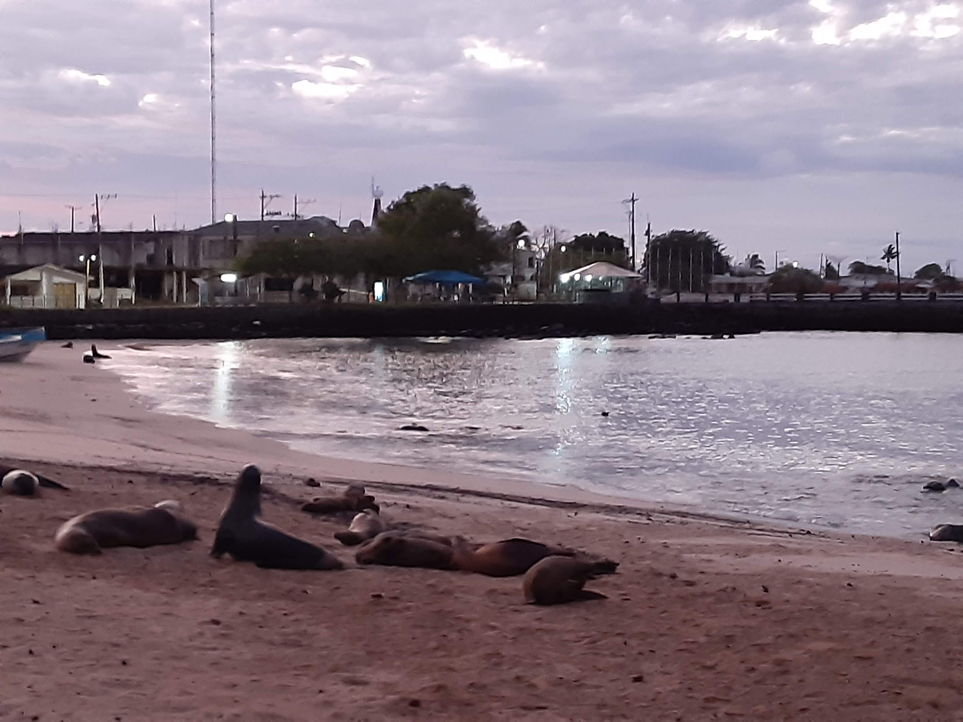
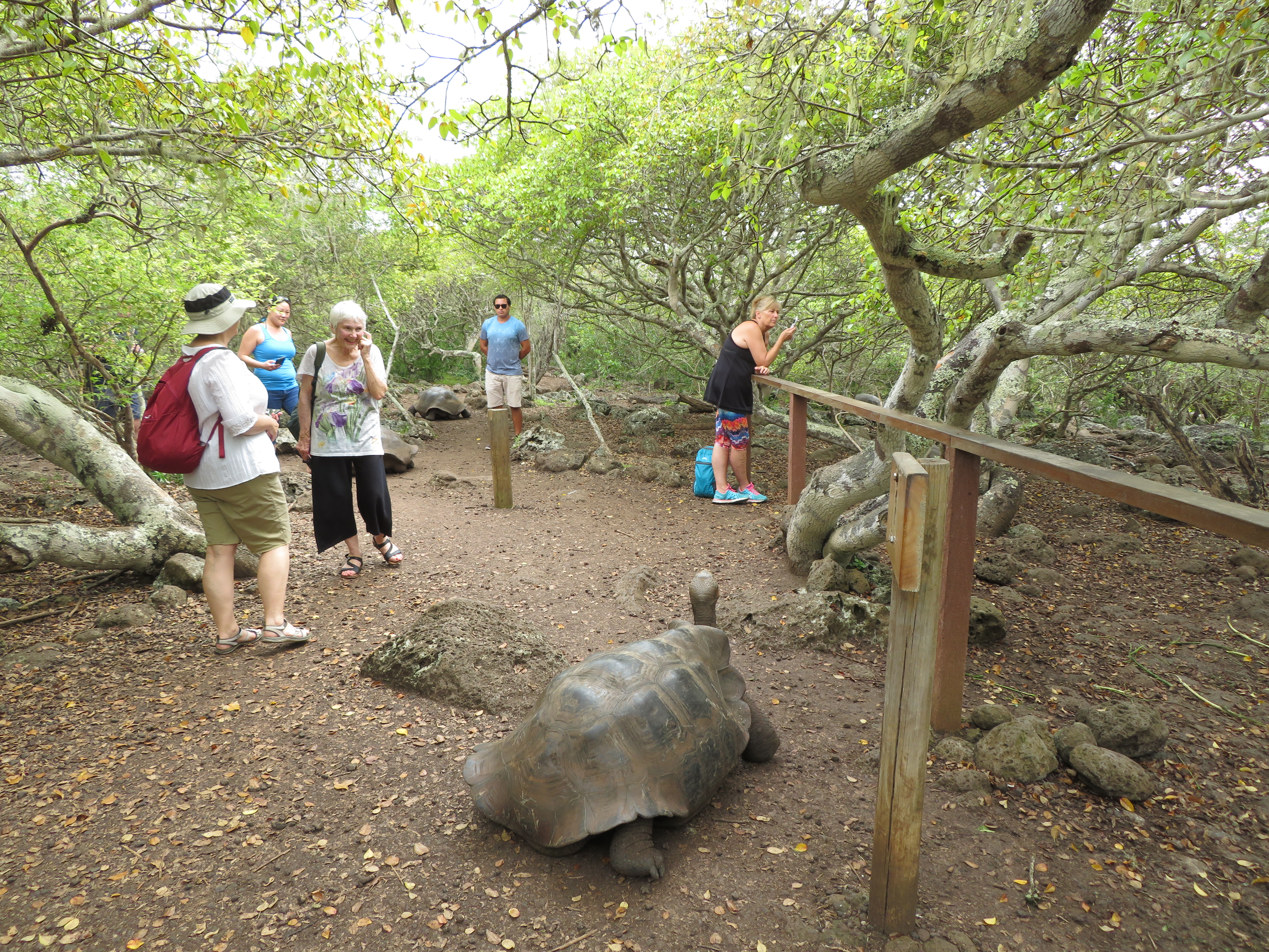
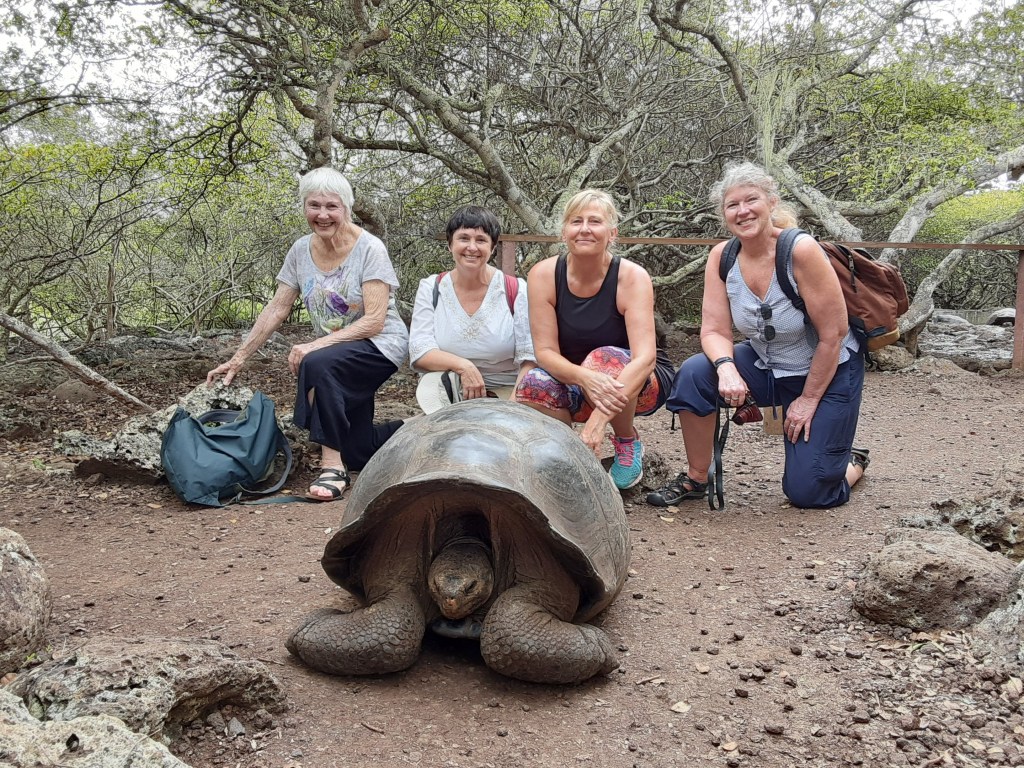
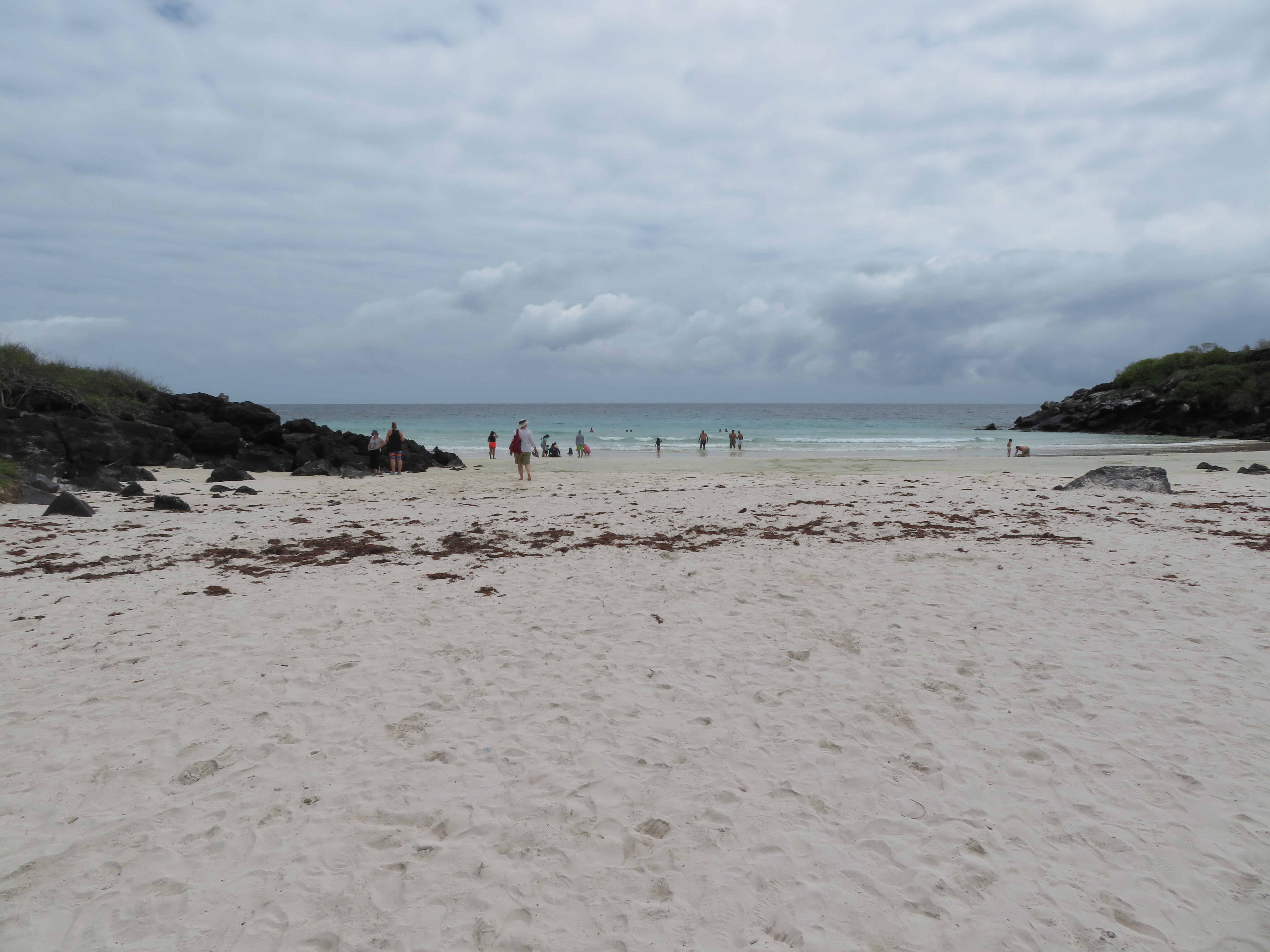

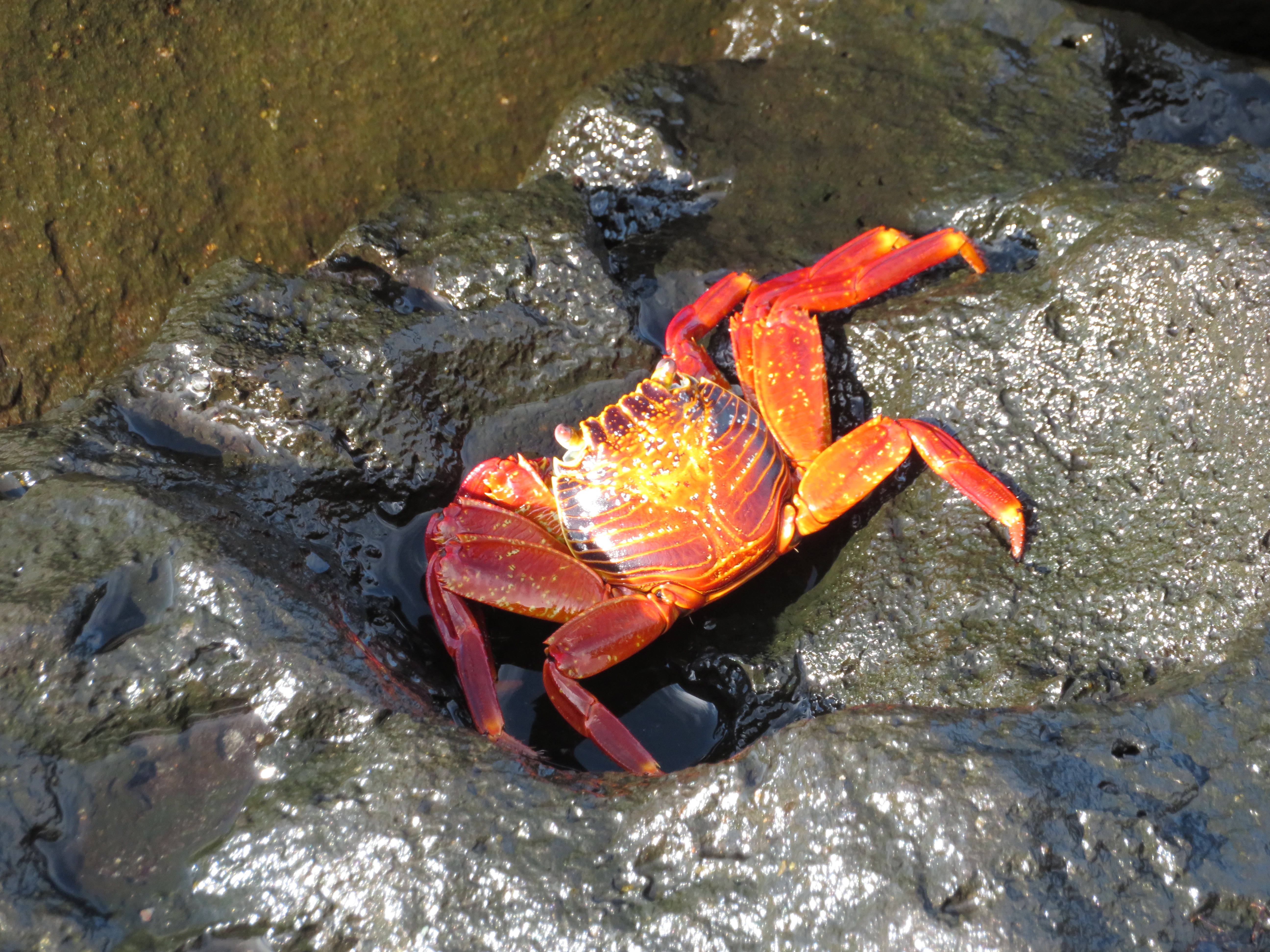


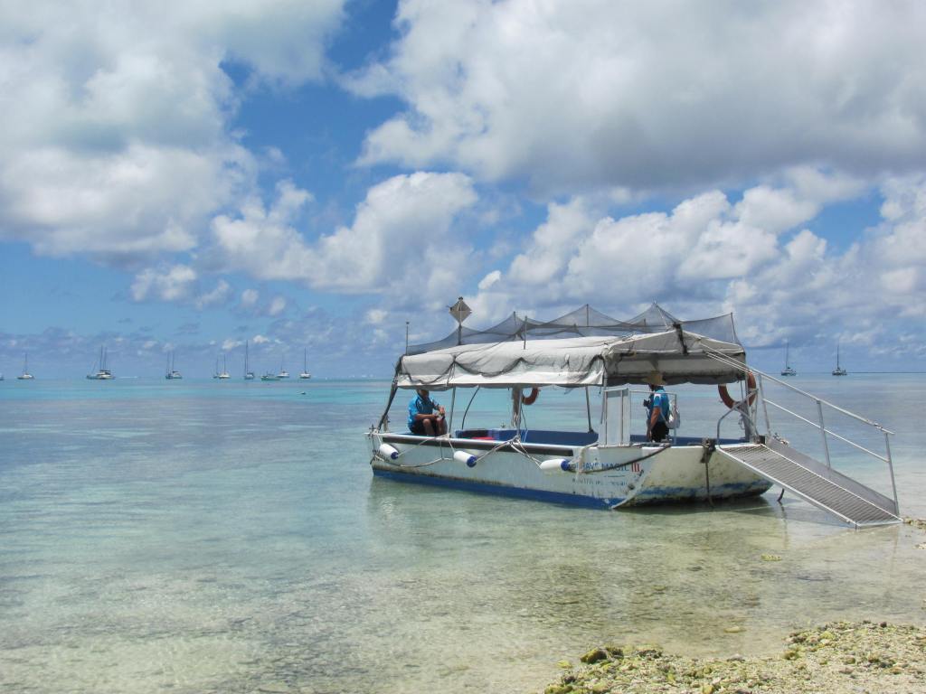
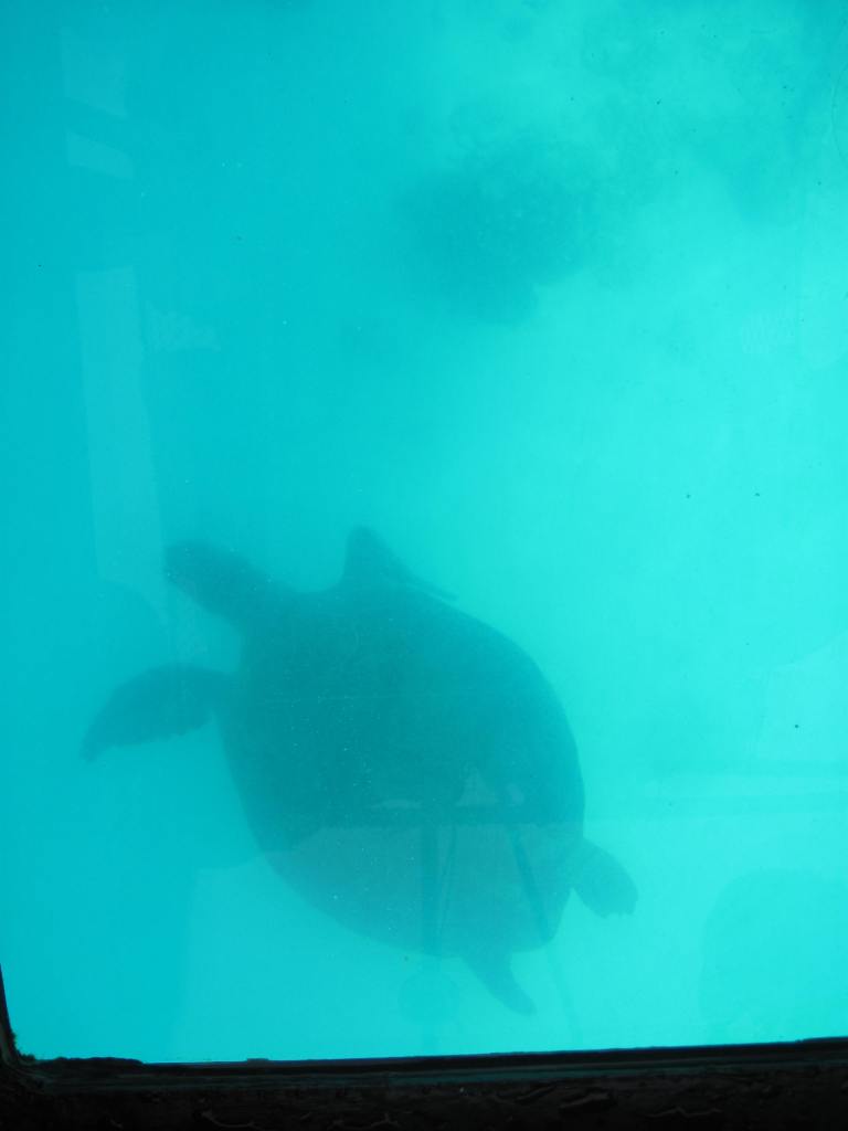
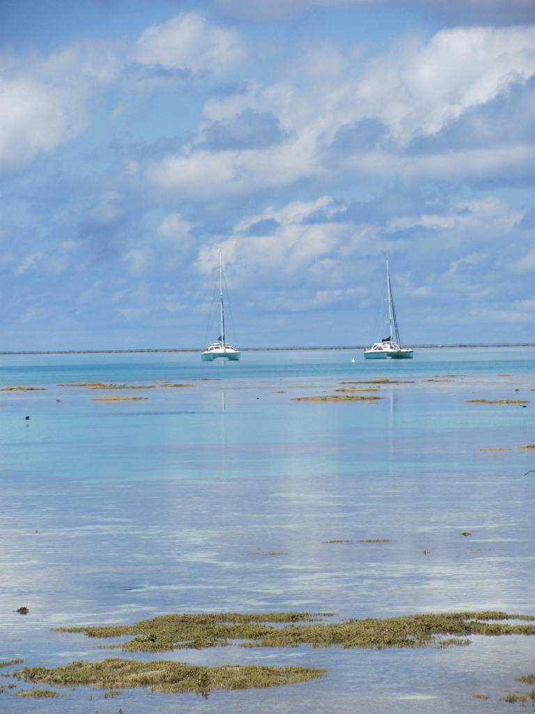
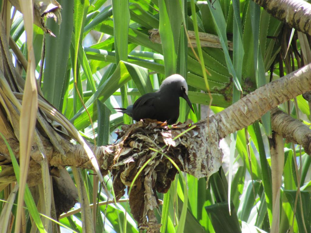
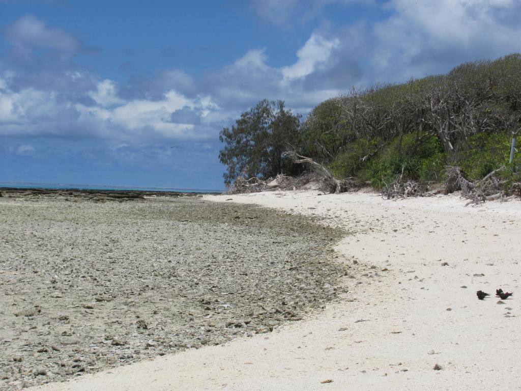


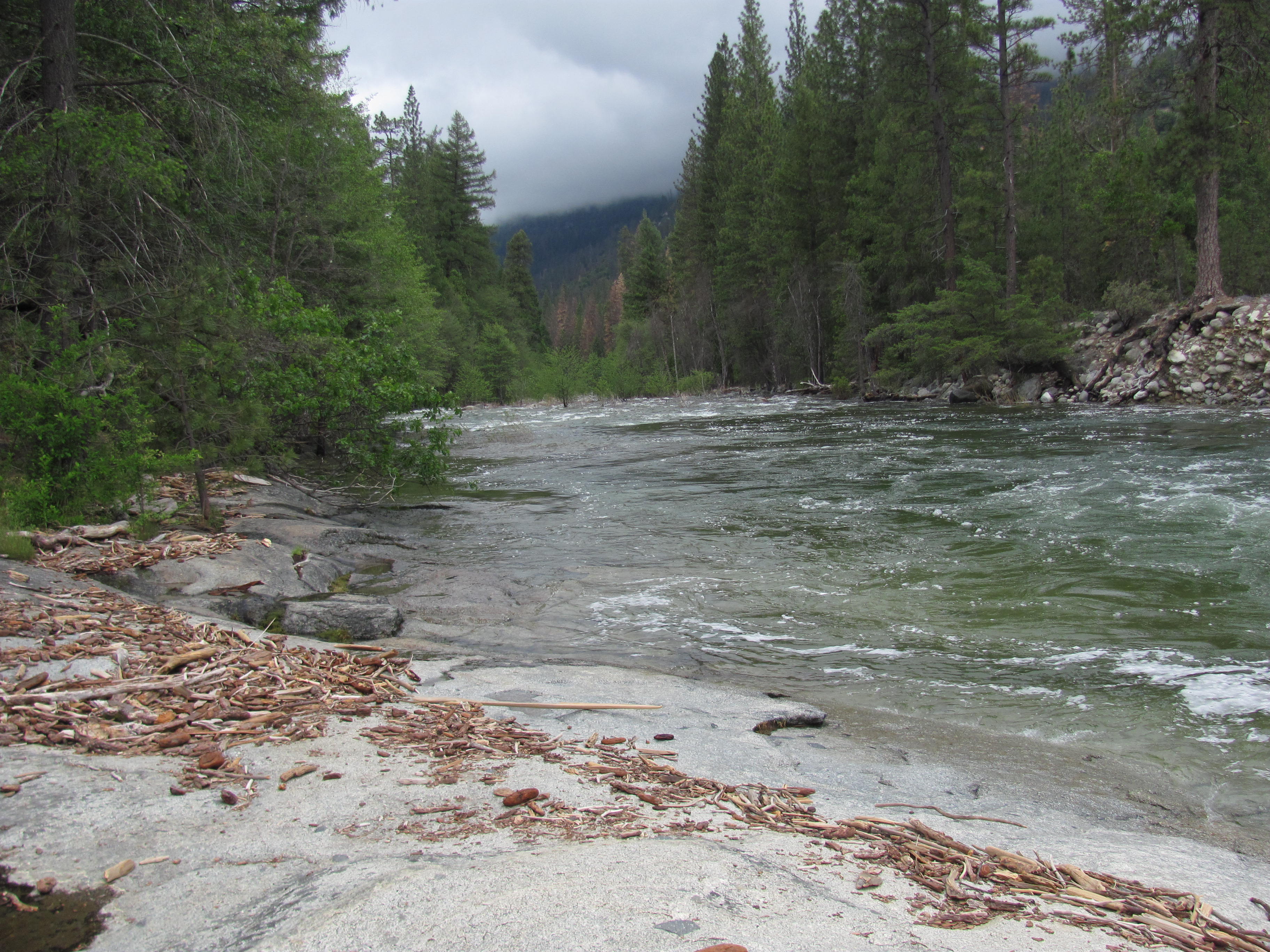

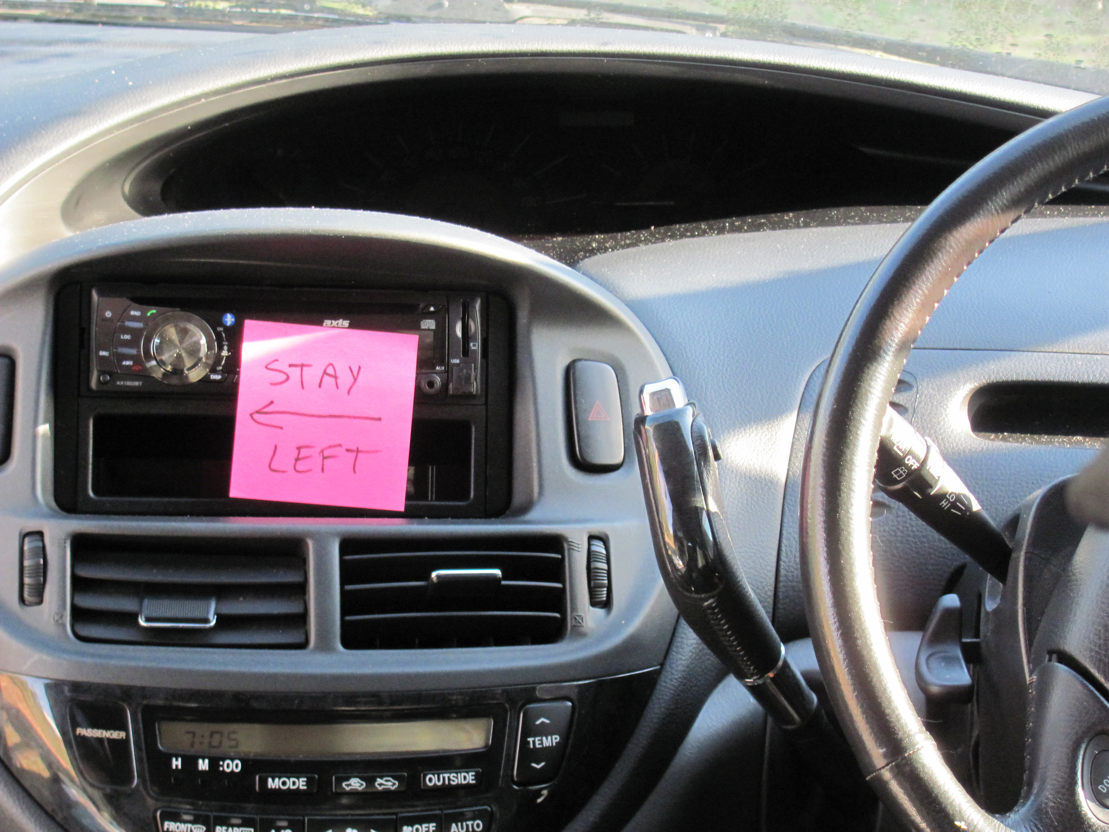
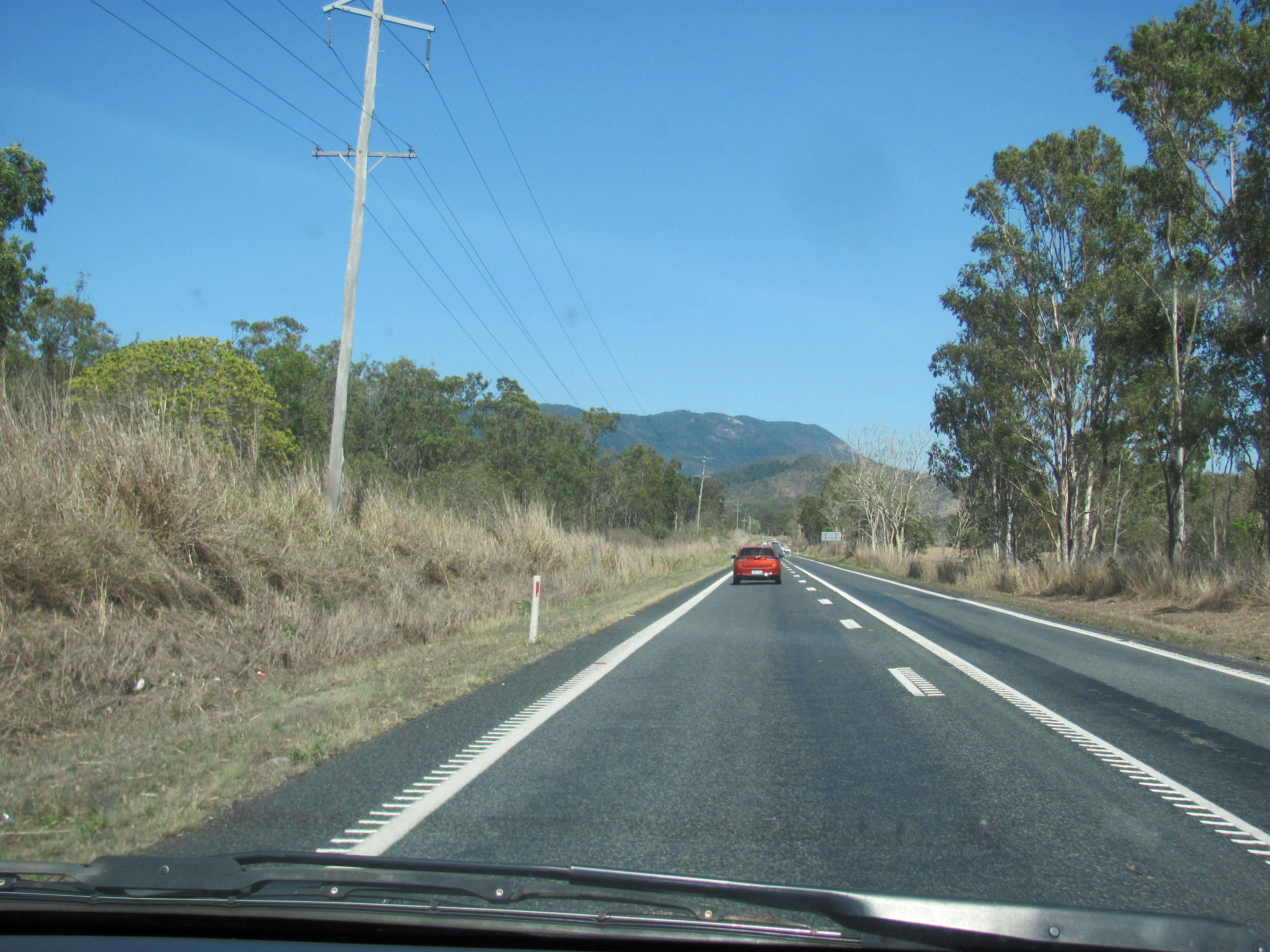
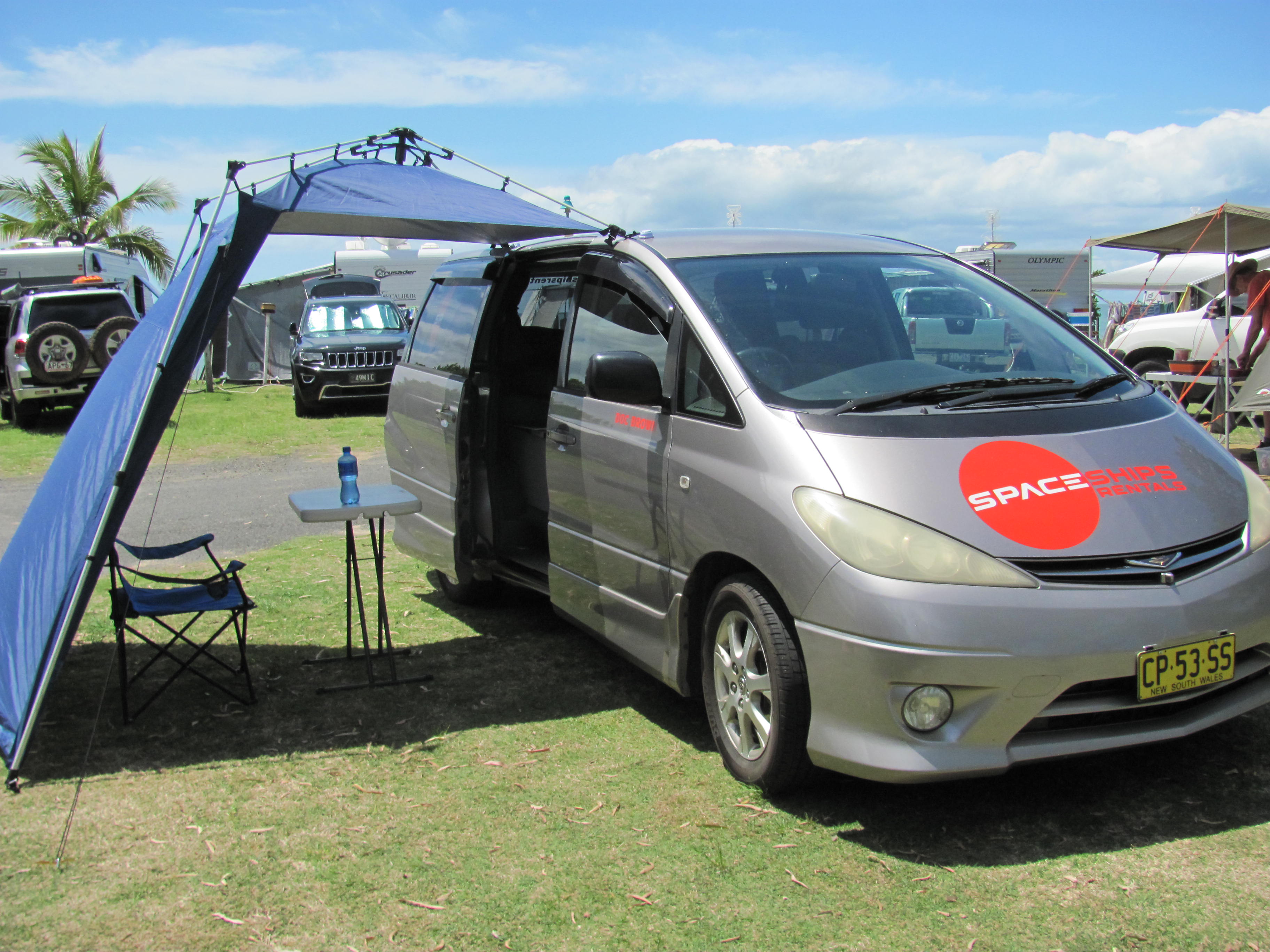
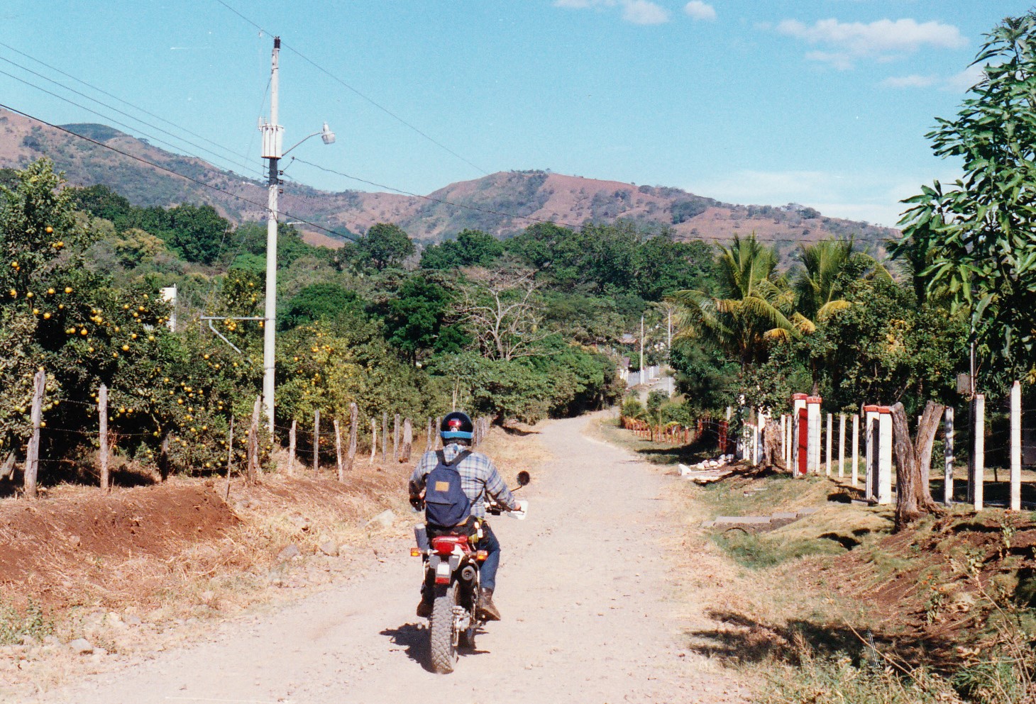
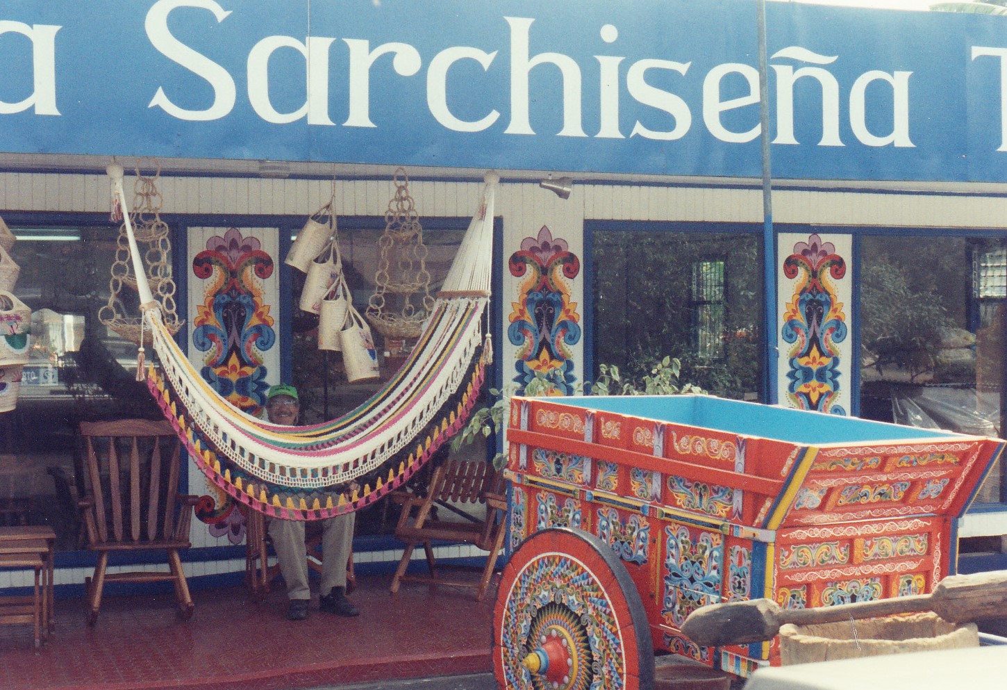
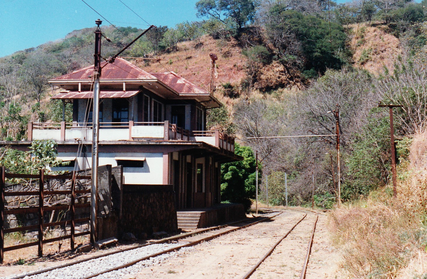
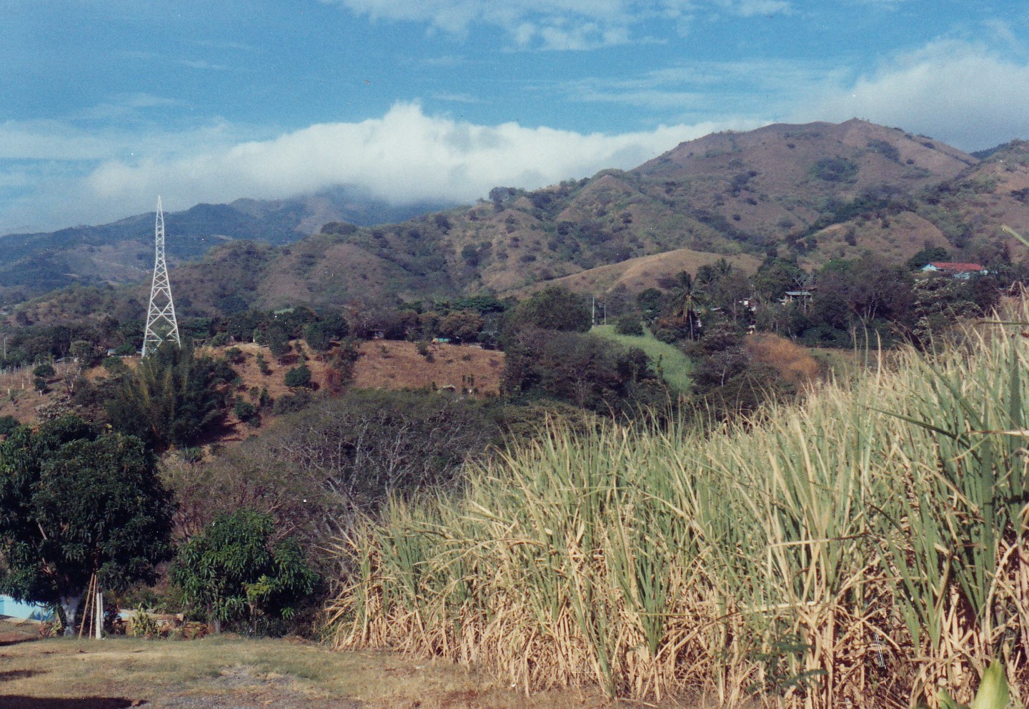
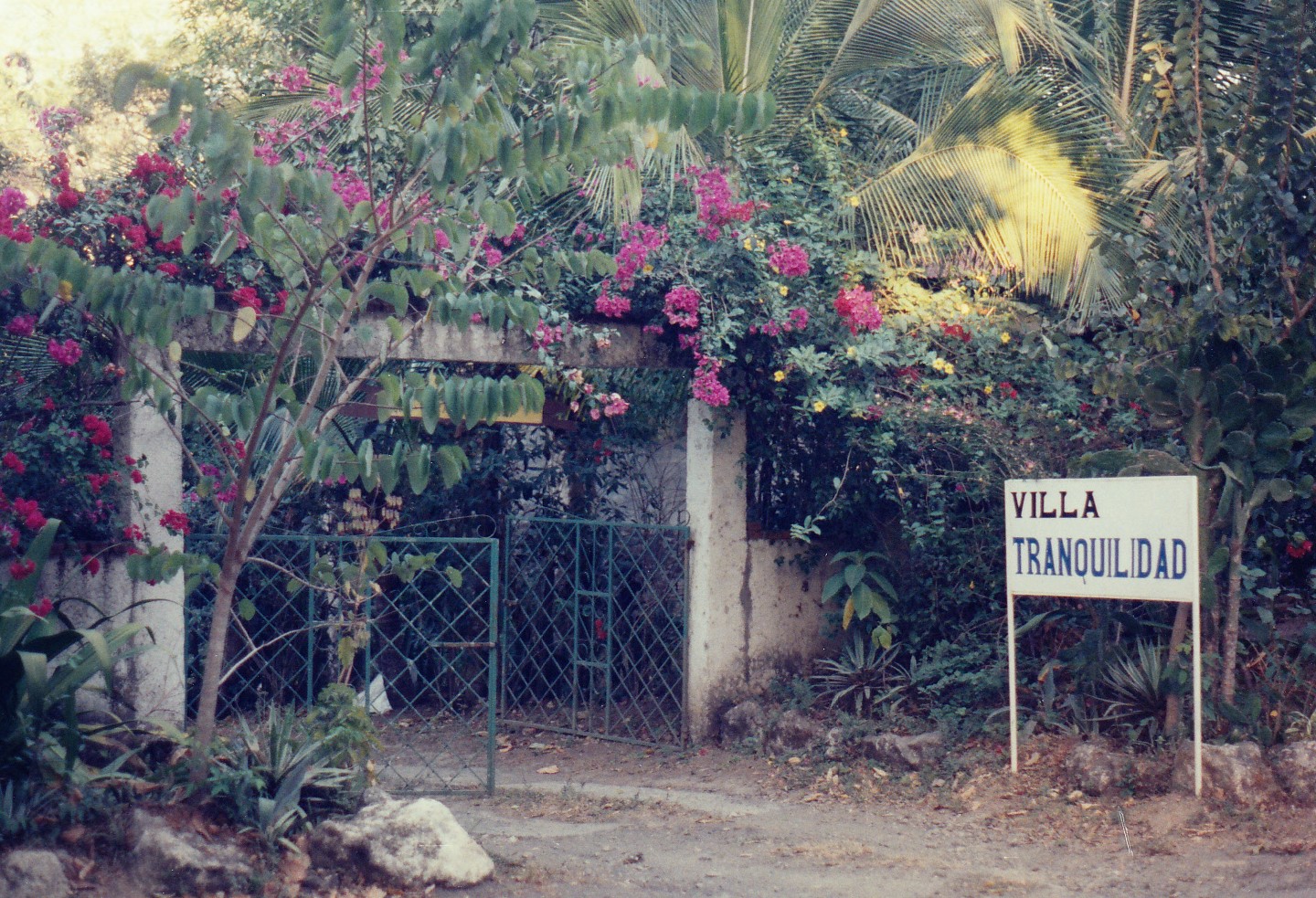
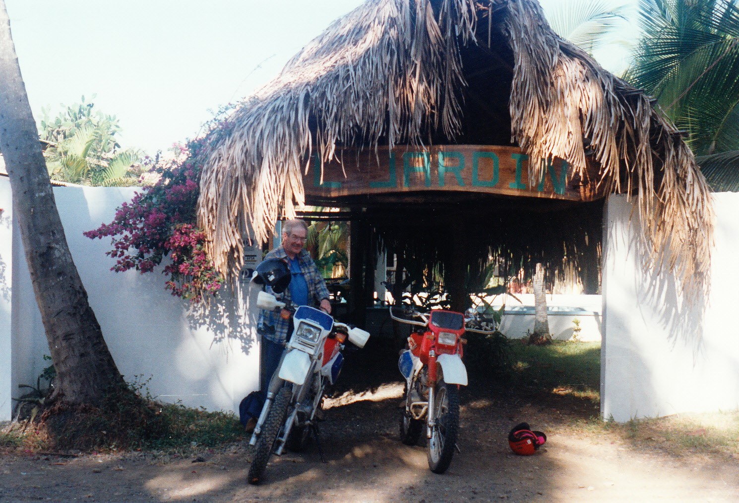
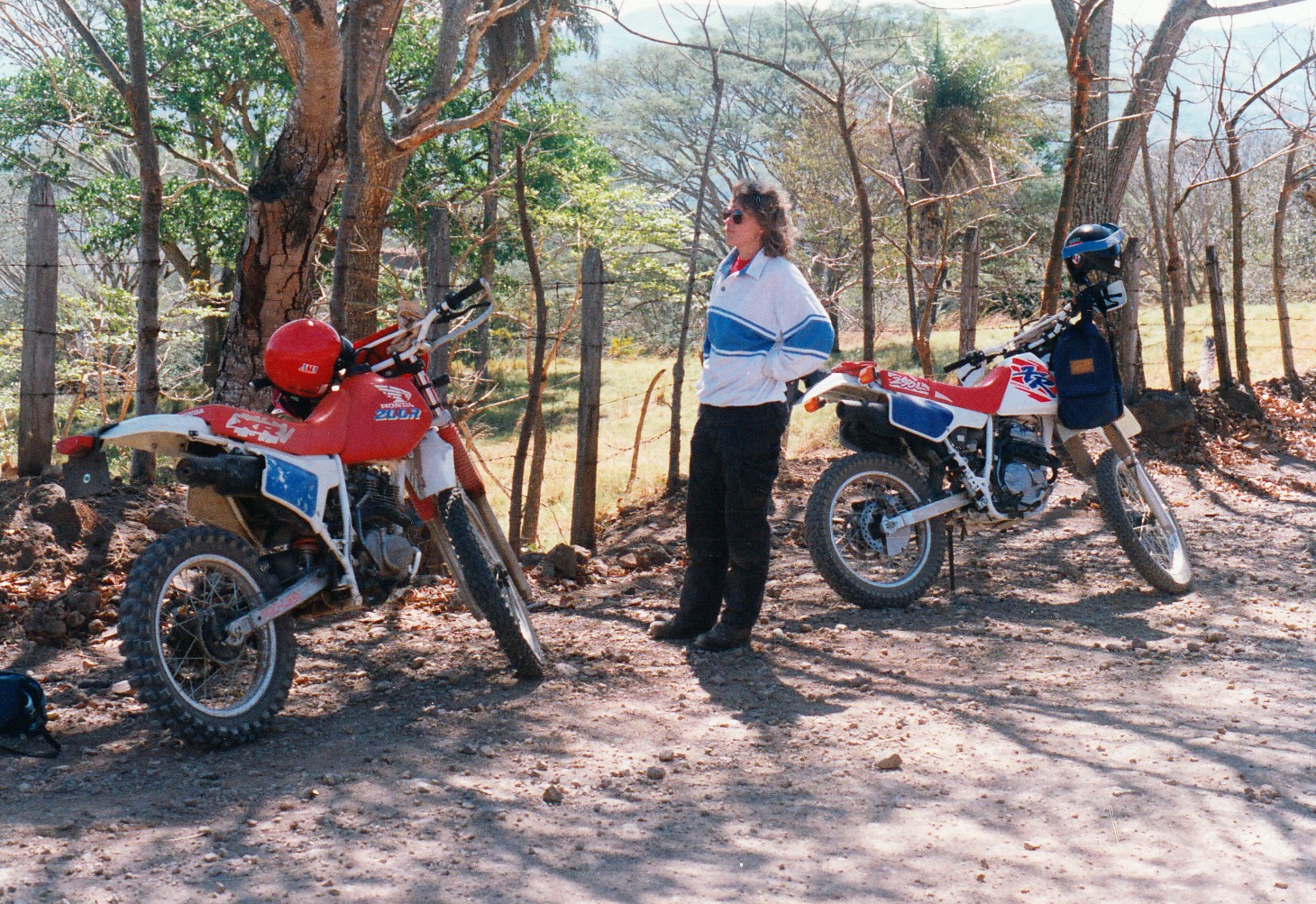
 retreat for himself and his buddies. My great-grandfather, Otto Crain, worked as the first ranch foreman. He arrived with his new bride, Gertrude Kavanagh, right after their New Years wedding, 1909. In a one-room log cabin that October, Gertrude gave birth to their first child, Louise.
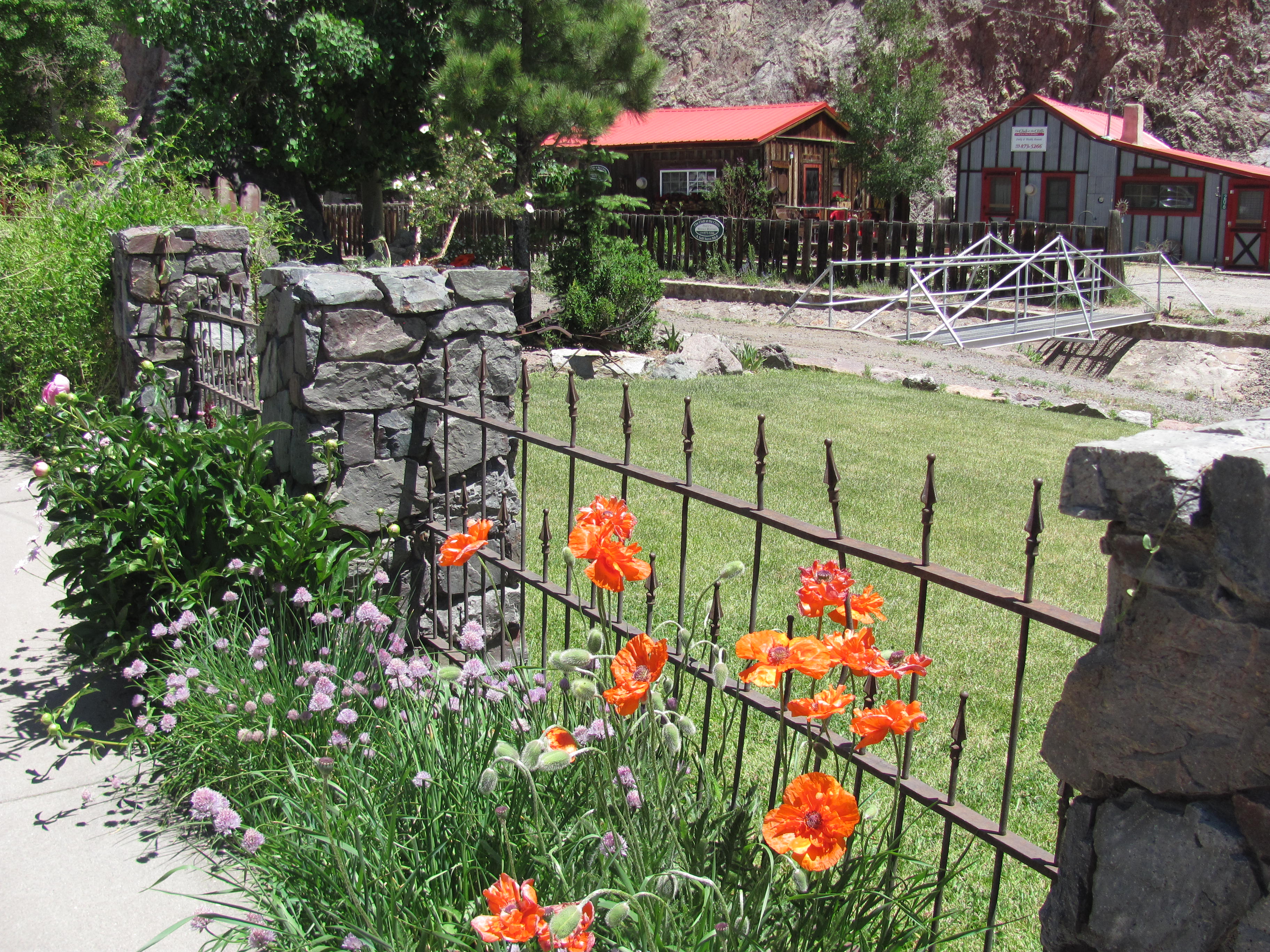 commercial center for nearby mining claims. Today it hangs on mostly due to a small but steady procession of two- and four-wheeled explorers traveling the rough dirt roads of the Alpine Loop Backcountry Byway from Silverton.
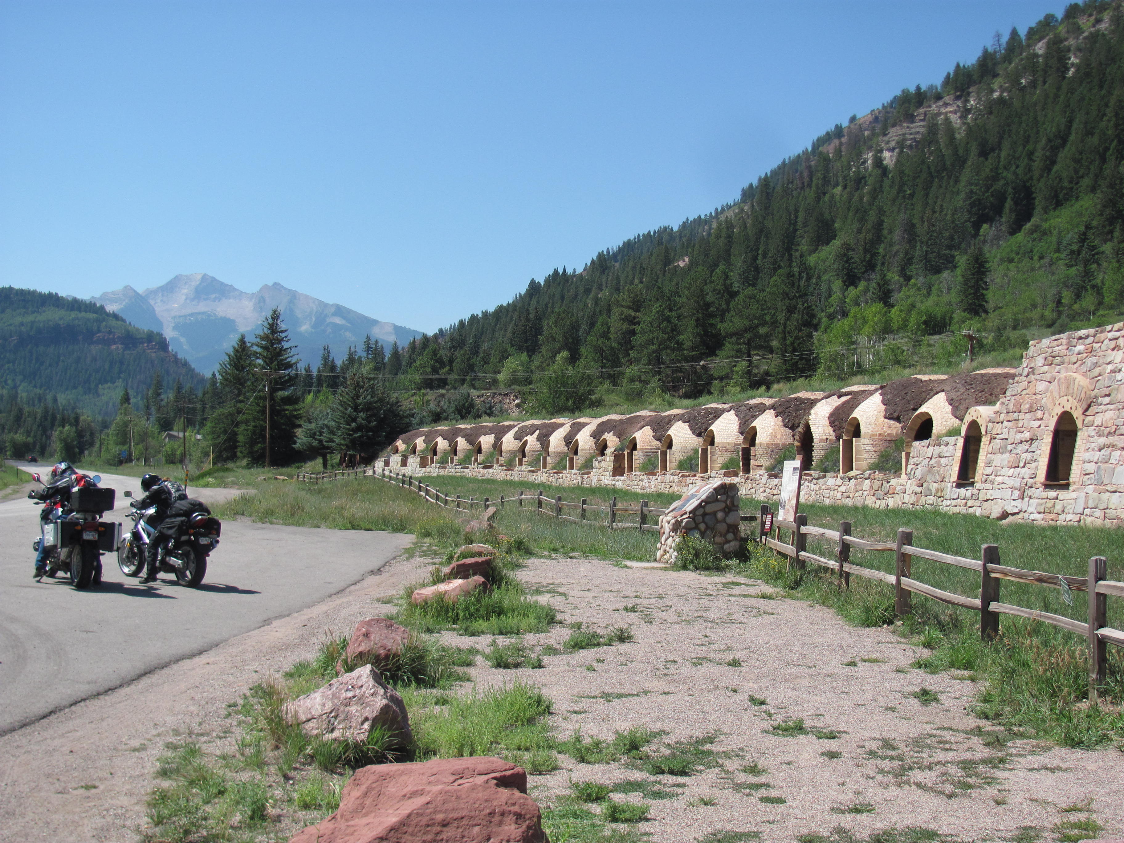 pulse quickened reflexively, since I have worked for more than twenty years in the fire suppression field. But a helicopter had already been launched and it was working the flames with its bucket, so I didn’t need to stop. A few miles later I reached world famous Aspen. To my right, trees were clear-cut in rows down the mountainsides to accommodate ski lifts and world class runs. Nothing of interest to a motorcyclist in August!!
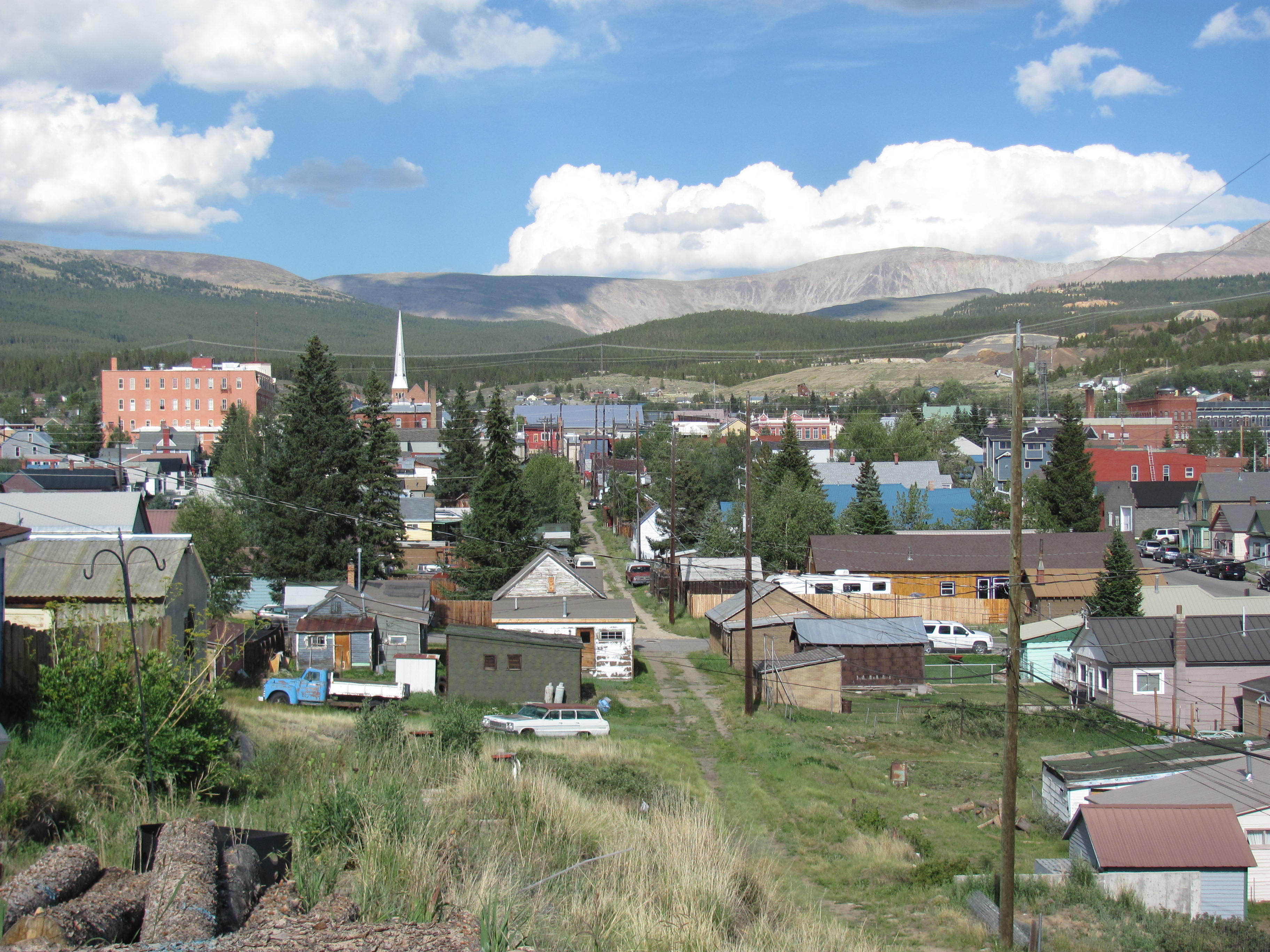 Kavanagh. He, along with his wife Mary and several children, made the difficult trek across country by rail, stage, and foot to reach Leadville in 1882. Austin had some connections with politicians and businessmen from his native Boston, so he established himself as the right-hand-man of a wealthy local businessman in Leadville. Most of their children perished in the harsh conditions at 10,400 ft elevation, but then two more (including my great-grandmother Gertrude) were born in Leadville, growing up fit and hardy in the rough mountain town.
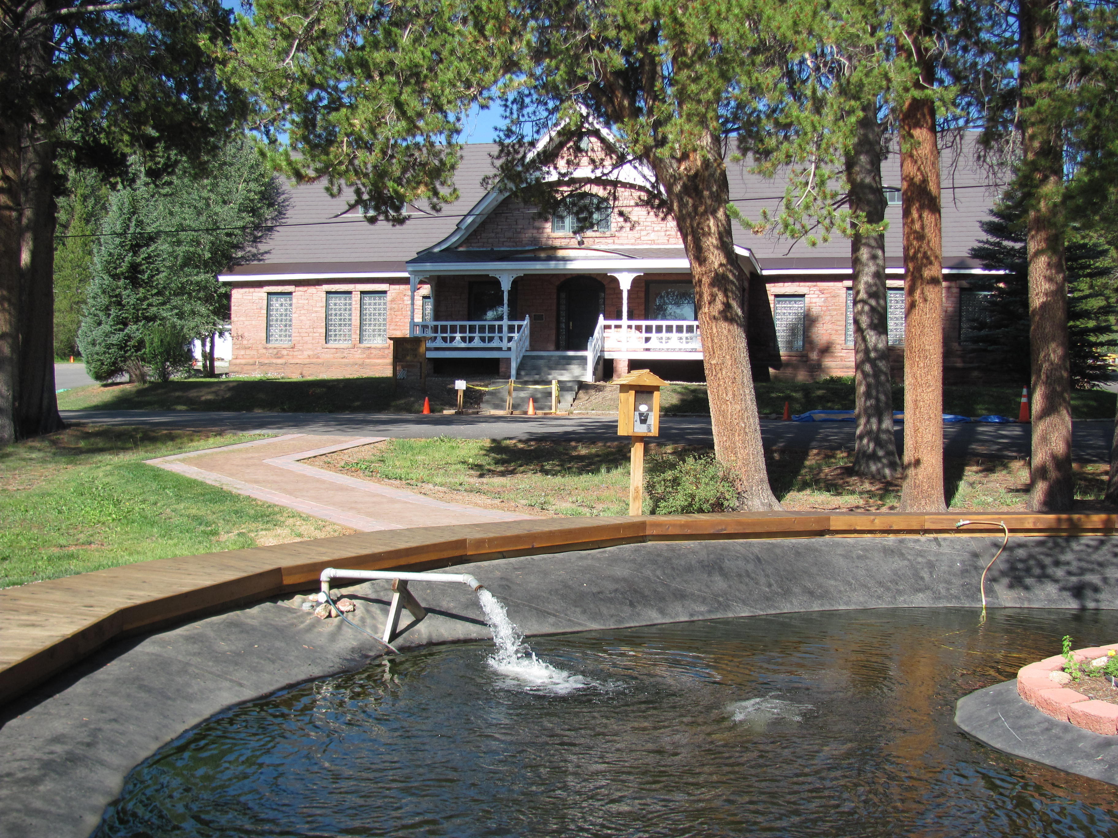 pictured my grandmother Louise and her seven siblings wandering around in these woods while their dad raised trout. The Crain family moved here after several years in Creede and lived in a tiny cabin behind the main hatchery building. The hatchery was a peaceful, natural place where I imagined the children would grow up away from the influence of crooked miners and other shady characters back in town. They lived there in apparent bliss, a loving Irish-American family with a new baby arriving almost every year.
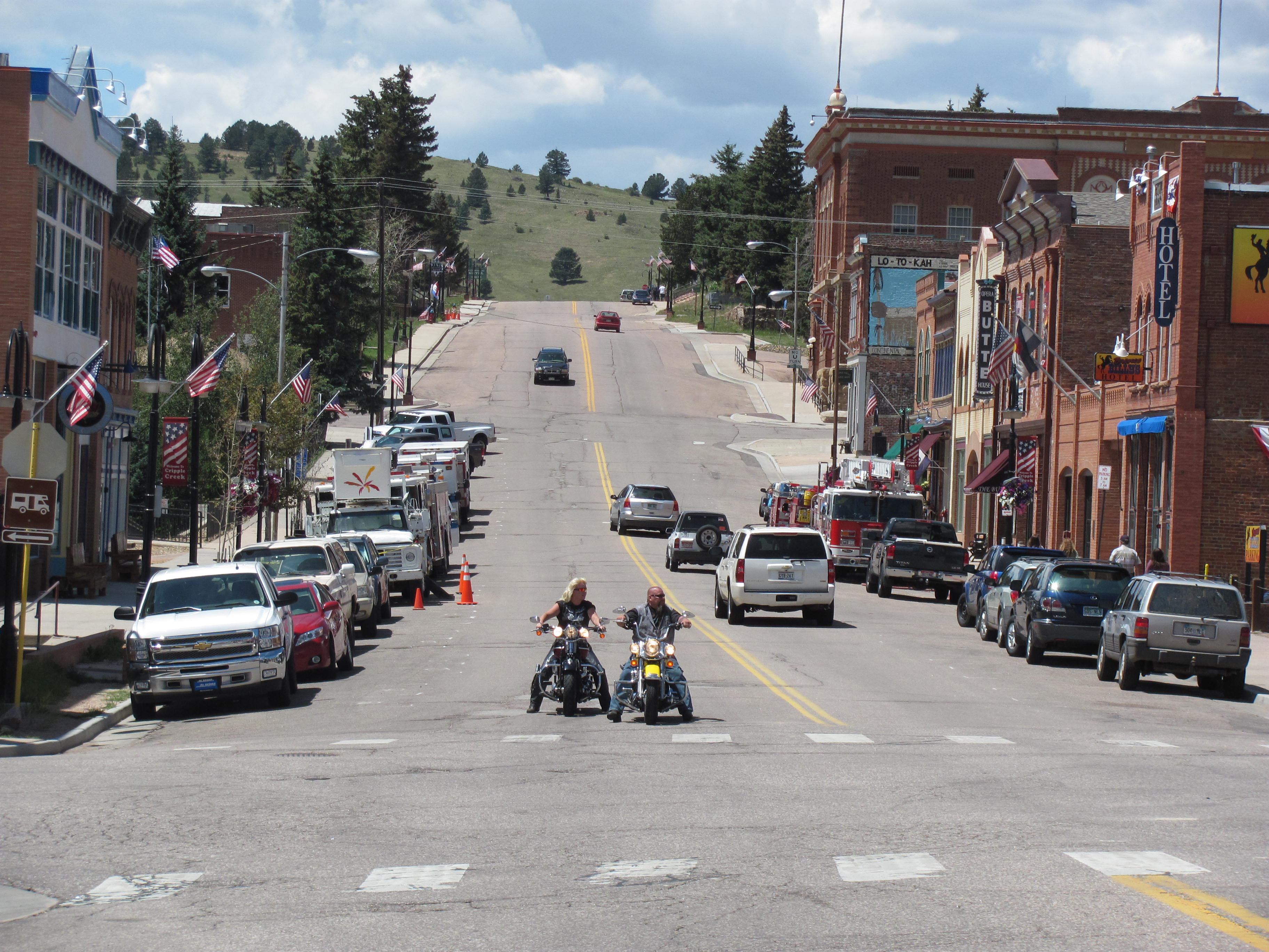 people’s hard-earned savings. The main street was lined with casinos, attracting people from Denver and Colorado Springs to try their luck on the poker machines and roulette wheels. One of my Ben Franklins disappeared at lightning speed into a one-armed bandit, so I gave up and headed back to my bike to continue my journey.
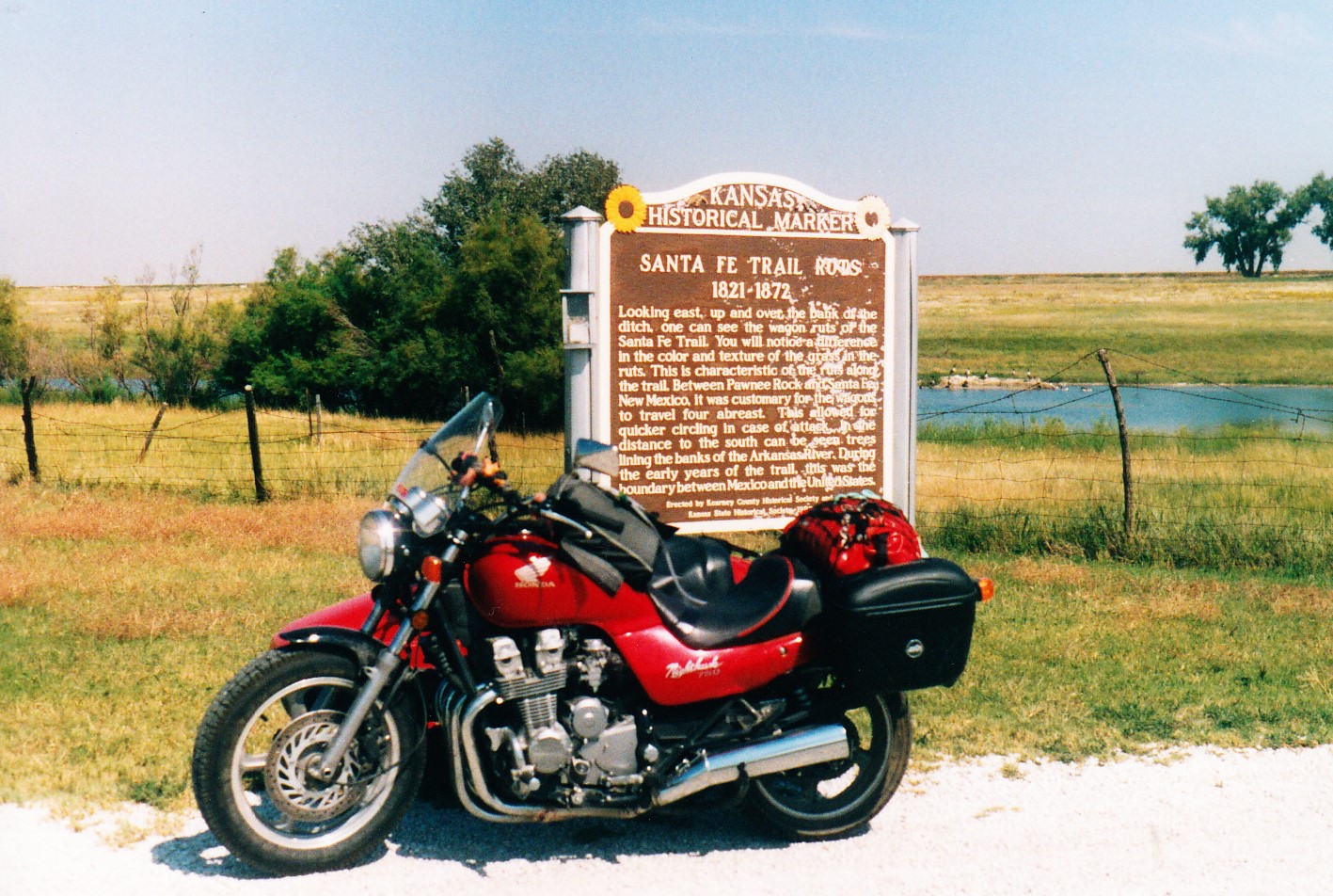 drawback: the rally took place in eastern Kansas. Kansas? What was there to see in Kansas?
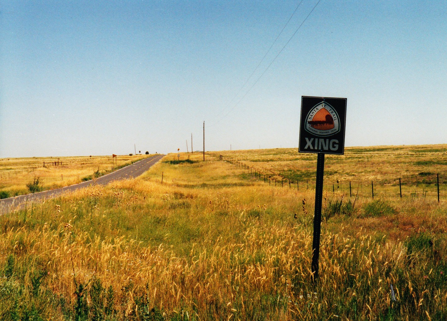 last (or first, depending on whether you were coming or going) view of the Rocky Mountains.
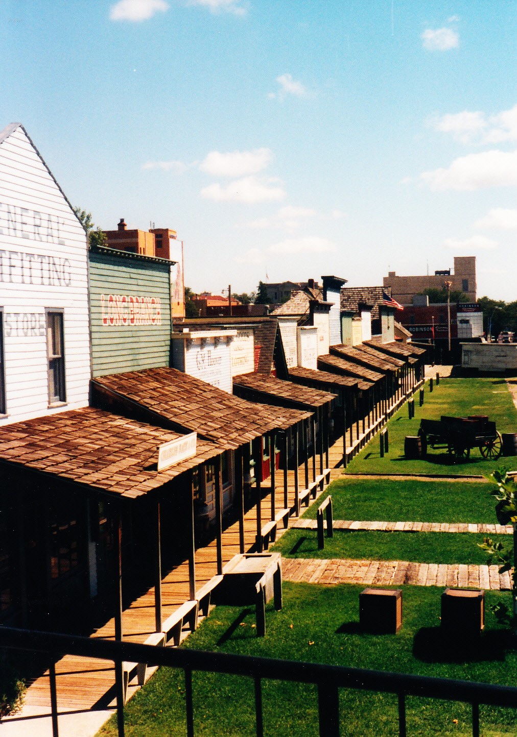 trading buffalo robes and beaded clothing for horses. Some conflicts were inevitable, but trail users for the most part cooperated with each other because everyone had something the others wanted.
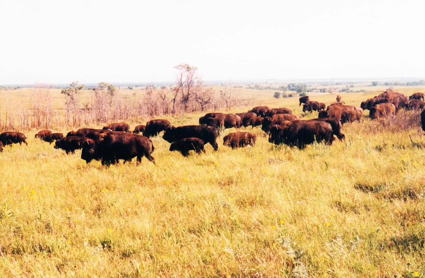 Our ride on a dirt road back to the highway the following morning was halted for a few magical minutes while a herd of bison passed by. Separated from us only by a cattle guard, they milled around, males sparring half-heartedly, calves chasing after mothers who leisurely grazed on the remnants of long prairie grasses.
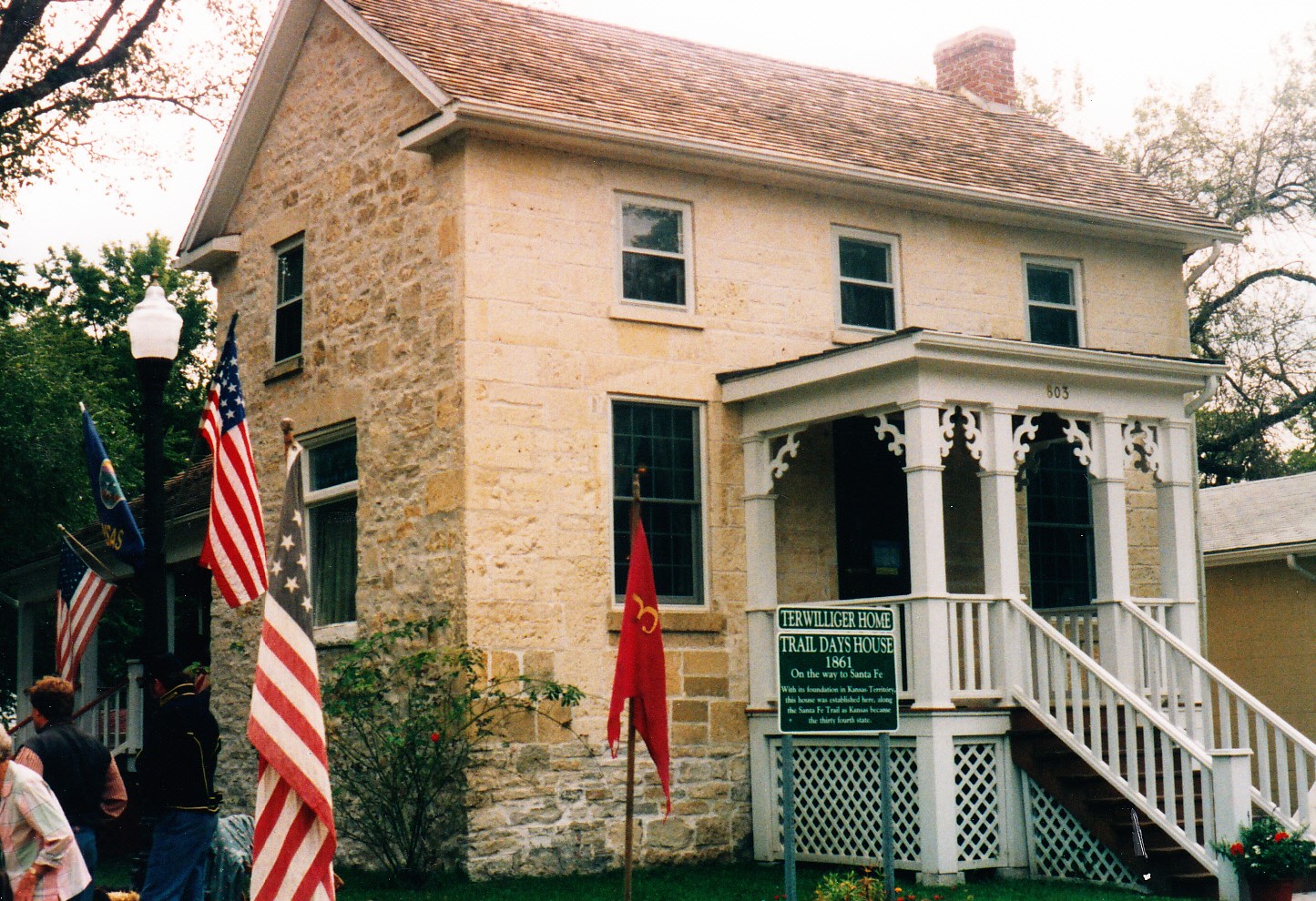 tallgrass prairie that once covered 400,000 square miles of the Great Plains. We stretched our legs walking up a steep driveway to reach a ranch home and three-story barn built of hand-cut limestone in 1881.
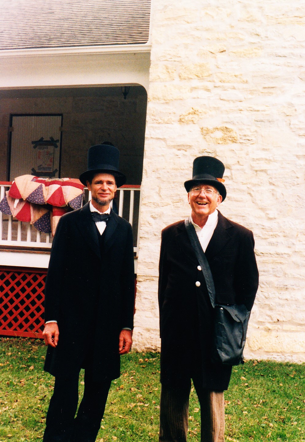 it is billed as the oldest continuously operated restaurant west of the Mississippi River.
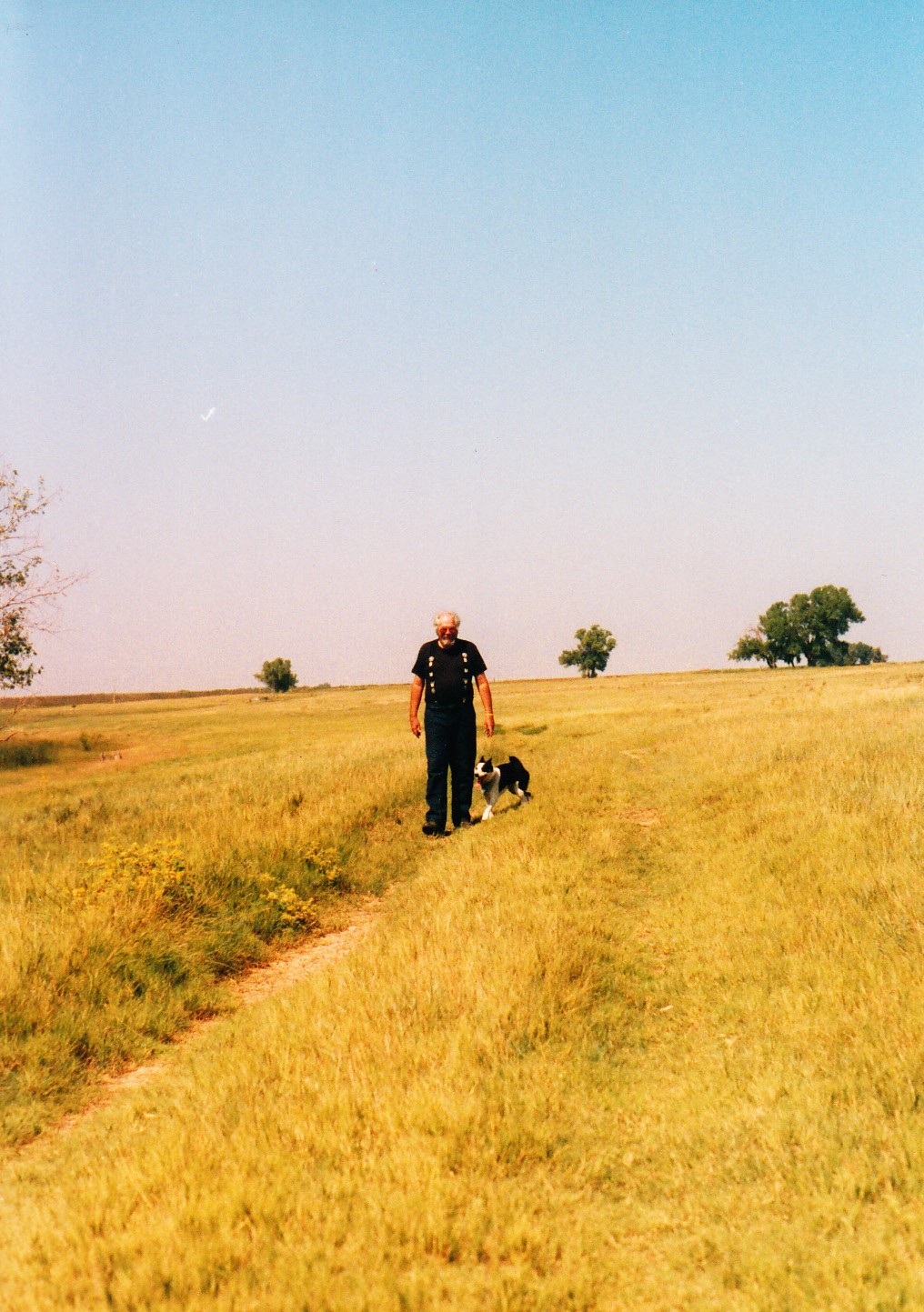 Colorado state line. The Santa Fe Trail followed the bank of the Arkansas River, once the southern border of the United States. The railroad, too, followed the trail route next to the river. Ironically, the materials used to build the railroad were hauled on the Santa Fe Trail; once completed in 1880, the railroad then rendered the trail obsolete. But later, when long-haul trucks eclipsed freight trains, the trail route was resurrected and paved.
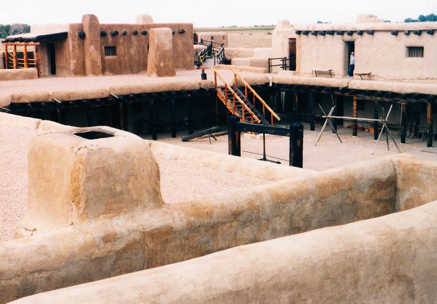 reconstructed the building in the 1970s using historically accurate drawings and photographs. As we wandered past doorways of more than 20 adobe rooms on two levels, a historian dressed in period clothing fed a campfire by the fort’s door and answered questions about life on the frontier. The smell of burning juniper added to the authenticity of the restoration at this important outpost on the Santa Fe Trail.