© 2015 by Kathleen Kemsley, from journals kept during a 2007 overland camping trip to Guatemala. The first day of our journey on La Ruta Maya was nearly a disaster. Leading up to the route’s start, my husband Brian and I had spent a day wandering through the mysterious Teotihuacán pyramids, watched dancers perform at El Tajin in Veracruz, and strolled past the giant black basalt Olmec heads in Tabasco state. So we were primed for our first Mayan ruin, not expecting a negative experience.
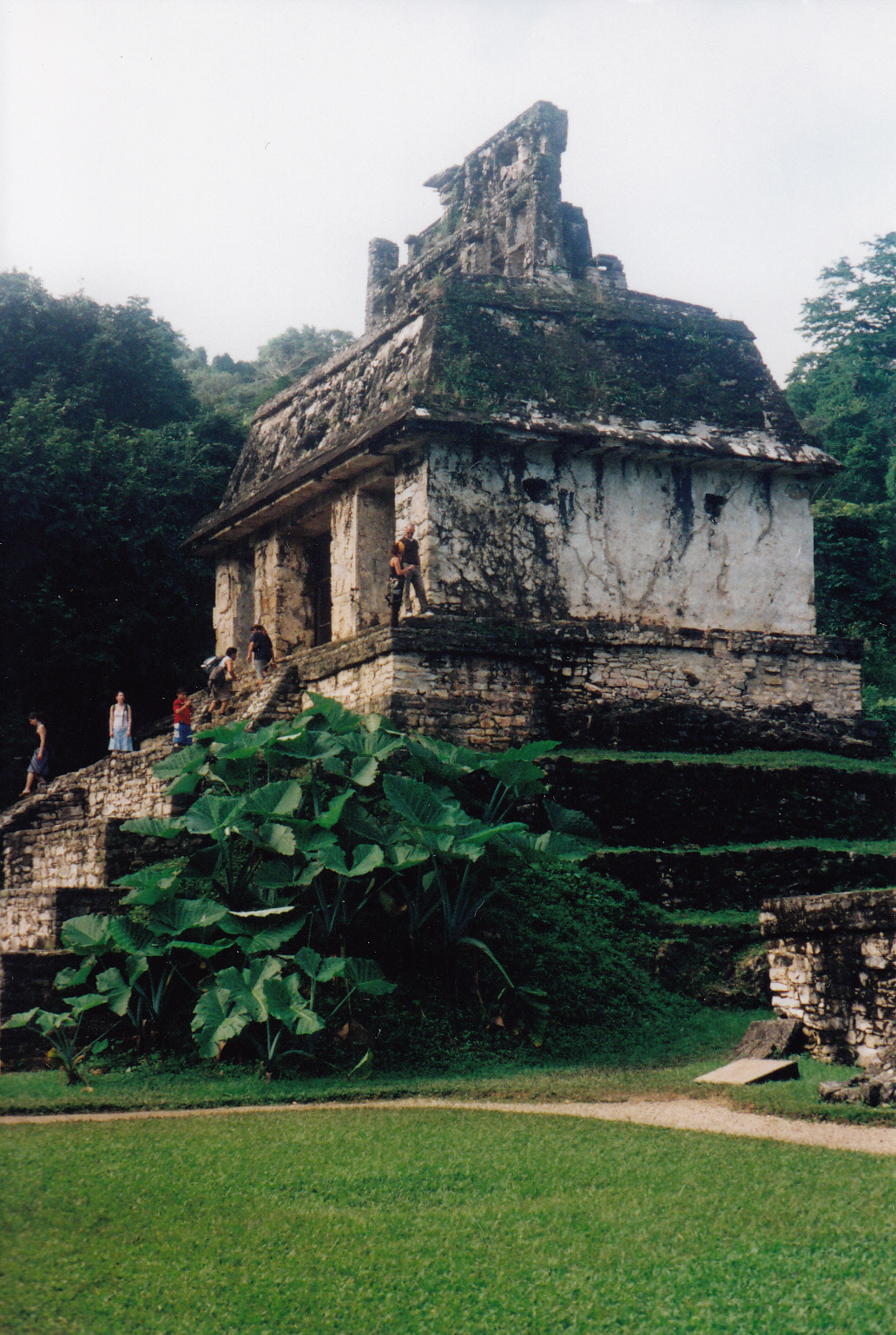
But it was undeniable – Palenque had bad vibes. We were late getting in to the park and out of sorts – simply a function of too many days in a row together in a tiny cab-over camper. So we agreed to disagree, and stayed separate for the rest of the day. Walking alone, Brian set his camera down on a wall and forgot it. When he returned a half hour later, of course, the camera had been stolen.
In a different part of the complex, I read interpretive signs describing the blood sacrifices made by the Mayan elite and felt my stomach turn. I pictured severed heads rolling down the steps. Blood running like a river in front of the palace. The violence of the place could still be felt a thousand years later. Most of the ruin had been rebuilt, but the new pieces looked like guesswork to me. The lower parts, small outlying villages of the main city, looked more natural with trees growing out of the middle and moss-covered jungle overtaking the civilization. I sensed turmoil in the quiet.
One of our Theories Of Camping is that when faced with overwhelming landscapes (i.e., the Grand Canyon or a huge Mayan ruin), people tend to make lots of noise because the place they’re visiting seems too vast. At the Maya Bell Campground just outside the park, this seemed to be the case. All the other campers were in the bar – except for one asshole from Colorado who cranked Johnny Cash up to top volume from his van, competing with the bar music. Everyone was drinking heavily.
Distressed, I left the campground and walked down the road until I couldn’t hear anything besides the natural world. Flocks of parakeets passed over. A howler monkey called out, the sound reminding me of the flush of an airplane toilet at 35,000 feet high.
Crossing from the jungle environment of Palenque to the Yucatan Peninsula meant moving into a more open, brushy and drier environment. We escaped the noisy crowds the next day, moving north to the next cluster of Mayan ruins. There we re-established equilibrium and the pleasure of discovery returned.
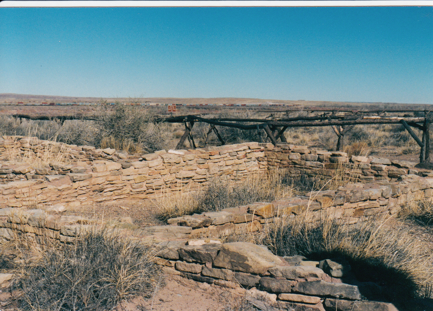
Edzna, a nice little ruin just outside of Campeche, provided us with a tidy introduction to the Ruta Maya proper, before, as the guidebook warned, we would be spoiled by Uxmal. We camped that night at Sacbe (the name referencing the paved elevated roads between Mayan cities). It was cheap enough, 50 pesos including nice hot water showers, but of course there was no toilet paper and no locks on the doors. The clouds misted and sprinkled on the bright red dirt which got tracked into the camper, making a big mess.
At the Chac-Mool Lodge while eating pibil (tender pork cooked in banana leaves), we learned that Chac-Mool is the Mayan god of rain. You pray to him for rain in the dry season because there is no natural water anywhere in the Yucatan. No rivers, lakes, or springs. The bedrock below the surface is porous limestone and rain soaks in like a sponge. So the people built these huge underground cisterns and caught rain water during the wet summer to use all winter. A small opening in the roof kept the water from evaporating. Very clever.
But I wondered: was there more to the story? The Chac-Mool stylized figure which is ubiquitous on Mayan buildings has this weird hook nose-looking protrusion. Now tell me that doesn’t look like a rain gutter holder? Seems like the Mayans, who mastered writing and numerology and astronomy, would have been morons not to have figured out how to catch run-off from the palace roofs with rain gutters.
Mayans approached the world differently than we do, though. So perhaps, hard as it might be to believe, they didn’t think of rain gutters. Logical, rational left-brain thinking was not their strong point. Dualities such as time and space, mind and body, science and religion were meaningless to them. The world was seen as magical and encompassing of all these things.
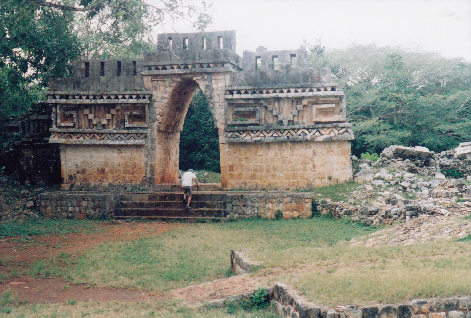
In Maya Land the brush and tangled woods and jungle beckoned. We explored Kabah, a small ruin near the Sacbe campground one day. On the west side the palace and buildings had been  excavated and neatly reconstructed. The front desk guy told us only an arch was visible across the street. But in the jumble of brush beyond, the forms of two pyramids emerged, one huge, the other smaller. They were covered with vegetation, cactus as tall as me, trees and rocks tumbling down. I was drawn toward them, but couldn’t get close without a machete. Then off to the east, a path lead through the woods and I came upon a site in the midst of excavation. I could see where workers had been camped recently, though there was no one there now. I was drawn in, back a little farther, a little farther – what else is here? I felt myself tugged ever-deeper into the jungle, by the mischievous magical spirits of the Mayans.
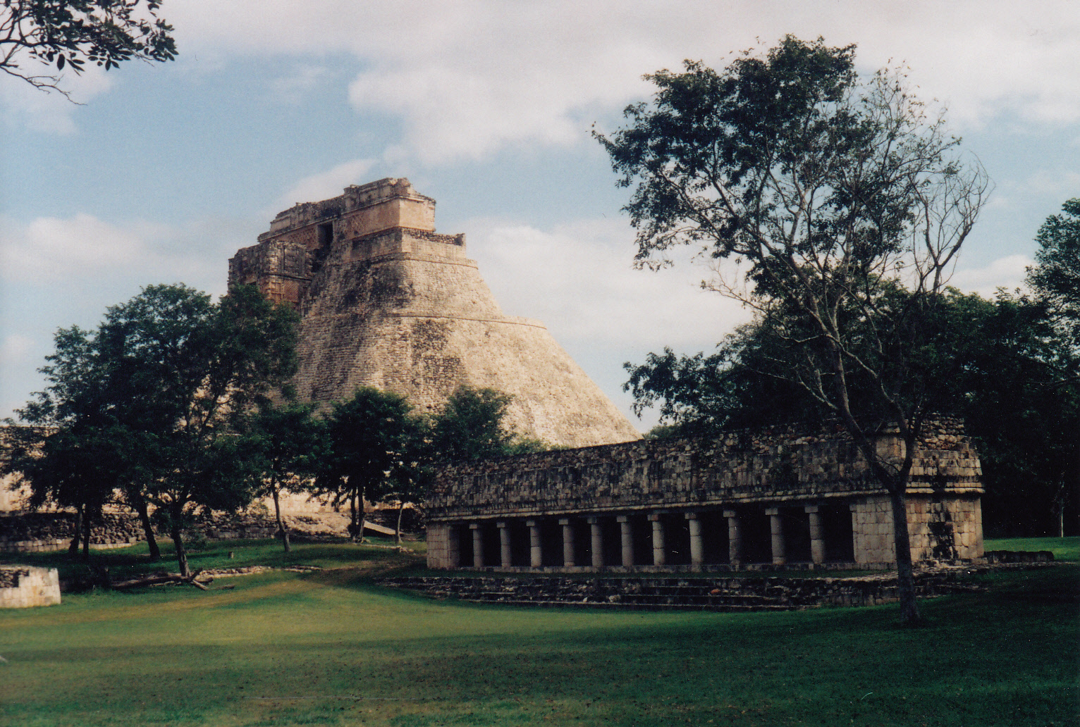
The city of ruins at Uxmal was graceful, welcoming, and peaceful. There had been no human  sacrifices here, unlike Palenque – just genteel life and perhaps higher learning. From atop the Grand (north) Pyramid I could see across the whole complex. We came back at night for an eerie light show and retelling of Mayan legends concerning four gods of four directions and four colors.
The resemblance to Zuni mythology was a bit unnerving. The two cultures flourished during the same time frames, but they were separated by thousands of miles at a time of no mass communication. At least none that we know of. But I wondered: the similarities strain the bounds of coincidence. The Mayans facially resembled Mongolians; built pyramids like Egyptians; worshiped the same three creatures as the Incas; used symbols comparable to the ancient people of Teotihuacan. The only relevant question was, what part of their culture was NOT related to other civilizations? The Mayans had the equinox and solstice figured out, a calendar, hieroglyphics. Farming. Irrigation. And yet – they only had stone tools? No wheels? No beasts of burden, no metal, nothing but stone and their own hands and backs? It’s hard to believe.
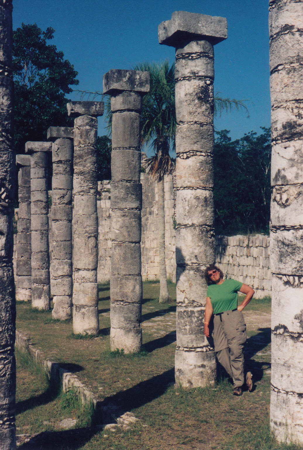
 We blew through Chichen Itza fairly quickly. Unlike some of the smaller ruins, it seemed overrun with tourists and the central pyramid was closed for repairs. We put in the requisite footsteps just to make sure we didn’t miss anything. But by now I actively avoided bi-lingual men who approached offering to “interpret” the ruins. Their every sentence was preceded with “They might have…” In other words, no one really knew. I preferred my own observations and imagination to their “educated” guesses.
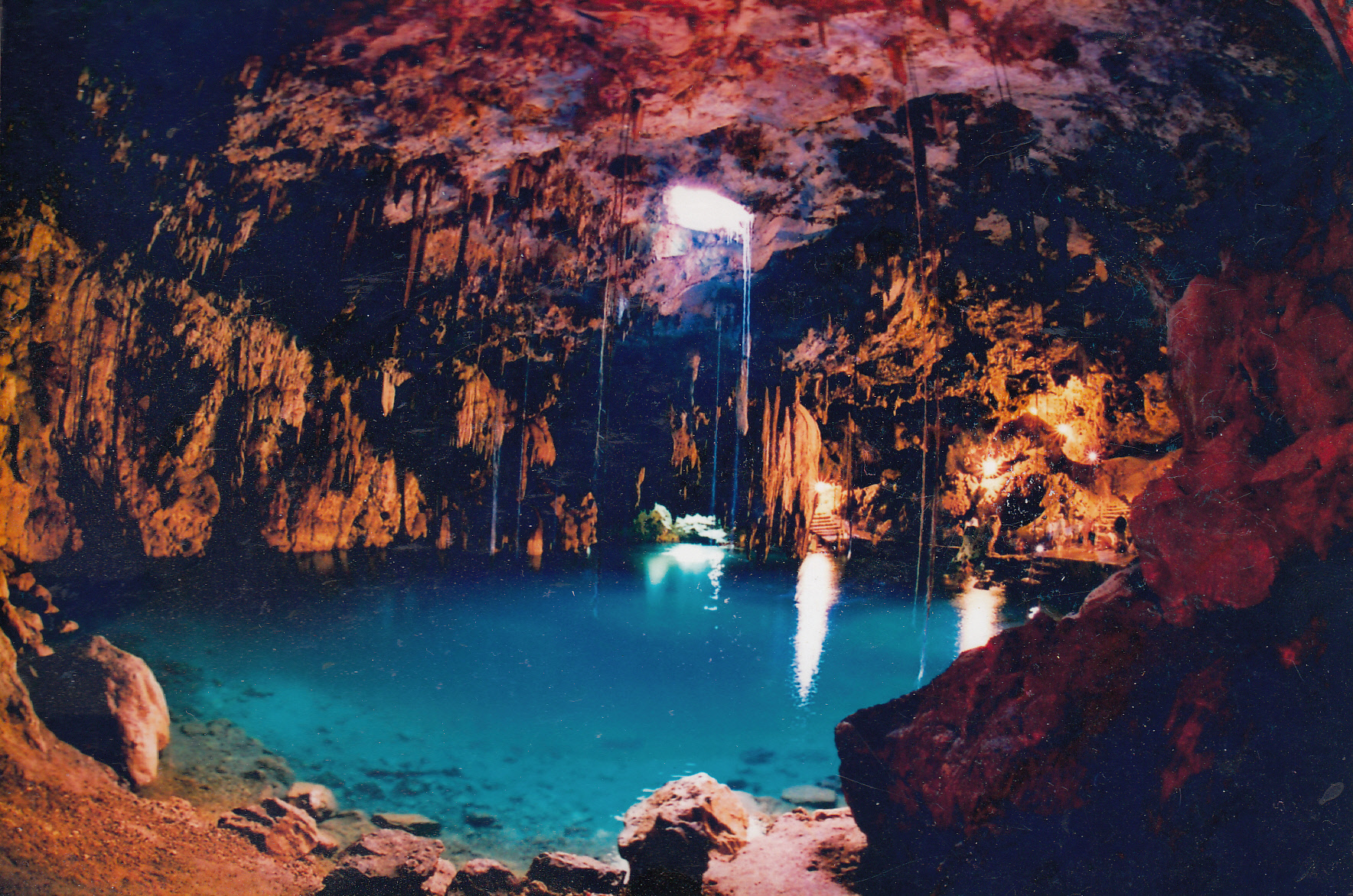
A highlight for me was a visit to the nearby Dzipnuk Cenote. Cenotes are natural caves beneath the surface of the limestone. In the Mayan world, cenotes were considered sacred places. The Mayan people often threw statues, valuable stones, jewelry, and even the bones of sacrificed humans to the murky bottom. I was the only person in the Dzipnuk Cenote at nine o’clock in the morning. Stalagtites rippled down like drapes from the cave’s ceiling and disappeared into the water. Bats flew around up high. Catfish swam in the water. How did they get there? I was confounded and frankly a little creeped out when they brushed past my legs. High overhead, an opening maybe 2 meters across provided the only illumination from the outside world. Clear blue water filled the cave, but you couldn’t see to the bottom. Greenery spread out across vertical cave walls, ferns and moss and roots of trees hanging from a domed ceiling.
Closer to the Caribbean coast, we ventured to Cobá, a giant ruin which is not very well known, despite containing the tallest pyramid in the Yucatan. Supposedly you could see the top of Chichen Itza from its peak, though they had the back half access blocked off so I couldn’t go check it out myself. At Cobá we walked for nearly five miles down several Sacbes – white stone highways – of which there were said to be more than 40. Coba was the largest city in Maya Land at one time. Now tell me, if they didn’t have wheels – why in the world would they have paved highways twelve or more feet wide?
We camped for free in the ruin parking lot and left early the next morning, reaching Tulum by nine o’clock to beat the crowd. Only two busses were parked there when we arrived; that number had multiplied to more than 30 by the time we left a couple hours later. Tulum Ruin was perched on a sea cliff, next to an azure sea picture-postcard perfect. Except for all those pesky tourists who walked in front of my camera just as the lens clicked. All my pictures of Tulum had modern humans in them. But as we exited, a sea of incoming thronged through the archway. I mean hundreds. Thousands. Guides babbling in four languages, theorizing about what “they might have” done in Tulum. Ugh.
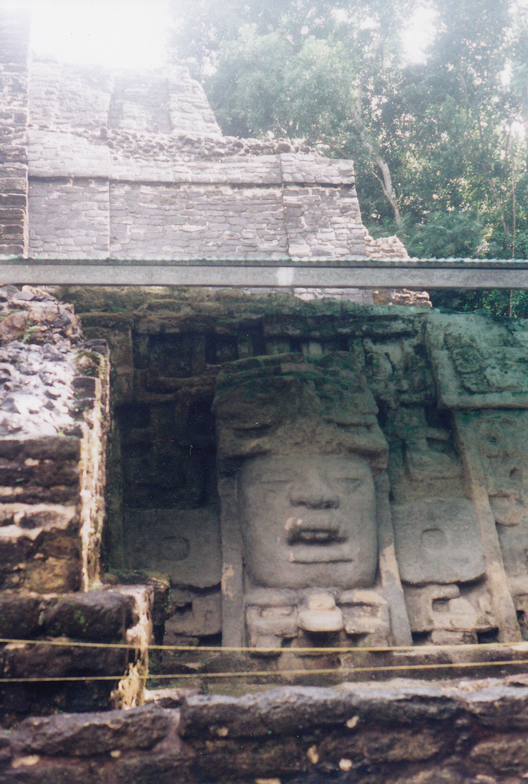
 Next crossing into Belize, we camped in the back yard of a small hotel in Orange Walk. The Queen Bee (Sonia, the proprietor’s wife) gave us a recommendation to catch a boat with these brothers on a jungle river float to the Lamanai Ruin. They departed from a bridge and floated us down past crocodiles, green herons, kingfishers, egrets, storks, and what they called “Jesus Christ Birds” because they walked on the water. Two hours later we beached the boats and hiked up to a smallish ruin hidden in the jungle. An intricate mask graced the front of one of the pyramids. We climbed it and from there took in a view of the river, the forest above the canopy, and miles of flat-ass swampland. It was a stunning vantage point.
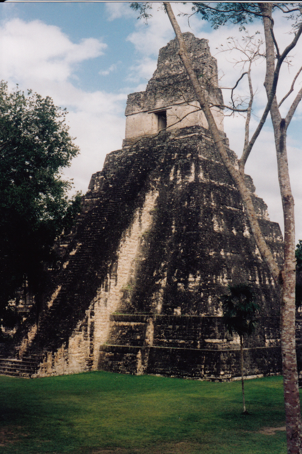
We had no trouble getting across the border from Belize to Guatemala, contrary to the horror stories we had been told, and we drove to Tikal before noon. Despite having “ruin fatigue” after touring 14 other Mayan ruins, we were impressed with Tikal. It was easy to imagine it a millennium ago. I got that same “woo-woo” feeling at Tikal as I had at Teotihuacan. The power of both places was tangible. Then I read that the two were the most powerful cities in Mesoamerica in 400 a.d. and that they forged a strong alliance.
Tikal was also special because it was located deep in the jungle: steamy, hot, sun and puffy clouds passing overhead. Spider monkeys swung from treetops, and I could hear howlers in the distance along with parrots and other strange birds calling. I climbed Mundo Perdido (Hidden World) Pyramid, where the tops of four other pyramids appeared above the canopy. The Jaguar Temple stood tall, slim, and regal. Tikal was set on a hill so that the tops of the structures gave a commanding view of the whole countryside. How did they learn to build up? And how did they move all that stone? Who was the architect? Great mysteries, few answers. And for me, the fun was to be mystified, intrigued, instead of being told by someone who may or may not know, what the current theory of answers is.
We spent a night outside of Tikal, then decided to move on the next morning. Mostly we were motivated by a desire to avoid this 18-vehicle caravan of RV’s which were on their way to Panama and back. The big rigs traveled in a pack and they took up a lot of space! We had camped with the same group in Belize a few days earlier. Twice was more than enough. They were nice enough folks, but the gaggle of them was pretty overwhelming.
So off we drove toward what we called “good filters,” rough dirt roads where the big rigs could not follow. Deep into the rural highlands of Guatemala we ventured, for an amazing journey which I will chronicle in another story soon.
 my husband, Brian, who passed away last fall. So I wanted to do something completely different, start a new tradition, break the mold.
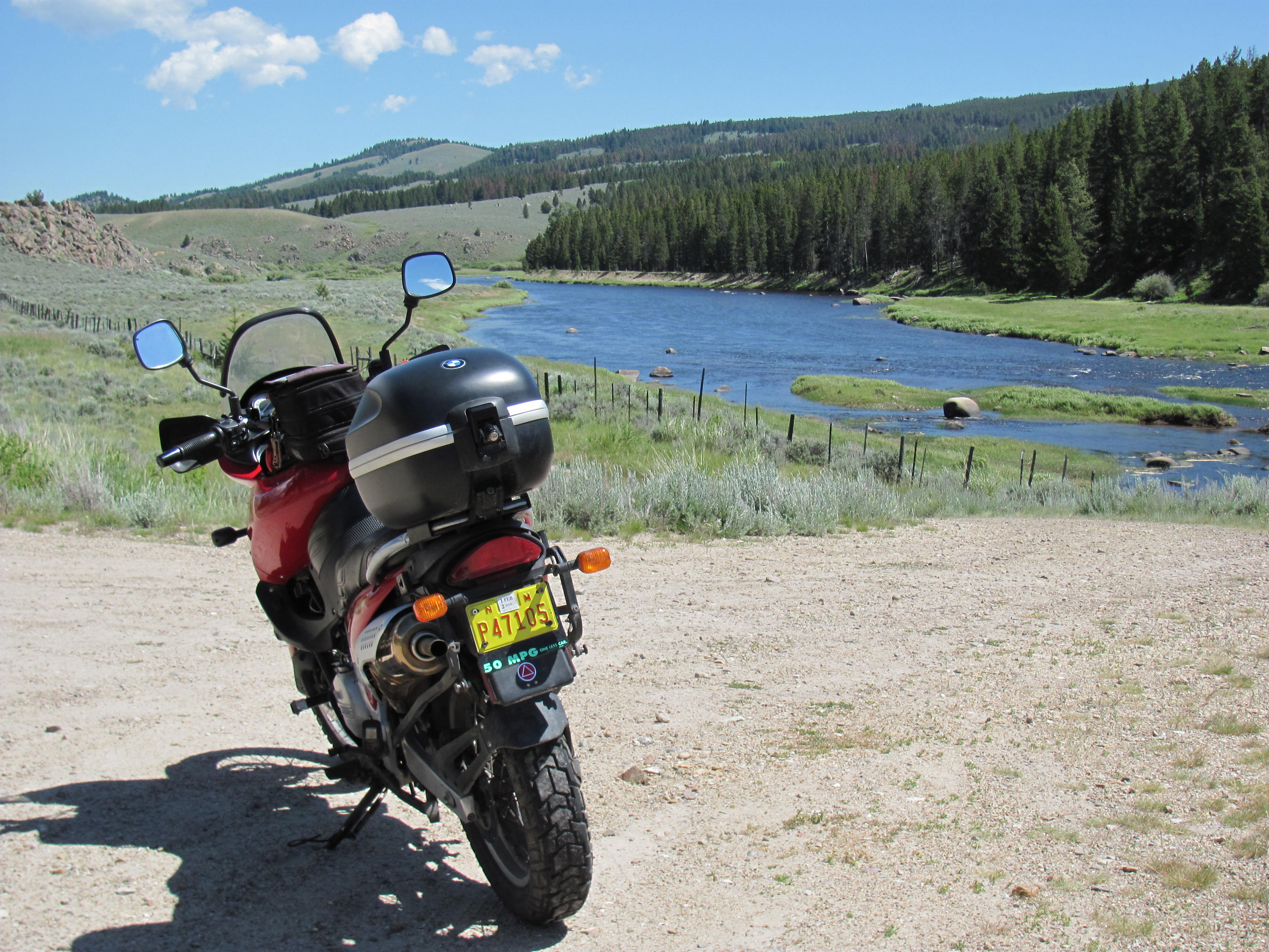
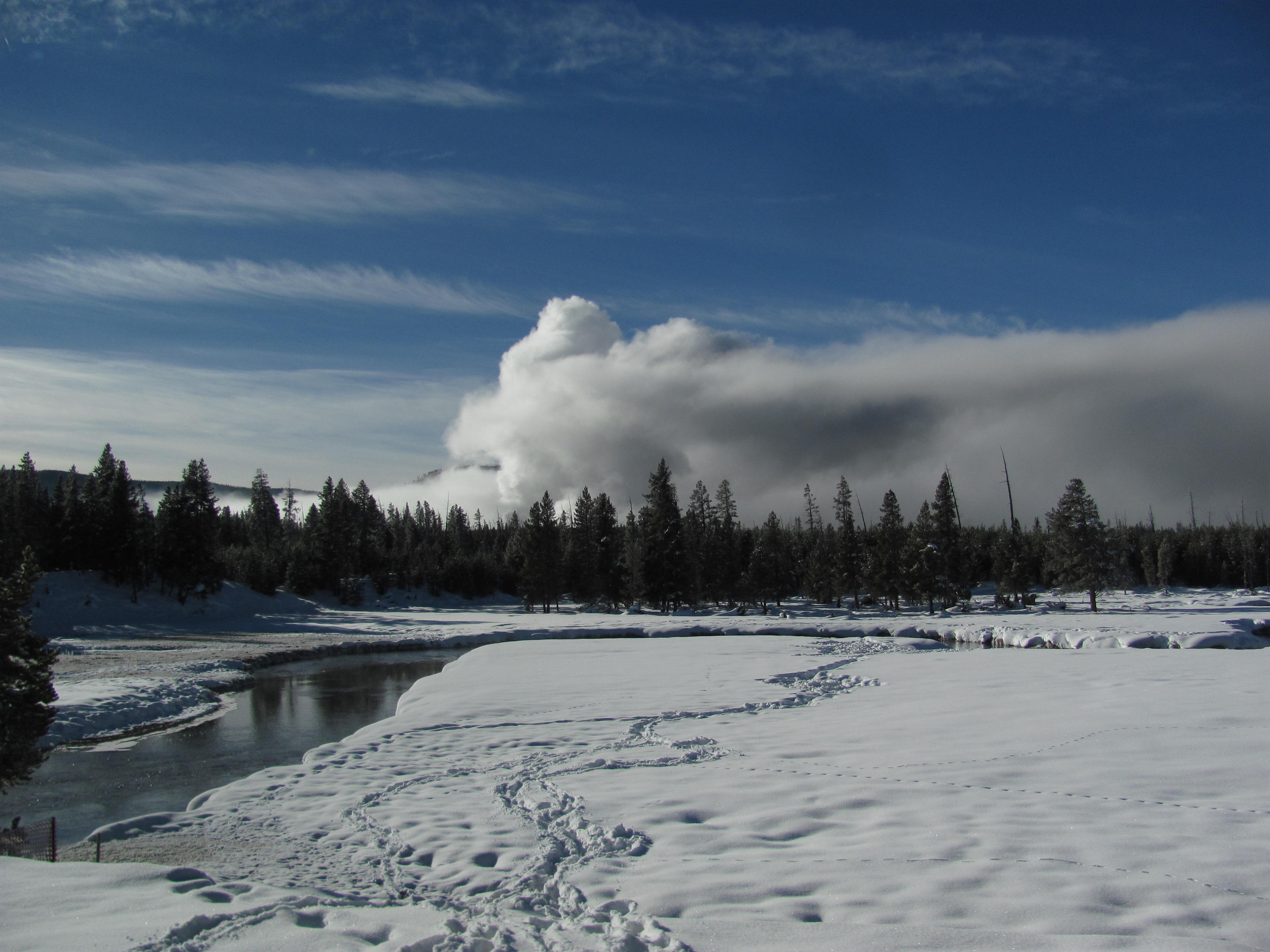
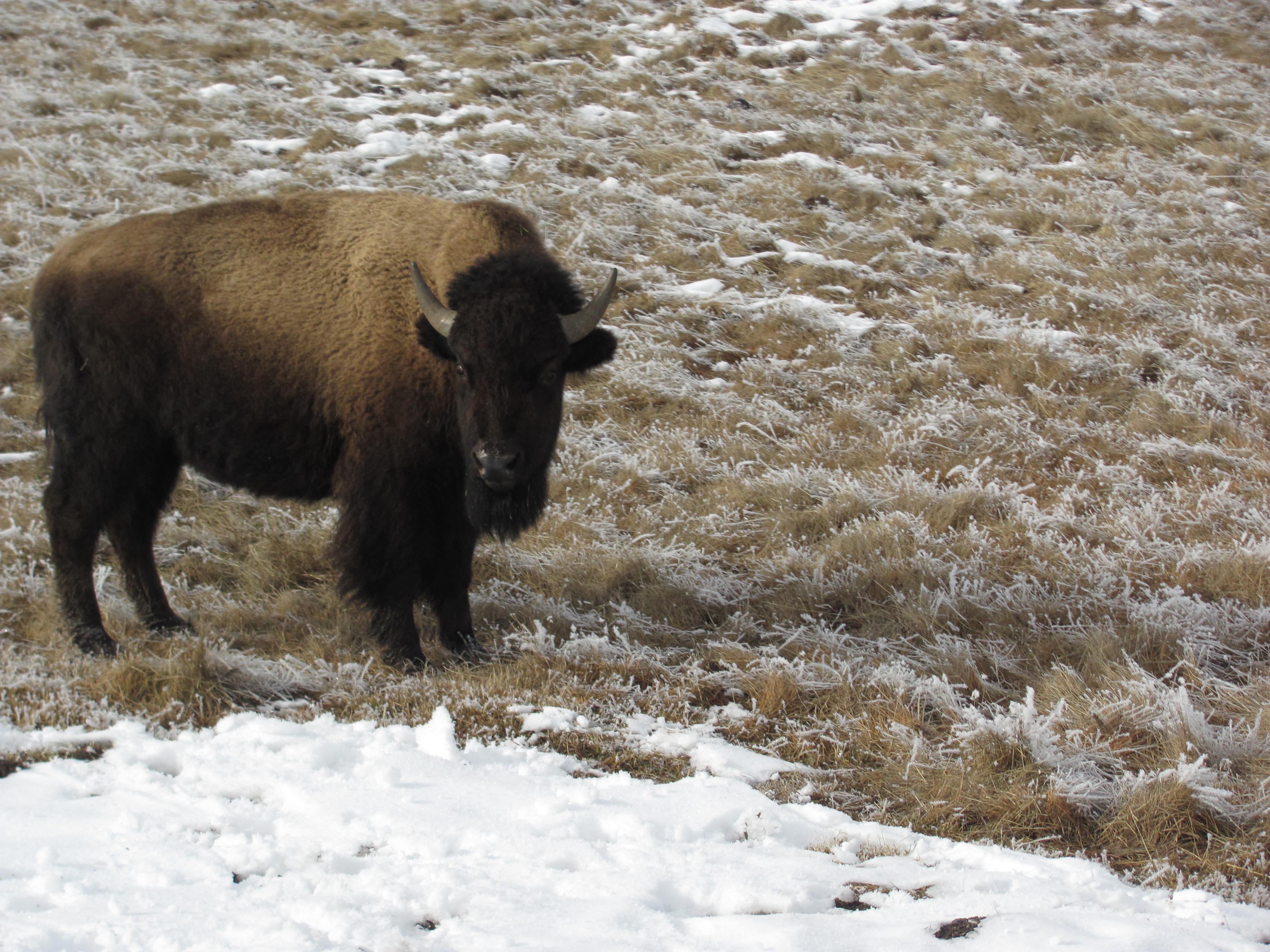 Yellowstone River.
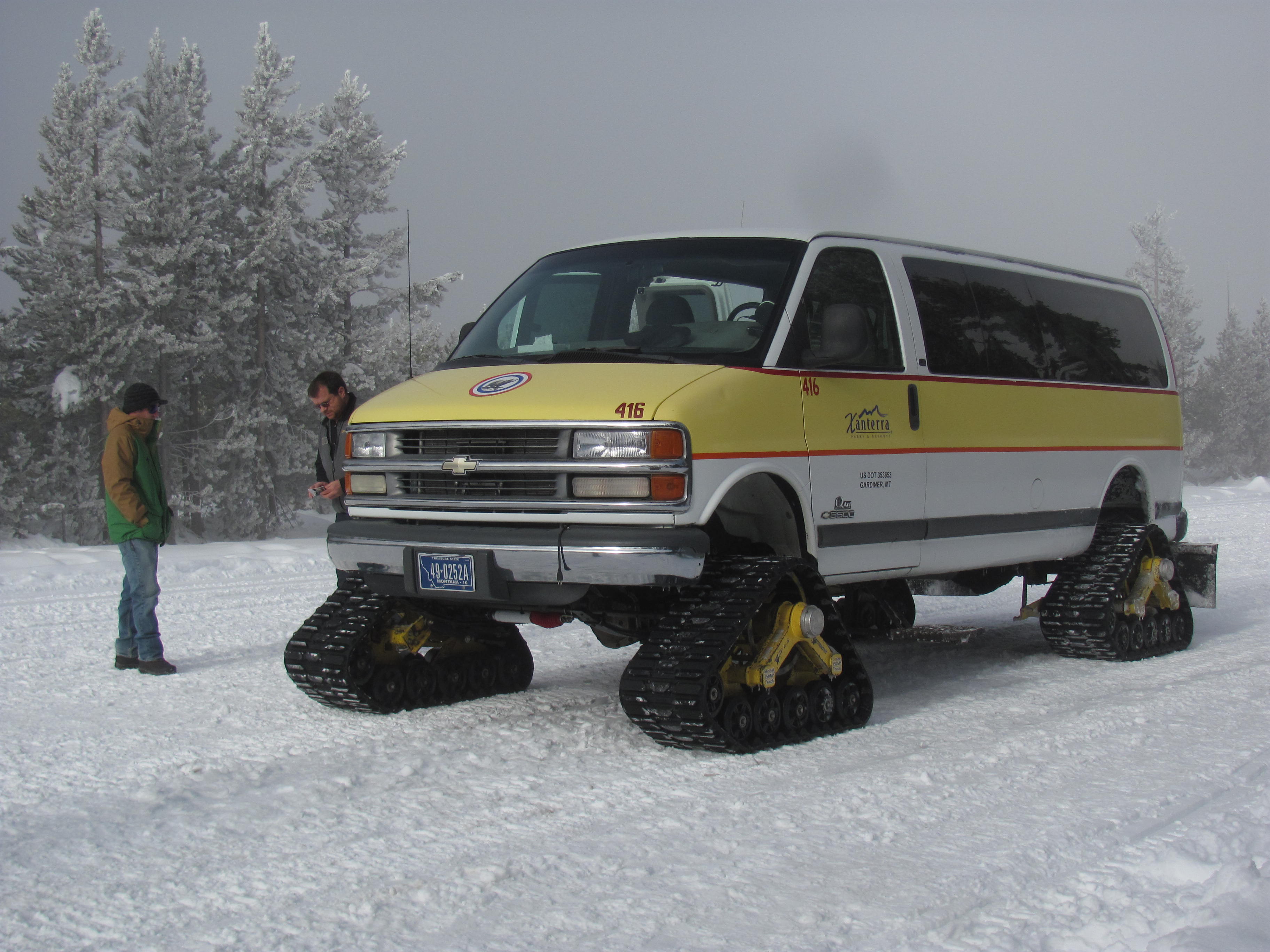 Our snow coach departed early the next morning for Old Faithful. The trek took more than five hours, due to planned stops to photograph geysers and waterfalls, along with unplanned stops whenever we saw wildlife (red foxes, bison, and a bald eagle). We also stopped just before Madison to help pull out a snow mobiler who had run off the road and was precariously balanced on a steep cliff with rushing water and rocks below.
 when no one was looking. Or I might not have. At any rate, nobody except Margi saw anything, and I trust her to keep mum. We agreed that Brian would have enjoyed the idea of floating in the current of a warm river on an eight-degree day.
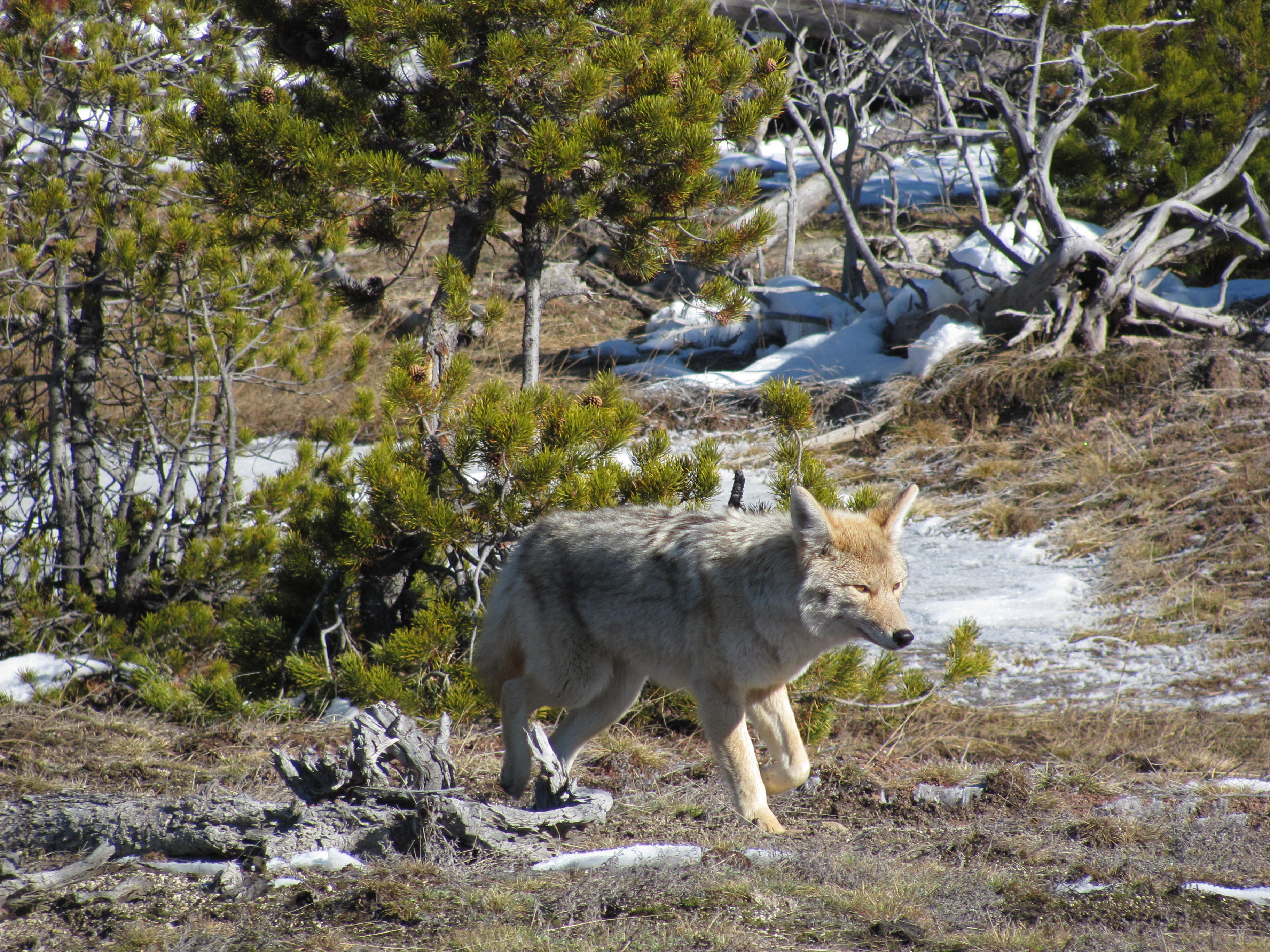 movement caught the corner of my eye. Looking over toward Grand Geyser, I spotted a well-fed, healthy looking coyote. Without a shred of shyness or fear, he loped directly toward us until he was less than 30 feet away. For a moment he stopped and looked directly into my eyes. Reflected back I saw the self-confidence of a creature living in the present.
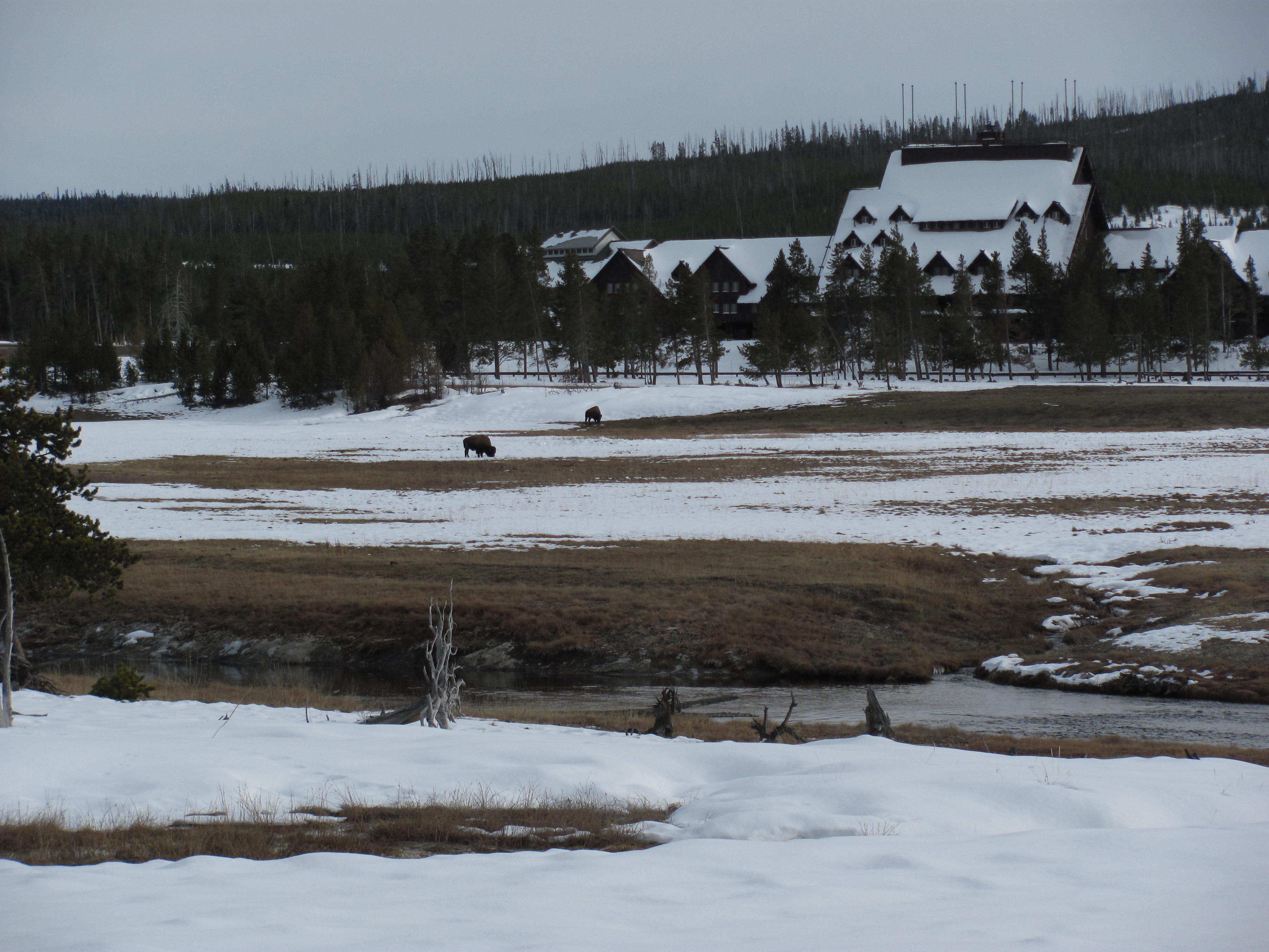 Oh Yellowstone, I thought as I watched Old Faithful Geyser erupt in the distance, you are my favorite place in the whole world. And you haven’t disappointed me. You produced Brian’s Spirit Coyote in the snowbound, magical world of the Upper Geyser Basin. And you helped, more than anything else has helped, to settle me, and to begin the process of acceptance. You let me know that Brian has successfully moved on to a better place.